Signs Tagged With Distance Marker
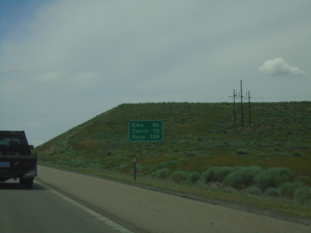
I-80 West - Distance Marker
Distance marker on I-80 west. Distance to Elko, Carlin, and Reno.
Taken 07-19-2023
 Wells
Elko County
Nevada
United States
Wells
Elko County
Nevada
United States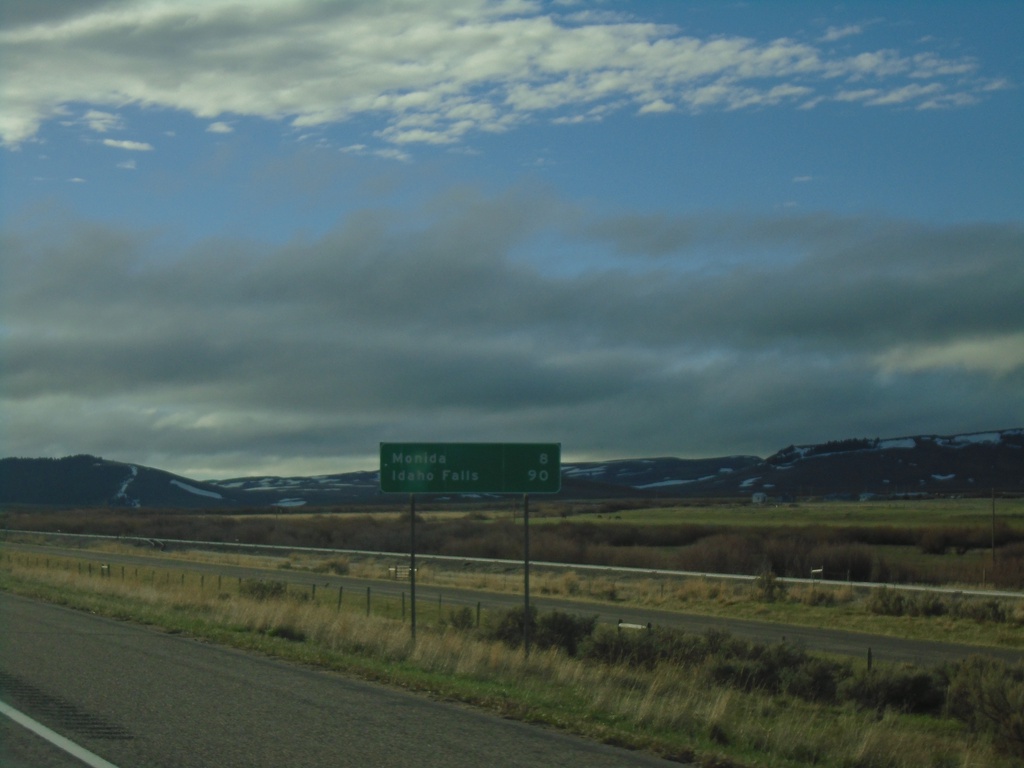
I-15 South - Distance Marker
Last distance marker in Montana on I-15 south. Distance to Monida and Idaho Falls (Idaho).
Taken 05-14-2023
 Lima
Beaverhead County
Montana
United States
Lima
Beaverhead County
Montana
United States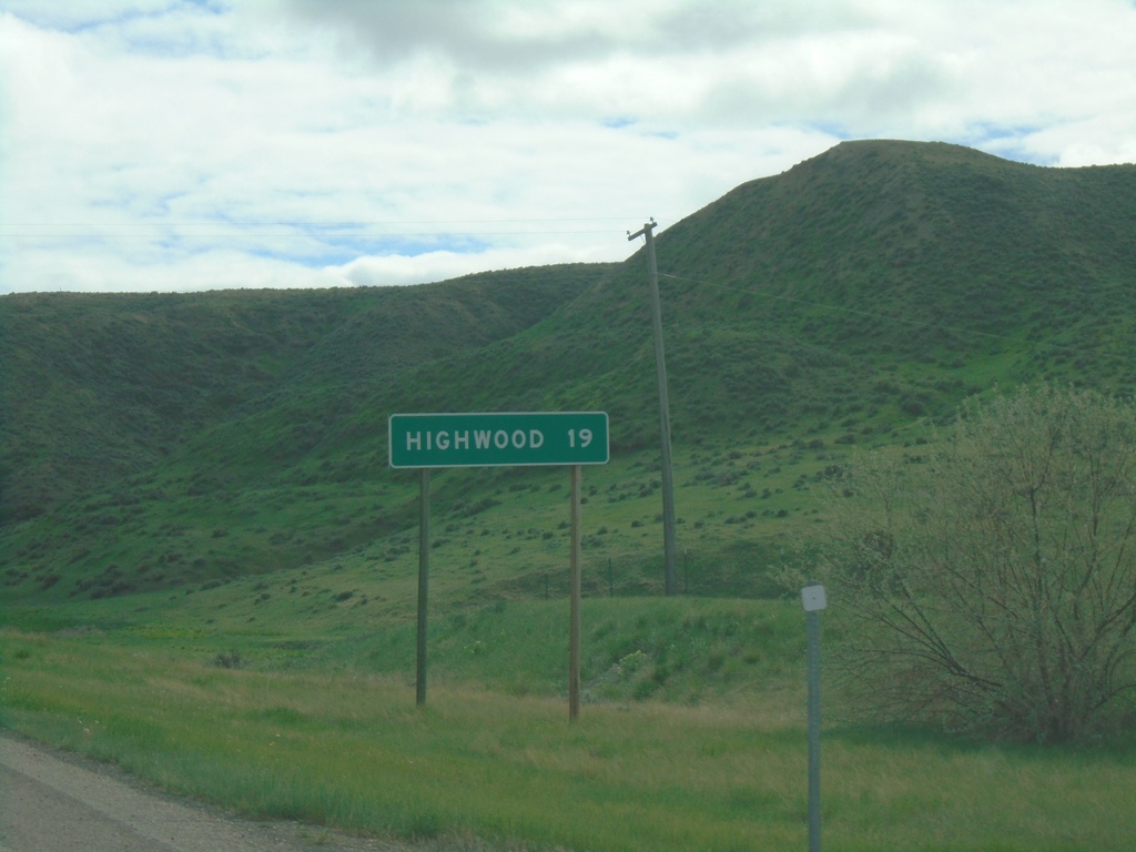
MTS-228 South - Distance Marker
Distance marker to Highwood on MTS-228 south
Taken 05-13-2023
 Fort Benton
Chouteau County
Montana
United States
Fort Benton
Chouteau County
Montana
United States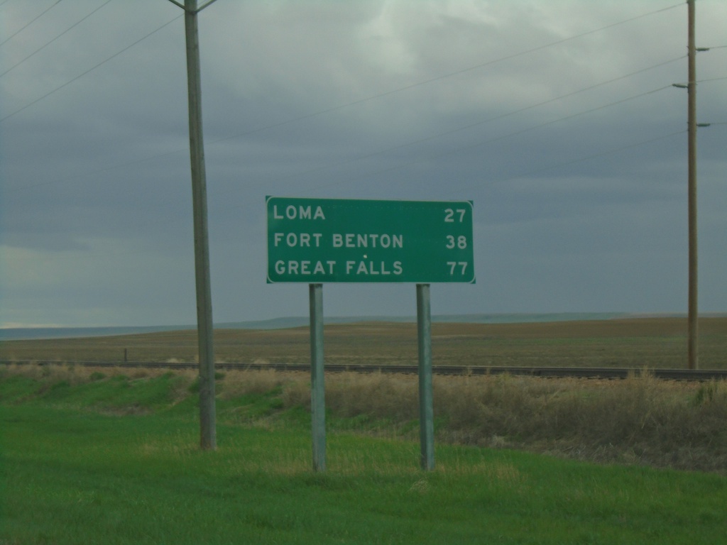
US-87 South - Distance Marker
Distance marker on US-87 south. Distance to Loma, Fort Benton, and Great Falls.
Taken 05-13-2023
 Big Sandy
Chouteau County
Montana
United States
Big Sandy
Chouteau County
Montana
United States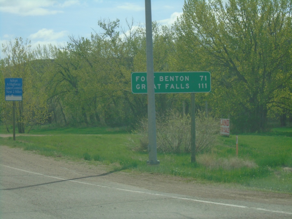
US-87 South - Distance Marker
Distance marker on US-87 southbound . Distance to Fort Benton and Great Falls.
Taken 05-13-2023
Havre
Hill County
Montana
United States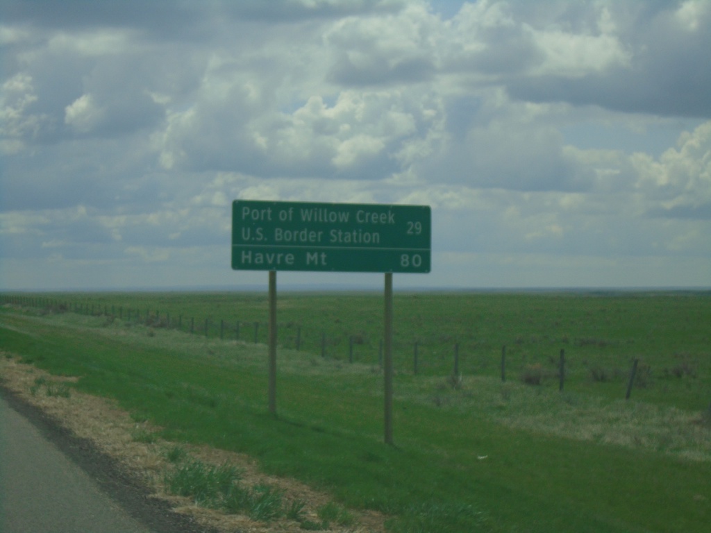
SK-21 South - Distance Marker
Distance marker on SK-21 south. Distance to Port of Willow Creek US Border Station and Havre, MT (United States).
Taken 05-13-2023
 Consul
Reno No. 51
Saskatchewan
Canada
Consul
Reno No. 51
Saskatchewan
Canada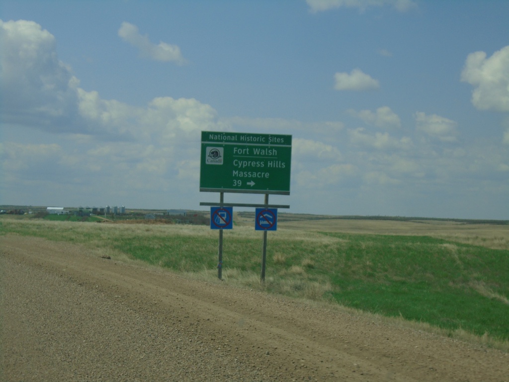
SK-13 West/SK-21 South Approaching SK-615
SK-13 West/SK-21 South approaching SK-615 to Fort Walsh/Cypress Hills Massacre.
Taken 05-13-2023

 Consul
Reno No. 51
Saskatchewan
Canada
Consul
Reno No. 51
Saskatchewan
Canada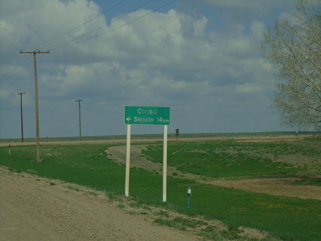
Range Road 271 North at SK-13
Range Road 271 North at SK-13 in Consul. Turn left for Senate - 14km
Taken 05-13-2023
Consul
Reno No. 51
Saskatchewan
Canada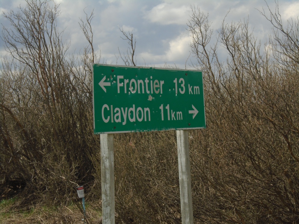
SK-614 South at SK-18
SK-614 South at SK-18 near Loomis. Use SK-18 west for Claydon; SK-18 east for Frontier. Distance units are marked with the text km, which is different than the other distance markers in southern Saskatchewan.
Taken 05-13-2023

 Claydon
Frontier No. 19
Saskatchewan
Canada
Claydon
Frontier No. 19
Saskatchewan
Canada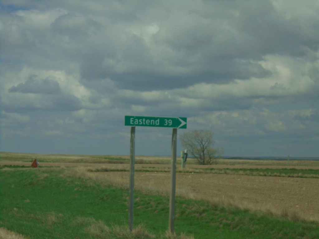
SK-18 West at SK-614 North
SK-18 West at SK-614 North to Eastend
Taken 05-13-2023
Claydon
Frontier No. 19
Saskatchewan
Canada