Signs Tagged With Distance Marker
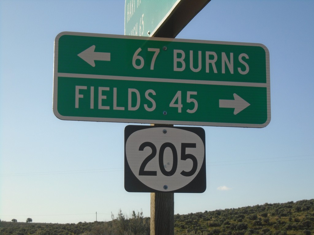
End Rock Creek Road at OR-205
End Rock Creek Road at OR-205 in Harney County. Turn right for Fields; left for Burns.
Taken 04-28-2019
 Harney County
Oregon
United States
Harney County
Oregon
United States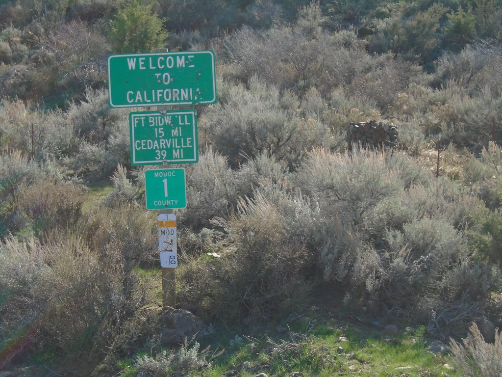
Entering California - Modoc County Highway 1
Entering California on Modoc County Highway 1 south. Distance to Fort Bidwell and Cedarville. Taken on the road between Adel, Oregon and Cedarville, California.
Taken 04-27-2019
 Adel
Modoc County
California
United States
Adel
Modoc County
California
United States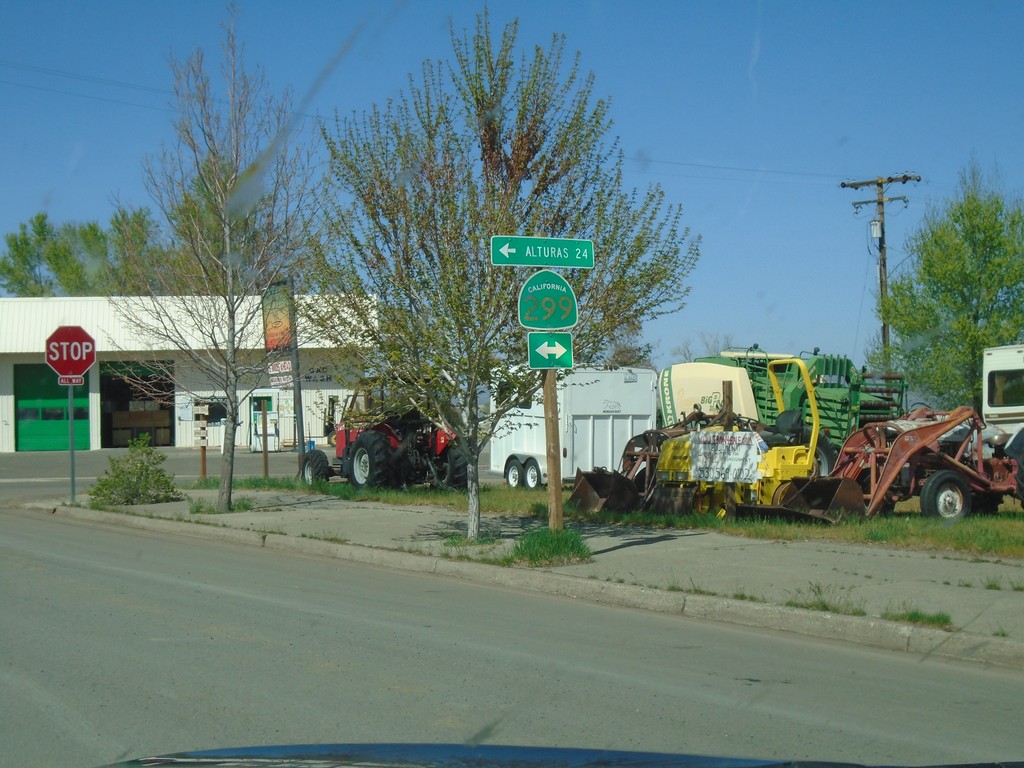
CH-1 (Main St.) at CA-299 - Cedarville
CH-1 (Main St.) at CA-299 in Cedarville. Turn left for CA-299 west to Alturas.
Taken 04-27-2019
 Alturas
Modoc County
California
United States
Alturas
Modoc County
California
United States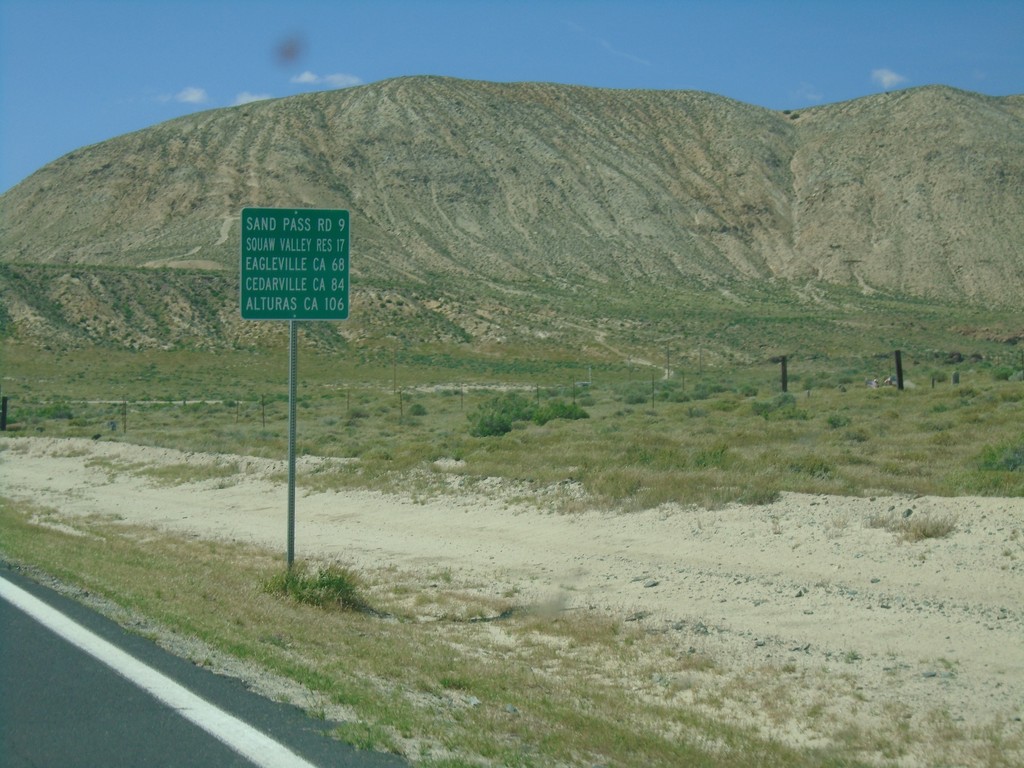
CH-447 North - Distance Marker
Distance marker on CH-447 North. Distance to Sand Pass Road, Squaw Valley Reservoir, Eagleville (California), Cedarville (California), and Alturas (California).
Taken 04-27-2019
 Gerlach
Washoe County
Nevada
United States
Gerlach
Washoe County
Nevada
United States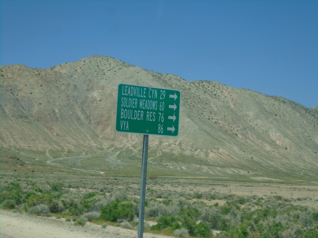
CH-447 North at CH-34
CH-447 North at CH-34 near Gerlach. Use CH-34 north for Leadville Canyon, Soldier Meadows, Boulder Reservoir, and Vya.
Taken 04-27-2019
 Gerlach
Washoe County
Nevada
United States
Gerlach
Washoe County
Nevada
United States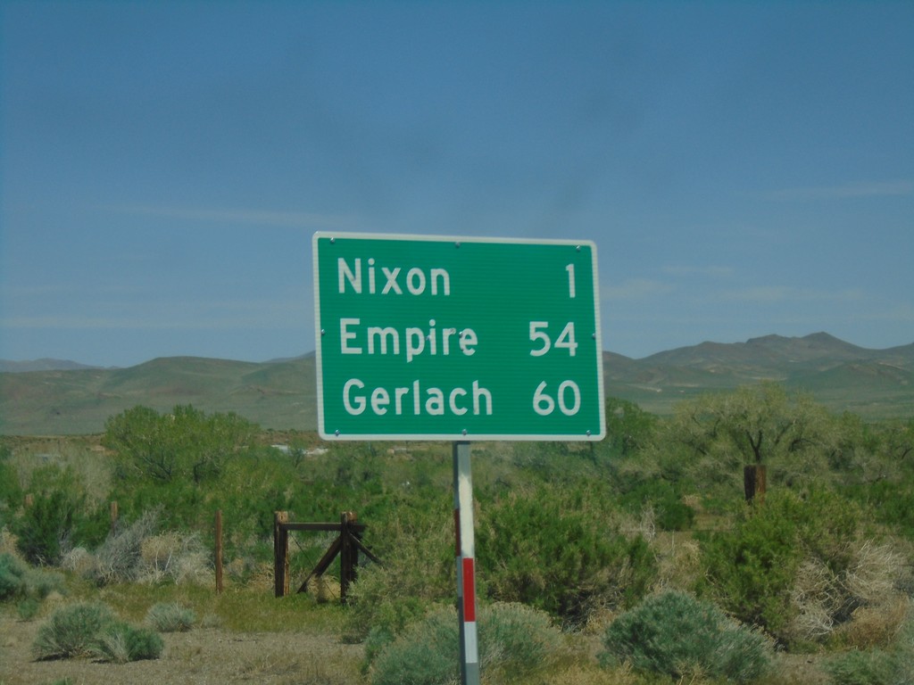
NV-447 North - Distance Marker
Distance marker on NV-447 north. Distance to Nixon, Empire and Gerlach.
Taken 04-27-2019
 Nixon
Washoe County
Nevada
United States
Nixon
Washoe County
Nevada
United States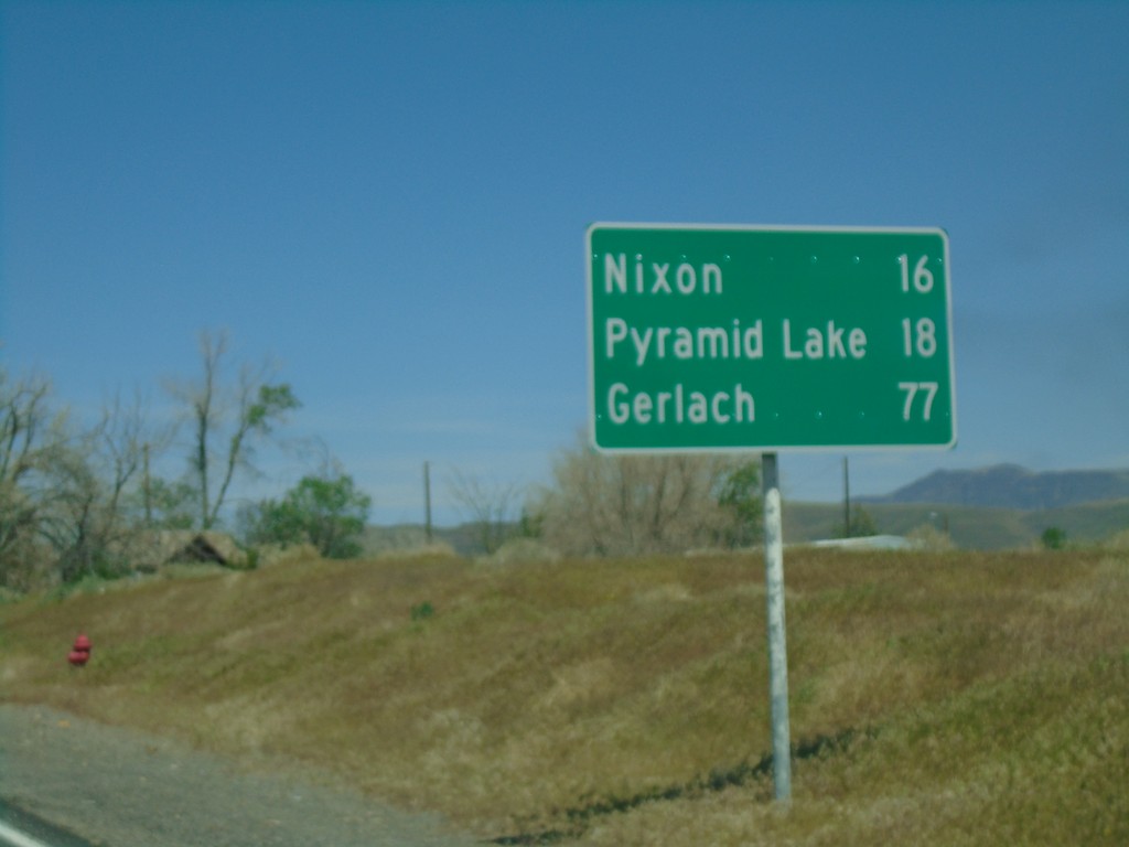
NV-447 North - Distance Marker
Distance marker on NV-447 North. Distance to Nixon, Pyramid Lake, and Gerlach.
Taken 04-27-2019
Sparks
Washoe County
Nevada
United States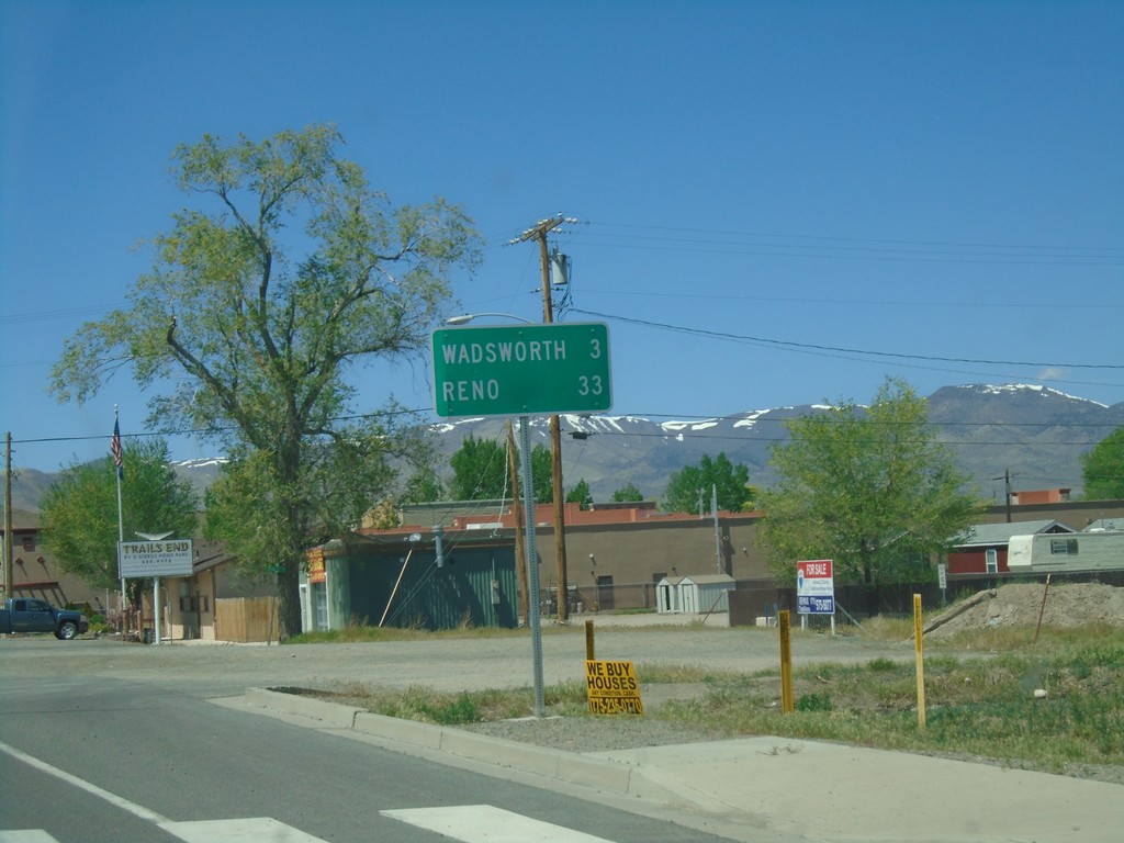
BL-80 West/NV-427 North - Distance Marker
Distance Marker on BL-80 West/NV-427 North. Distance to Wadsworth and Reno.
Taken 04-27-2019

 Fernley
Lyon County
Nevada
United States
Fernley
Lyon County
Nevada
United States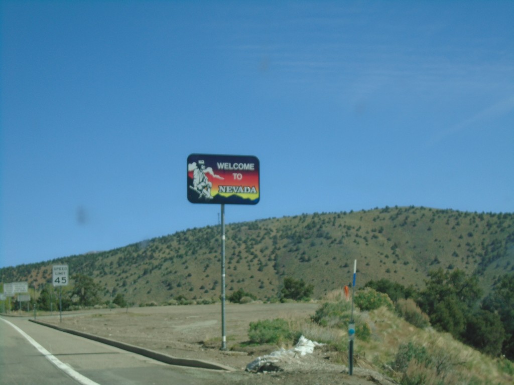
US-395 North - Welcome to Nevada
Welcome to Nevada on US-395 north. Taken at the California - Nevada state line.
Taken 04-27-2019
 Gardnerville
Douglas County
Nevada
United States
Gardnerville
Douglas County
Nevada
United States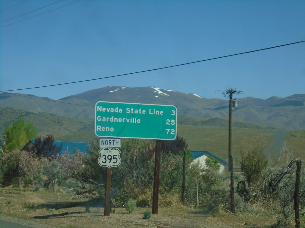
US-395 North - Distance Marker
Distance marker to Nevada State Line, Carson City, and Reno on US-395 north.
Taken 04-27-2019
Coleville
Mono County
California
United States