Signs Tagged With Distance Marker
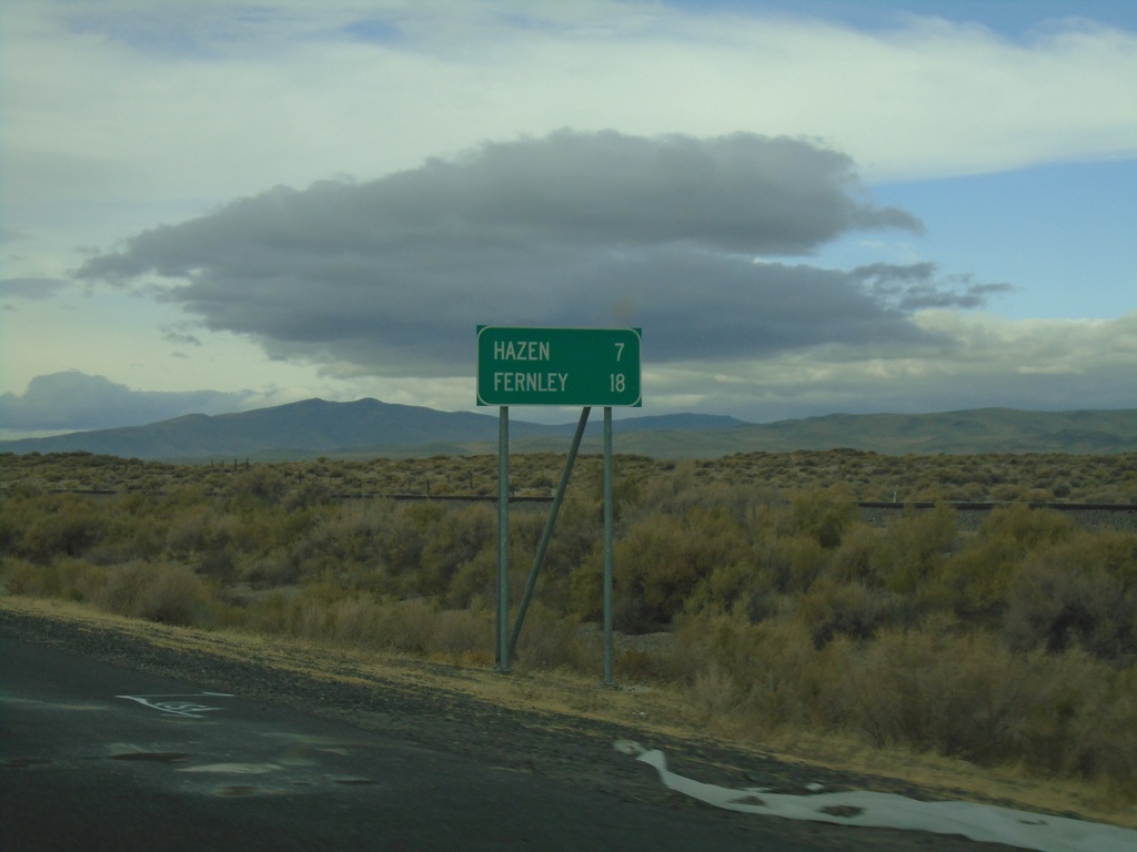
Alt. US-50 West - Distance Marker
Distance marker on Alt. US-50 West. Distance to Hazen and Fernley.
Taken 10-19-2019
 Fallon
Churchill County
Nevada
United States
Fallon
Churchill County
Nevada
United States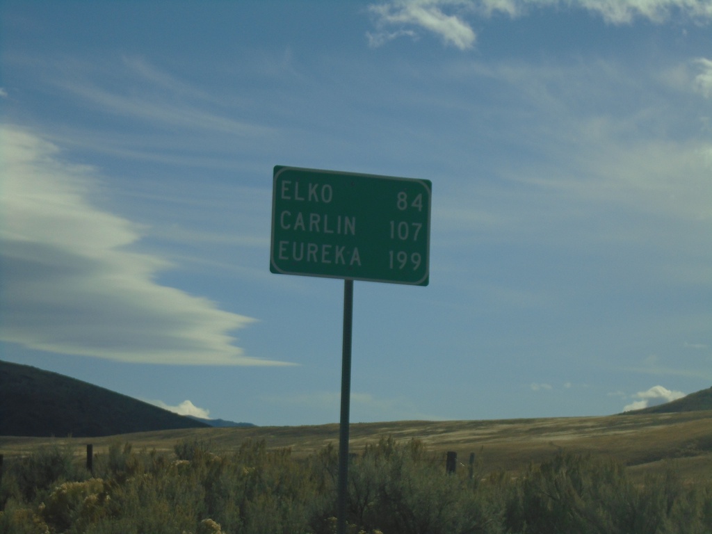
NV-225 South - Distance Marker
Distance marker on NV-225 south. Distance to Elko, Carlin (via I-80), and Eureka (via I-80 and NV-278).
Taken 10-18-2019
 Mountain City
Elko County
Nevada
United States
Mountain City
Elko County
Nevada
United States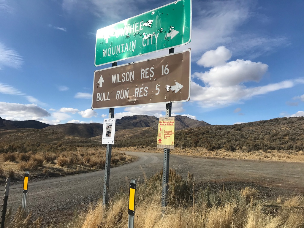
End NV-226 North
End NV-226 North in Elko County. Turn left for Owyhee and Wilson Reservoir; turn right for Mountain City and Bull Run Reservoir. Either road is unpaved.
Taken 10-18-2019
 Mountain City
Elko County
Nevada
United States
Mountain City
Elko County
Nevada
United States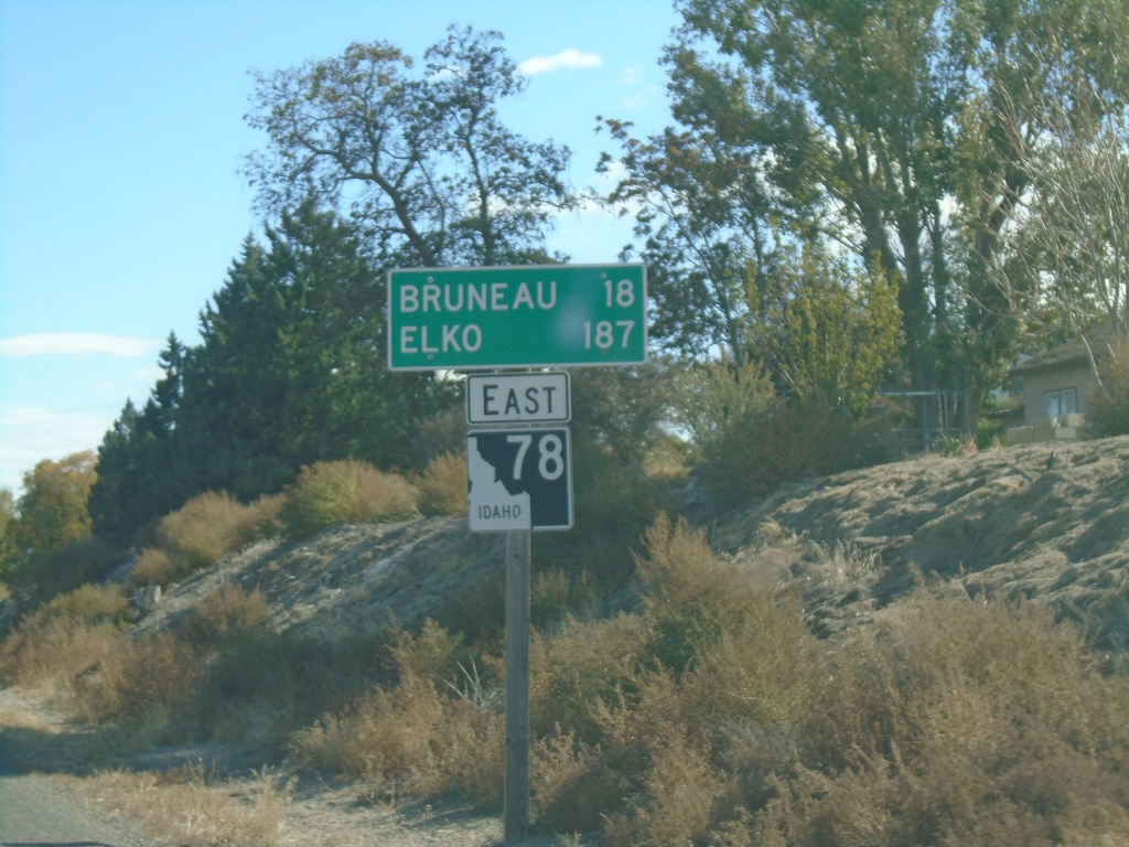
ID-78 East - Distance Marker
Distance marker on ID-78 east. Distance to Bruneau and Elko (Nevada).
Taken 10-18-2019
 Grand View
Owyhee County
Idaho
United States
Grand View
Owyhee County
Idaho
United States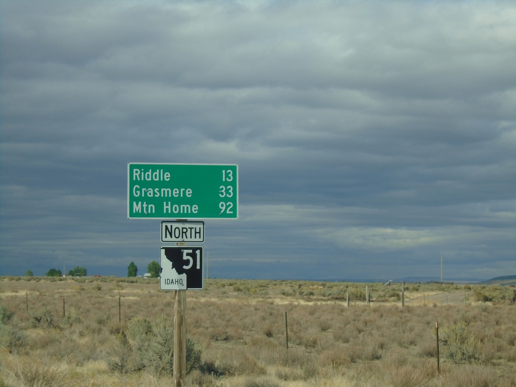
ID-51 North - Distance Marker
Distance marker on ID-51 north. Distance to Riddle, Grasmere, and Mountain Home. This is the first shield and distance marker along ID-51 after the stateline.
Taken 09-28-2019
 Owyhee
 County
Idaho
United States
Owyhee
Owyhee County
Idaho
United States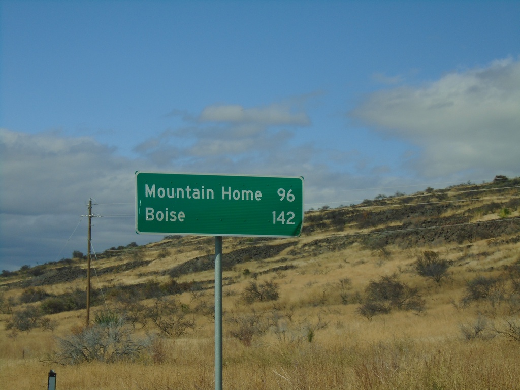
NV-225 North - Distance Marker
Distance marker on NV-225 north. Distance to Mountain Home (Idaho) and Boise (Idaho). This is the last distance marker northbound on NV-225 in Nevada.
Taken 09-28-2019
Owyhee
Elko County
Nevada
United States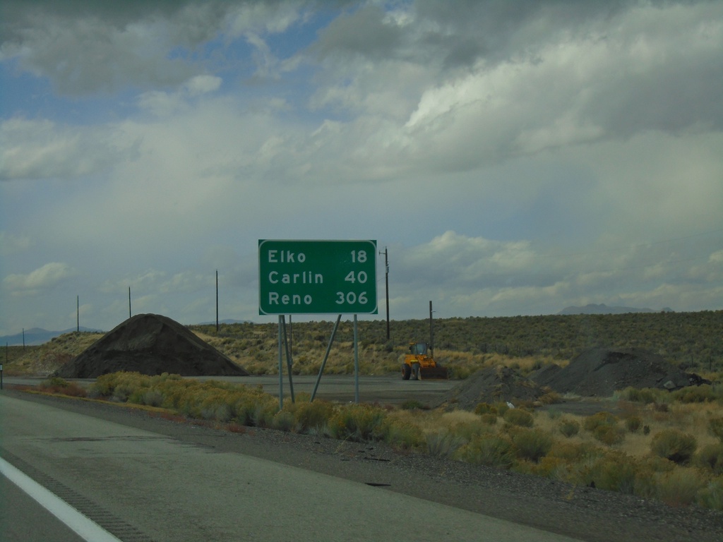
I-80 West - Distance Marker
Distance marker on I-80 west. Distance to Elko, Carlin, and Reno.
Taken 09-28-2019
 Elko
Elko County
Nevada
United States
Elko
Elko County
Nevada
United States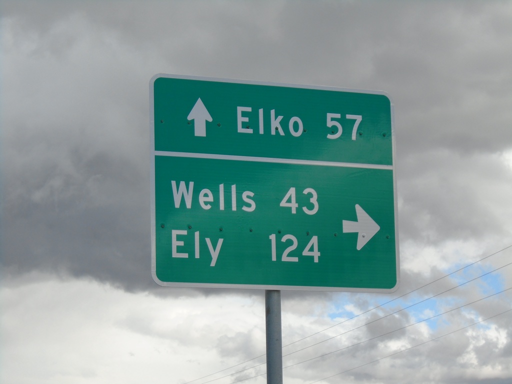
End NV-767 North at NV-229
End NV-767 North at NV-229. Turn right for NV-229 South to Ely (via US-93 South) and Wells (via US-93 North). Continue straight for NV-229 North to Elko (via I-80 West).
Taken 09-28-2019

 Ruby Valley
Elko County
Nevada
United States
Ruby Valley
Elko County
Nevada
United States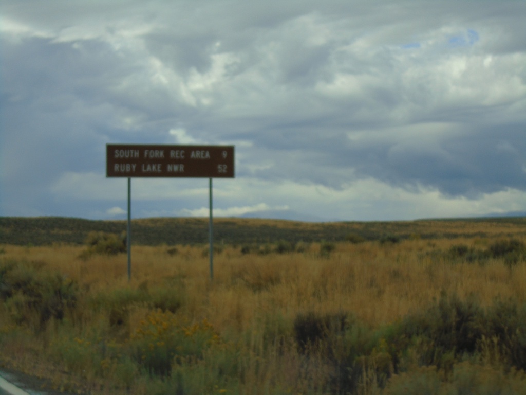
NV-228 South - Distance Marker
Distance marker on NV-228 south. Distance to South Fork Recreation Area and Ruby Lake NWR.
Taken 09-28-2019
 Spring Creek
Elko County
Nevada
United States
Spring Creek
Elko County
Nevada
United States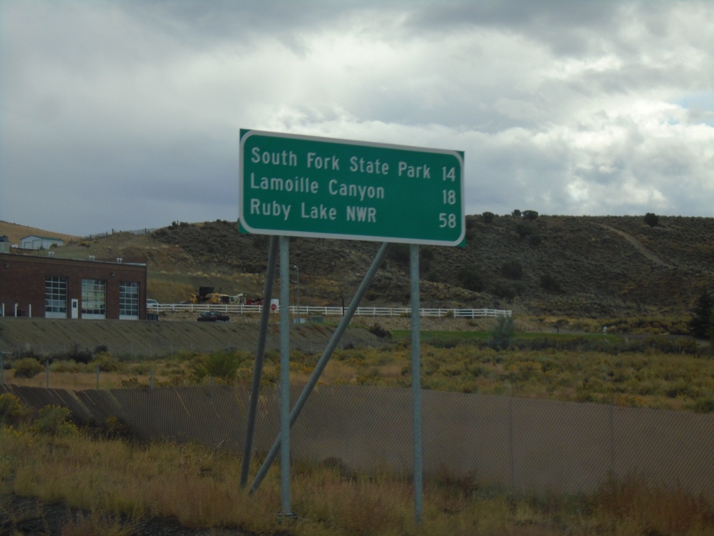
NV-227 South - Distance Marker
Distance marker on NV-227 south. Distance to South Fork State Park (via NV-228), Lamoille, and Ruby Lake NWR (via NV-228).
Taken 09-28-2019
 Elko
Elko County
Nevada
United States
Elko
Elko County
Nevada
United States