Signs Tagged With Distance Marker
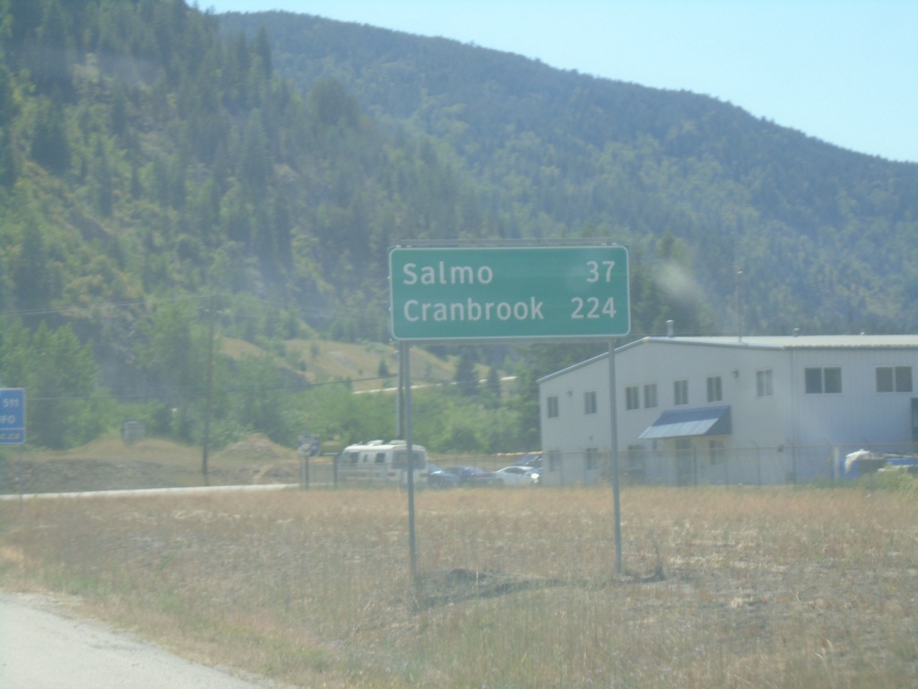
BC-3 East - Distance Marker
Distance marker on BC-3 east. Distance to Salmo and Cranbrook.
Taken 07-27-2023
 Castlegar
Central Kootenay
British Columbia
Canada
Castlegar
Central Kootenay
British Columbia
Canada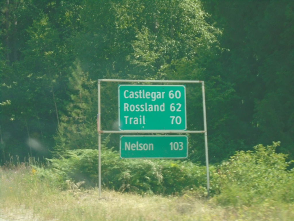
BC-3 East - Distance Marker
Distance marker on BC-3 east. Distance to Castlegar, Rossland, Trail, and Nelson.
Taken 07-24-2023
Christina Lake
Kootenay Boundary
British Columbia
Canada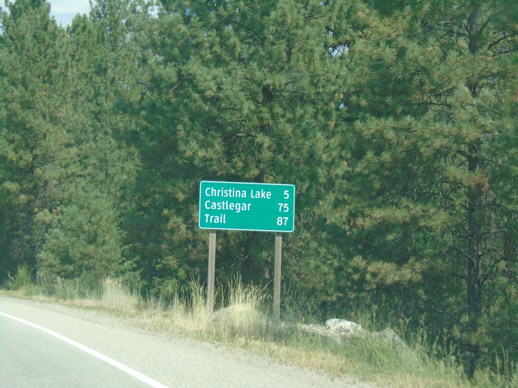
BC-3 East - Distance Marker
Distance marker on BC-3 east. Distance to Christina Lake, Castlegar, and Trail.
Taken 07-24-2023
Grand Forks
Kootenay Boundary
British Columbia
Canada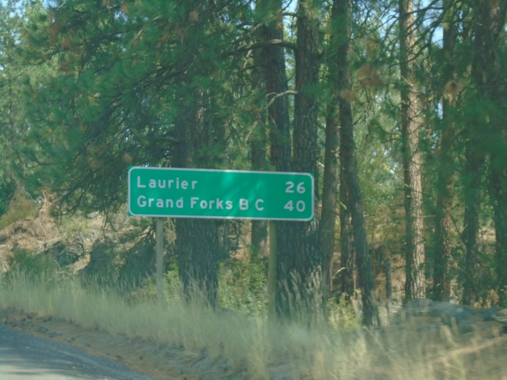
US-395 North - Distance Marker
Distance marker on US-395 north. Distance to Laurier and Grand Forks, BC. Laurier is settlement at the US/Canada Border.
Taken 07-24-2023
 Kettle Falls
Ferry County
Washington
United States
Kettle Falls
Ferry County
Washington
United States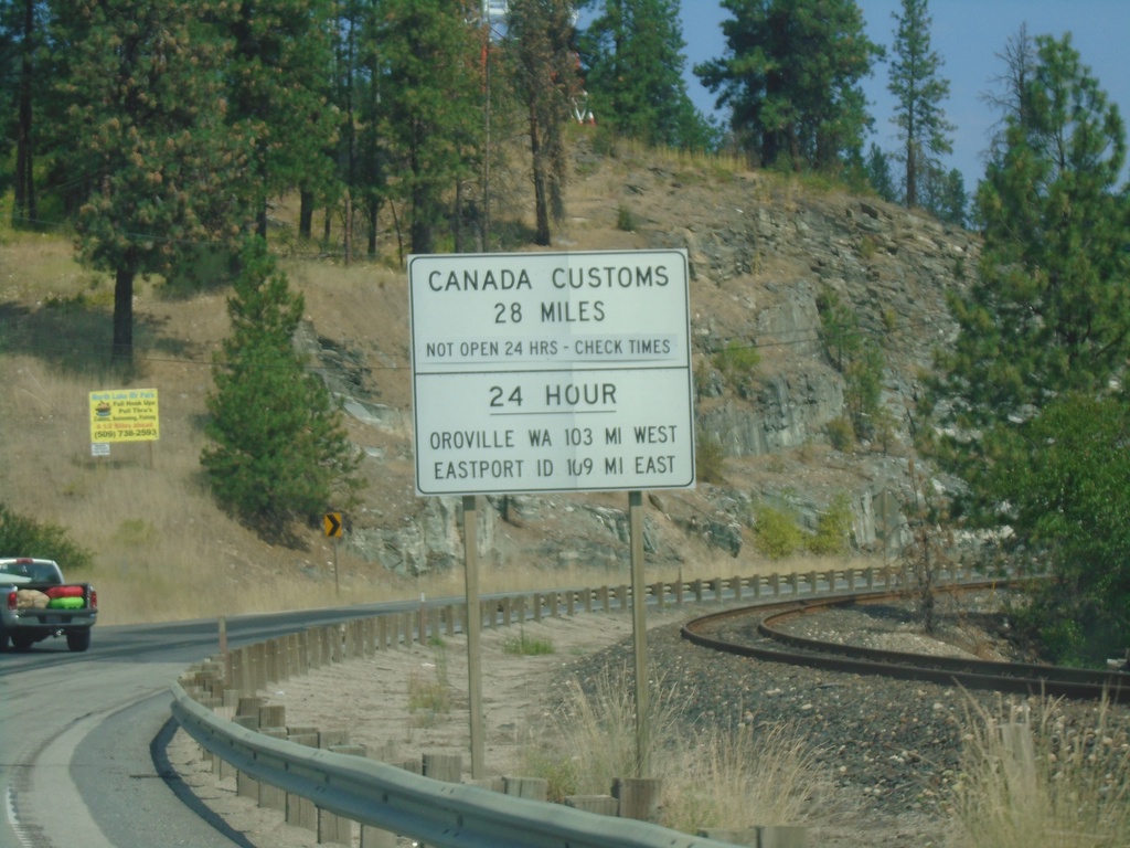
US-395 North - Border Crossing Hours
Border Crossing information on US-395 North. Port of Laurier on US-395 north is not a 24 hour port of entry. For 24 hour port of entries, use Port of Oroville (to the west on US-97) or Port of Eastport, Idaho (to the east on US-95). This sign is typical on highways leading to ports of entry not open 24 hours in Washington.
Taken 07-24-2023
Kettle Falls
Ferry County
Washington
United States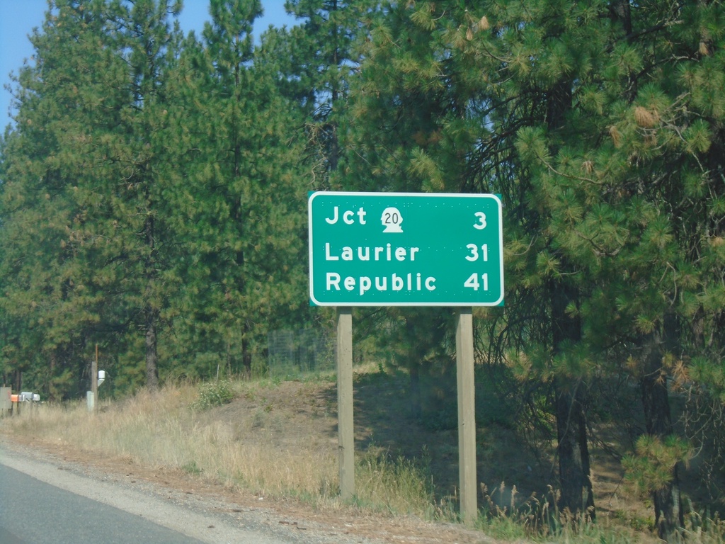
US-395 North/WA-20 West - Distance Marker
Distance Marker on US-395 North/WA-20 West. Distance to WA-20, Laurier (via US-395), and Republic (via WA-20).
Taken 07-24-2023
 Kettle Falls
Stevens County
Washington
United States
Kettle Falls
Stevens County
Washington
United States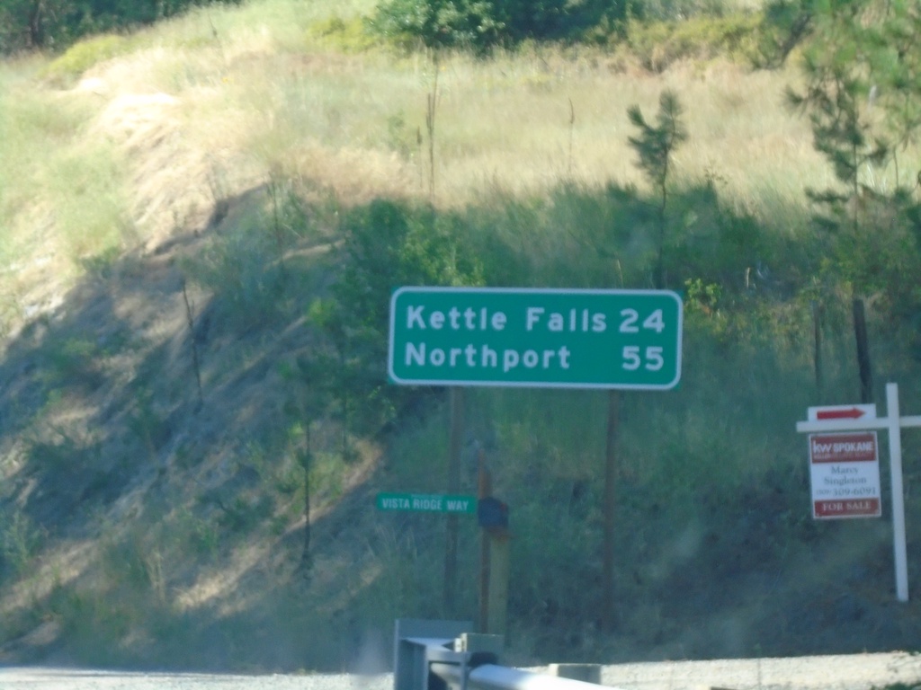
WA-25 North - Distance Marker
Distance marker on WA-25 north. Distance to Kettle Falls and Northport.
Taken 07-23-2023
 Gifford
Stevens County
Washington
United States
Gifford
Stevens County
Washington
United States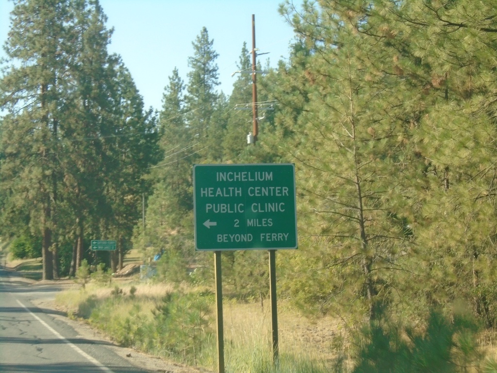
WA-25 North Approaching Gifford Ferry
WA-25 North approaching Gifford Ferry dock. Use the Gifford Ferry for the Inchelium Health Center Public Clinic.
Taken 07-23-2023
Gifford
Stevens County
Washington
United States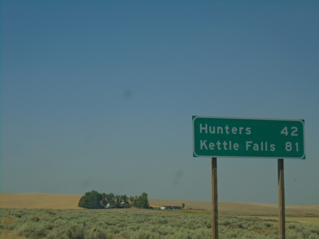
WA-25 North - Distance Marker
Distance marker on WA-25 north. Distance to Hunters and Kettle Falls.
Taken 07-23-2023
Davenport
Lincoln County
Washington
United States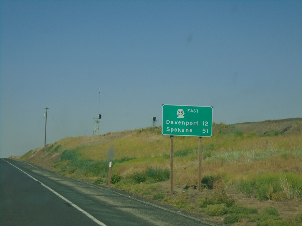
WA-28 East - Distance Marker
Distance marker on WA-28 east. Distance to Davenport and Spokane.
Taken 07-23-2023
 Harrington
Lincoln County
Washington
United States
Harrington
Lincoln County
Washington
United States