Signs Tagged With Distance Marker
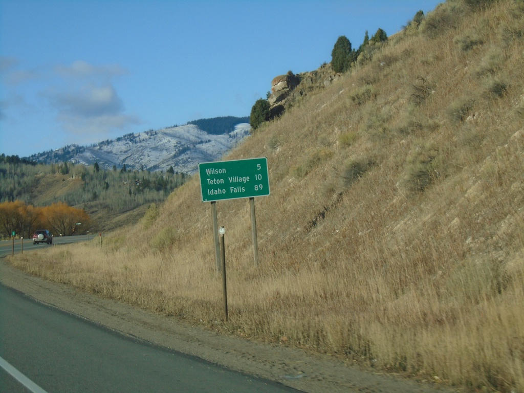
WY-22 West - Distance Marker
Distance marker on WY-22 west. Distance to Wilson, Teton Village (via WY-390) and Idaho Falls (Idaho).
Taken 10-27-2019
 Jackson
Teton County
Wyoming
United States
Jackson
Teton County
Wyoming
United States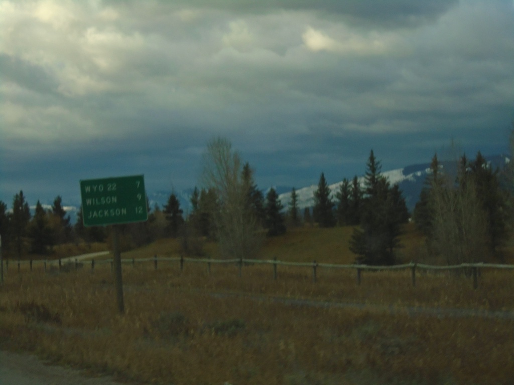
WY-390 South - Distance Marker
Distance marker on WY-390 south. Distance to WYO-22, Wilson, and Jackson.
Taken 10-26-2019
 Wilson
Teton County
Wyoming
United States
Wilson
Teton County
Wyoming
United States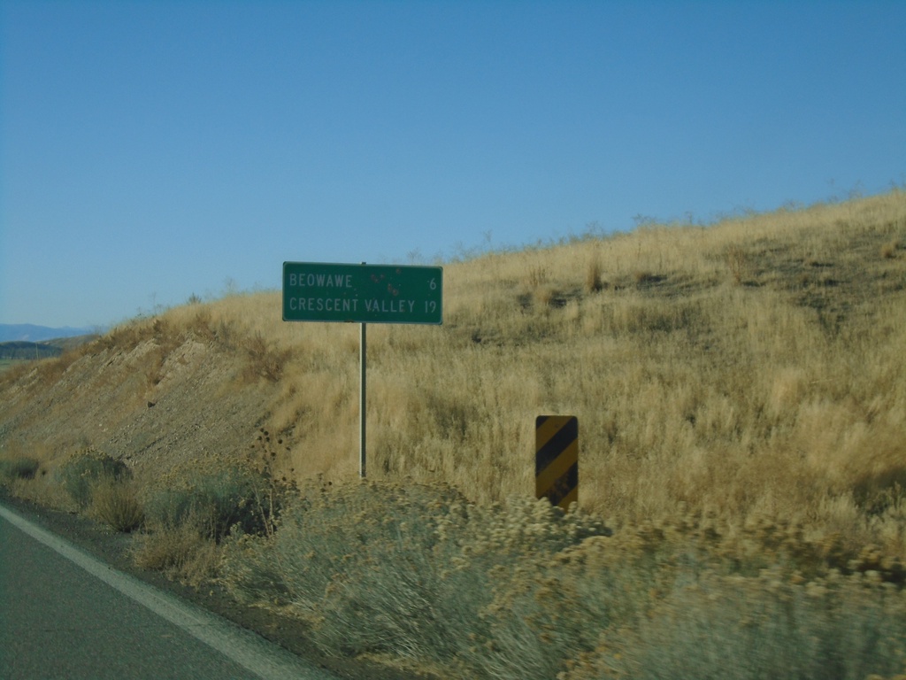
NV-306 South - Distance Marker
Distance marker on NV-306 south. Distance to Beowawe and Crescent Valley.
Taken 10-20-2019
 Crescent Valley
Eureka County
Nevada
United States
Crescent Valley
Eureka County
Nevada
United States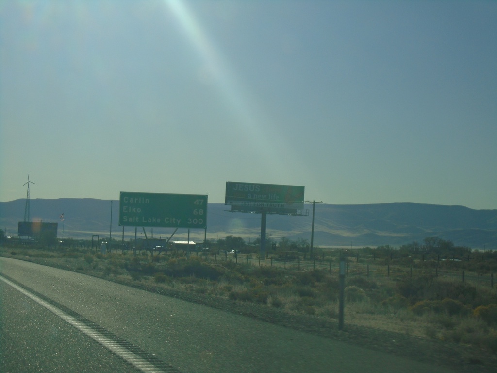
I-80 East - Distance Marker
Distance marker on I-80 east. Distance to Carlin, Elko, and Salt Lake City. This is the first appearance of Salt Lake City as a control city along I-80 east in Nevada.
Taken 10-20-2019
 Battle Mountain
Lander County
Nevada
United States
Battle Mountain
Lander County
Nevada
United States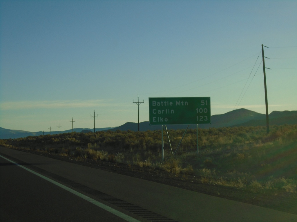
I-80 East - Distance Marker
Distance marker on I-80 west. Distance to Battle Mountain, Carlin, and Elko.
Taken 10-20-2019
Winnemucca
Humboldt County
Nevada
United States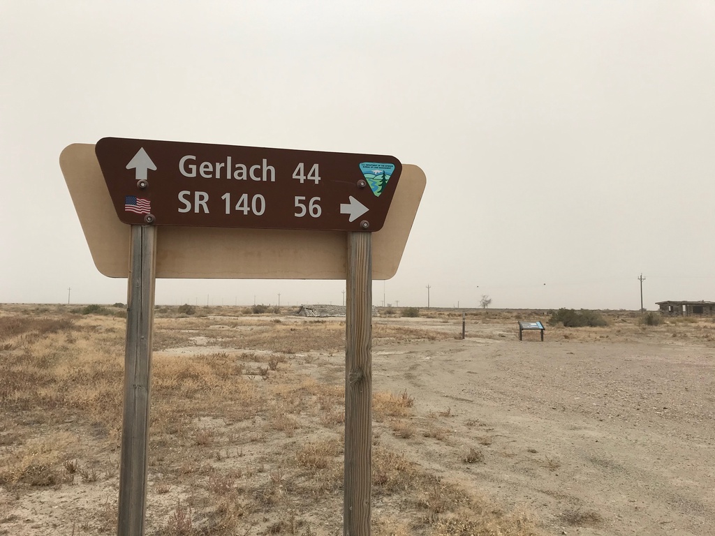
Jungo Road at Jackson Creek Ranch Road
Jungo Road West at Jackson Creek Ranch Road. Use Jackson Creek Ranch Road north for NV-140; continue on Jungo Road west for Gerlach.
Taken 10-19-2019
Sulphur Humboldt County Nevada United States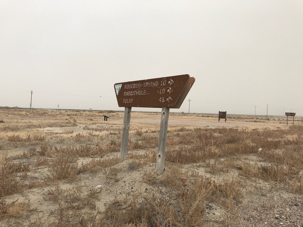
Jungo Road at County Road
Jungo Road at County Road south to Imlay, Rabbithole, and Rosebud Spring. Taken in the ghost town of Sulphur.
Taken 10-19-2019
Winnemucca Humboldt County Nevada United States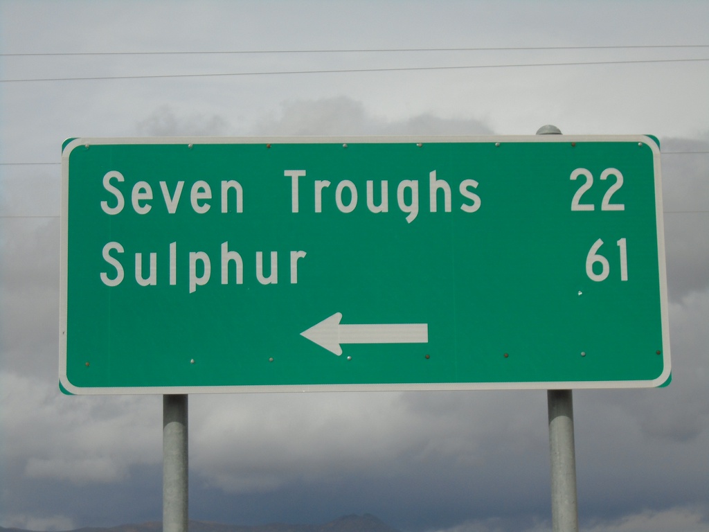
End NV-854 at NV-399
End NV-854 at NV-399 in Pershing County. Use NV-399 west for Seven Troughs and Sulphur.
Taken 10-19-2019

 Lovelock
Pershing County
Nevada
United States
Lovelock
Pershing County
Nevada
United States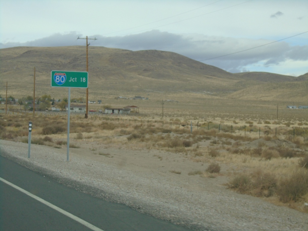
NV-439 North - Distance Marker
Distance marker on NV-439 North. Distance to I-80.
Taken 10-19-2019
 Silver Springs
Lyon County
Nevada
United States
Silver Springs
Lyon County
Nevada
United States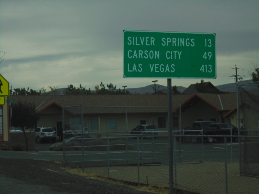
Alt. US-95 South/Alt. US-50 West - Distance Marker
Distance Marker on Alt. US-95 South/Alt. US-50 West. Distance to Silver Springs, Carson City, and Las Vegas.
Taken 10-19-2019

 Fernley
Lyon County
Nevada
United States
Fernley
Lyon County
Nevada
United States