Signs Tagged With Distance Marker
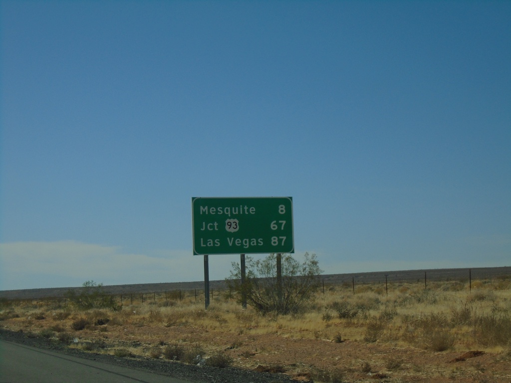
I-15 South - Distance Marker
Distance marker on I-15 south. Distance to Mesquite, Jct. US-93, and Las Vegas. All destinations are in Nevada. This is the last distance marker southbound on I-15 in Arizona.
Taken 11-26-2019

 Littlefield
Mohave County
Arizona
United States
Littlefield
Mohave County
Arizona
United States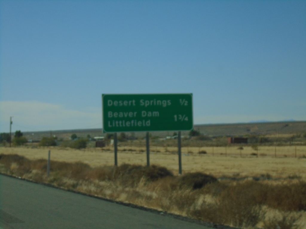
I-15 South Approaching Exits 9 and 8
I-15 south approaching Exit 9 - Desert Springs and approaching Exit 8 - Littlefield/Beaver Dam.
Taken 11-26-2019
Littlefield
Mohave County
Arizona
United States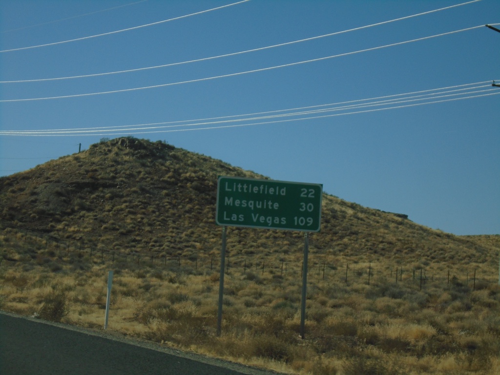
I-15 South - Distance Marker
Distance marker on I-15 south. Distance to Littlefield, Mesquite (Nevada), Las Vegas (Nevada). This is the first distance marker southbound along I-15 in Arizona.
Taken 11-26-2019
Littlefield
Mohave County
Arizona
United States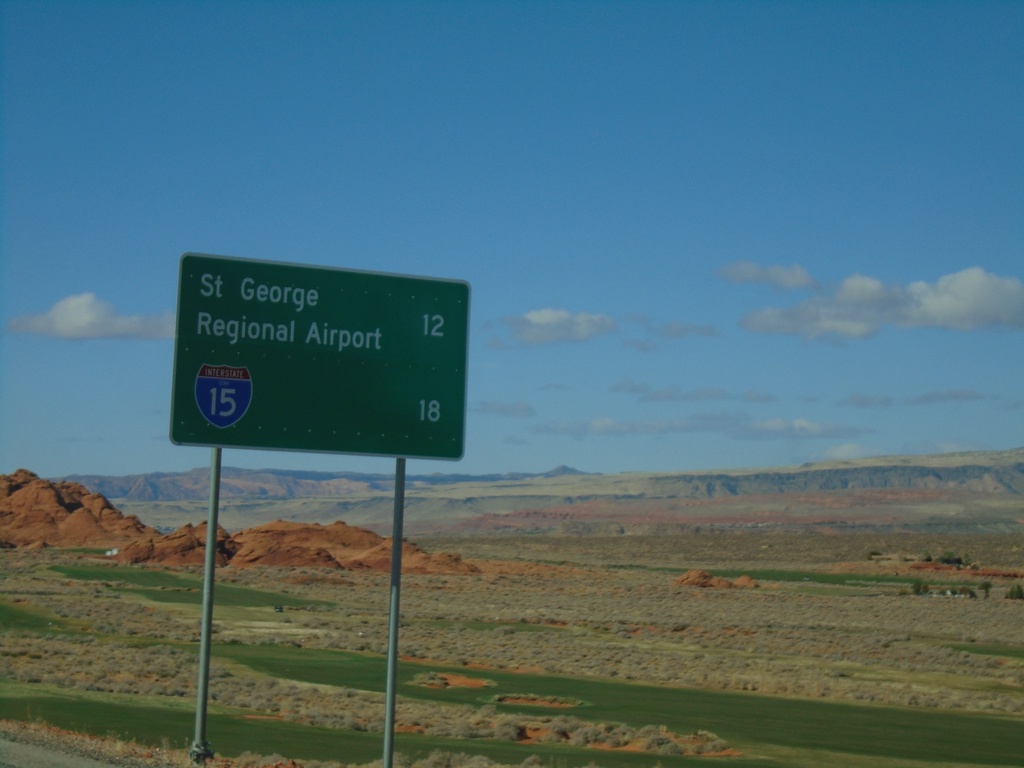
UT-7 West - Distance Marker
Distance marker on UT-7 west. Distance to St. George Regional Airport and I-15.
Taken 11-26-2019
 Hurricane
Washington County
Utah
United States
Hurricane
Washington County
Utah
United States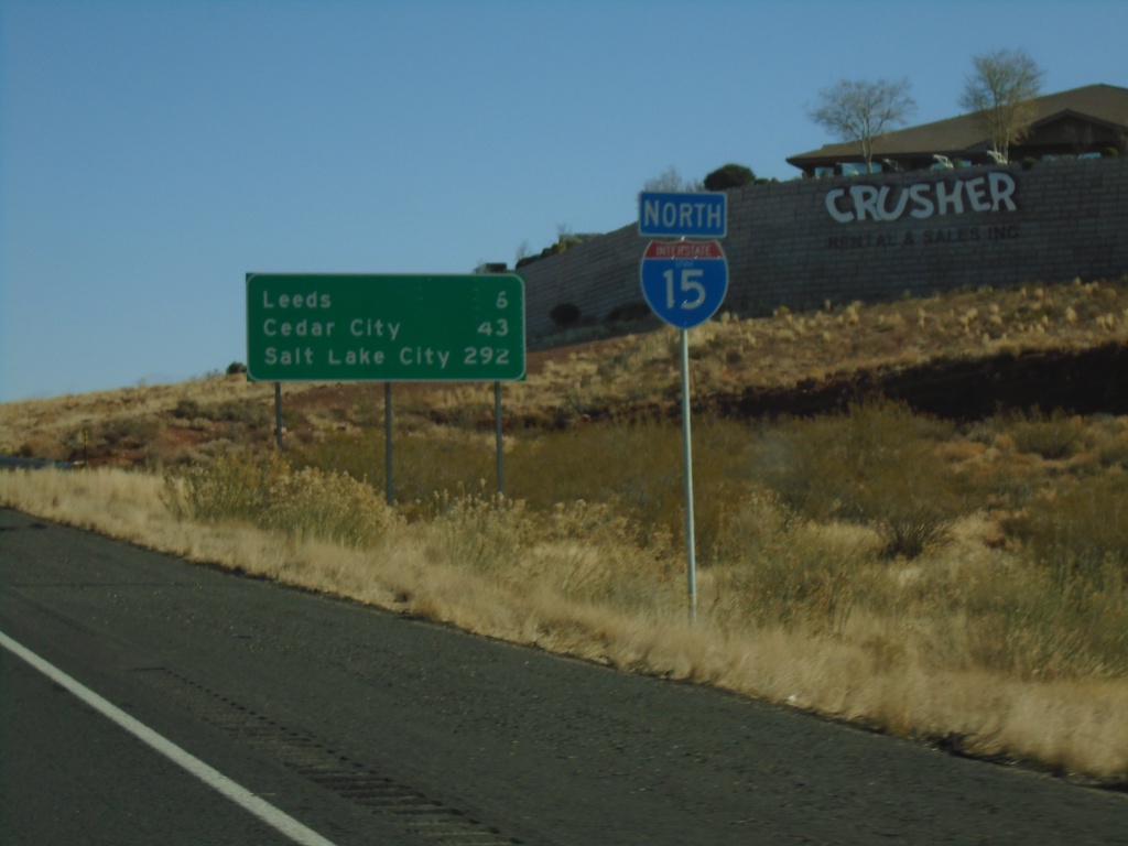
I-15 North - Distance Marker
Distance marker and I-15 shield on I-15 North. Distance to Leeds, Cedar City, and Salt Lake City.
Taken 11-26-2019
Hurricane
Washington County
Utah
United States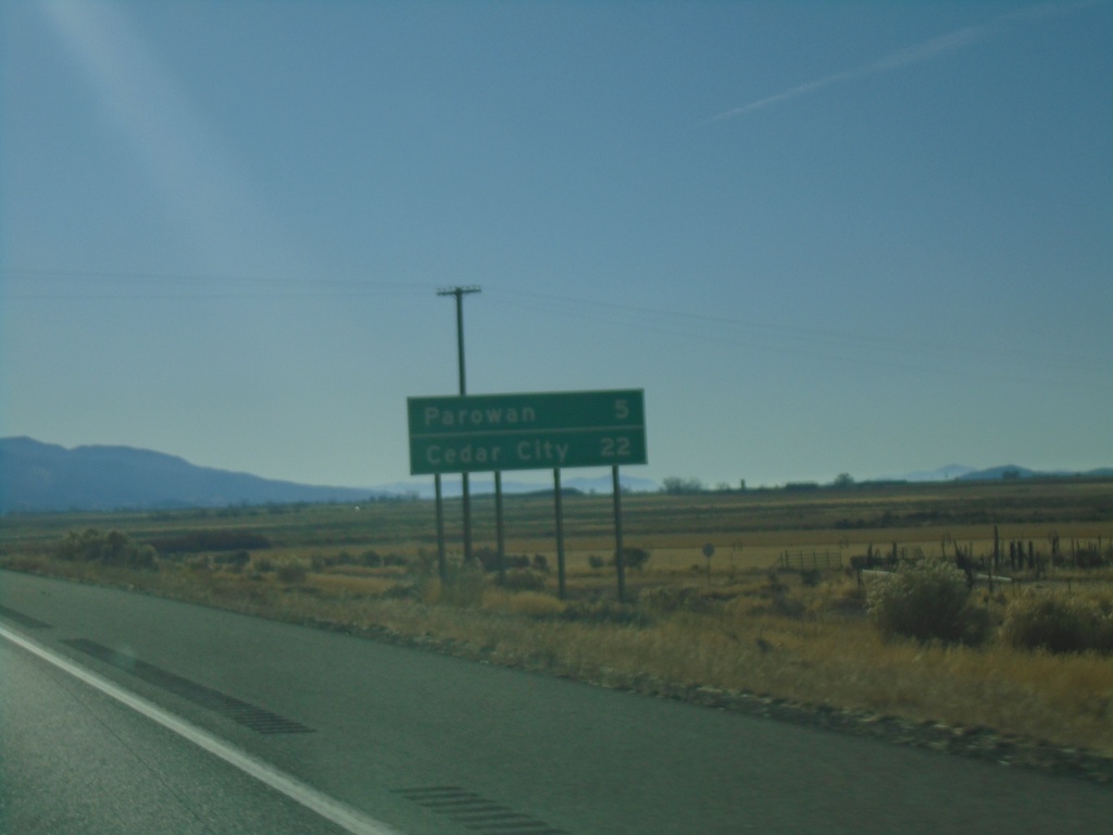
I-15 South - Distance Marker
Distance marker on I-15 south. Distance to Parowan and Cedar City. This is the older type of distance marker with horizontal lines between each destination.
Taken 11-24-2019
Paragonah
Iron County
Utah
United States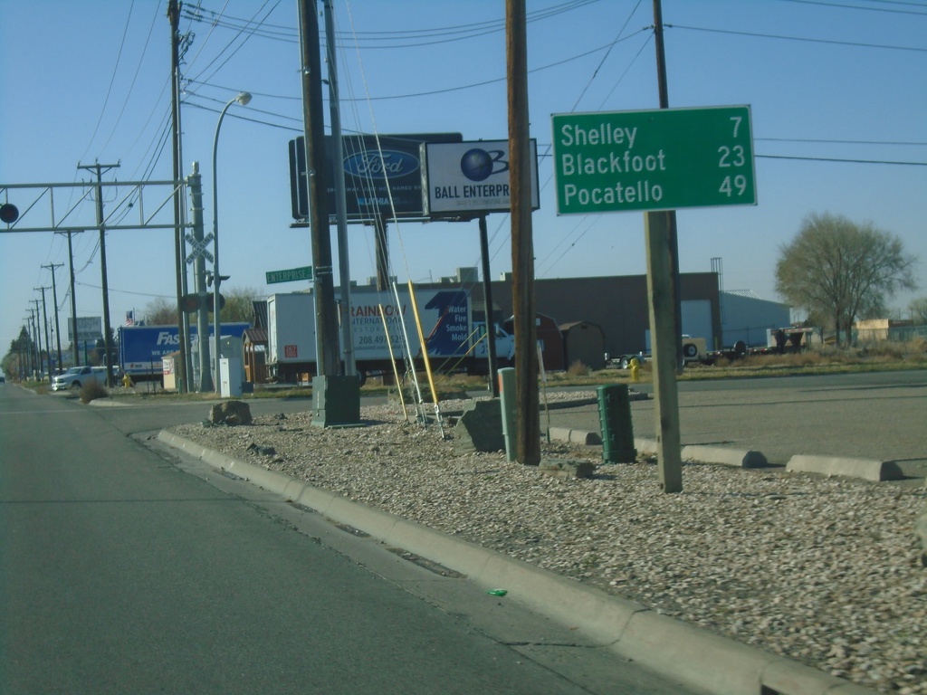
Bus. BL-15 South/US-26 West - Distance Marker
Distance marker on Bus. BL-15 South/US-26 West. Distance to Shelley (via US-91), Blackfoot, and Pocatello.
Taken 10-27-2019

 Idaho Falls
Bonneville County
Idaho
United States
Idaho Falls
Bonneville County
Idaho
United States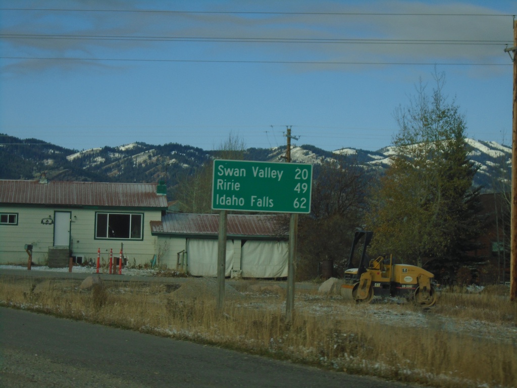
ID-31 South - Distance Marker
Distance marker on ID-31 south. Distance to Swan Valley, Ririe, and Idaho Falls.
Taken 10-27-2019
 Victor
Teton County
Idaho
United States
Victor
Teton County
Idaho
United States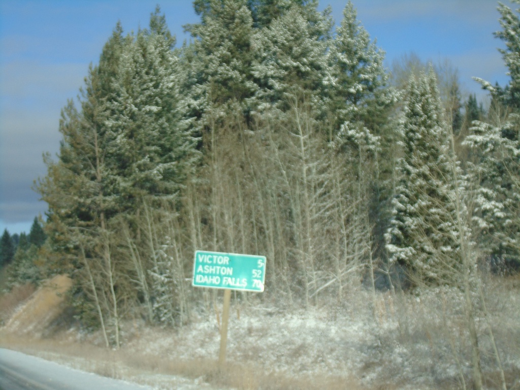
ID-33 West - Distance Marker
Distance marker on ID-33 west. Distance to Victor, Ashton, and Idaho Falls.
Taken 10-27-2019
 Victor
Teton County
Idaho
United States
Victor
Teton County
Idaho
United States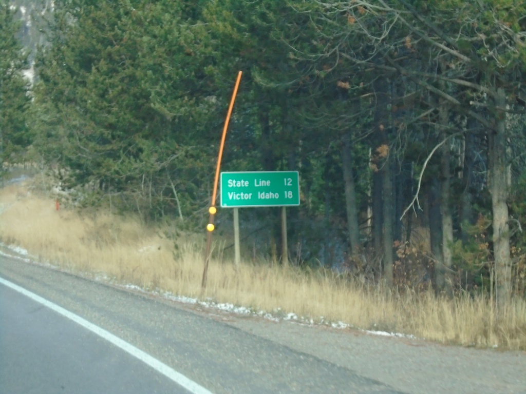
WY-22 West - Distance Marker
Distance marker on WY-22 west. Distance to (Idaho-Wyoming) State Line and Victor Idaho.
Taken 10-27-2019
 Wilson
Teton County
Wyoming
United States
Wilson
Teton County
Wyoming
United States