Signs Tagged With Distance Marker
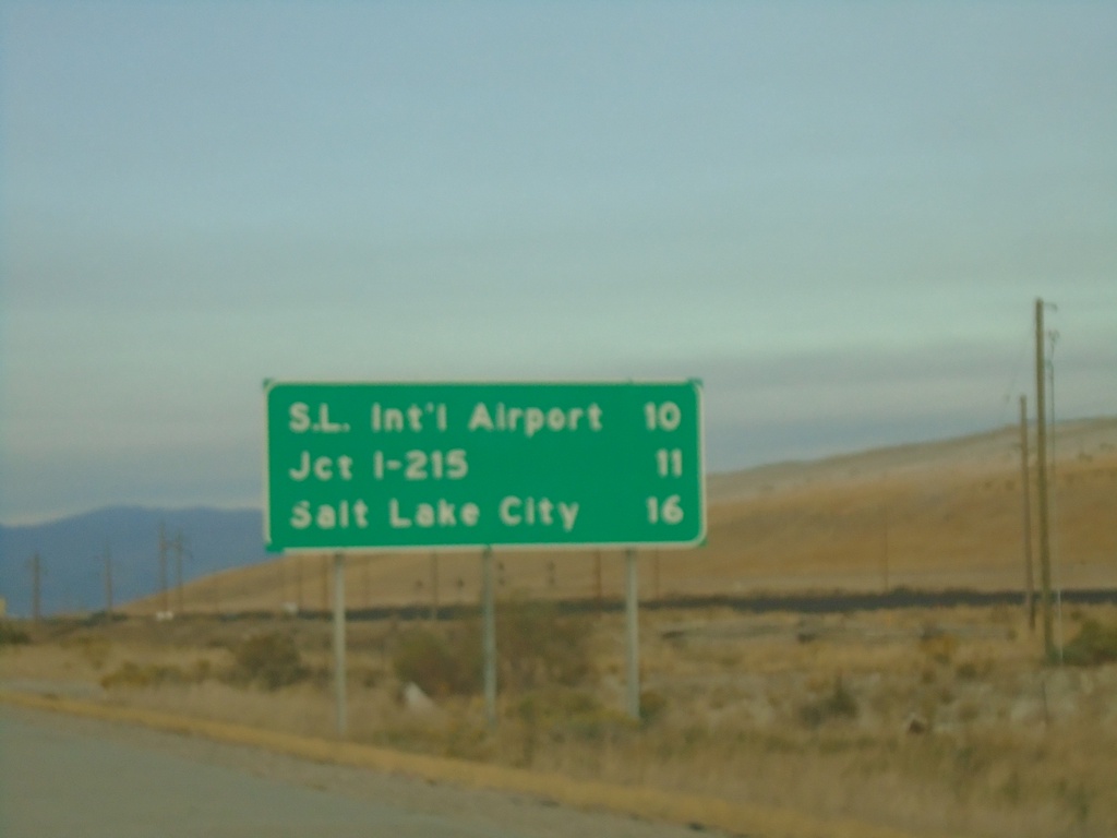
I-80 East - Distance Marker
Distance marker on I-80 east. Distance to Salt Lake International Airport, Jct. I-215, and Salt Lake City.
Taken 10-02-2020
 Tooele
Salt Lake County
Utah
United States
Tooele
Salt Lake County
Utah
United States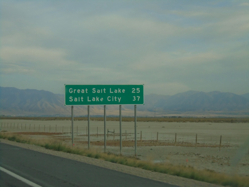
I-80 East - Distance Marker
Distance marker on I-80 East. Distance to Great Salt Lake and Salt Lake City.
Taken 10-02-2020
Grantsville
Tooele County
Utah
United States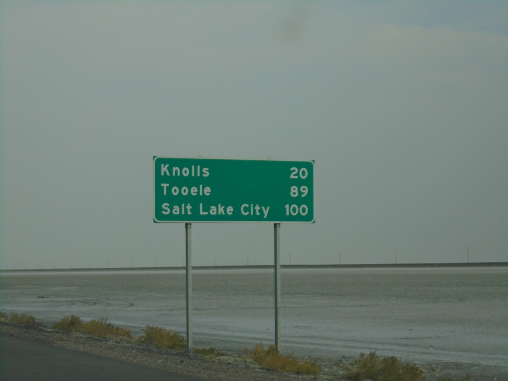
I-80 East - Distance Marker
Distance marker on I-80 east. Distance to Knolls, Tooele, and Salt Lake City.
Taken 10-02-2020
Wendover
Tooele County
Utah
United States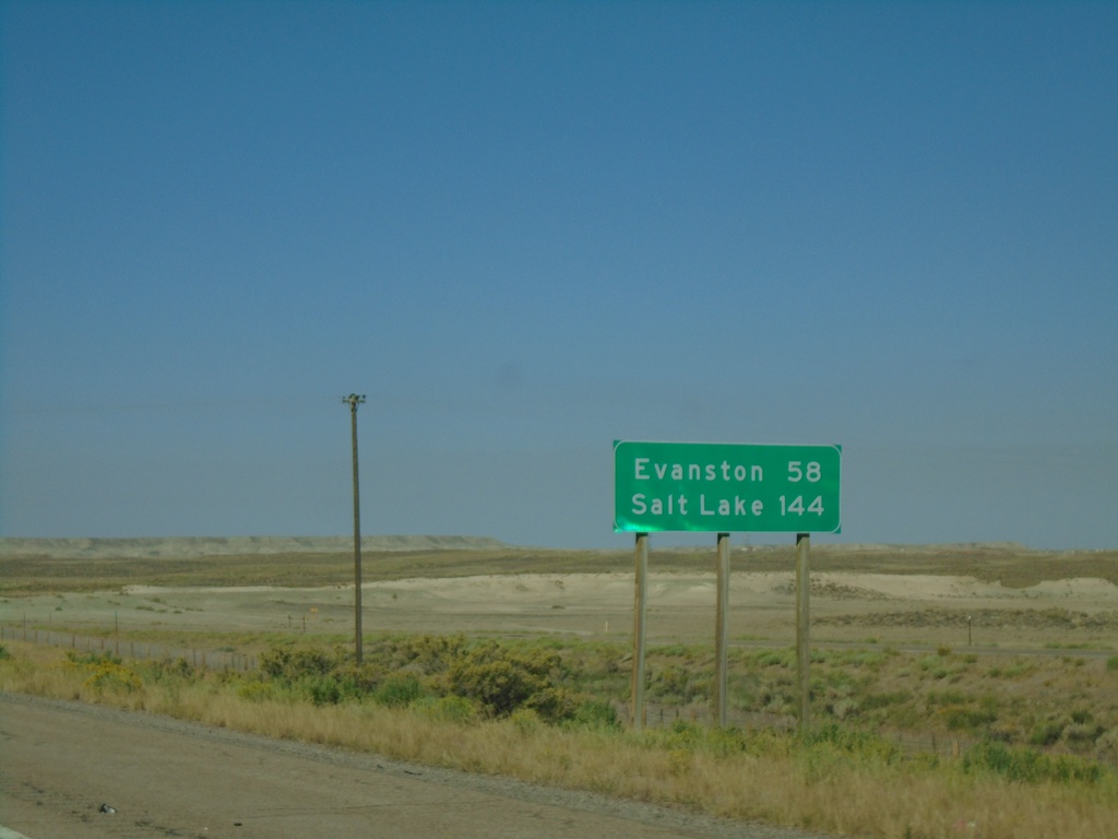
I-80 West - Distance Marker
Distance marker on I-80 west. Distance to Evanston and Salt Lake (Utah).
Taken 08-15-2020
Granger
Sweetwater County
Wyoming
United States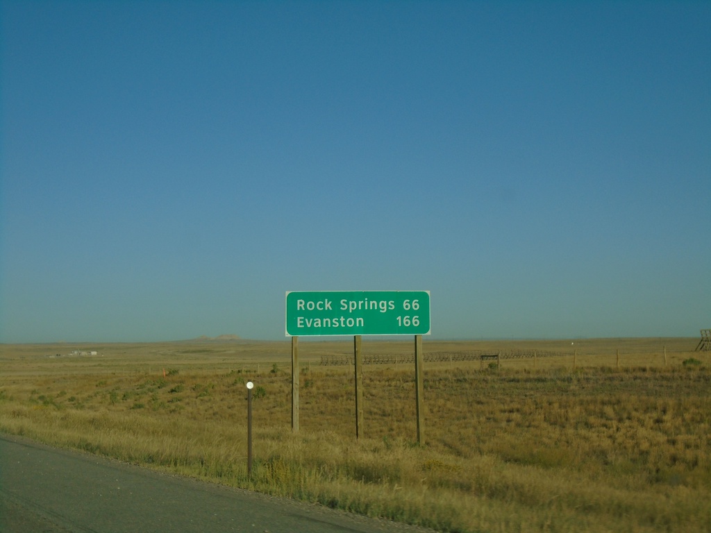
I-80 West - Distance Marker
Distance marker on I-80 west. Distance to Rock Springs and Evanston.
Taken 08-15-2020
 Wamsutter
Sweetwater County
Wyoming
United States
Wamsutter
Sweetwater County
Wyoming
United States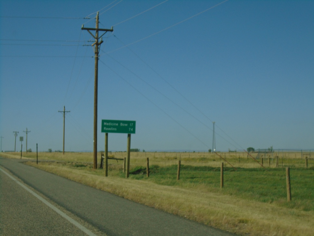
US-30 West/US-287 North - Distance Marker
Distance marker on US-30 West/US-287 North. Distance to Medicine Bow and Rawlins.
Taken 08-14-2020
 Rock River
Albany County
Wyoming
United States
Rock River
Albany County
Wyoming
United States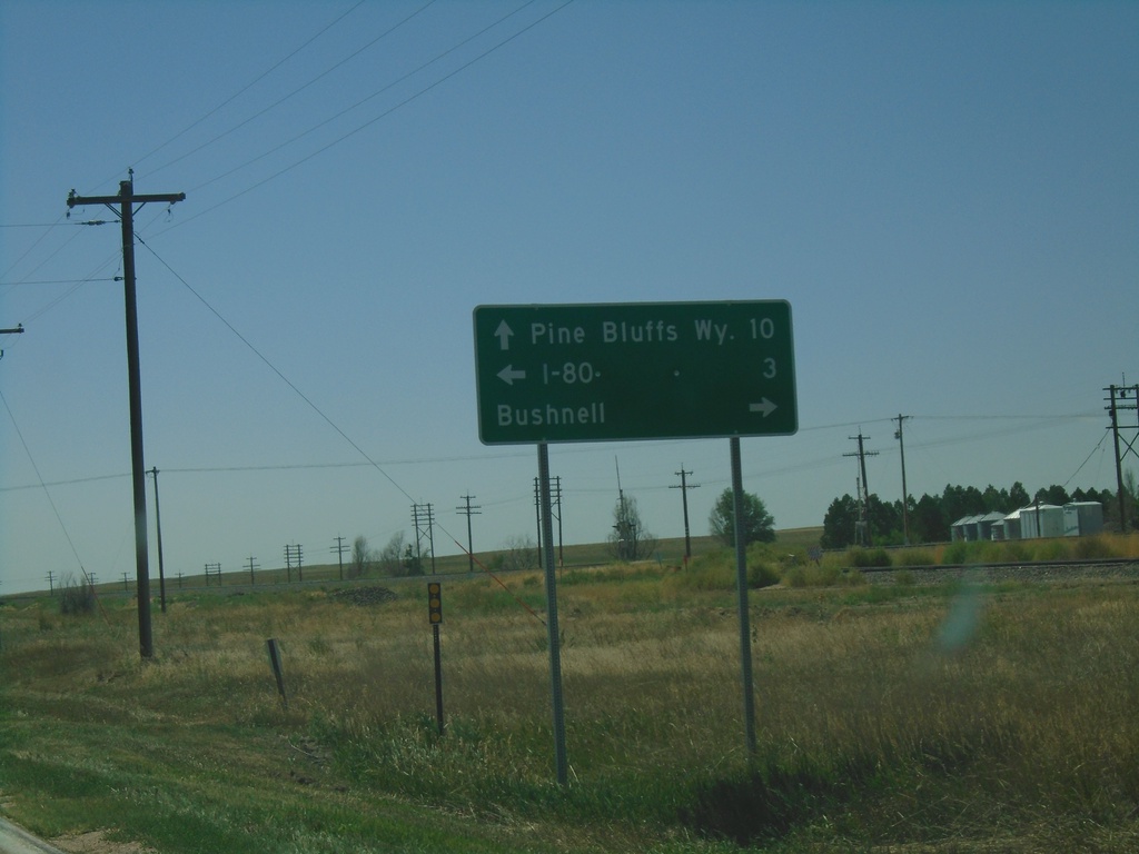
US-30 West at NE-53C Link
US-30 West at NE-53C Link south to I-80. Turn right on Birch St. for Bushnell. Continue west on US-30 for Pine Bluffs, WY.
Taken 08-14-2020
 Bushnell
Kimball County
Nebraska
United States
Bushnell
Kimball County
Nebraska
United States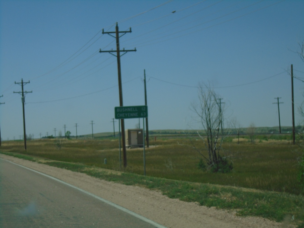
US-30 West - Distance Marker
Distance marker on US-30 west. Distance to Bushnell and Cheyenne (Wyoming).
Taken 08-14-2020
Kimball
Kimball County
Nebraska
United States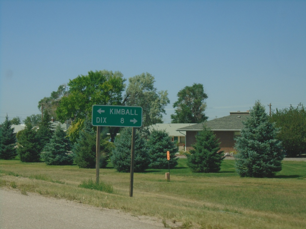
NE-53E Link North at US-30
NE-53E Link North at US-30. Turn right on US-30 for Dix; left for Kimball.
Taken 08-14-2020
 Kimball
 County
Nebraska
United States
Kimball
Kimball County
Nebraska
United States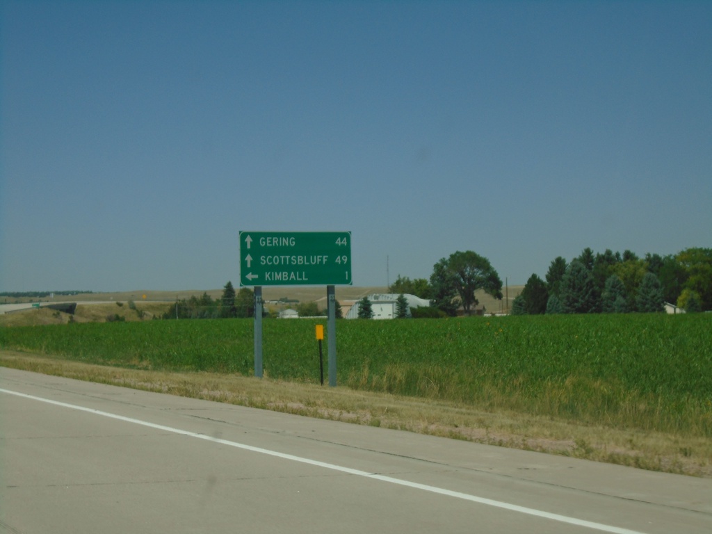
NE-71 North Approaching NE-53E Link
NE-71 North approaching NE-53E Link. Use NE-53E Link North for Kimball; continue north on NE-71 for Scottsbluff and Gering.
Taken 08-14-2020
 Kimball
 County
Nebraska
United States
Kimball
Kimball County
Nebraska
United States