Signs Tagged With Distance Marker
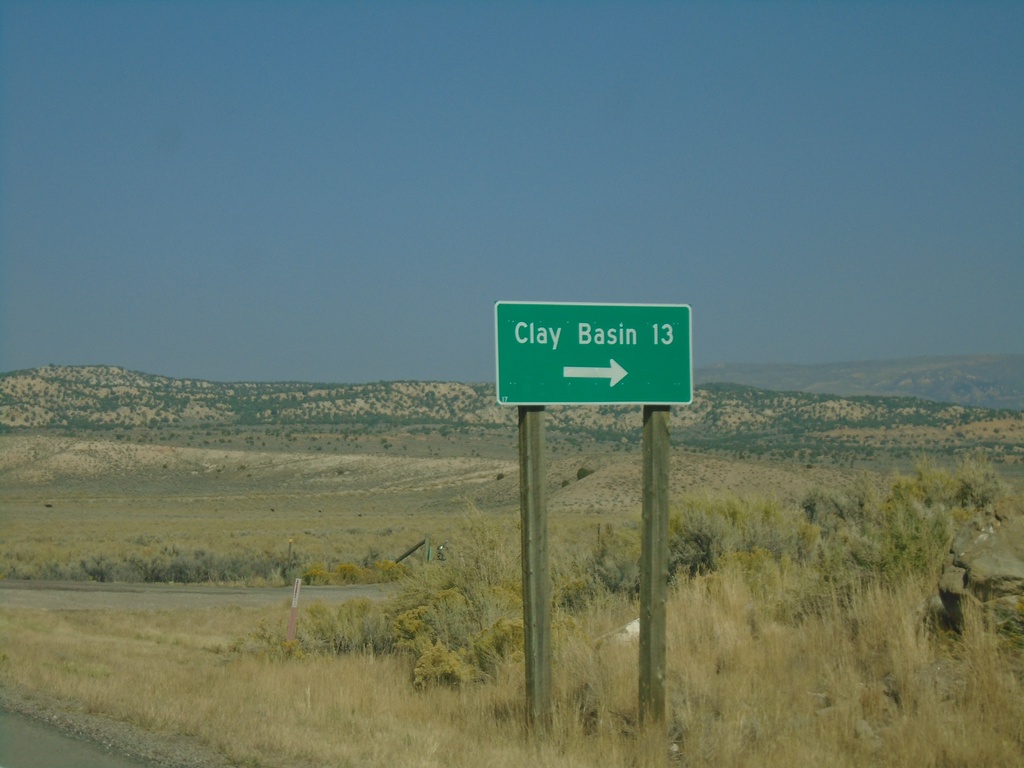
US-191 North - Clay Basin Jct.
US-191 north at Clay Basin junction. This road eventually becomes CO-318 in Colorado and provides access to the Green River at the Gates of Lodore.
Taken 10-03-2020
 Rock Springs
Sweetwater County
Wyoming
United States
Rock Springs
Sweetwater County
Wyoming
United States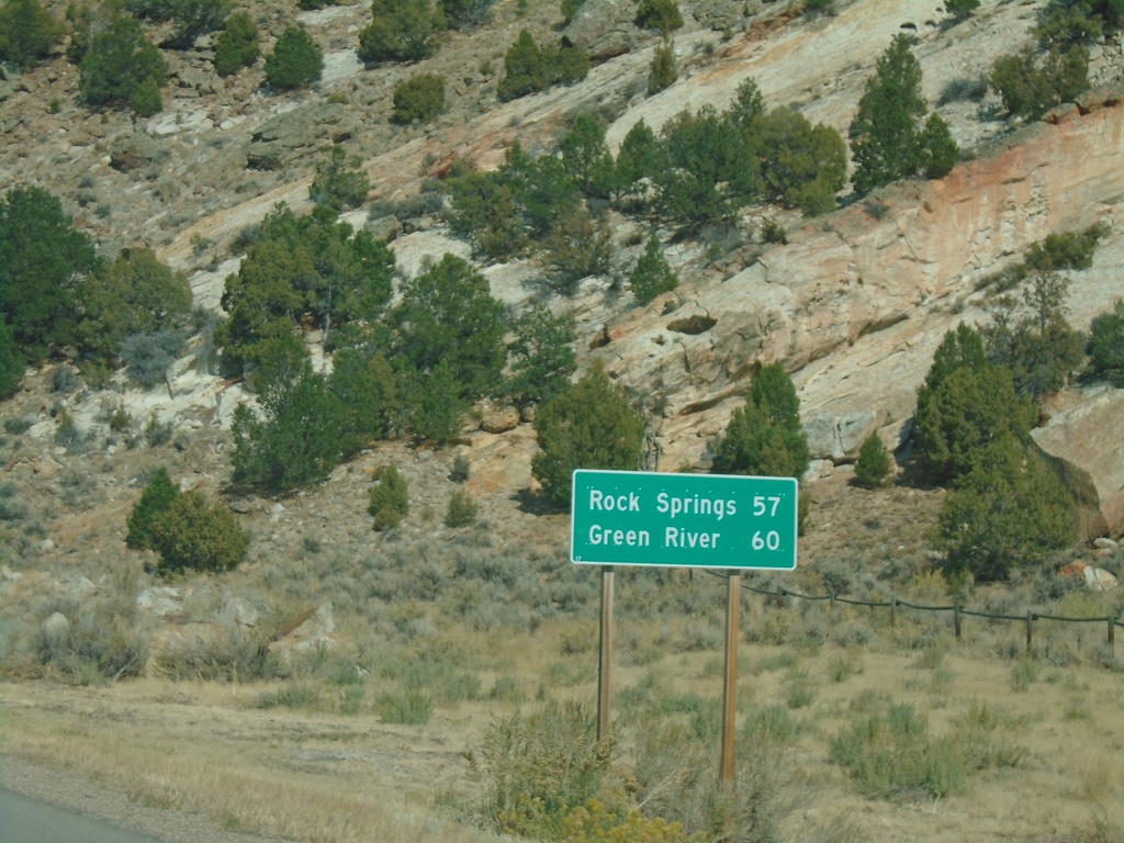
US-191 North - Distance Marker
Distance marker on US-191 north. Distance to Rock Springs and Green River. This is the first distance marker on US-191 northbound in Wyoming.
Taken 10-03-2020
Rock Springs
Sweetwater County
Wyoming
United States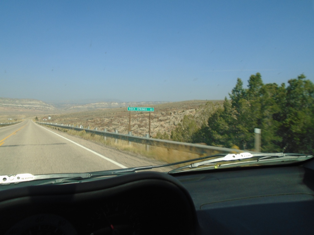
US-191 North - Distance Marker
Distance marker on US-191 north. Distance to Rock Springs (Wyoming). This is the last distance marker on US-191 north in Utah.
Taken 10-03-2020
Dutch John
Daggett County
Utah
United States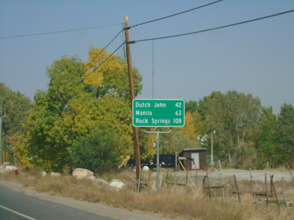
US-191 North - Distance Marker
Distance marker on US-191 north. Distance to Dutch John, Manila, and Rock Springs (Wyoming).
Taken 10-03-2020
Vernal
Uintah County
Utah
United States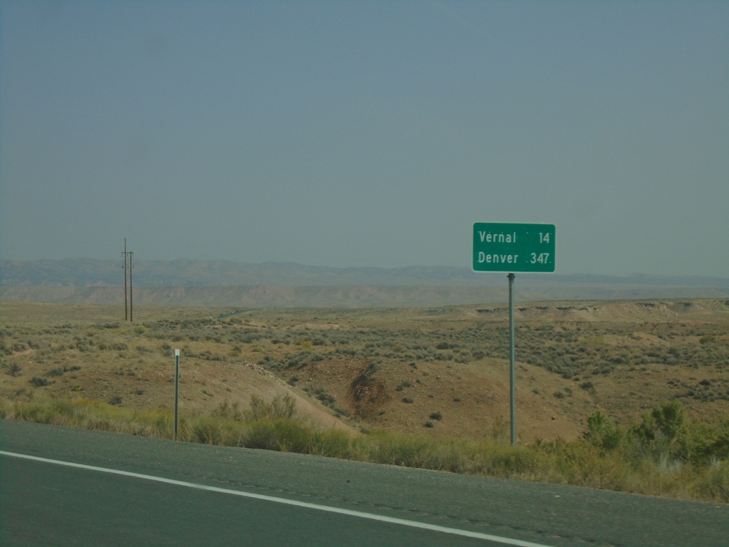
US-40 East/US-191 North - Distance Marker
Distance Marker on US-40 East/US-191 North. Distance to Vernal and Denver (Colorado).
Taken 10-03-2020
 Vernal
Uintah County
Utah
United States
Vernal
Uintah County
Utah
United States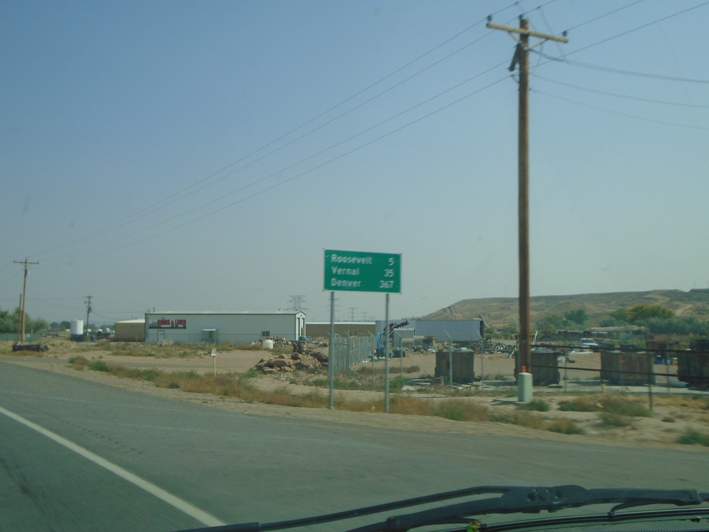
US-40 East/US-191 North - Distance Marker
Distance Marker on US-40 East/US-191 North. Distance to Roosevelt, Vernal, and Denver (Colorado).
Taken 10-03-2020
Myton
Duchesne County
Utah
United States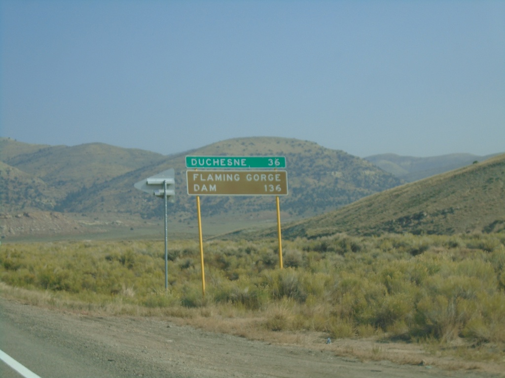
US-191 North - Distance Marker
Distance marker on US-191 north. Distance to Duchesne and Flaming Gorge Dam.
Taken 10-03-2020
Helper
Carbon County
Utah
United States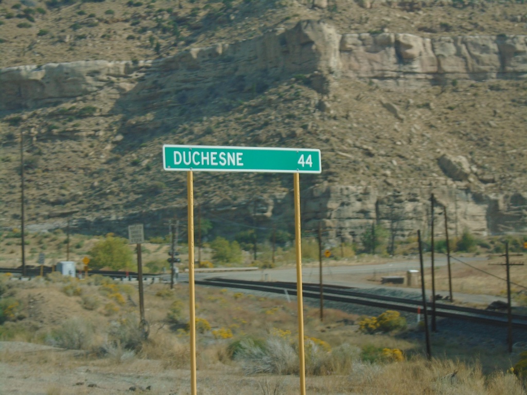
US-191 North - Distance Marker
Distance marker on US-191 north. Distance to Duchesne.
Taken 10-03-2020
Helper
Carbon County
Utah
United States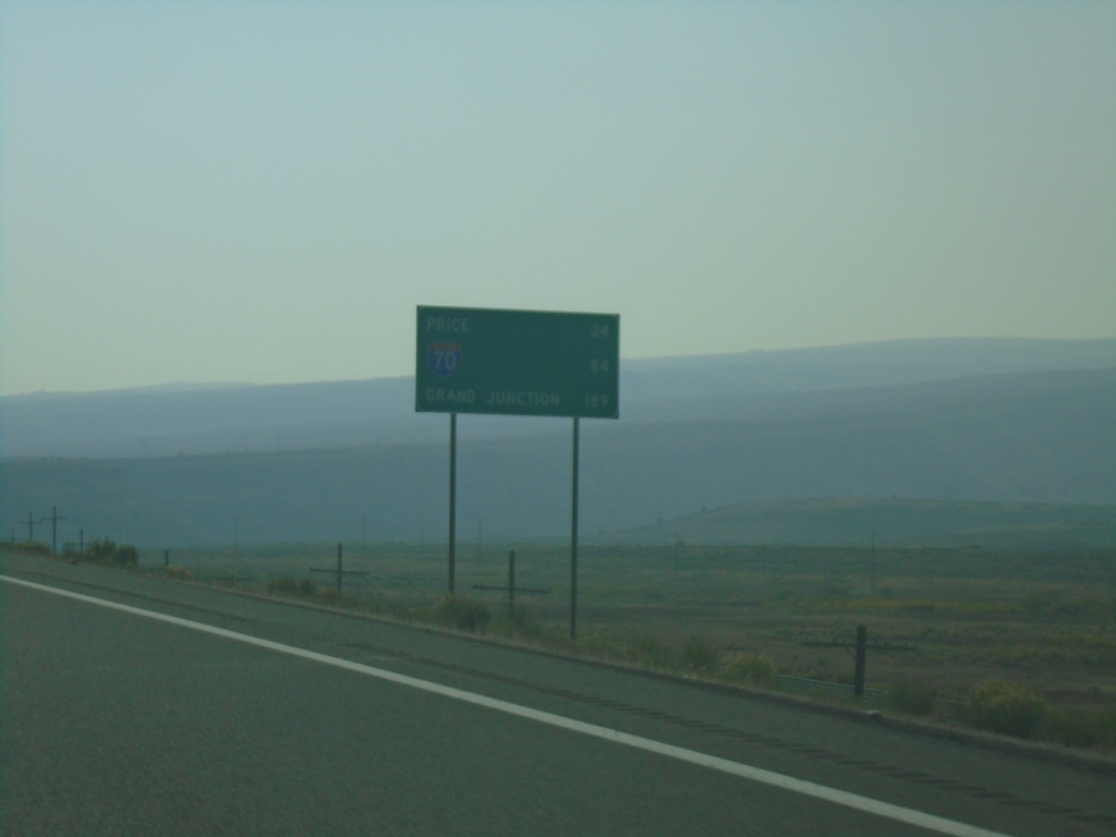
US-6 East - Distance Marker
Distance marker on US-6 east. Distance to Price, I-70 Junction, and Grand Junction (Colorado).
Taken 10-03-2020

 Colton
Utah County
Utah
United States
Colton
Utah County
Utah
United States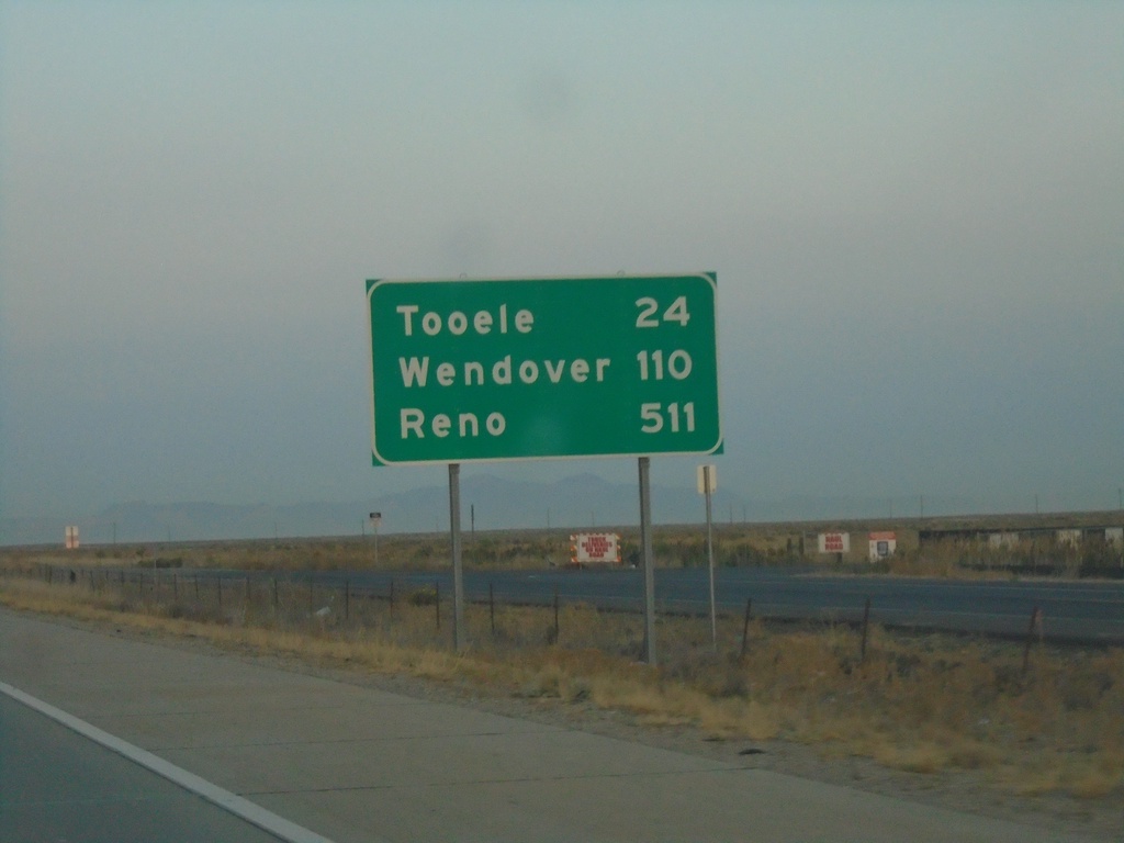
I-80 West - Distance Marker
Distance marker on I-80 west. Distance to Tooele, Wendover, and Reno (Nevada).
Taken 10-03-2020
 Salt Lake City
Salt Lake County
Utah
United States
Salt Lake City
Salt Lake County
Utah
United States