Signs Tagged With Distance Marker
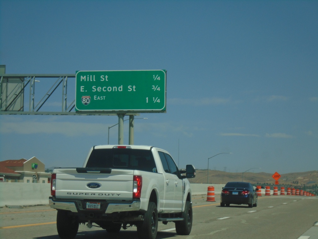
I-580 North/US-395 - Next Exits
Next 3 Exits on I-580 North/US-395: Mill St., E. Second St. and I-80.
Taken 07-12-2021

 Reno
Washoe County
Nevada
United States
Reno
Washoe County
Nevada
United States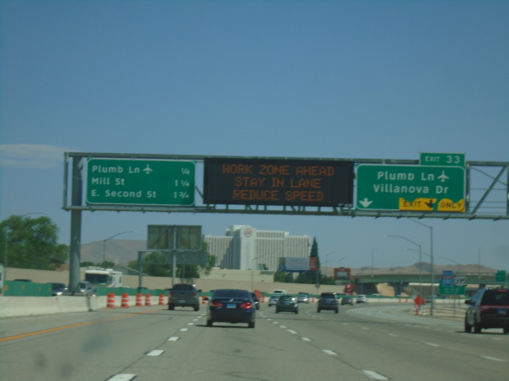
I-580/US-395 North Approaching Exit 33
I-580/US-395 north approaching Exit 33 - Plumb Lane/Villanova Drive. A distance marker showing the next three Reno exits is on the left side of the picture. The next three exits are: Plumb Lane, Mill St., and E. Second St. Use the Plumb Lane exit for the Reno-Tahoe International Airport.
Taken 07-12-2021
Reno
Washoe County
Nevada
United States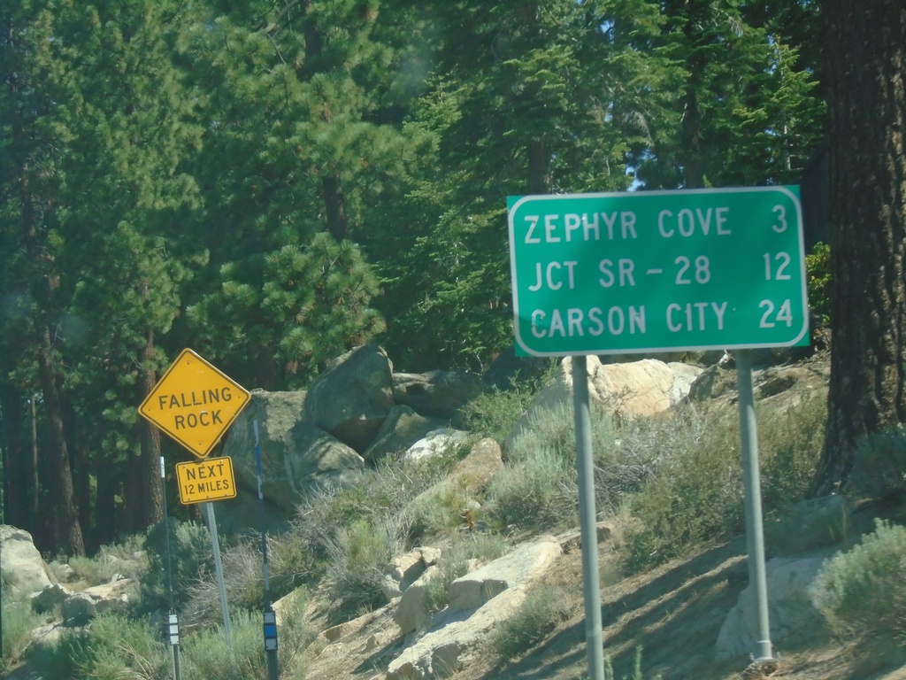
US-50 East - Distance Marker
First distance marker on US-50 east in Nevada. Distance to Zephyr Cove, Jct SR-28, and Carson City.
Taken 07-12-2021
 Stateline
Douglas County
Nevada
United States
Stateline
Douglas County
Nevada
United States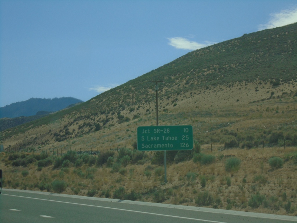
US-50 West - Distance Marker
Distance marker on US-50 west. Distance to Jct. SR-28, South Lake Tahoe (CA), and Sacramento (CA).
Taken 07-09-2021
Carson City
Nevada
United States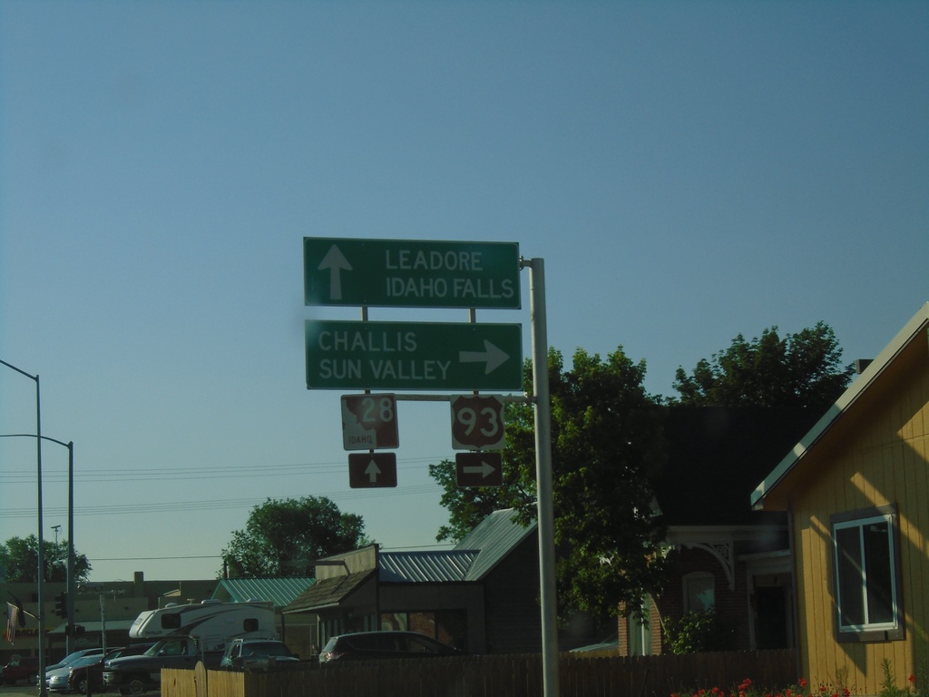
US-93 South at ID-28
US-93 south at ID-28 in Salmon. Turn right to continue south on US-93 to Challis and Sun Valley. Continue straight on Main St. for ID-28 South to Leadore and Idaho Falls.
Taken 07-03-2021

 Salmon
Lemhi County
Idaho
United States
Salmon
Lemhi County
Idaho
United States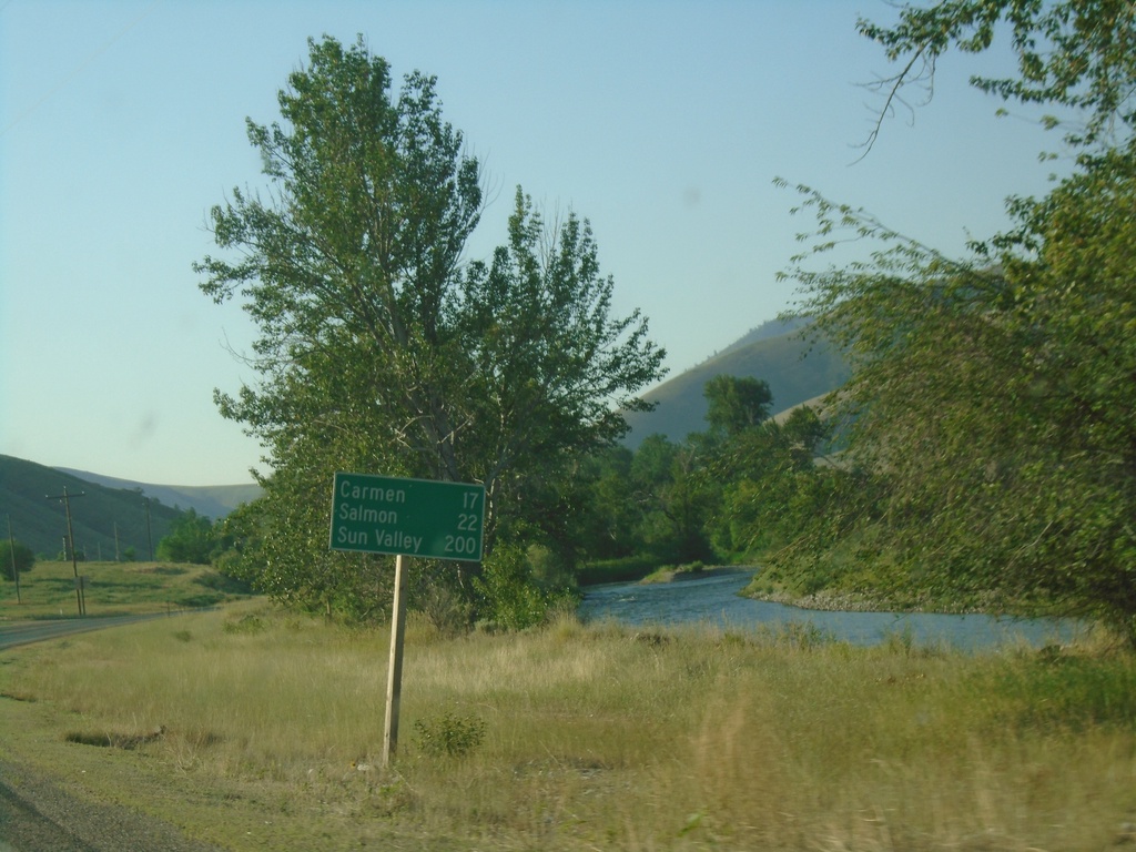
US-93 South - Distance Marker
Distance marker on US-93 south. Distance to Carmen, Salmon, and Sun Valley.
Taken 07-03-2021
North Fork
Lemhi County
Idaho
United States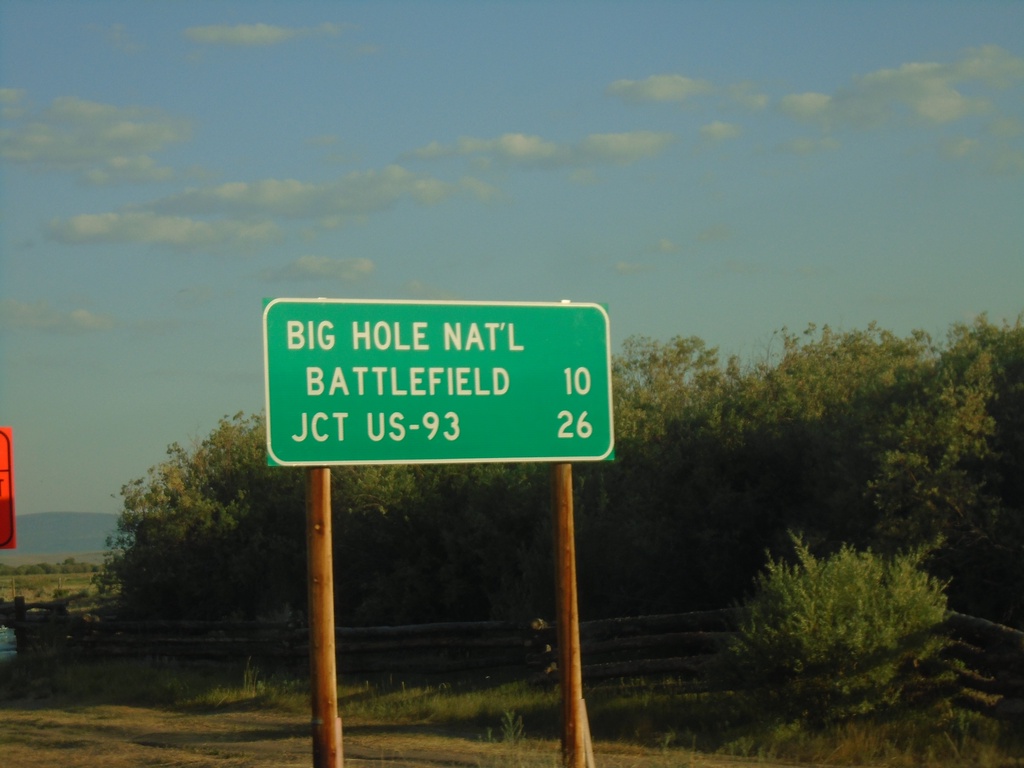
MT-43 West - Distance Marker
Distance marker on MT-43 west. Distance to Big Hole National Battlefield and Jct. US-93.
Taken 07-03-2021
 Wisdom
Beaverhead County
Montana
United States
Wisdom
Beaverhead County
Montana
United States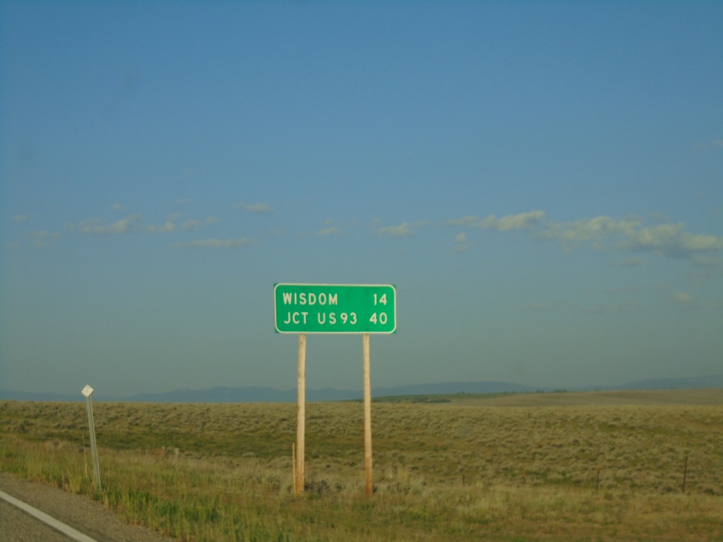
MT-43 West - Distance Marker
Distance marker on MT-43 west. Distance to Wisdom and Jct. US-93.
Taken 07-03-2021
Wise River
Beaverhead County
Montana
United States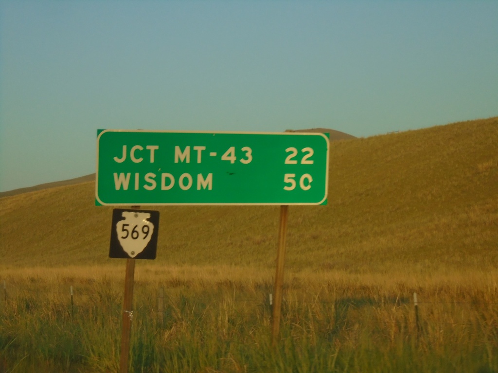
MTS-569 South - Distance Marker
Distance marker on MTS-569 south. Distance to Jct. MT-43 and Wisdom.
Taken 07-03-2021
 Anaconda
Deer Lodge County
Montana
United States
Anaconda
Deer Lodge County
Montana
United States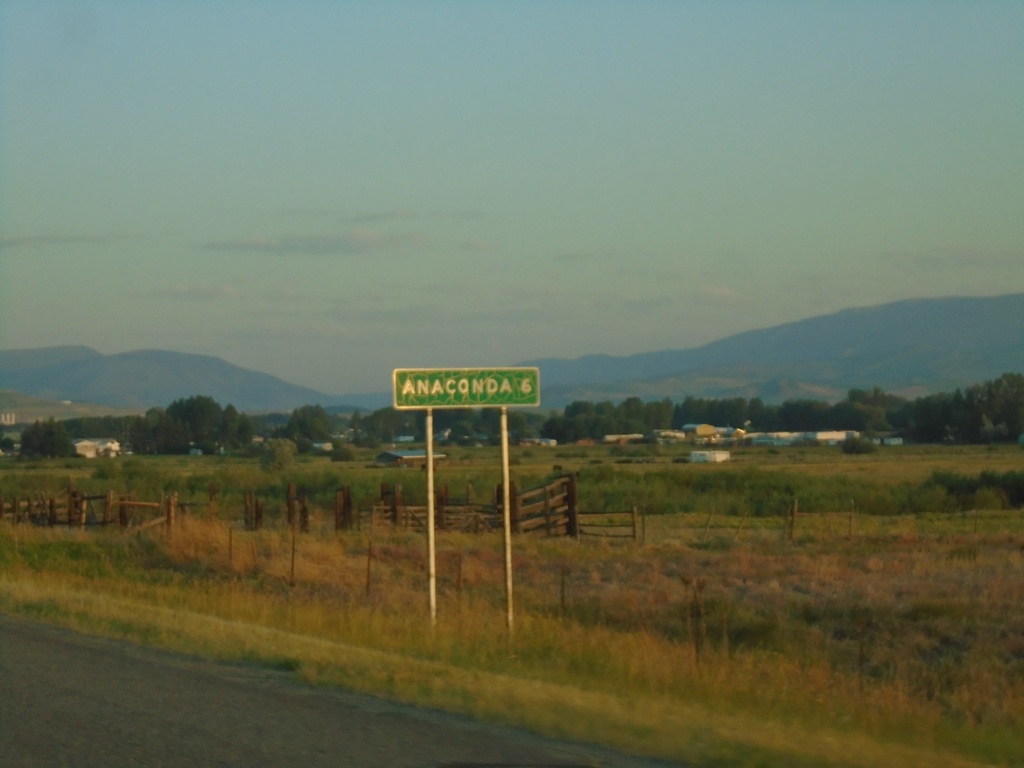
MT-1 West - Distance Marker
Distance marker on MT-1 west. Distance to Anaconda.
Taken 07-03-2021
 Anaconda
Deer Lodge County
Montana
United States
Anaconda
Deer Lodge County
Montana
United States