Signs Tagged With Distance Marker
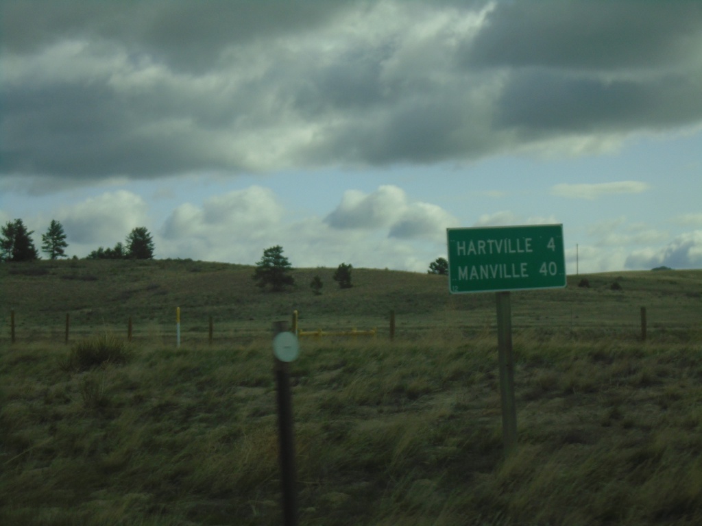
WY-270 North - Distance Marker
Distance marker on WY-270 north. Distance to Hartville, and Manville.
Taken 04-30-2022
 Guernsey
Platte County
Wyoming
United States
Guernsey
Platte County
Wyoming
United States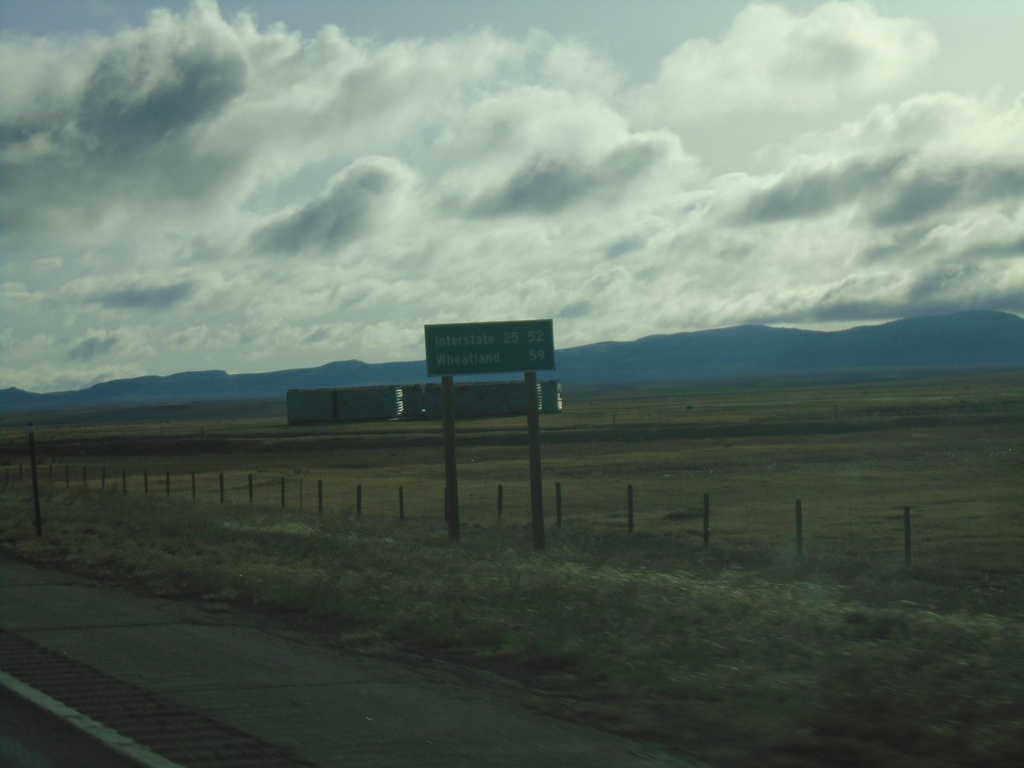
WY-34 East - Distance Marker
Distance marker on WY-34 east. Distance to I-25 and Wheatland (via I-25).
Taken 04-30-2022
 Laramie
Albany County
Wyoming
United States
Laramie
Albany County
Wyoming
United States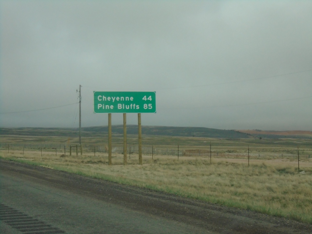
I-80 East - Distance Marker
Distance marker on I-80 east. Distance to Cheyenne and Pine Bluffs. Pine Bluffs is on the border with Nebraska.
Taken 04-29-2022
 Laramie
Albany County
Wyoming
United States
Laramie
Albany County
Wyoming
United States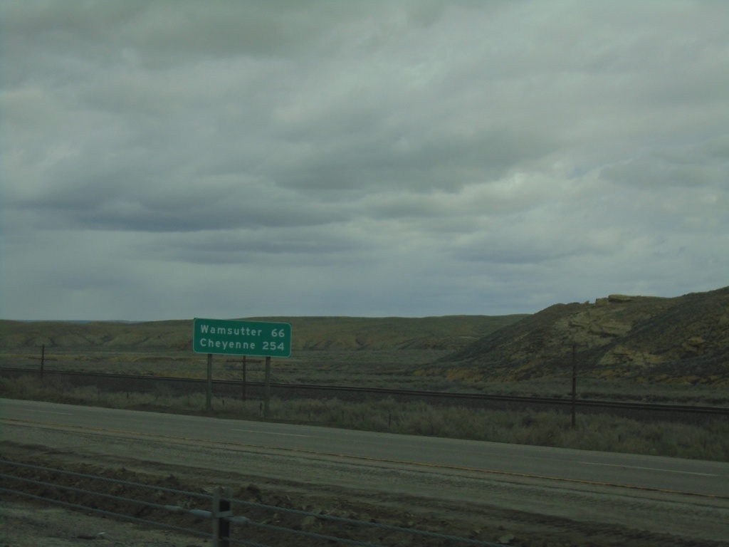
I-80 East - Distance Marker
Distance marker on I-80 east. Distance to Wamsutter and Cheyenne.
Taken 04-29-2022
 Rock Springs
Sweetwater County
Wyoming
United States
Rock Springs
Sweetwater County
Wyoming
United States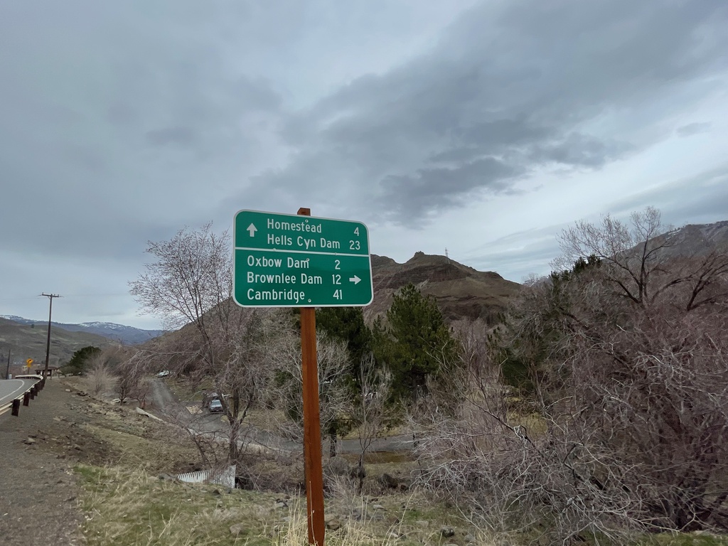
OR-86 East at Brownlee-Oxbow Highway
OR-86 East at Brownlee-Oxbow Highway. Turn right on Brownlee-Oxbow Highway to Oxbow Dam, Brownlee Dam, and Cambridge (Idaho). Continue east on OR-86 for Homestead and Hells Canyon Dam.
Taken 03-19-2022
 Halfway
Baker County
Oregon
United States
Halfway
Baker County
Oregon
United States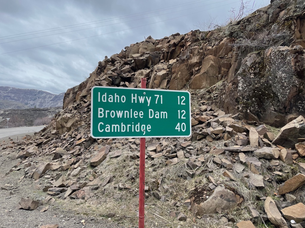
Oxbow-Brownlee Highway South - Distance Marker
Distance Marker on Oxbow-Brownlee Highway south. Distance to Idaho Highway 71, Brownlee Dam, and Cambridge (Idaho). The Oxbow-Brownlee Highway is managed by Idaho Power and connects OR-86 and ID-71, and is part of a network of roads connecting the three Hells Canyon dams.
Taken 03-19-2022
Halfway Baker County Oregon United States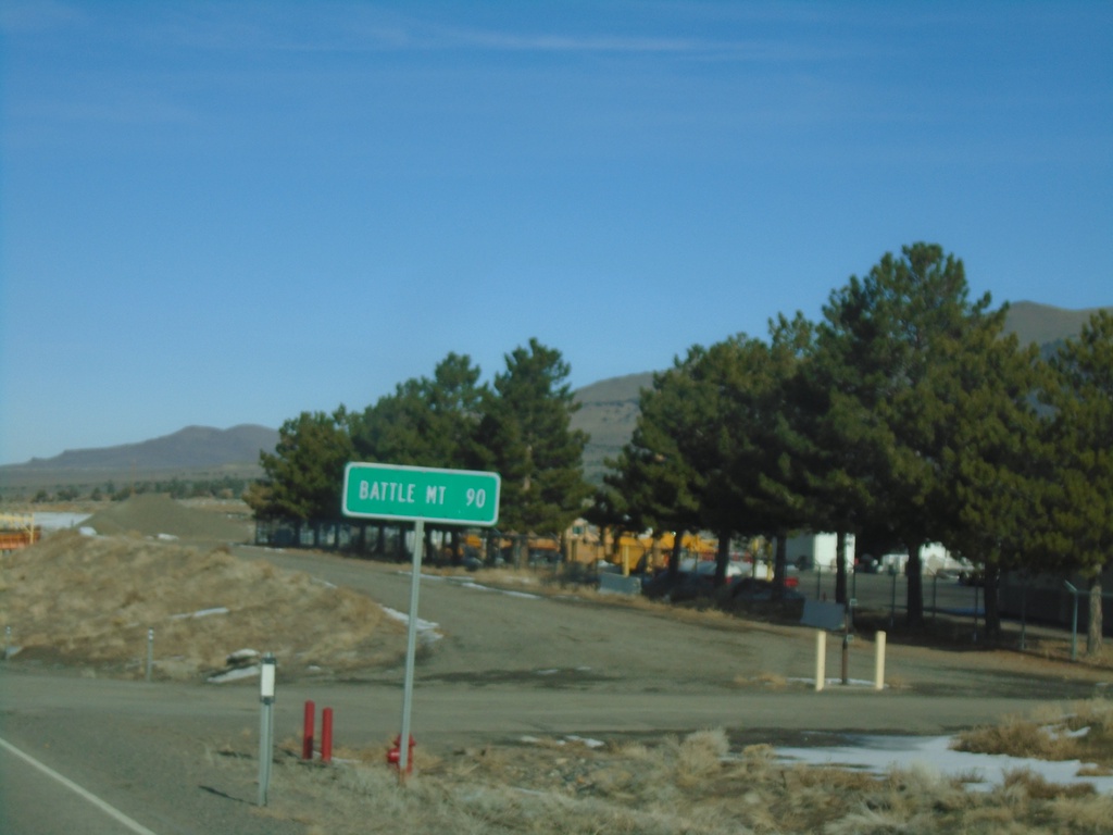
NV-305 North - Distance Marker
Distance marker on NV-305 north. Distance to Battle Mountain.
Taken 01-15-2022
 Austin
Lander County
Nevada
United States
Austin
Lander County
Nevada
United States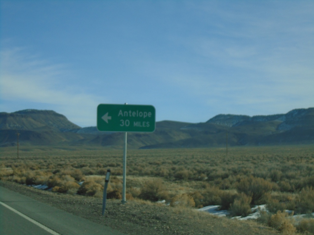
US-50 East - Antelope Junction
US-50 East approaching Antelope junction.
Taken 01-15-2022
 Fallon
Churchill County
Nevada
United States
Fallon
Churchill County
Nevada
United States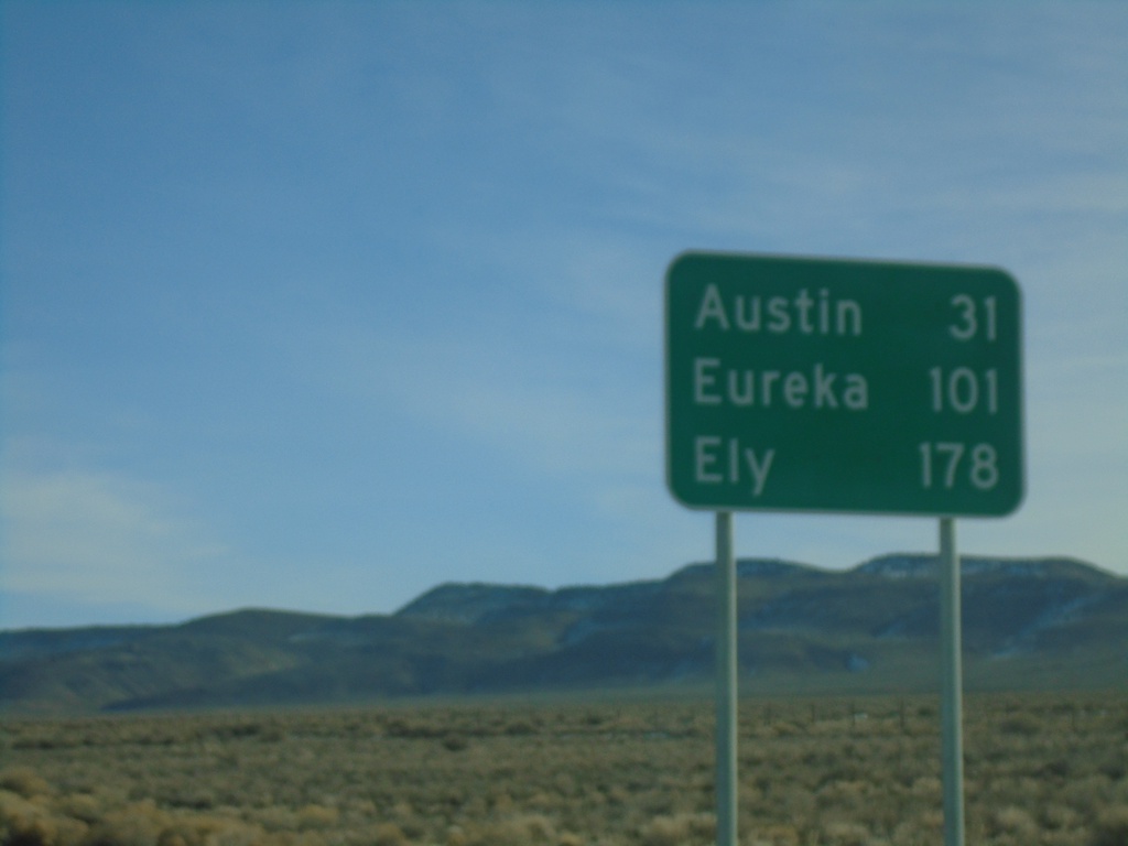
US-50 East - Distance Marker
Distance marker on US-50 east. Distance to Austin, Eureka, and Ely.
Taken 01-15-2022
Fallon
Churchill County
Nevada
United States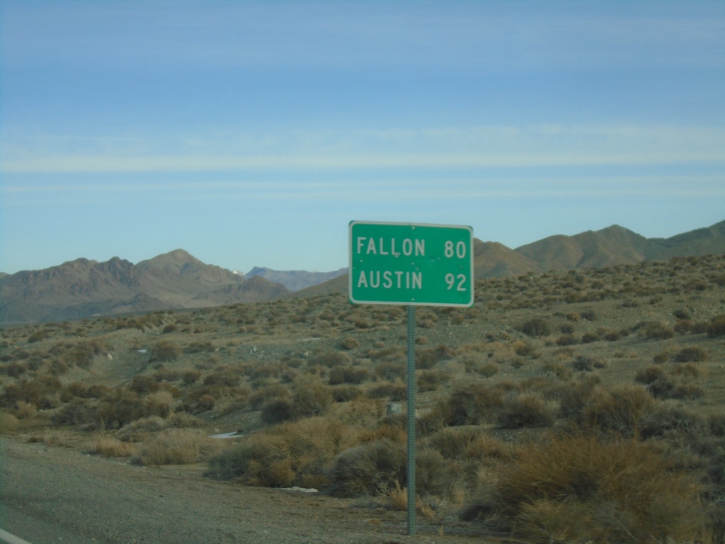
NV-361 North - Distance Marker
Distance marker on NV-361 north. Distance to Fallon (via US-50 West) and Austin (via US-50 East).
Taken 01-15-2022
 Gabbs
Nye County
Nevada
United States
Gabbs
Nye County
Nevada
United States