Signs Tagged With Distance Marker
SD-34 East/SD-25 North at SD-34/SD-25 Split
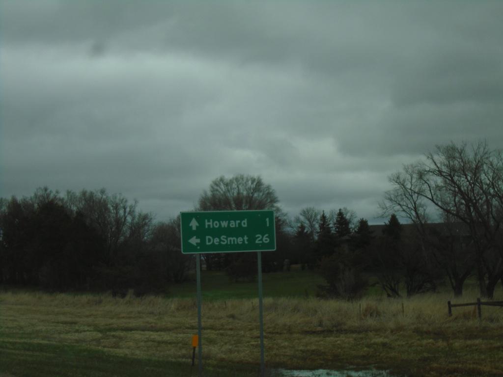
SD-34 East/SD-25 North at SD-34/SD-25 split in Miner County. Use SD-25 North to De Smet; SD-34 East to Howard.
Taken 05-01-2022

 Howard
Miner County
South Dakota
United States
Howard
Miner County
South Dakota
United States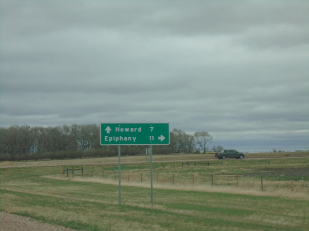
SD-34 East at SD-25 South
SD-34 East at SD-25 South to Epiphany. Continue on SD-34 East/SD-25 North to Howard. SD-25 North joins SD-34 eastbound.
Taken 05-01-2022
Howard
Miner County
South Dakota
United States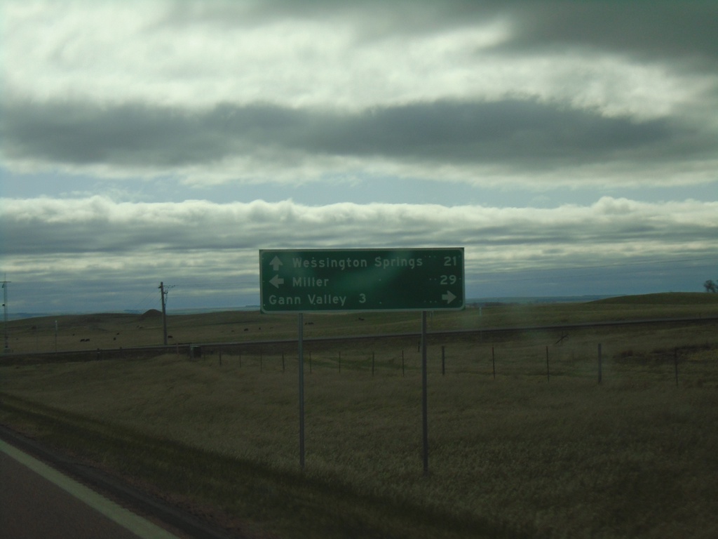
SD-34 East Approaching SD-45
SD-34 East approaching SD-45. Use SD-45 south for Gann Valley; SD-45 north for Miller. Continue east on SD-34 for Wessington Springs.
Taken 05-01-2022
 Gann Valley
Buffalo County
South Dakota
United States
Gann Valley
Buffalo County
South Dakota
United States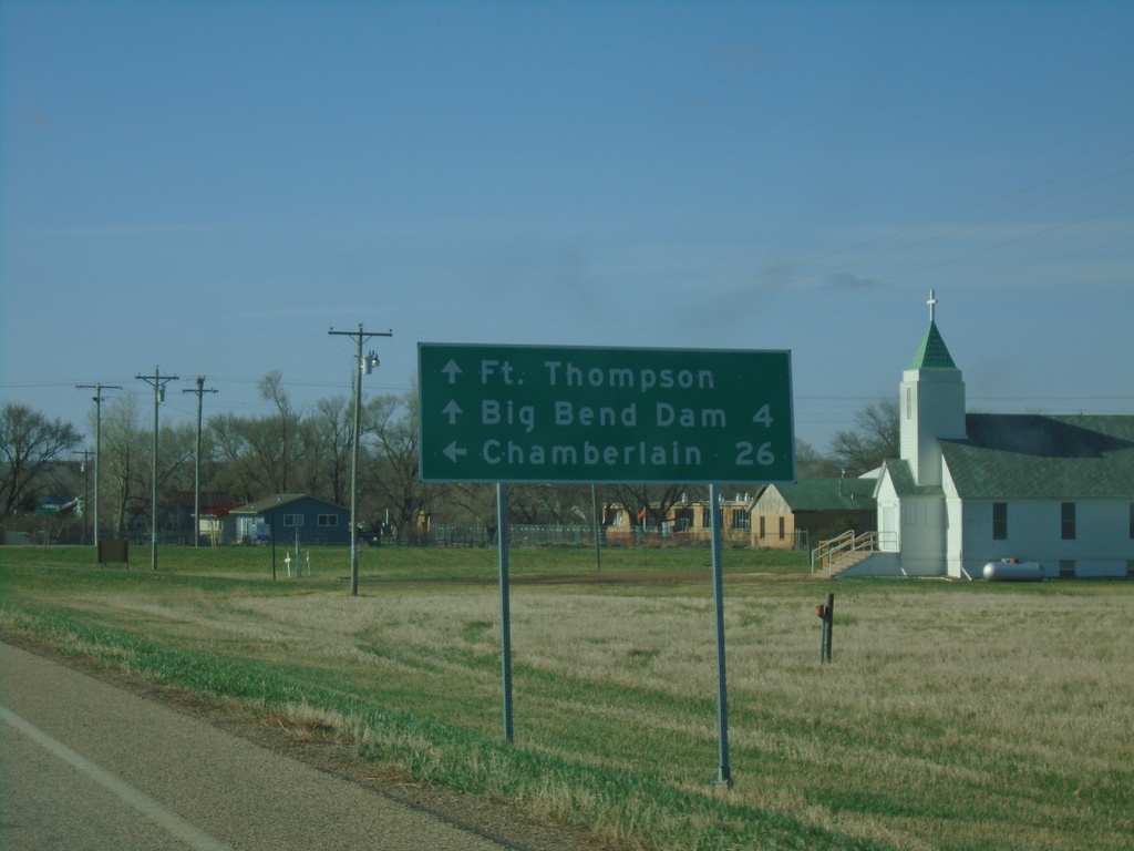
SD-34 East/SD-47 South Approaching SD-34/SD-47 Split
SD-34 East/SD-47 South approaching SD-34/SD-47 split in Fort Thompson. Continue south on SD-47 for Fort Thompson and Big Bend Dam. Turn left for SD-34 east to Chamberlain.
Taken 05-01-2022
 Fort Thompson
Buffalo County
South Dakota
United States
Fort Thompson
Buffalo County
South Dakota
United States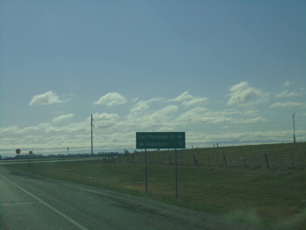
SD-34 East at SD-47 - Hyde County
SD-34 East at SD-47 in Hyde County. Use SD-47 north for Highmore; SD-34 East/SD-47 South for Fort Thompson. SD-47 South joins SD-34 East to Fort Thompson.
Taken 05-01-2022
Highmore
Hyde County
South Dakota
United States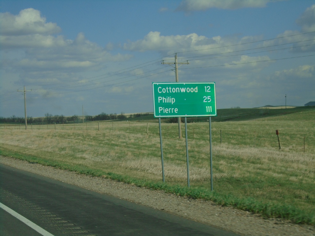
US-14 East - Distance Marker
Distance marker on US-14 east. Distance to Cottonwood, Phillip, and Pierre.
Taken 04-30-2022
 Quinn
Pennington County
South Dakota
United States
Quinn
Pennington County
South Dakota
United States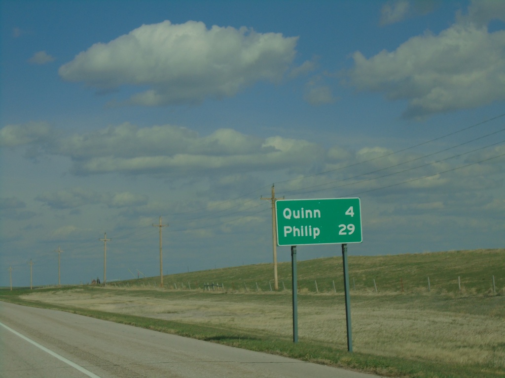
US-14 East - Distance Marker
Distance marker on US-14. Distance to Quinn and Phillip.
Taken 04-30-2022
Quinn
Pennington County
South Dakota
United States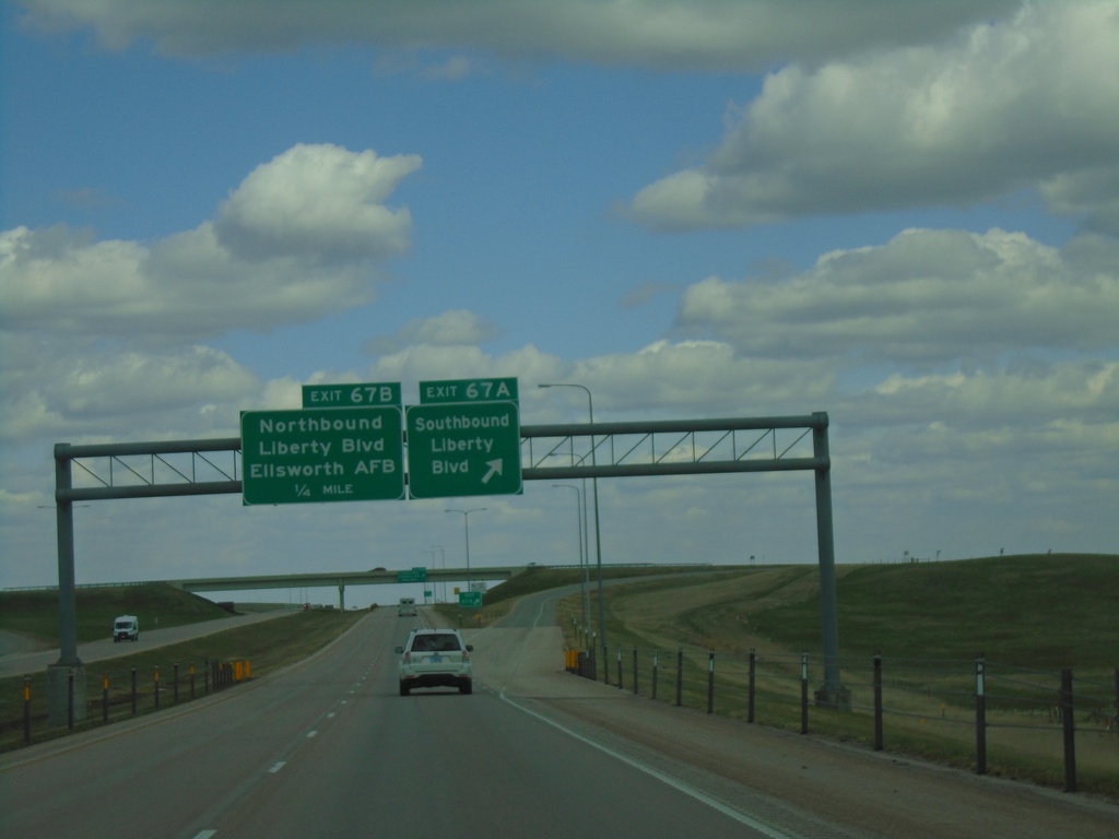
I-90 East - Exits 67A and 67B
I-90 east at Exit 67A - Southbound Liberty Blvd. Approaching Exit 67B - Northbound Liberty Blvd./Ellsworth AFB.
Taken 04-30-2022
 Box Elder
Pennington County
South Dakota
United States
Box Elder
Pennington County
South Dakota
United States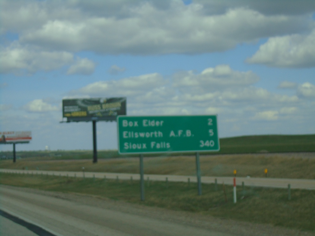
I-90 East - Distance Marker
Distance marker on I-90 east. Distance to Box Elder, Ellsworth AFB, and Sioux Falls.
Taken 04-30-2022
Rapid City
Pennington County
South Dakota
United States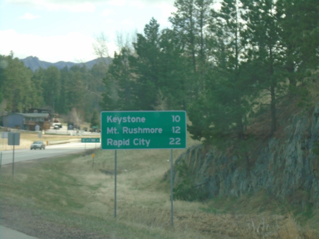
US-16 East - Distance Marker
Distance Marker on US-16 East. Distance to Keystone, Mount Rushmore, and Rapid City.
Taken 04-30-2022
 Rapid City
Pennington County
South Dakota
United States
Rapid City
Pennington County
South Dakota
United States