Signs Tagged With Distance Marker
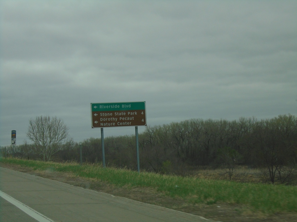
I-29 South Exit 151 Offramp at IA-12
I-29 South Exit 151 offramp at IA-12. Turn left on IA-12 north for Riverside Blvd., Stone State Park, Dorothy Peanut Nature Center.
Taken 05-02-2022

 Sioux City
Woodbury County
Iowa
United States
Sioux City
Woodbury County
Iowa
United States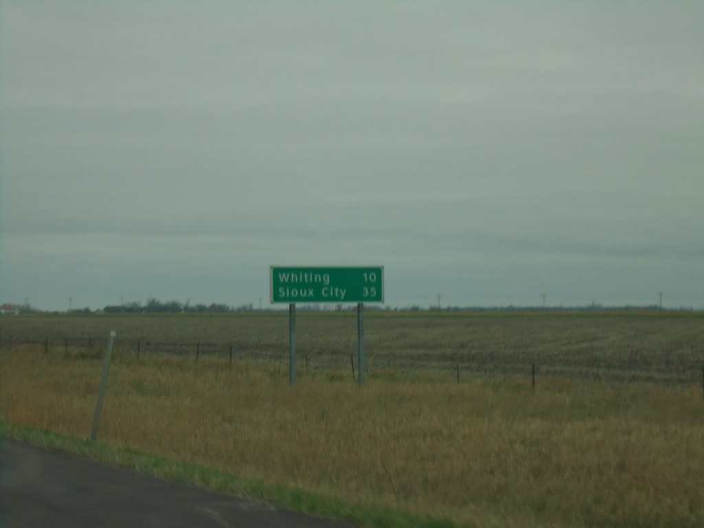
I-29 North - Distance Marker
Distance marker on I-29 north. Distance to Whiting and Sioux City.
Taken 05-02-2022
Onawa
Monona County
Iowa
United States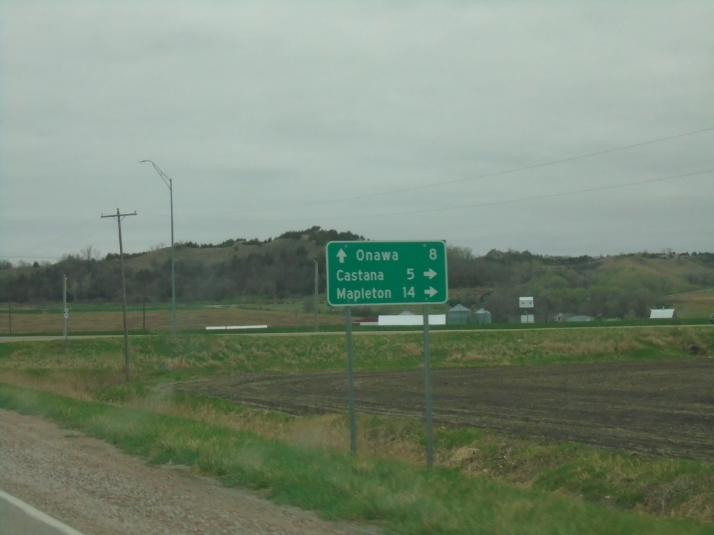
End IA-37 at IA-175
End IA-37 at IA-175 in Monona County. Use IA-175 east to Castana and Mapleton. Use IA-175 west to Onawa.
Taken 05-02-2022

 Onawa
Monona County
Iowa
United States
Onawa
Monona County
Iowa
United States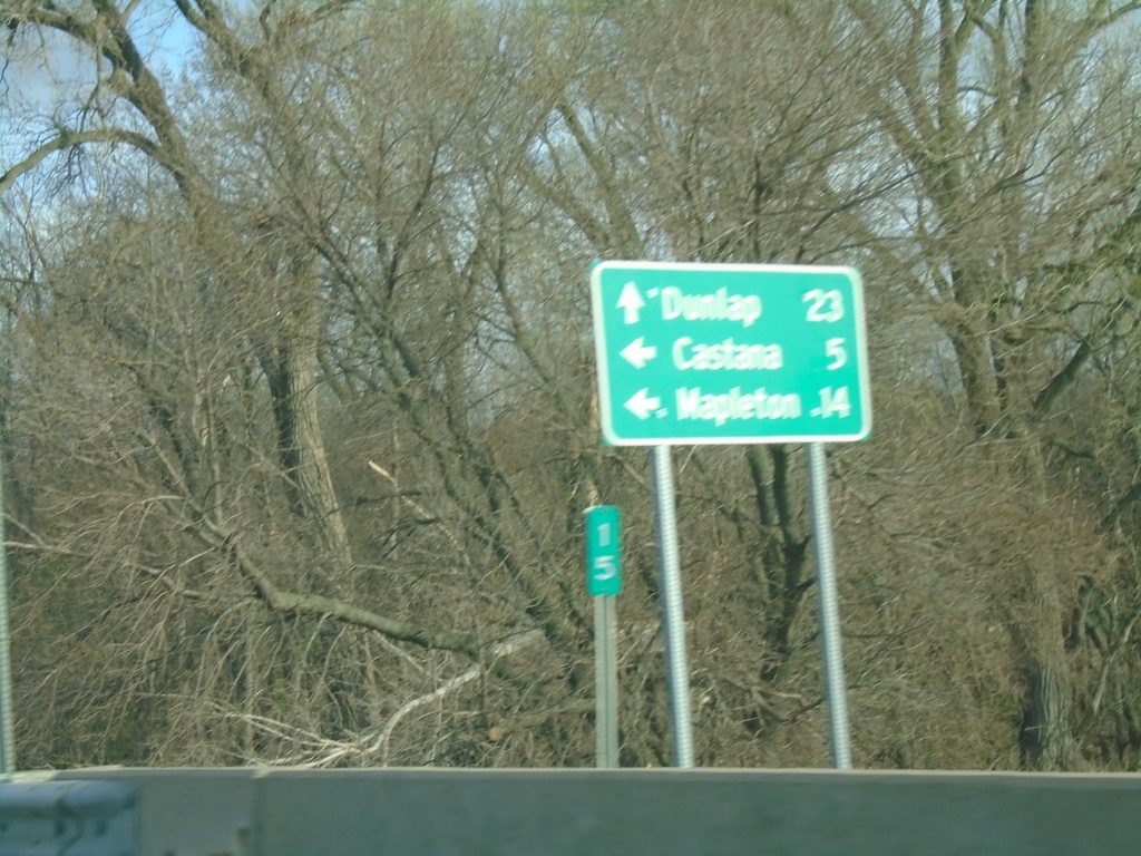
IA-175 East at IA-37
IA-175 East at IA-37 in Monona County. Use IA-37 East to Dunlap; IA-175 East to Castana and Mapleton.
Taken 05-01-2022
Onawa
Monona County
Iowa
United States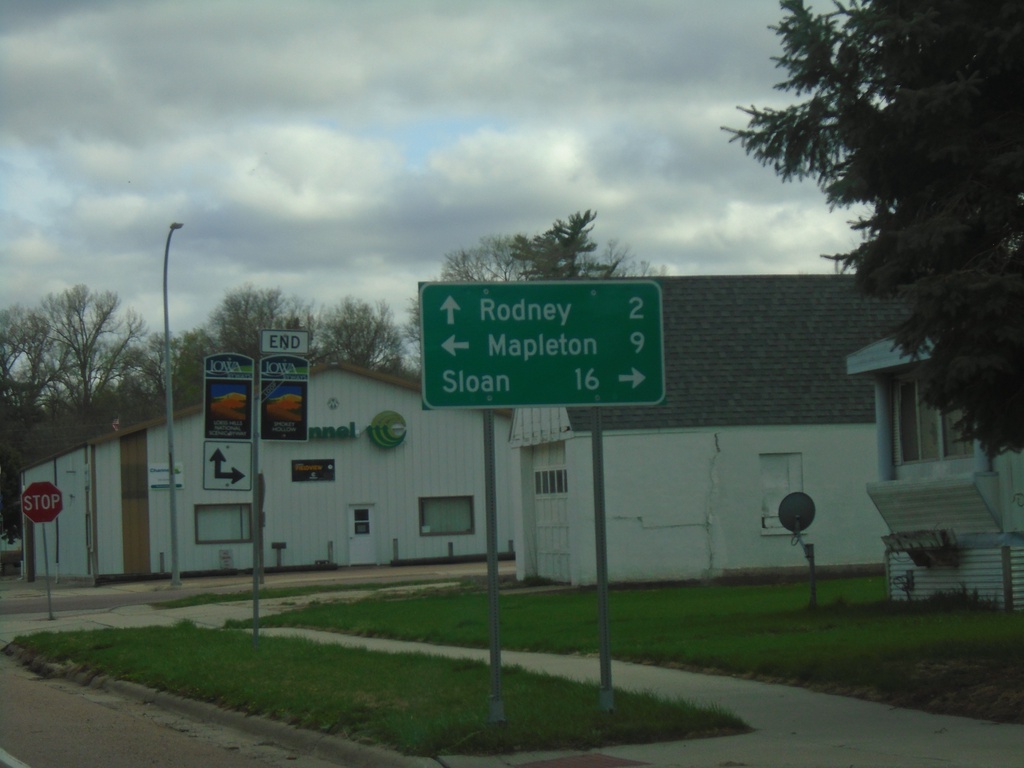
End IA-31 South at IA-141 and CH-L12
End IA-31 South at IA-141 and CH-L12 in Smithland. Use IA-141 west to Sloan; IA-141 east to Mapleton; and CH-L12 South to Rodney. The signs in the background indicate routes of the Loess Hills National Scenic Byway.
Taken 05-01-2022


 Smithland
Woodbury County
Iowa
United States
Smithland
Woodbury County
Iowa
United States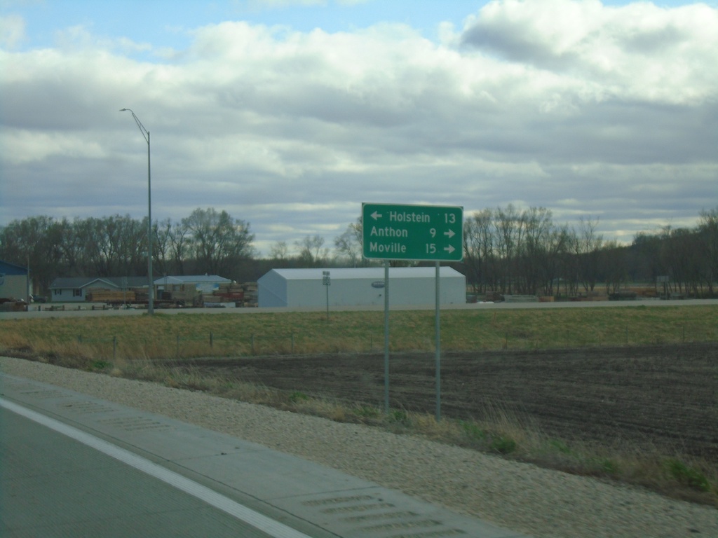
IA-31 South at US-20 - Correctionville
IA-31 South at US-20 in Correctionville. Use US-20 West to Holstein; US-20 East to Anthon and Molville. IA-31 South joins US-20 briefly eastbound.
Taken 05-01-2022
 Correctionville
Woodbury County
Iowa
United States
Correctionville
Woodbury County
Iowa
United States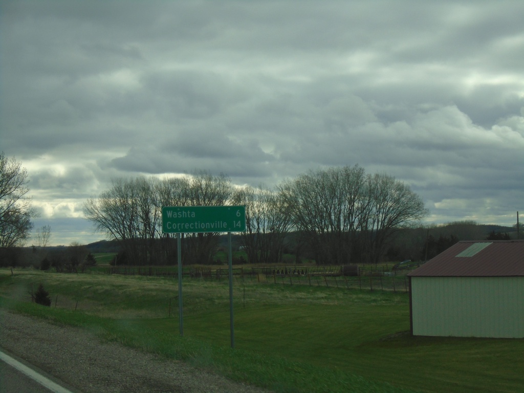
IA-31 South - Distance Marker
Distance marker on IA-31 south. Distance to Washta and Correctionville.
Taken 05-01-2022
Quimby
Cherokee County
Iowa
United States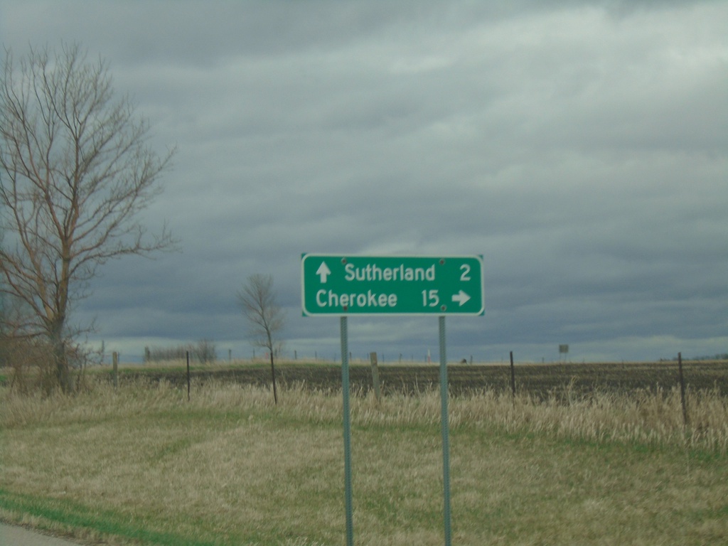
US-59 South/IA-10 East Approaching US-59/IA-10 Split
US-59 South/IA-10 East approaching US-59/IA-10 Split in O’Brien County. Use US-59 south to Cherokee; US-59 north to Sutherland.
Taken 05-01-2022

 Sutherland
O'Brien County
Iowa
United States
Sutherland
O'Brien County
Iowa
United States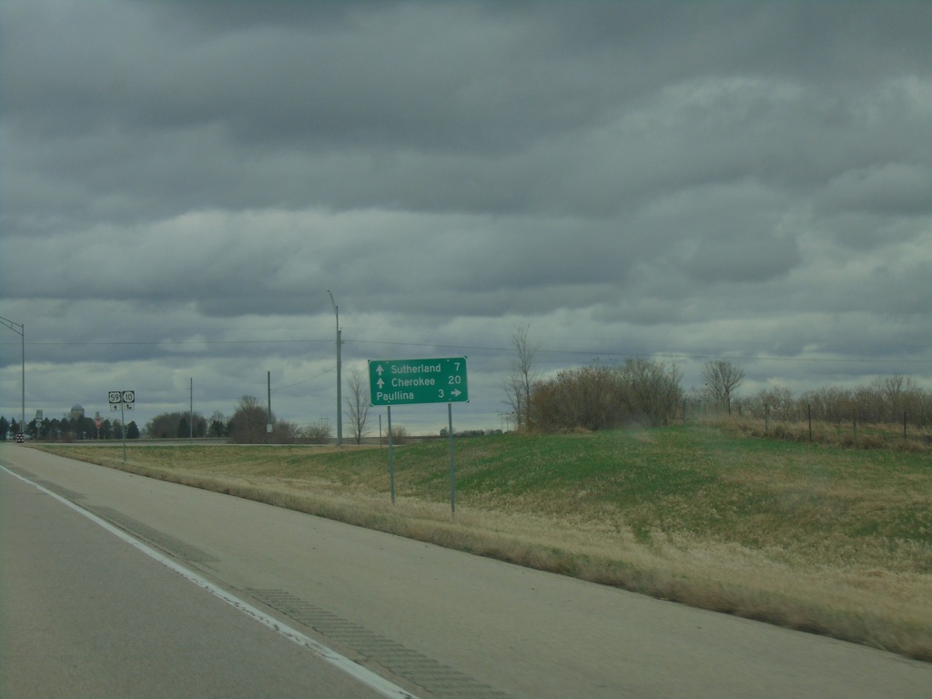
US-59 South Approaching IA-10
US-59 South approaching IA-10 in O’Brien County. Use IA-10 West to Paulina. IA-10 East joins US-59 south. Use IA-10/US-59 for Southerland and Cherokee.
Taken 05-01-2022
Paullina
O'Brien County
Iowa
United States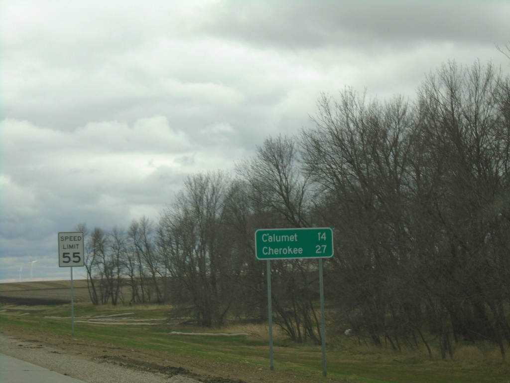
US-59 South - Distance Marker
Distance marker on US-59 south. Distance to Calumet and Cherokee.
Taken 05-01-2022
Primghar
O'Brien County
Iowa
United States