Signs Tagged With Distance Marker
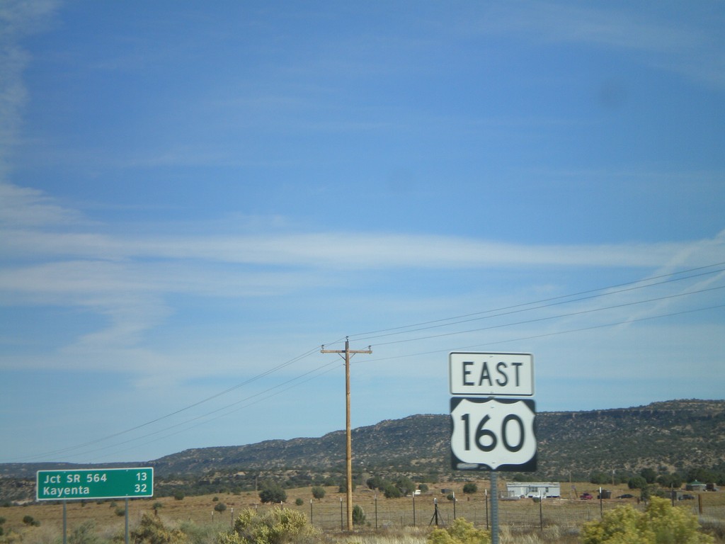
US-160 East - Shield and Distance Marker
Distance marker on US-160 east of AZ-98. Distance given to Jct. SR-564 and Kayenta. US-160 shield in foreground.
Taken 10-18-2008
 Shonto
Navajo County
Arizona
United States
Shonto
Navajo County
Arizona
United States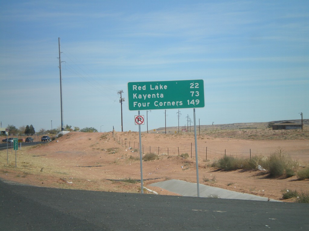
US-160 East - Distance Marker
US-160 east of AZ-264 junction. Distance marker to Red Lake, Kayenta, and Four Corners.
Taken 10-18-2008
 Tuba City
Coconino County
Arizona
United States
Tuba City
Coconino County
Arizona
United States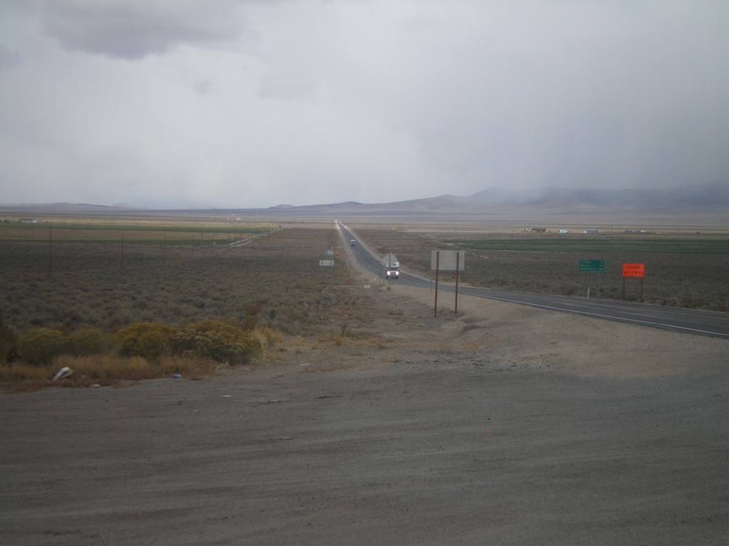
US-93 North - Distance Marker
Distance marker on US-93 north. Distance to Currie, Wells, and Twin Falls (Idaho).
Taken 10-11-2008

 Ely
White Pine County
Nevada
United States
Ely
White Pine County
Nevada
United States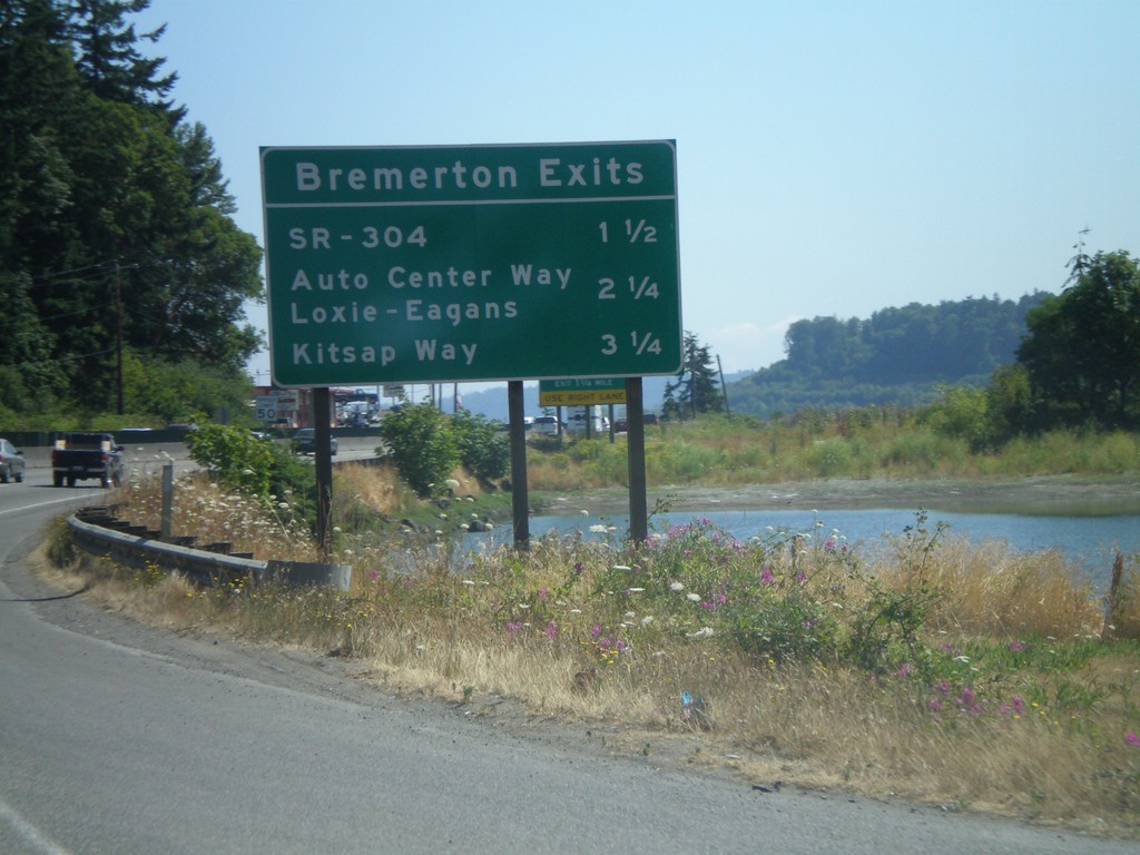
WA-3 North - Bremerton Exits
Bremerton exits on WA-3 north.
Taken 07-24-2008
 Bremerton
Kitsap County
Washington
United States
Bremerton
Kitsap County
Washington
United States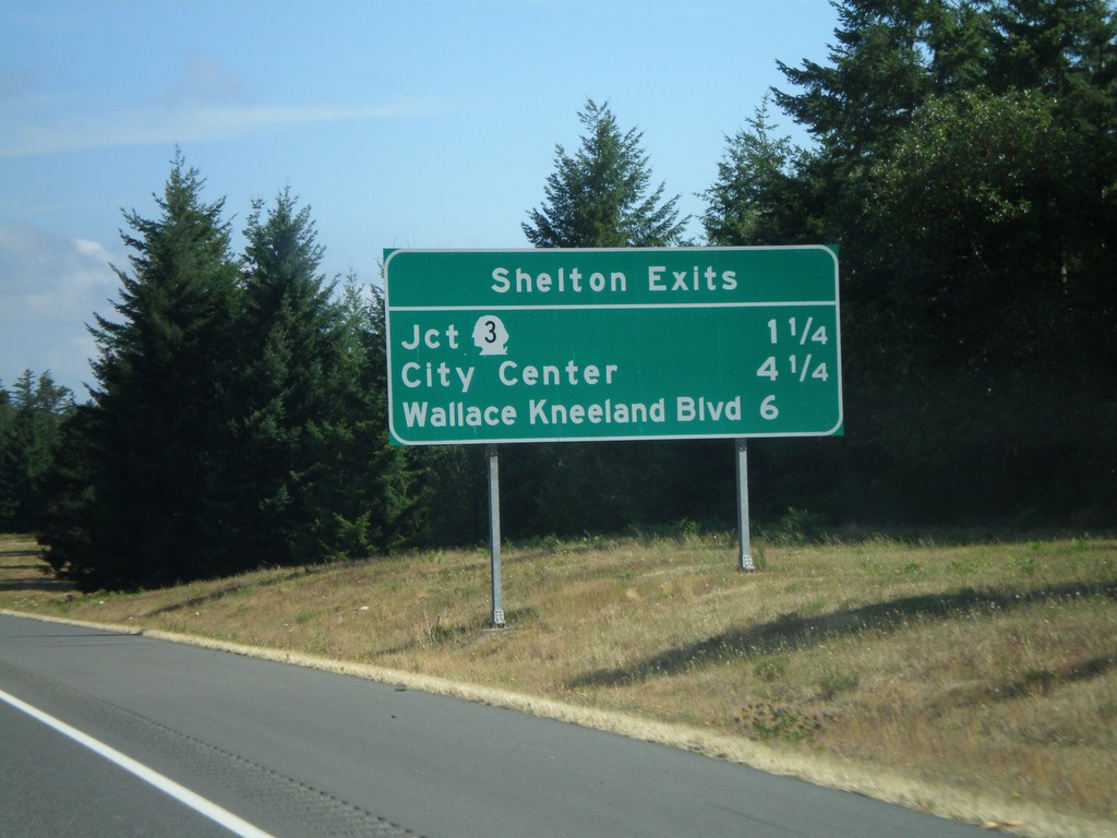
US-101 North - Shelton Exits
Shelton Exits on US-101 north.
Taken 07-24-2008
 Shelton
Mason County
Washington
United States
Shelton
Mason County
Washington
United States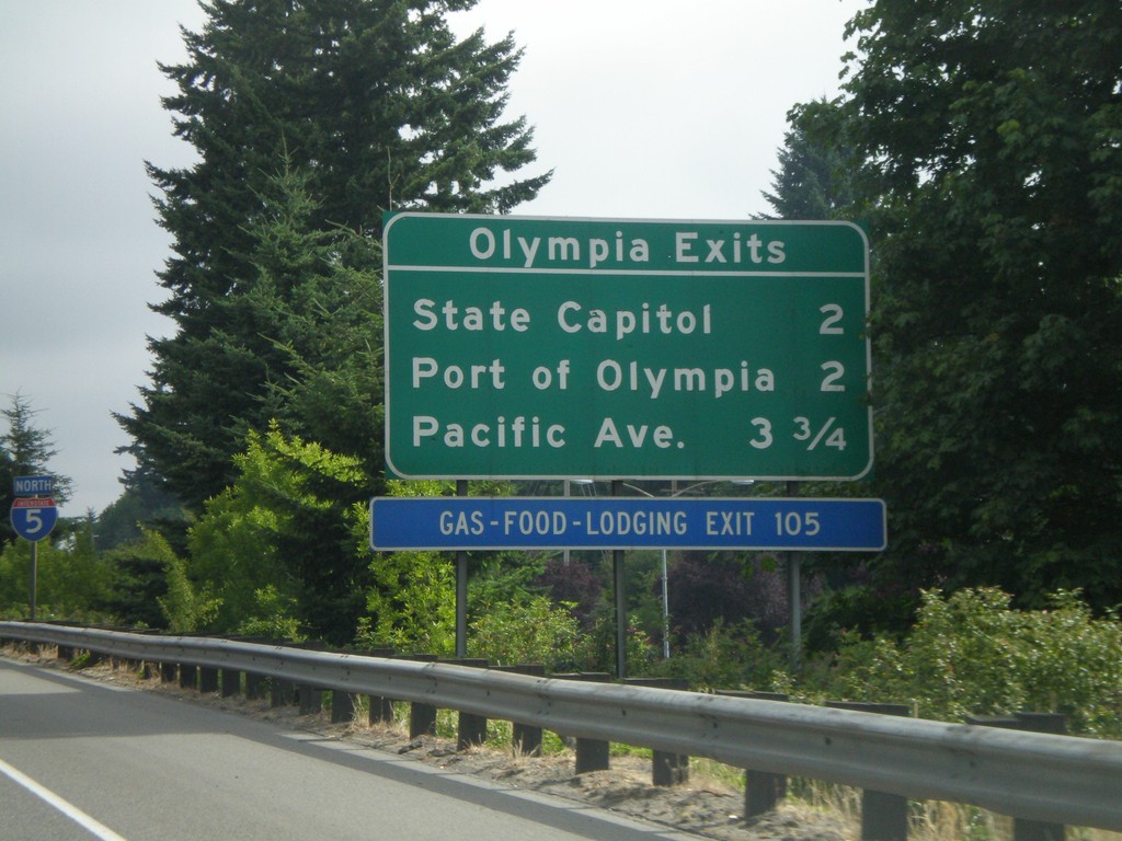
I-5 North - Olympia Exits
Olympia exits on I-5 north.
Taken 07-24-2008
 Tumwater
Thurston County
Washington
United States
Tumwater
Thurston County
Washington
United States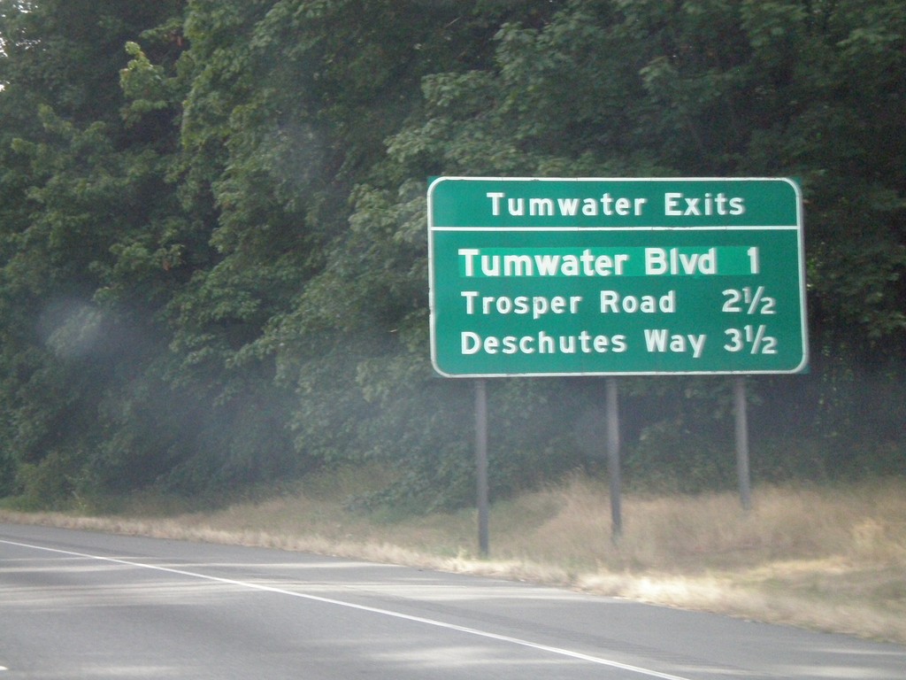
I-5 North - Tumwater Exits
Tumwater Exits on I-5 north. Tumwater is a suburb of Olympia.
Taken 07-24-2008
Tumwater
Thurston County
Washington
United States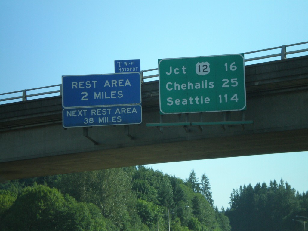
I-5 North - Distance Overhead
I-5 overhead with distance marker to US-12, Chehalis, and Seattle. Rest Area with Wi-Fi access in 2 miles.
Taken 07-24-2008
Castle Rock
Cowlitz County
Washington
United States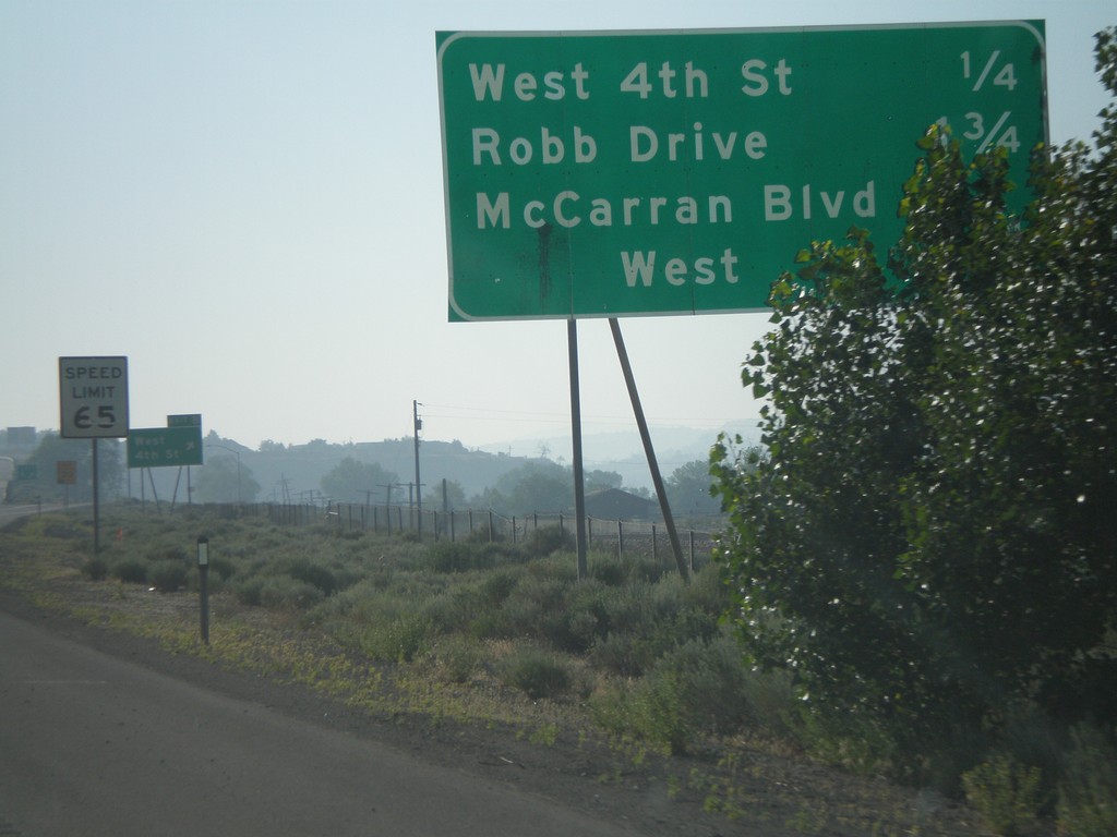
I-80 East - Reno Exits
Exits on I-80 east near Reno.
Taken 07-07-2008
 Reno
Washoe County
Nevada
United States
Reno
Washoe County
Nevada
United States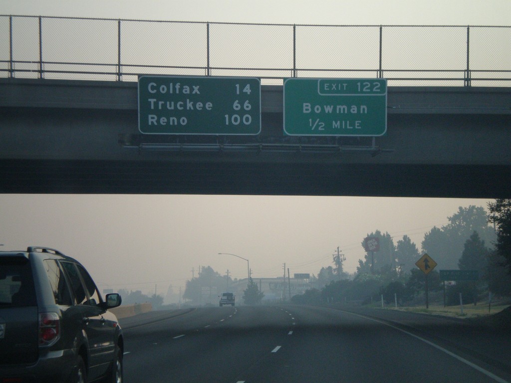
I-80 East Exit 122
I-80 east approaching Exit 122 - Bowman. Overhead distance marker to Colfax, Truckee, and Reno.
Taken 07-07-2008
Auburn
Placer County
California
United States