Signs Tagged With Distance Marker
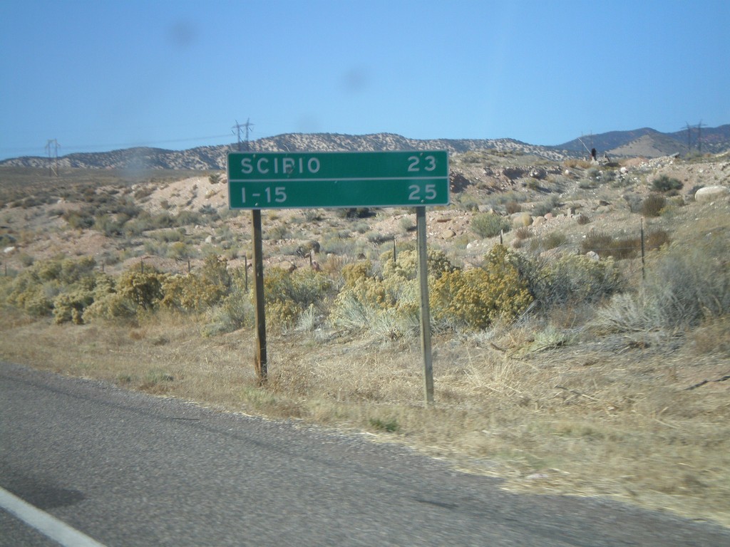
US-50 West - Distance Marker
Distance marker on US-50 west to Scipio and I-15.
Taken 10-25-2008
 Salina
Sevier County
Utah
United States
Salina
Sevier County
Utah
United States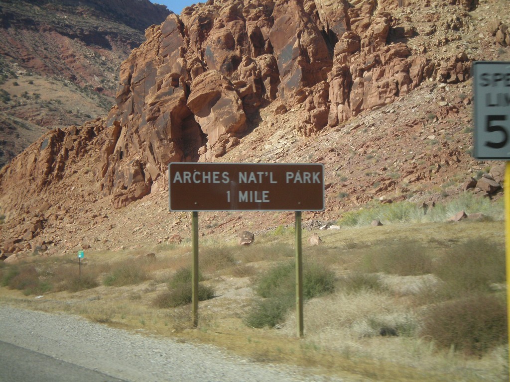
US-191 North - Arches National Park
Distance marker to Arches National Park on US-191 north.
Taken 10-24-2008
 Moab
Grand County
Utah
United States
Moab
Grand County
Utah
United States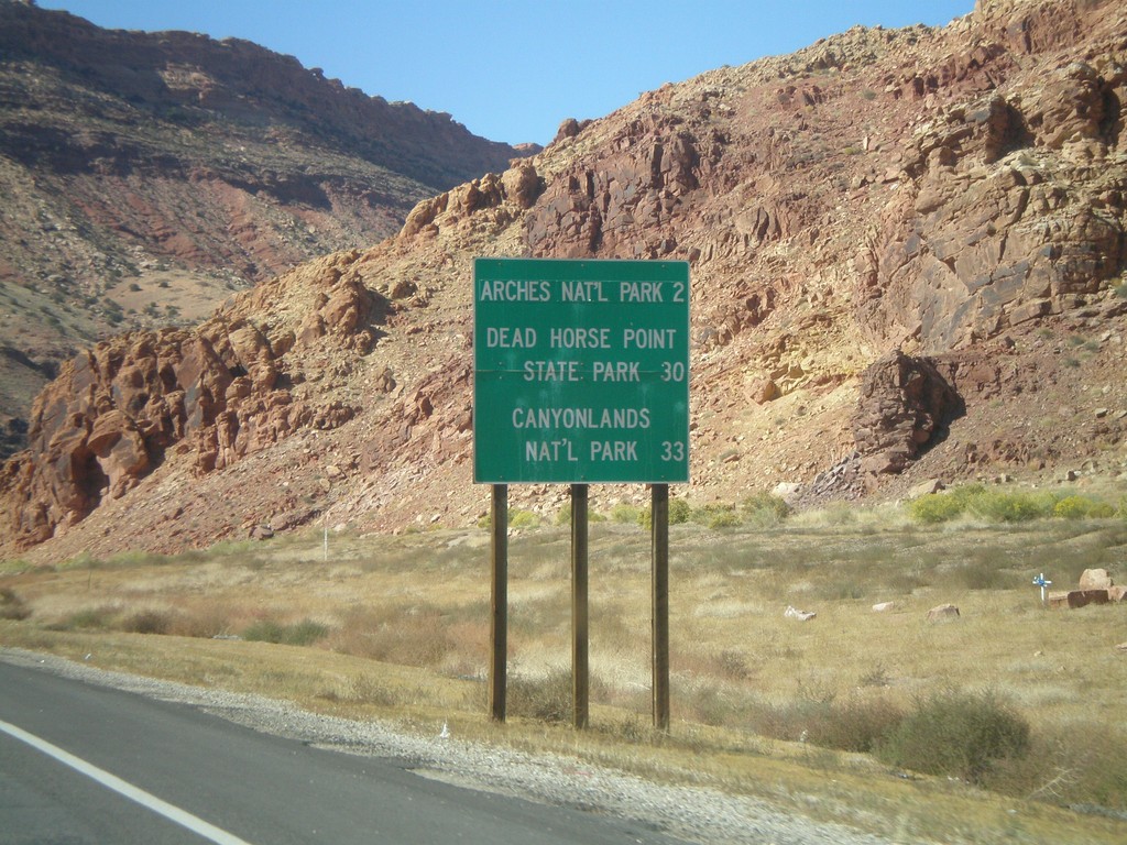
US-191 North - National Parks Distance Marker
Distance marker on US-191 north to Arches NP, Dead Horse Point SP, and Canyonlands NP.
Taken 10-24-2008
Moab
Grand County
Utah
United States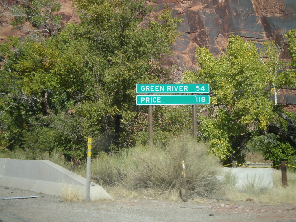
US-191 North - Distance Marker
Distance marker on US-191 north. Distance to Green River and Price.
Taken 10-24-2008
Moab
Grand County
Utah
United States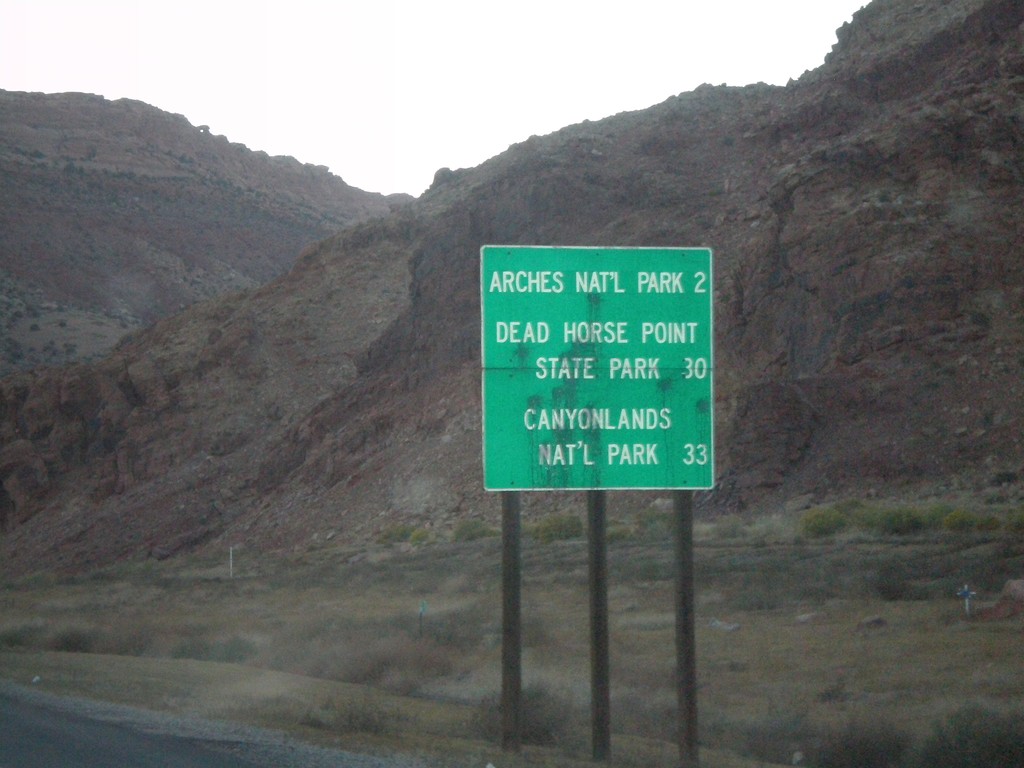
US-191 North - National Parks Distance Marker
Distance marker on US-191 north to Arches NP, Dead Horse Point SP, and Canyonlands NP.
Taken 10-23-2008
Moab
Grand County
Utah
United States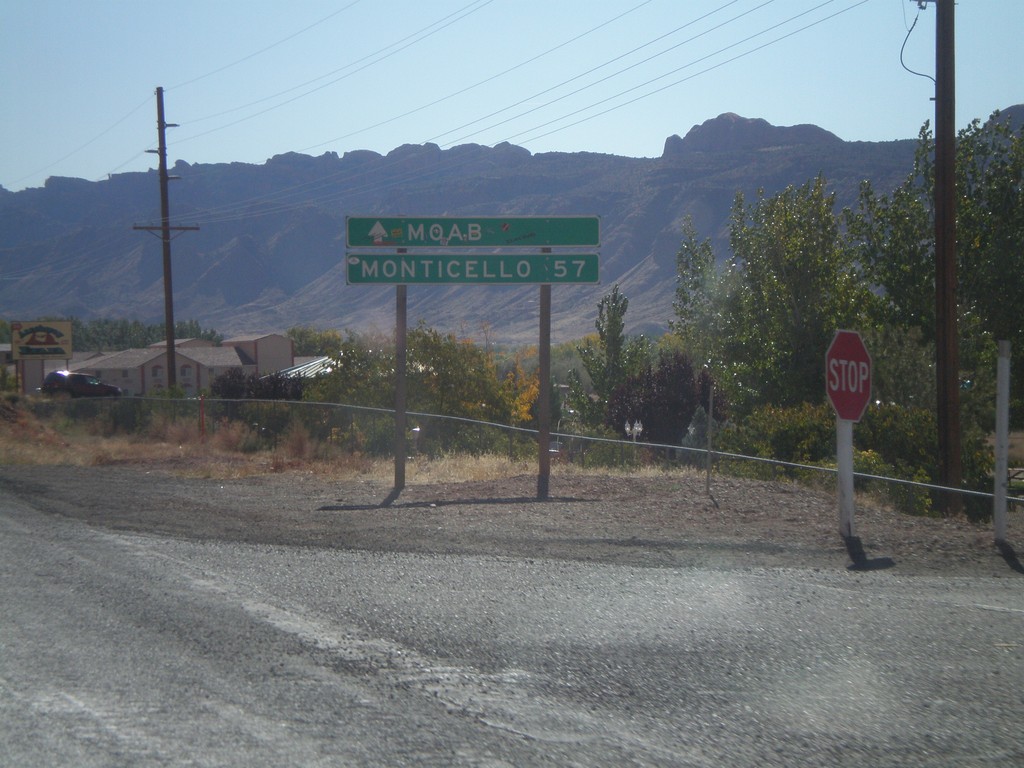
US-191 South - Distance Marker
US-191 south of UT-128. Distance marker to Moab and Monticello.
Taken 10-22-2008
 Moab
Grand County
Utah
United States
Moab
Grand County
Utah
United States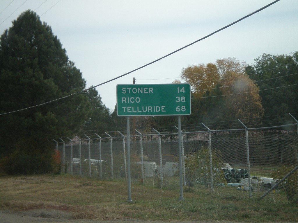
CO-145 - Distance Marker
Distance marker on CO-145 east of Dolores. Distances to Rico, Stoner, and Telluride.
Taken 10-21-2008
 Dolores
Montezuma County
Colorado
United States
Dolores
Montezuma County
Colorado
United States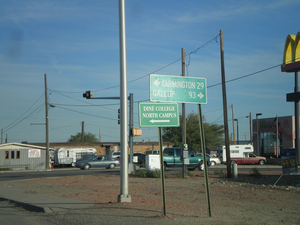
US-64 East at US-491
US-64 east at US-491. Use US-491 south for Gallup. US-491 north joins US-64 through Shiprock.
Taken 10-18-2008

 Shiprock
San Juan County
New Mexico
United States
Shiprock
San Juan County
New Mexico
United States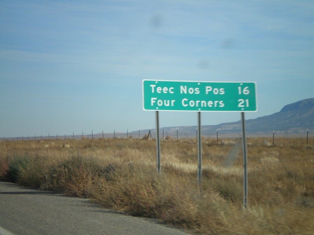
US-160 East - Distance Marker
Distance marker on US-160 east to Teec Nos Pos and Four Corners.
Taken 10-18-2008
 Red Mesa
Apache County
Arizona
United States
Red Mesa
Apache County
Arizona
United States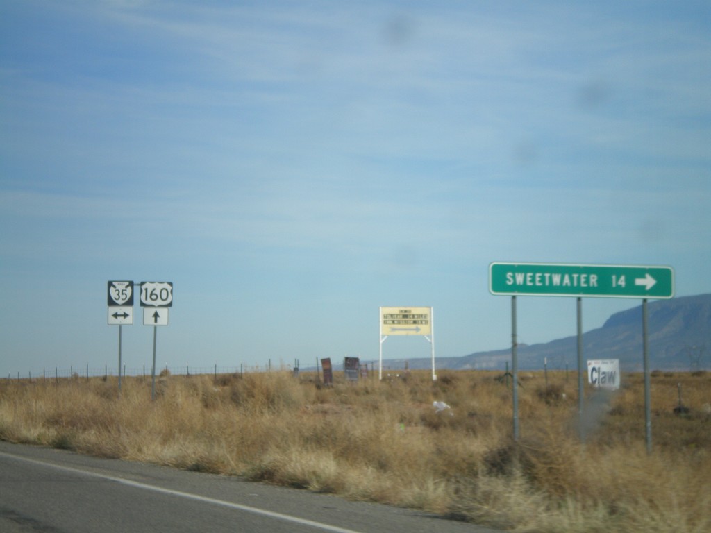
US-160 East at BIA-35
US-160 east at BIA-35. Sweetwater is 14 miles to the south on BIA-35.
Taken 10-18-2008
 Red Mesa
Apache County
Arizona
United States
Red Mesa
Apache County
Arizona
United States