Signs Tagged With Distance Marker
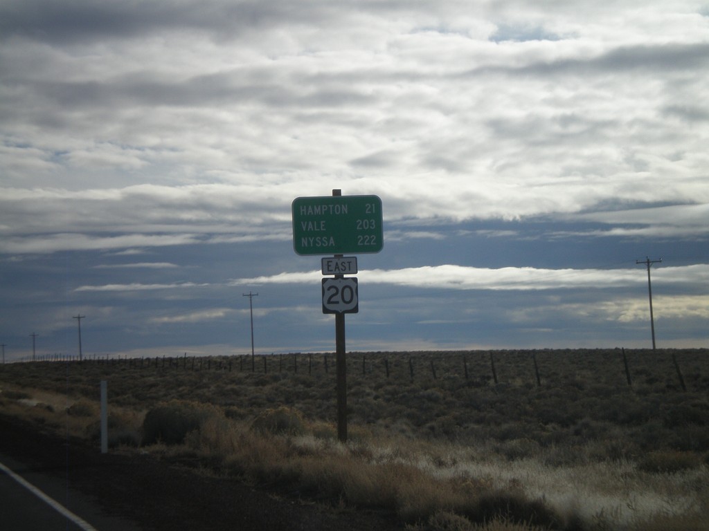
US-20 East - Brothers
Distance marker on US-20 east outside of Brothers. Distance to Hampton, Vale, and Nyssa.
Taken 01-18-2010
 Brothers
Deschutes County
Oregon
United States
Brothers
Deschutes County
Oregon
United States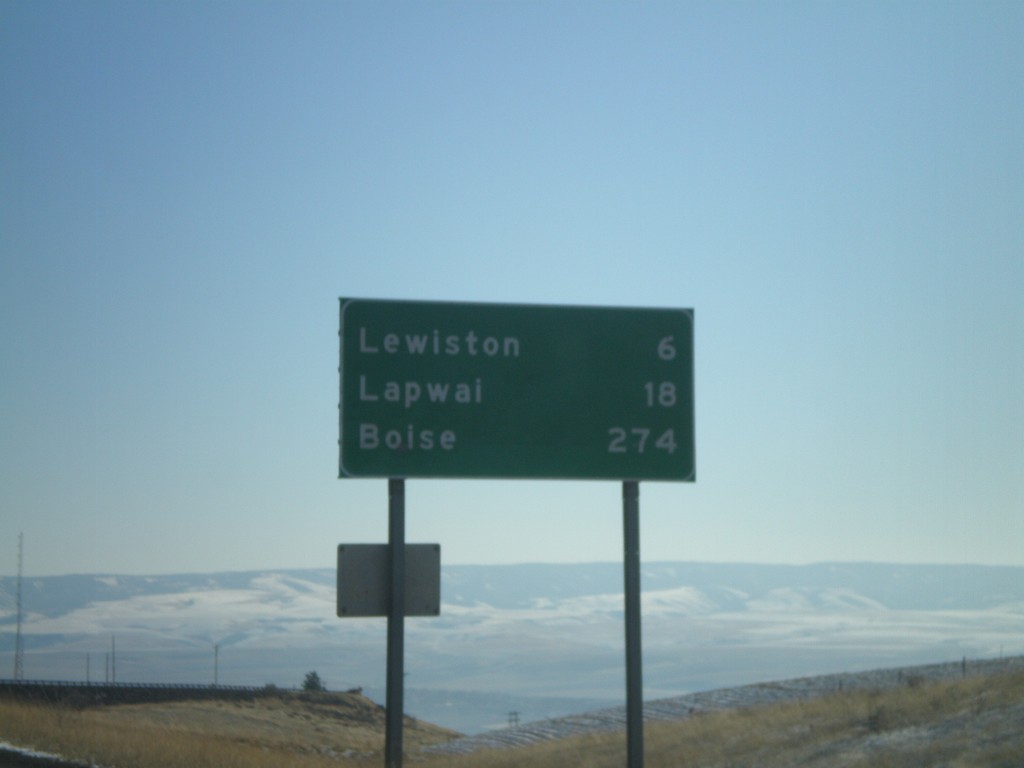
US-95 South - Distance Marker
Distance marker on US-95 south at the top of Lewiston Hill. Distance to Lewiston, Lapwai, and Boise.
Taken 12-27-2009
 Genesee
Nez Perce County
Idaho
United States
Genesee
Nez Perce County
Idaho
United States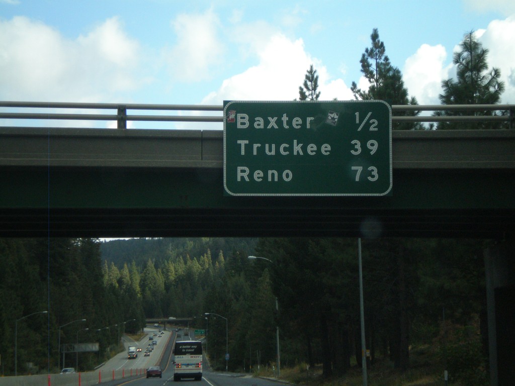
I-80 East - Distance Marker
Distance marker on I-80 east at the Crystal Springs (Exit 148A) interchange. Distance to Baxter, Truckee, and Reno.
Taken 10-04-2009
 Alta
Placer County
California
United States
Alta
Placer County
California
United States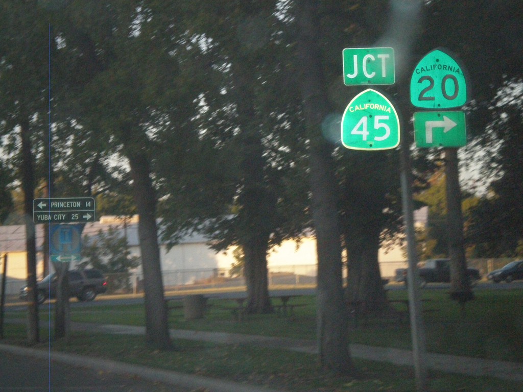
CA-20 East at CA-45
CA-20 east at CA-45 in Colusa. CA-45 south joins CA-20 through Colusa. Use CA-45 north for Princeton. Use CA-20/CA-45 south for Yuba City.
Taken 09-25-2009

 Colusa
 County
California
United States
Colusa
Colusa County
California
United States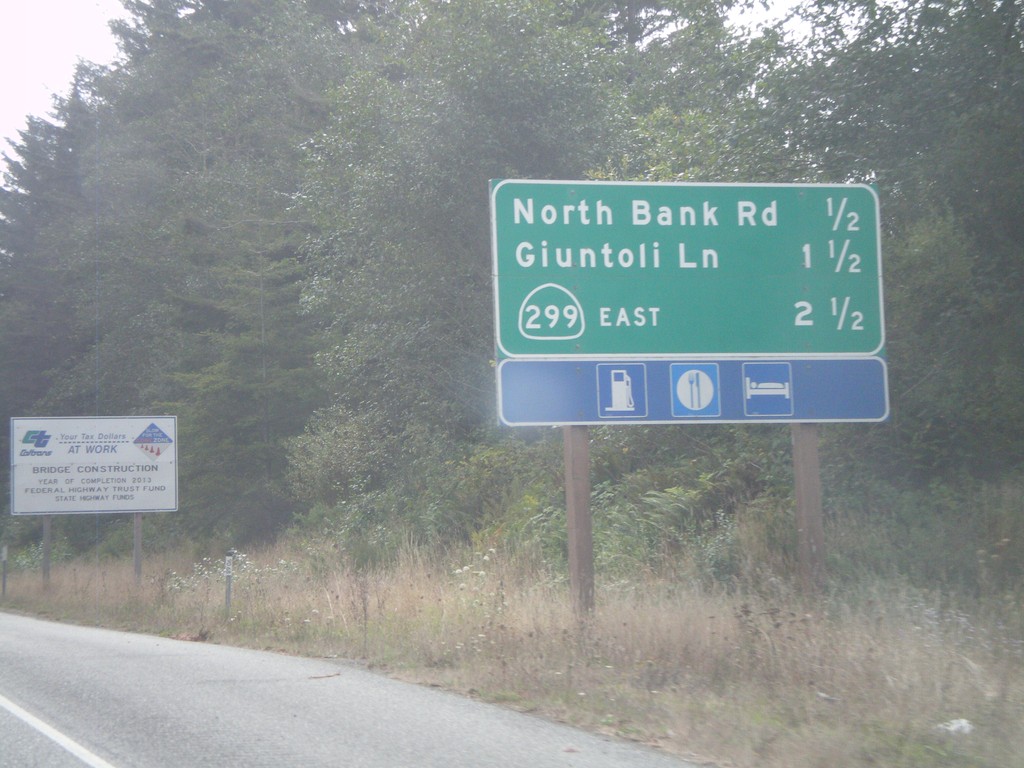
US-101 South - Arcata Exits
US-101 South - Arcata Exits. Next 3 exits: North Bank Road, Giuntoli Lane, CA-299 East.
Taken 09-25-2009
 McKinleyville
Humboldt County
California
United States
McKinleyville
Humboldt County
California
United States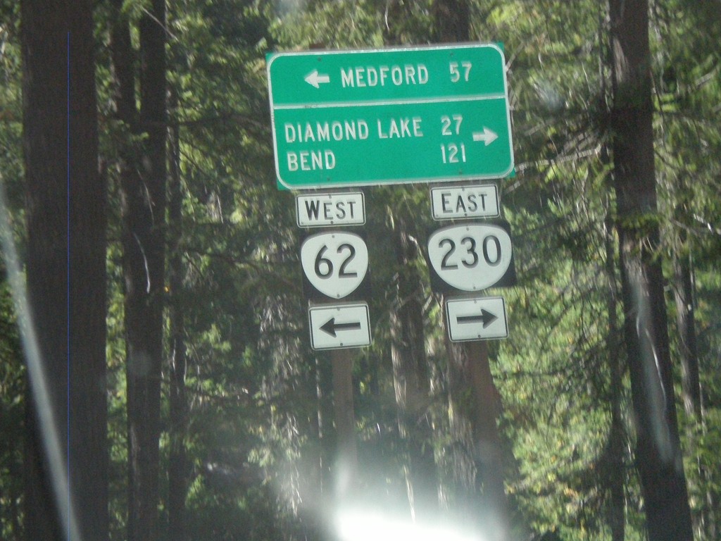
OR-62 West at OR-230 East
OR-62 west at OR-230 east to Diamond Lake and Bend. Use OR-62 west for Medford.
Taken 09-20-2009

 Prospect
Jackson County
Oregon
United States
Prospect
Jackson County
Oregon
United States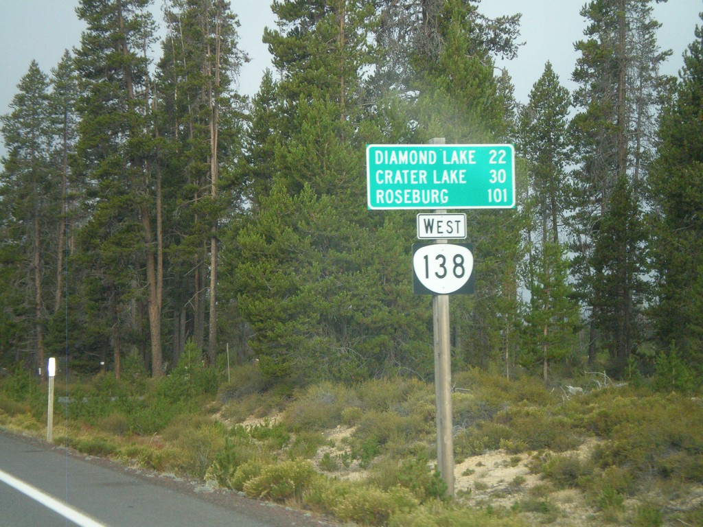
Distance Marker on OR-138 West
Distance marker on OR-138 west to Diamond Lake, Crater Lake, and Roseburg. Taken just west of Diamond Lake Junction.
Taken 09-20-2009
 Chemult
Klamath County
Oregon
United States
Chemult
Klamath County
Oregon
United States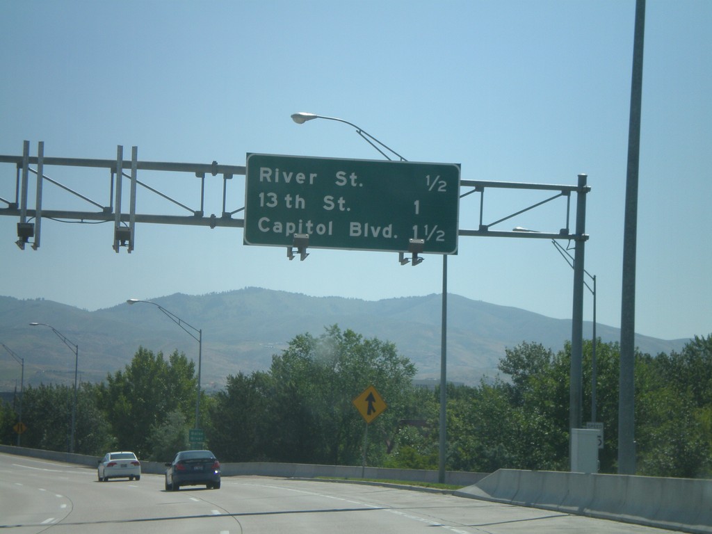
End I-184 East at US-20/US-26
Eastern terminus of I-184 east where US-20/US-26 merge on the freeway. There is no end I-184 marker. Distance marker for River St., 13th St., and Capitol Blvd. Only River St. is a freeway interchange. 13th St. is the end of the freeway.
Taken 06-28-2009

 Boise
Ada County
Idaho
United States
Boise
Ada County
Idaho
United States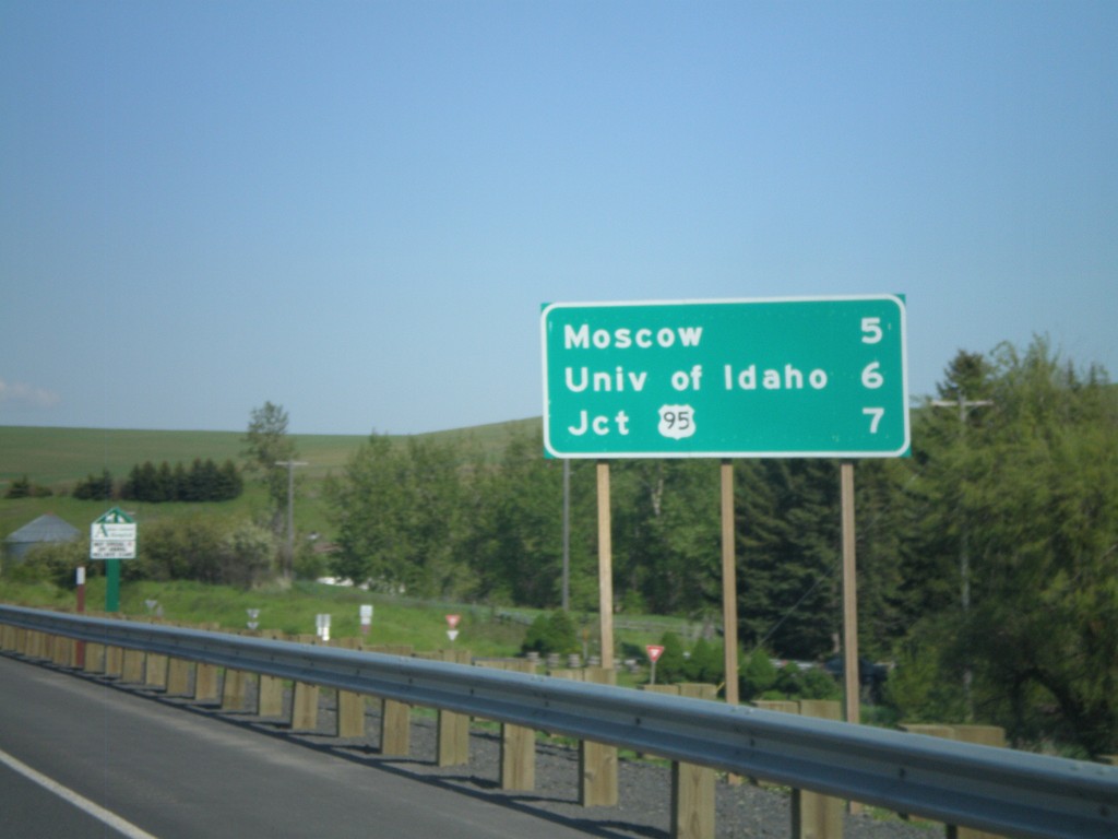
WA-270 Distance Marker
Distance marker on WA-270 west to Moscow, University of Idaho, and US-95.
Taken 05-25-2009
 Pullman
Whitman County
Washington
United States
Pullman
Whitman County
Washington
United States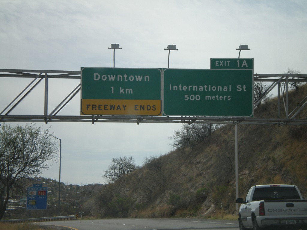
I-19 South Approaching Exit 1A
I-19 south approaching Exit 1A - International St. Freeway ends after Exit 1A in Downtown Nogales.
Taken 03-22-2009
 Nogales
Santa Cruz County
Arizona
United States
Nogales
Santa Cruz County
Arizona
United States