Signs Tagged With Distance Marker
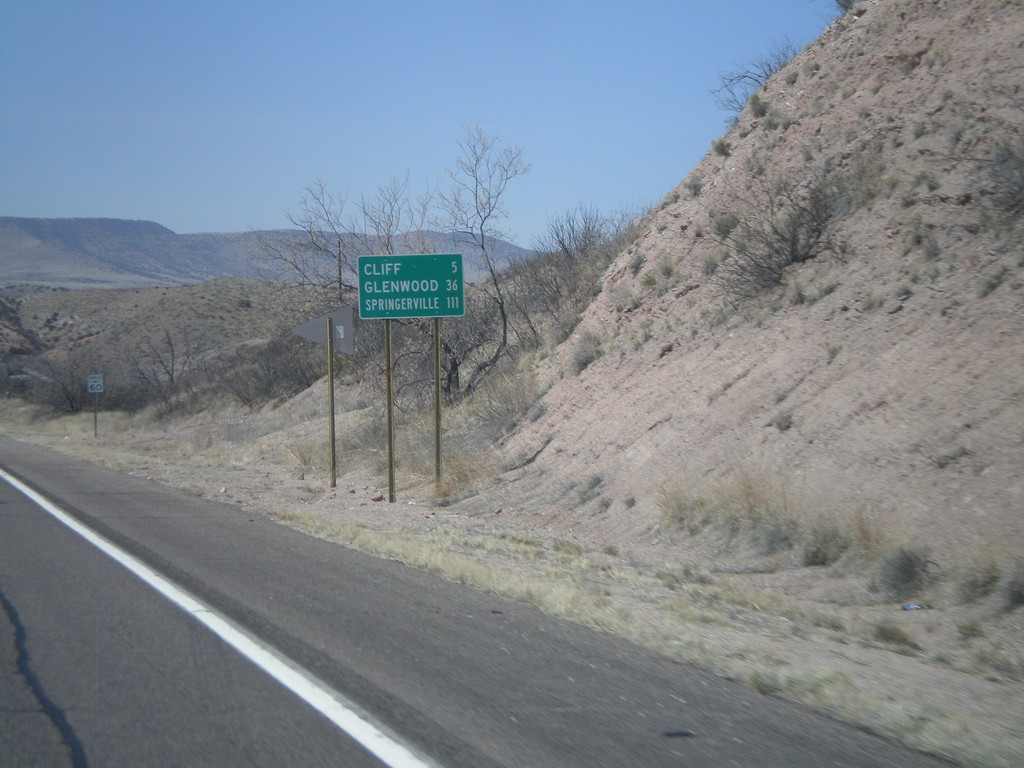
US-180 West - Distance Marker
Distance marker on US-180 west to Cliff, Glenwood, and Springerville (AZ).
Taken 03-21-2010
 Gila
Grant County
New Mexico
United States
Gila
Grant County
New Mexico
United States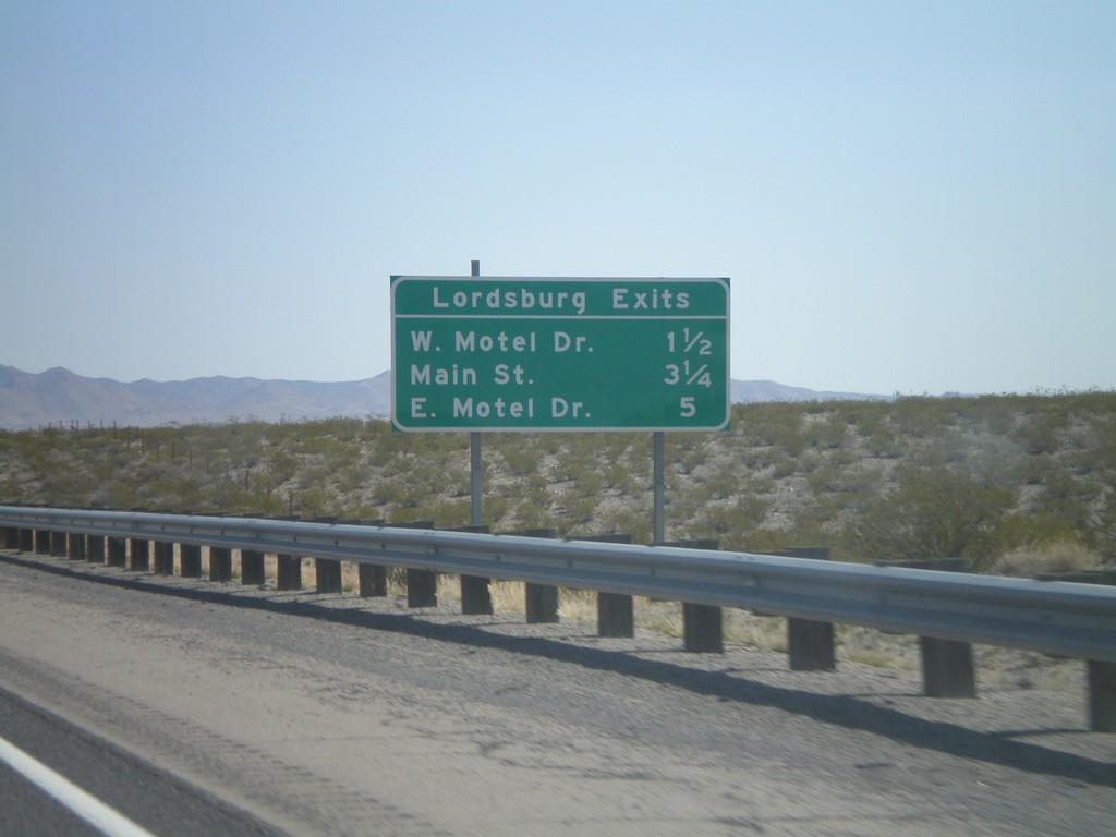
I-10 East - Lordsburg Exits
Lordsburg Exits on I-10 East - W. Motel Drive, Main St., and E. Motel Drive.
Taken 03-21-2010
 Lordsburg
Hidalgo County
New Mexico
United States
Lordsburg
Hidalgo County
New Mexico
United States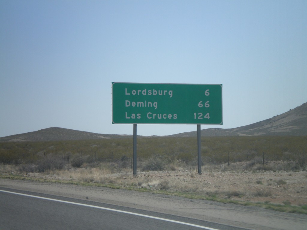
I-10 East - Distance Marker
Distance marker on I-10 east to Lordsburg, Deming, and Las Cruces. The control city in western New Mexico along I-10 is Las Cruces. In Arizona the control city is El Paso.
Taken 03-21-2010
Lordsburg
Hidalgo County
New Mexico
United States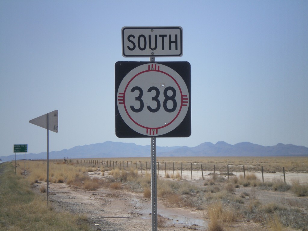
NM-338 South
NM-338 south. In the background there is a distance marker to Cotton City, Animas, and Playas.
Taken 03-21-2010
 Animas
Hidalgo County
New Mexico
United States
Animas
Hidalgo County
New Mexico
United States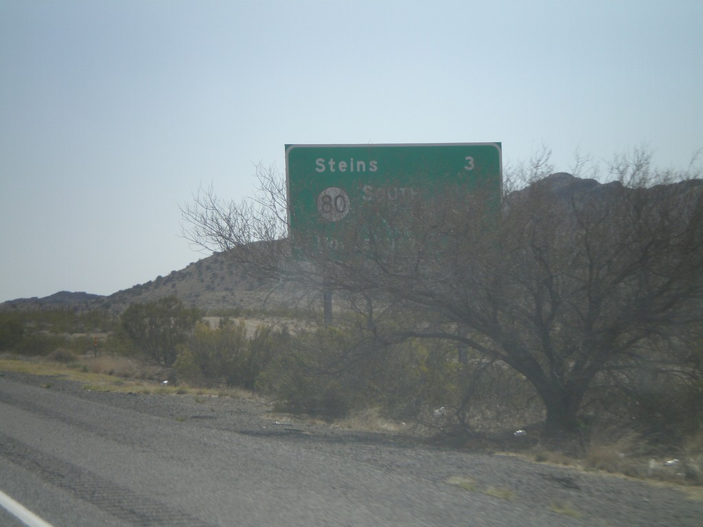
I-10 East - Distance Marker
Distance marker on I-10 east. Distance to Steins, NM-80, and Lordsburg. This is the first distance marker along I-10 in New Mexico.
Taken 03-21-2010
Steins
Hidalgo County
New Mexico
United States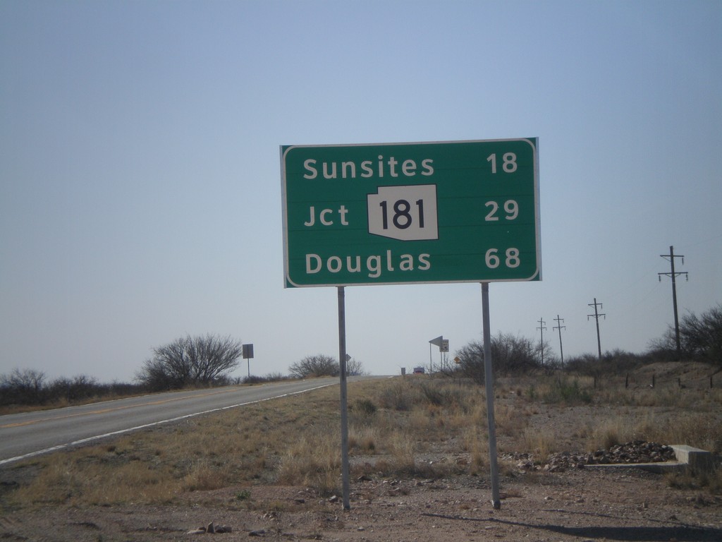
US-191 South - Distance Marker
Distance marker on US-191 south to Sunsites, AZ-181, and Douglas.
Taken 03-21-2010
 Cochise
 County
Arizona
United States
Cochise
Cochise County
Arizona
United States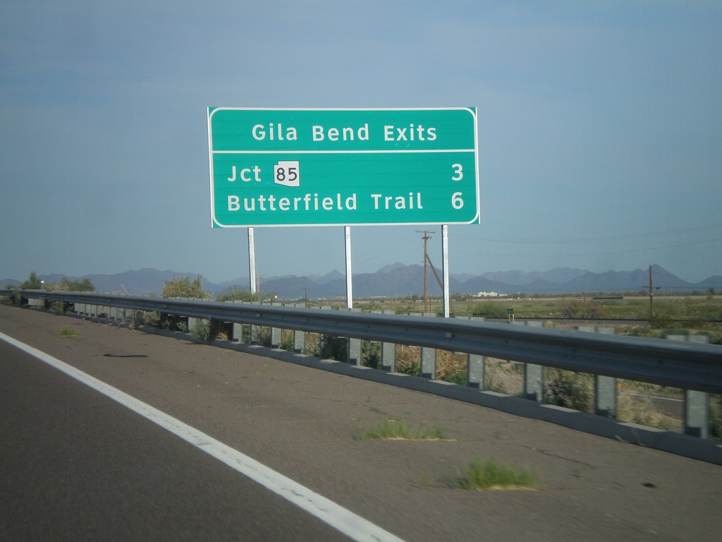
I-8 East - Gila Bend Exits
Gila Bend exits on I-8 east - Jct. AZ-85 and Butterfield Trail.
Taken 03-20-2010
 Gila Bend
Maricopa County
Arizona
United States
Gila Bend
Maricopa County
Arizona
United States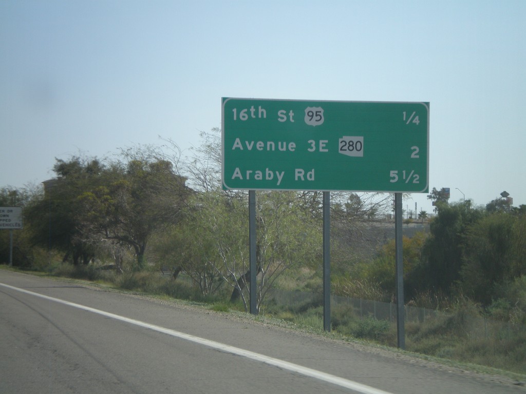
I-8 East - Distance Marker
Upcoming exits on I-8 east - 16th St./US-95, Ave 3E/AZ-280, Araby Road.
Taken 03-20-2010
Yuma
Yuma County
Arizona
United States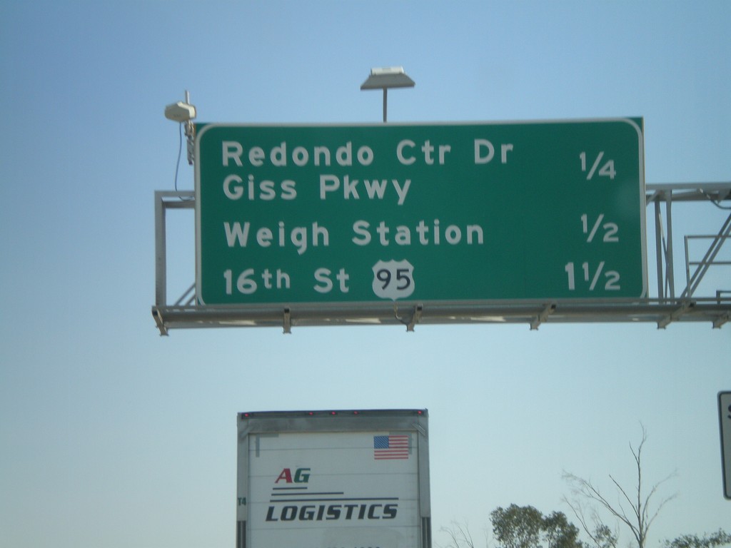
I-8 East - Yuma Exits
Upcoming exits on I-8 east in Yuma - Redondo Center Drive/Giss Parkway, Weigh Station, 16th St./US-95.
Taken 03-20-2010
Yuma
Yuma County
Arizona
United States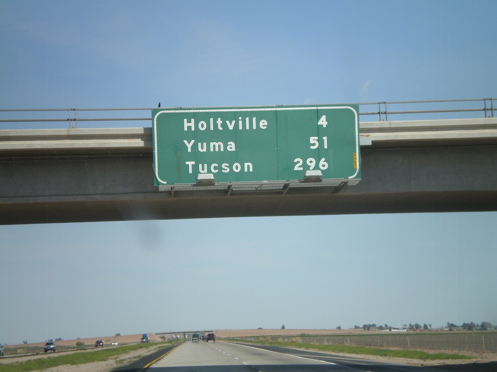
I-8 East - Distance Marker
Distance marker on I-8 east. Distances to Holtville, Yuma, and Tucson.
Taken 03-20-2010
El Centro
Imperial County
California
United States