Signs Tagged With Distance Marker
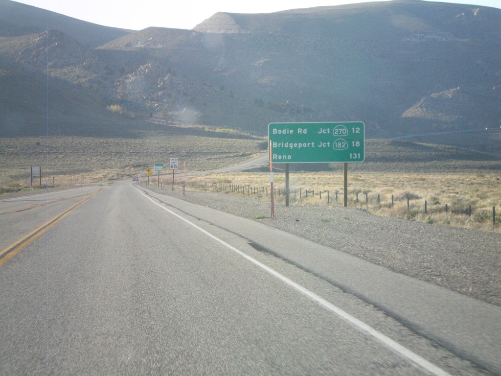
US-395 North - Distance Marker
Distance marker on US-395 north. Distance to Bodie Road - Jct. CA-270, Bridgeport - Jct. CA-182, and Reno (Nevada).
Taken 05-06-2012


 Lee Vining
Mono County
California
United States
Lee Vining
Mono County
California
United States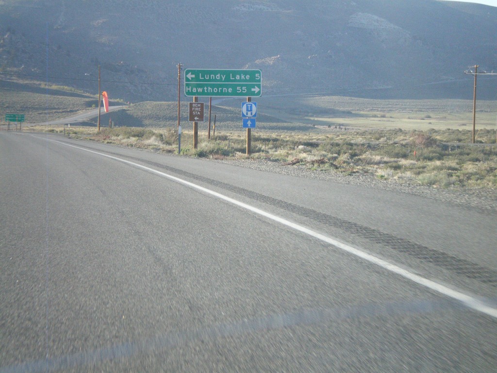
US-395 North at CA-167
US-395 north at CA-167 east to Hawthorne (Nevada). Turn left for Lundy Lake.
Taken 05-06-2012
 Mono City
Mono County
California
United States
Mono City
Mono County
California
United States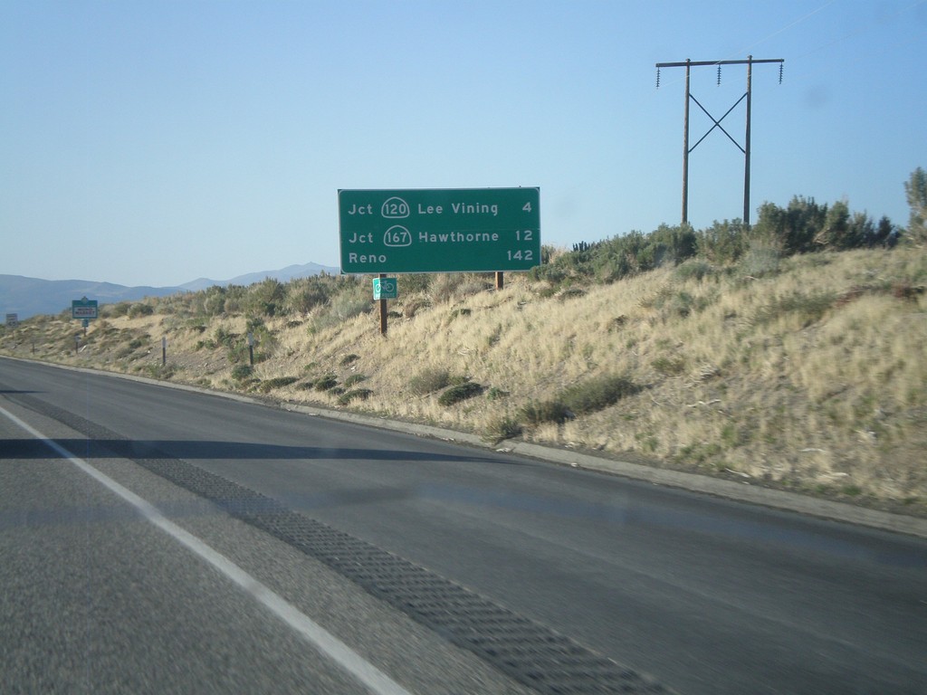
US-395 North - Distance Marker
Distance marker on US-395 north. Distance to Jct. CA-120 in Lee Vining, Jct. CA-160 to Hawthorne, and Reno.
Taken 05-06-2012
 Lee Vining
Mono County
California
United States
Lee Vining
Mono County
California
United States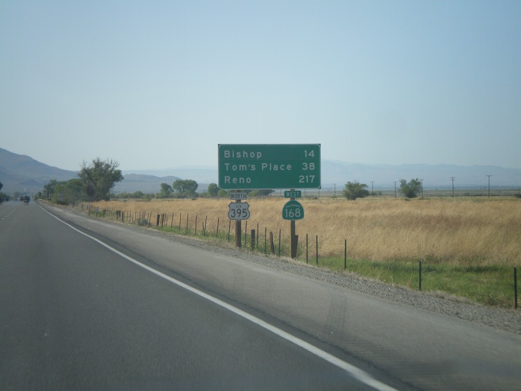
US-395 North/CA-168 West - Distance Marker
Distance marker on US-395 North/CA-168 West. Distance to Bishop, Tom’s Place, and Reno.
Taken 05-06-2012
 Big Pine
Inyo County
California
United States
Big Pine
Inyo County
California
United States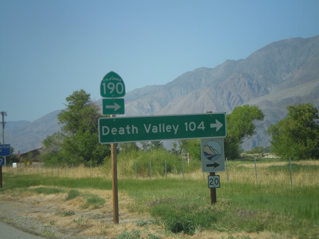
US-395 North at CA-136 (To CA-190)
US-395 north at CA-136 north to CA-190. Use CA-136 east for Death Valley. The logo at the bottom of the sign, with the number 20 written on it, is for the Eastern Sierra Scenic Byway. Site number 20 refers to the Highest to Lowest and Desert’s Edge interpretive site.
Taken 05-06-2012

 Lone Pine
Inyo County
California
United States
Lone Pine
Inyo County
California
United States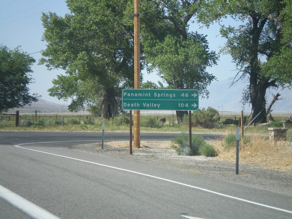
US-395 North at CA-190 East
US-395 north at CA-190 east. Use CA-190 east for Death Valley and Panamint Springs.
Taken 05-06-2012
Olancha
Inyo County
California
United States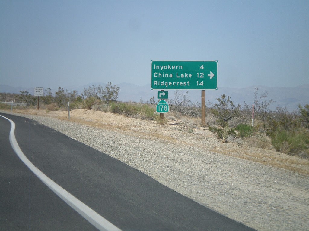
CA-14 North/CA-178 East at CA-178 East
CA-14 North/CA-178 East at CA-178 East junction. Turn right for CA-178 east to Inyokern, China Lake, and Ridgecrest. CA-178 leaves US-395 here.
Taken 05-06-2012

 Inyokern
Kern County
California
United States
Inyokern
Kern County
California
United States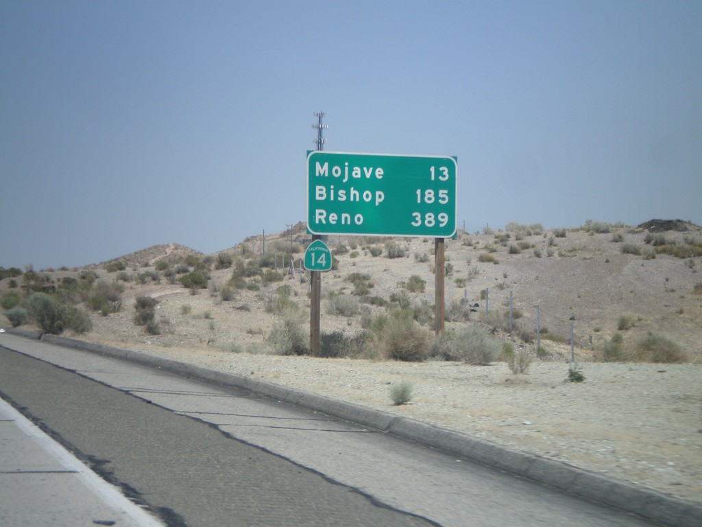
CA-14 North - Distance Marker
Distance marker on CA-14 north to Mojave, Bishop, and Reno (Nevada). Taken just north of the Rosamond Blvd. interchange.
Taken 05-06-2012
Rosamond
Kern County
California
United States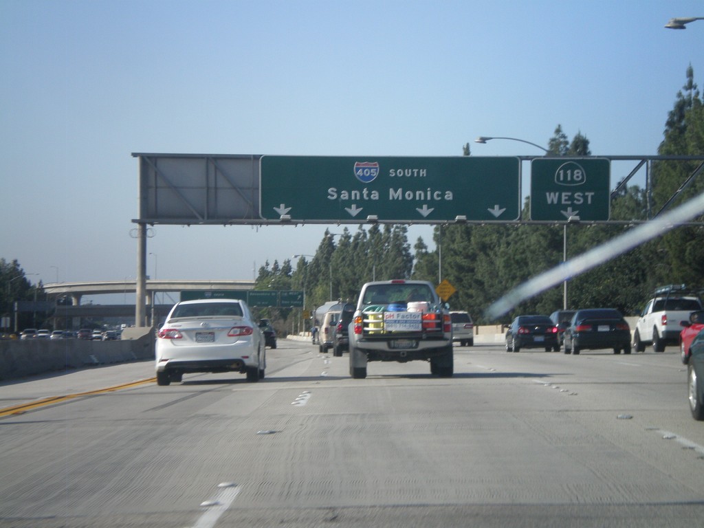
I-405 South - Exit 71
I-405 south at Exit 71 - CA-118 West.
Taken 05-05-2012

 Los Angeles
 County
California
United States
Los Angeles
Los Angeles County
California
United States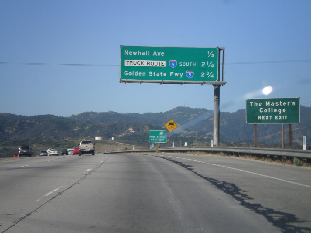
CA-14 South - Next Three Exits
Next three exits on CA-14 south in Santa Clarita: Newhall Ave., I-5 South Truck Route, and I-5/Golden State Freeway.
Taken 05-05-2012
 Santa Clarita
Los Angeles County
California
United States
Santa Clarita
Los Angeles County
California
United States