Signs Tagged With Diagram
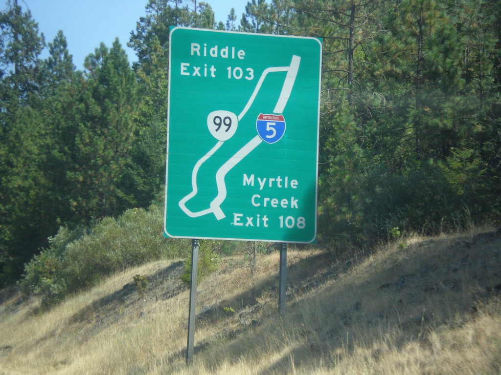
I-5 South - Exit 109 and 103 Route Diagram
Route Diagram showing OR-99 access to I-5 for Myrtle Creek and Riddle.
Taken 08-17-2015

 Myrtle Creek
Douglas County
Oregon
United States
Myrtle Creek
Douglas County
Oregon
United States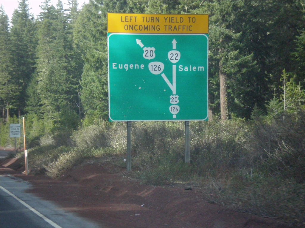
Diagram of US-20/OR-126/OR-22 Junction - US-20/OR-126 West
Map diagram of junction at US-20/OR-126/OR-22 junction on US-20/OR-126 West. Continue straight for OR-22 west to Salem; merge left to continue west on US-20/OR-126 West to Eugene.
Taken 02-13-2015


 Santiam Junction
Linn County
Oregon
United States
Santiam Junction
Linn County
Oregon
United States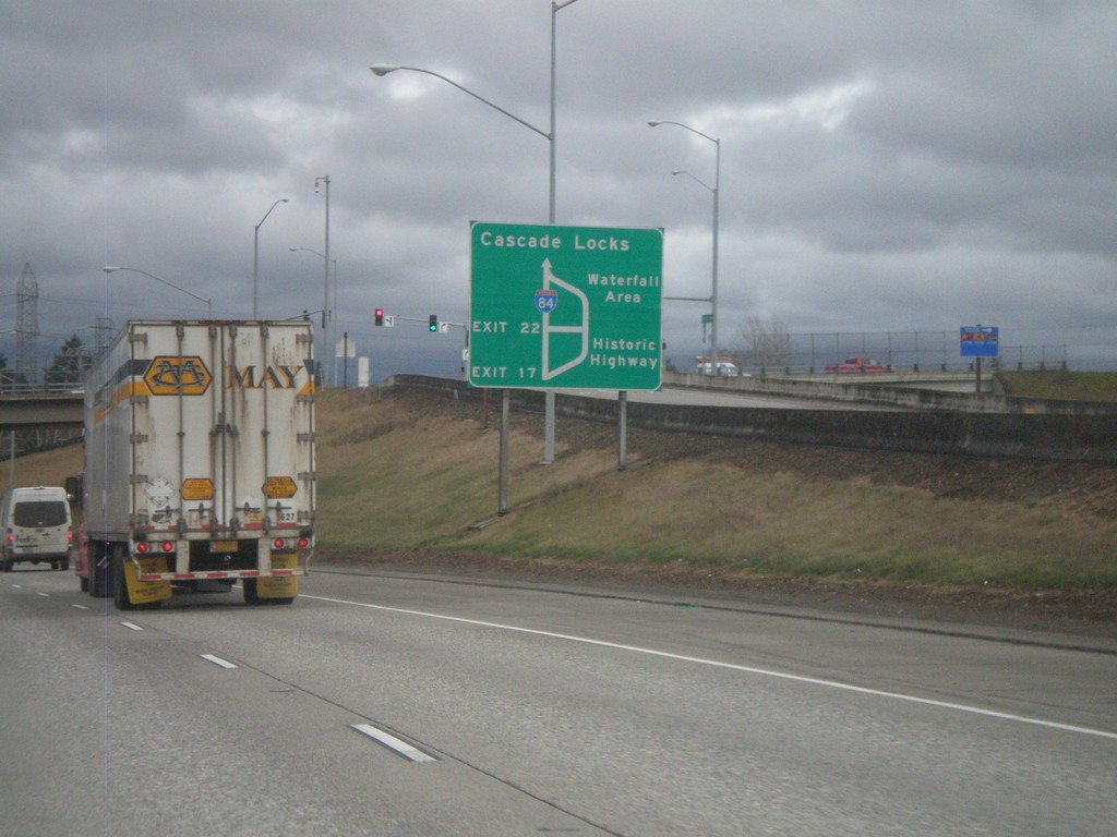
I-84/US-30 East - Historic Columbia River Highway Diagram
Route diagram for the Historic Columbia River Highway on I-84/US-30 East. Use Exit 17 (last Portland Metro. Area exit) on I-84/US-30 East for the Historic Highway. The Historic Columbia River Highway and I-84/US-30 rejoin before Cascade Locks.
Taken 02-21-2012

 Fairview
Multnomah County
Oregon
United States
Fairview
Multnomah County
Oregon
United States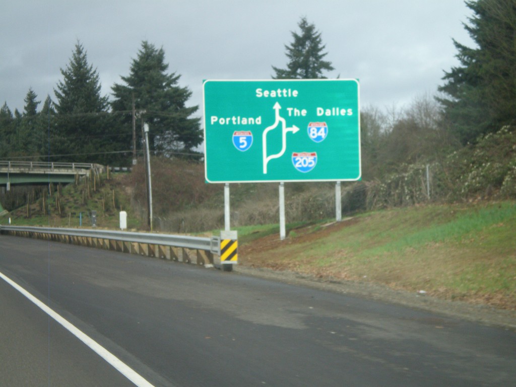
I-5 North - Portland Route Diagram
Portland area route diagram on I-5 north approaching I-205 junction.
Taken 02-21-2012
 Tualatin
Washington County
Oregon
United States
Tualatin
Washington County
Oregon
United States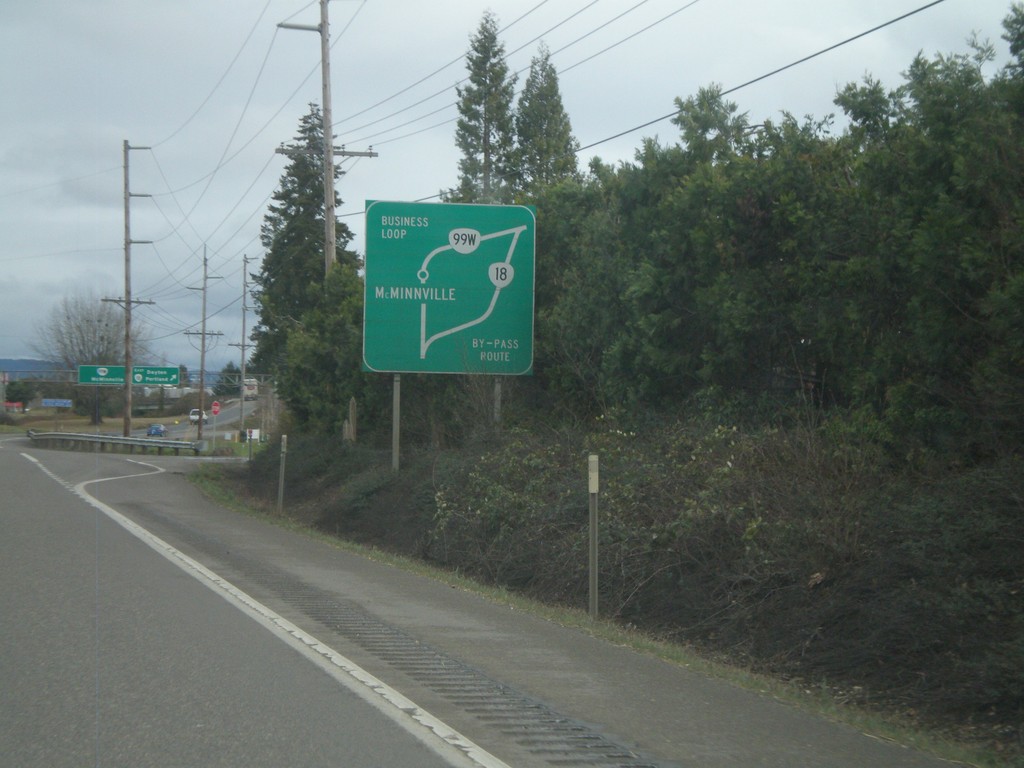
OR-18 East - Route Diagram
OR-18 East route diagram for McMinnville area, approaching OR-99W junction. Use OR-99W as a business loop through McMinnville. Use OR-18 as a bypass around McMinnville.
Taken 02-21-2012

 McMinnville
Yamhill County
Oregon
United States
McMinnville
Yamhill County
Oregon
United States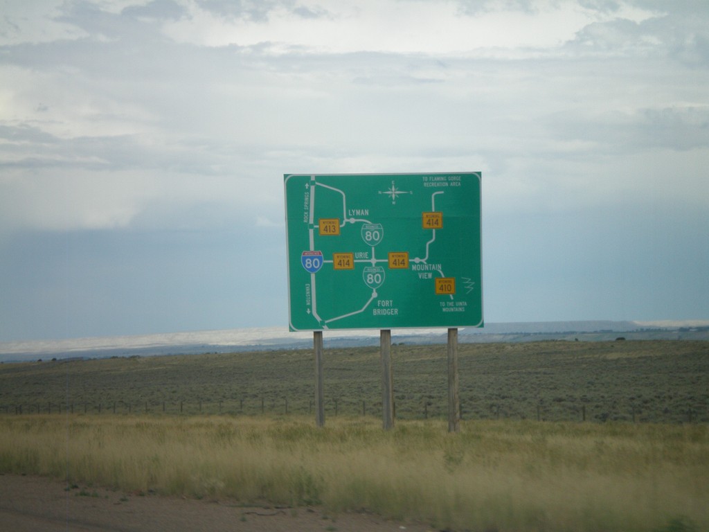
Bridger Valley Route Diagram
Route diagram for the Bridger Valley on I-80 east, descending into the Bridger Valley.
Taken 07-31-2010


 Fort Bridger
Uinta County
Wyoming
United States
Fort Bridger
Uinta County
Wyoming
United States