Signs Tagged With County Line
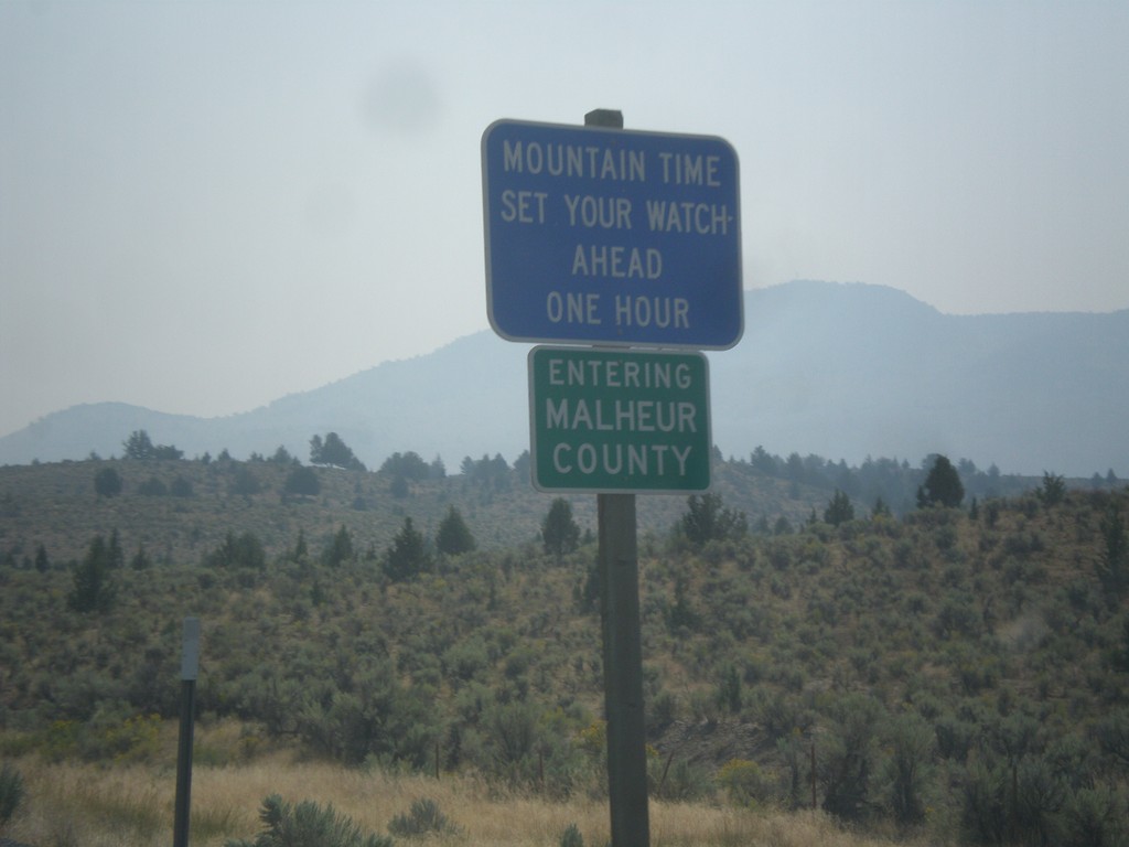
US-20 East - Malheur County/Mountain Time Zone
Entering Malheur County and Mountain Time Zone on US-20 East. The northern portion of Malheur County is the only area in Oregon that follows Mountain Time. From my travels in Oregon, this is the only blue time zone sign in the state. The rest are the standard green color.
Taken 08-23-2015
 Drewsey
Malheur County
Oregon
United States
Drewsey
Malheur County
Oregon
United States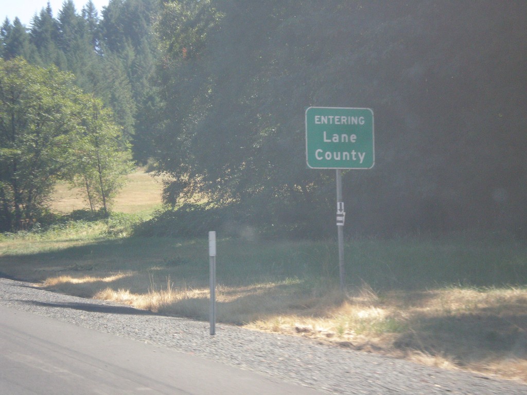
I-5 North - Lane County
Entering Lane County on I-5 north.
Taken 08-22-2015
 Cottage Grove
Lane County
Oregon
United States
Cottage Grove
Lane County
Oregon
United States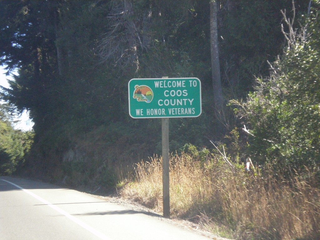
US-101 North - Coos County
Entering Coos County on US-101 north.
Taken 08-22-2015
 Langlois
Coos County
Oregon
United States
Langlois
Coos County
Oregon
United States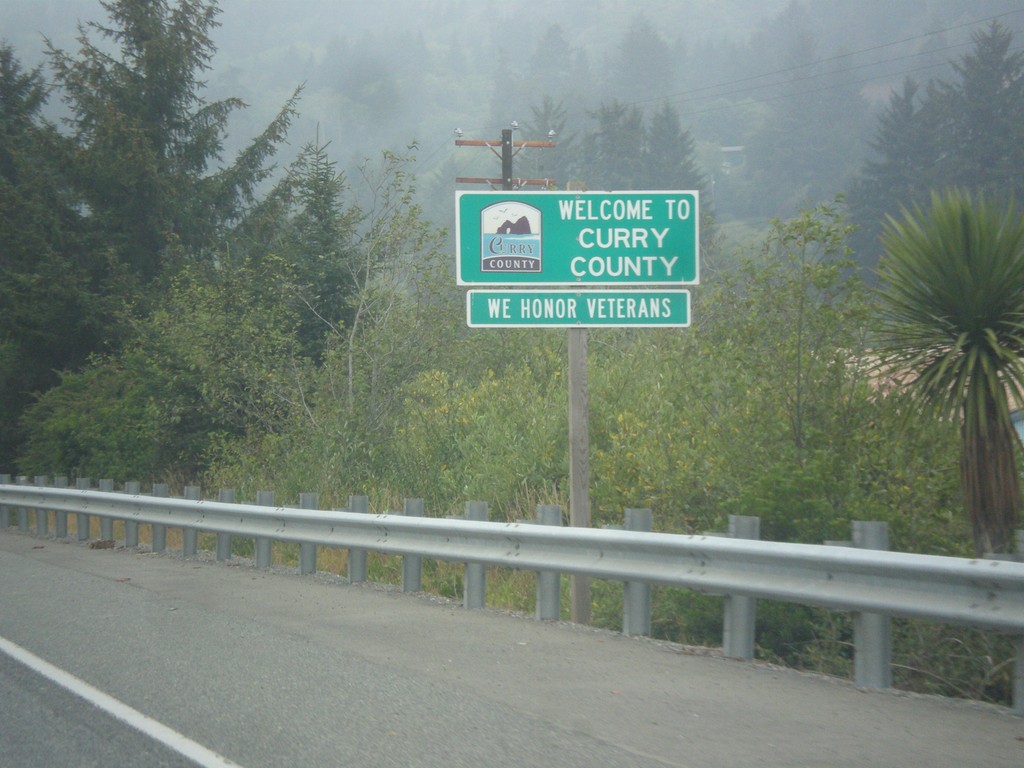
US-101 North - Curry County
Entering Curry County on US-101 north. Many Oregon counties, especially in western Oregon have graphics on the county line signs.
Taken 08-20-2015
Brookings
Curry County
Oregon
United States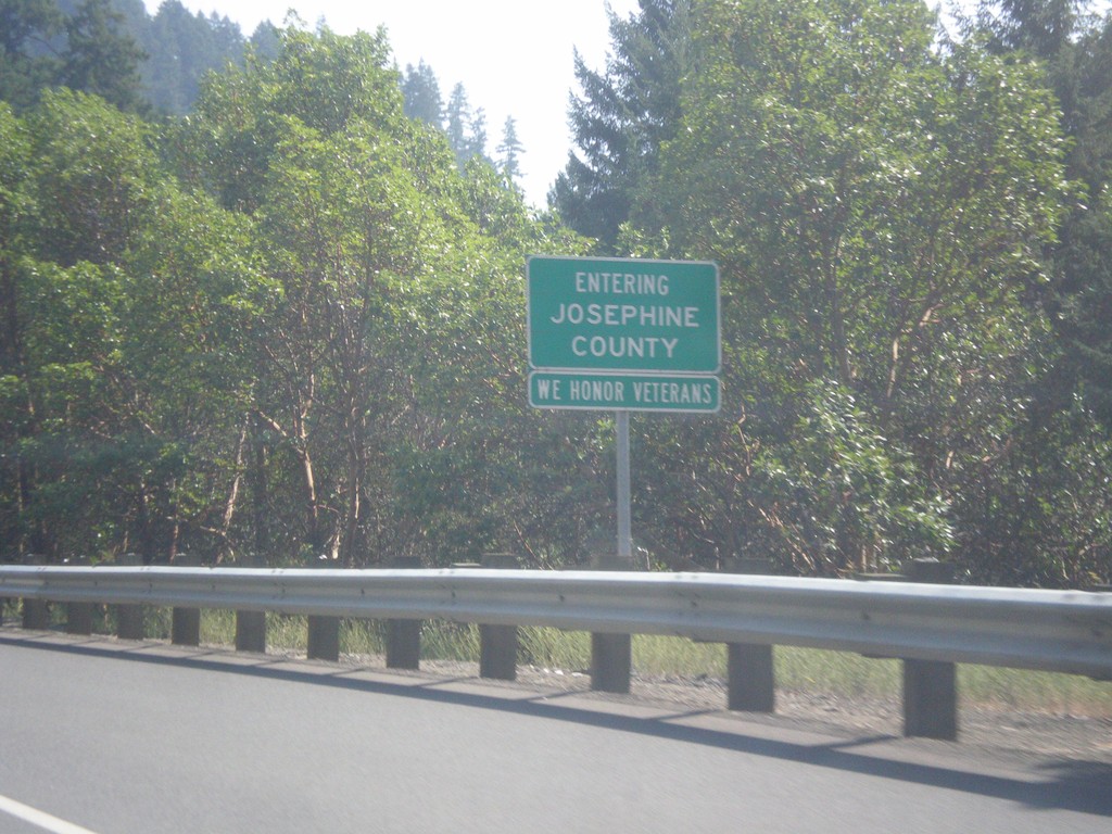
I-5 South - Entering Josephine County
Entering Josephine County on I-5 south. Many of the county line signs in southern Oregon (and Del Norte County California) contain the phrase We Honor Veterans.
Taken 08-17-2015
Glendale
Josephine County
Oregon
United States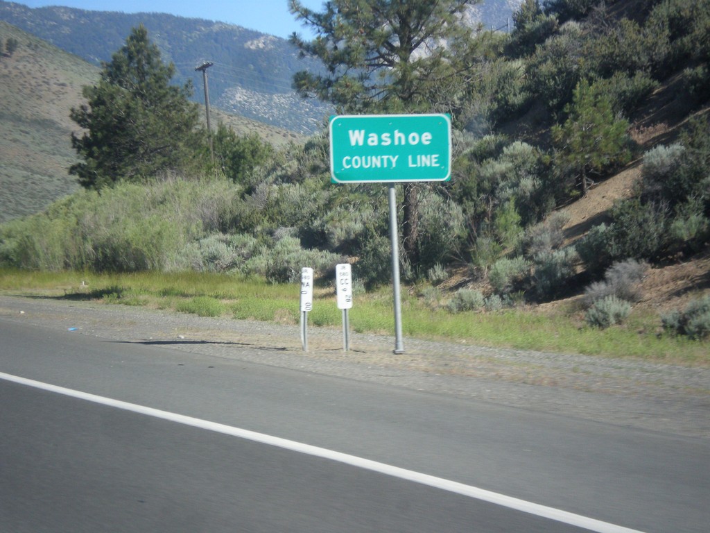
I-580/US-395 North - Washoe County Line
Washoe County Line on I-580/US-395 North.
Taken 06-15-2015

 Carson City
Washoe County
Nevada
United States
Carson City
Washoe County
Nevada
United States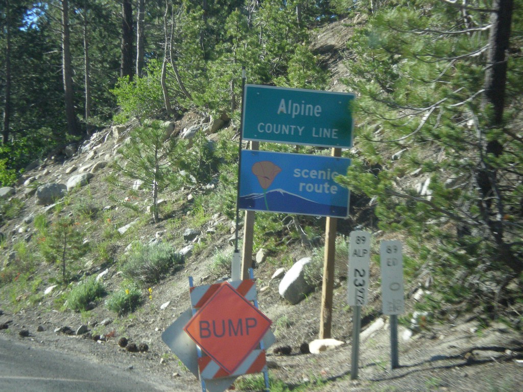
CA-89 South - Alpine County
Alpine County Line on CA-89 south. Alpine County is the smallest county in California by population. CA-89 is posted as a scenic route.
Taken 06-15-2015
 Markleeville
Alpine County
California
United States
Markleeville
Alpine County
California
United States
I-15 South - Entering Clark County
I-15 south Entering Clark Count and Leaving Montana. Taken on Monida Pass on the Continental Divide between Idaho and Montana.
Taken 05-10-2015
 Humphrey
Clark County
Idaho
United States
Humphrey
Clark County
Idaho
United States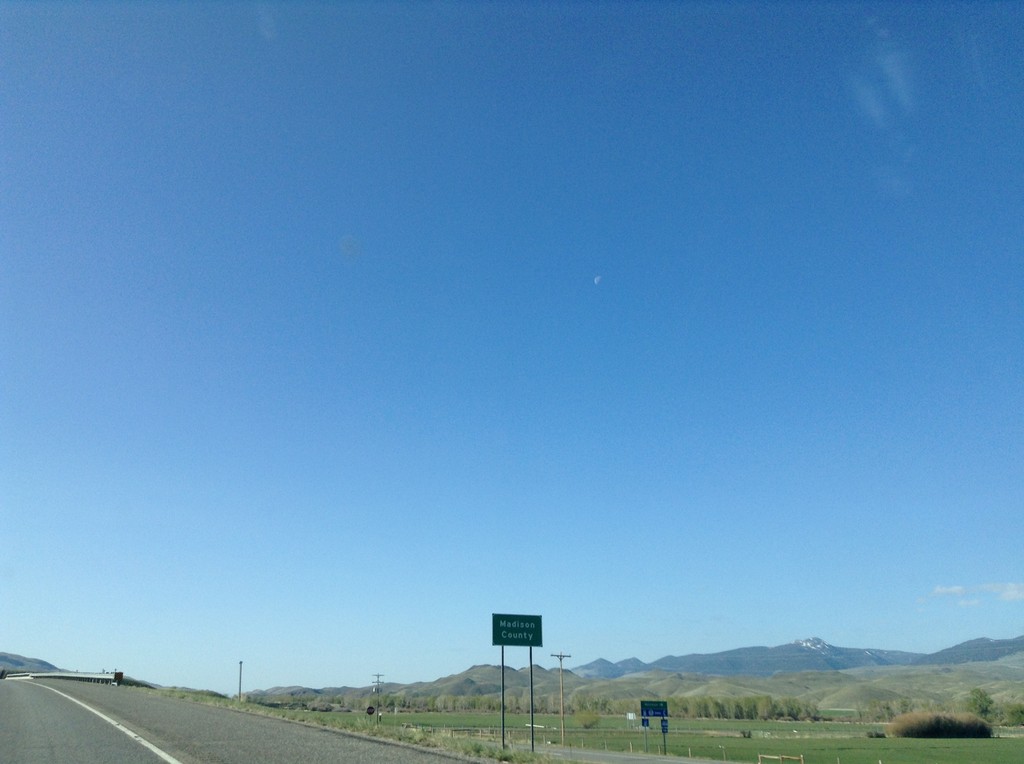
I-15 South - Madison County
Madison County on I-15 south.
Taken 05-10-2015
Silver Star
Madison County
Montana
United States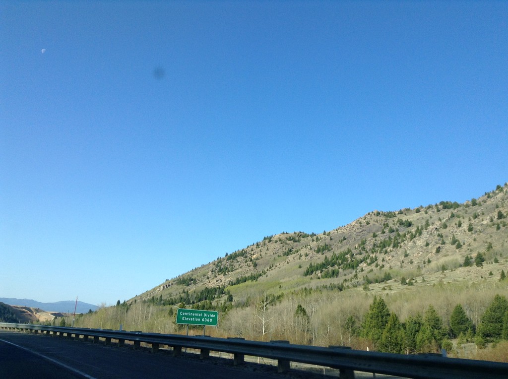
I-15 South - Elk Park Pass
I-15 south at Elk Park Pass (Continental Divide). Elevation 6368 Feet. This is also the county boundary between Silver Bow and Jefferson County.
Taken 05-10-2015
Woodville
Jefferson County
Montana
United States