Signs Tagged With Continental Divide
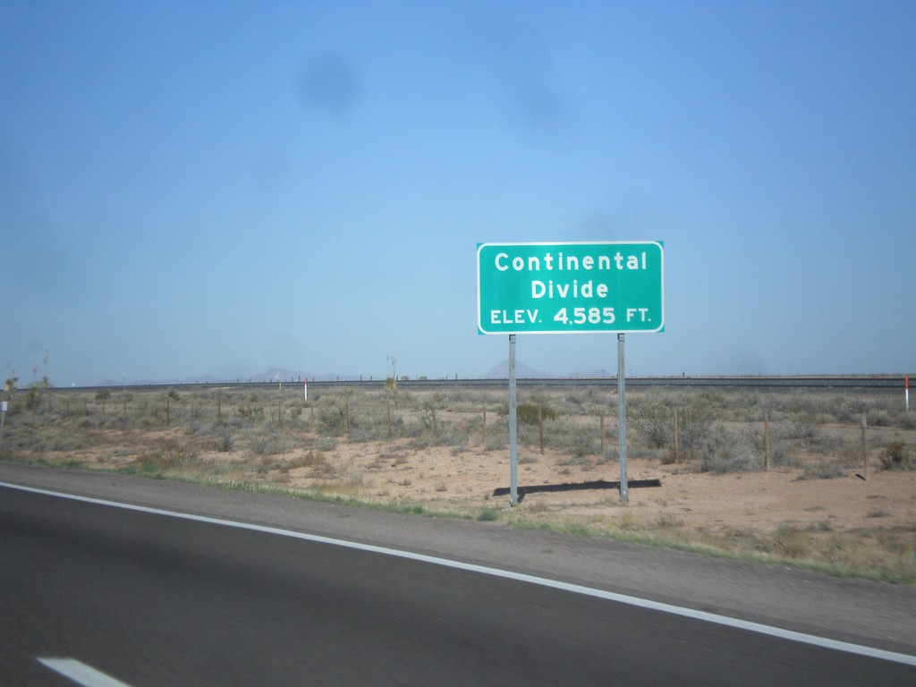
I-10 West - Continental Divide
Continental Divide on I-10 west - Elevation 4,585 Feet. This is the dividing line between the Gila River (flows to Colorado River) and the Mimbres River (flows into a closed basin).
Taken 04-14-2013
 Deming
Luna County
New Mexico
United States
Deming
Luna County
New Mexico
United States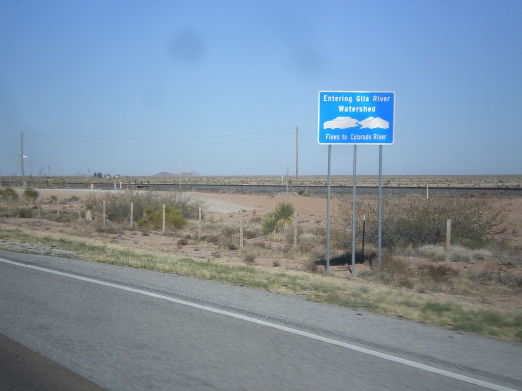
I-10 West - Entering Gila River Watershed
Entering Gila River Watershed on I-10 west. The Gila River flows to the Colorado River. This is the Continental Divide.
Taken 04-14-2013
Wilna
Grant County
New Mexico
United States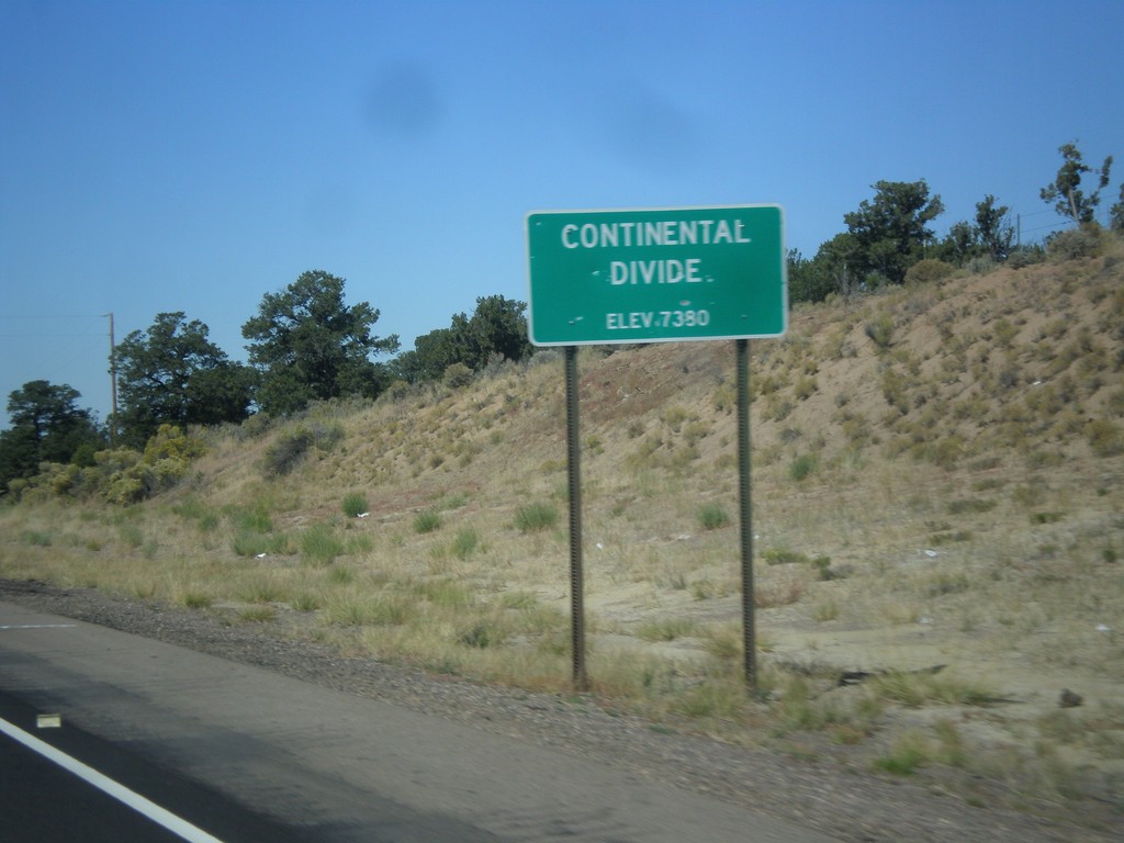
US-550 North - Continental Divide
Continental Divide - Elevation 7380 Feet on US-550 north. This is the divide between the San Juan River drainage and the Rio Grande drainage.
Taken 10-15-2012
 Cuba
Sandoval County
New Mexico
United States
Cuba
Sandoval County
New Mexico
United States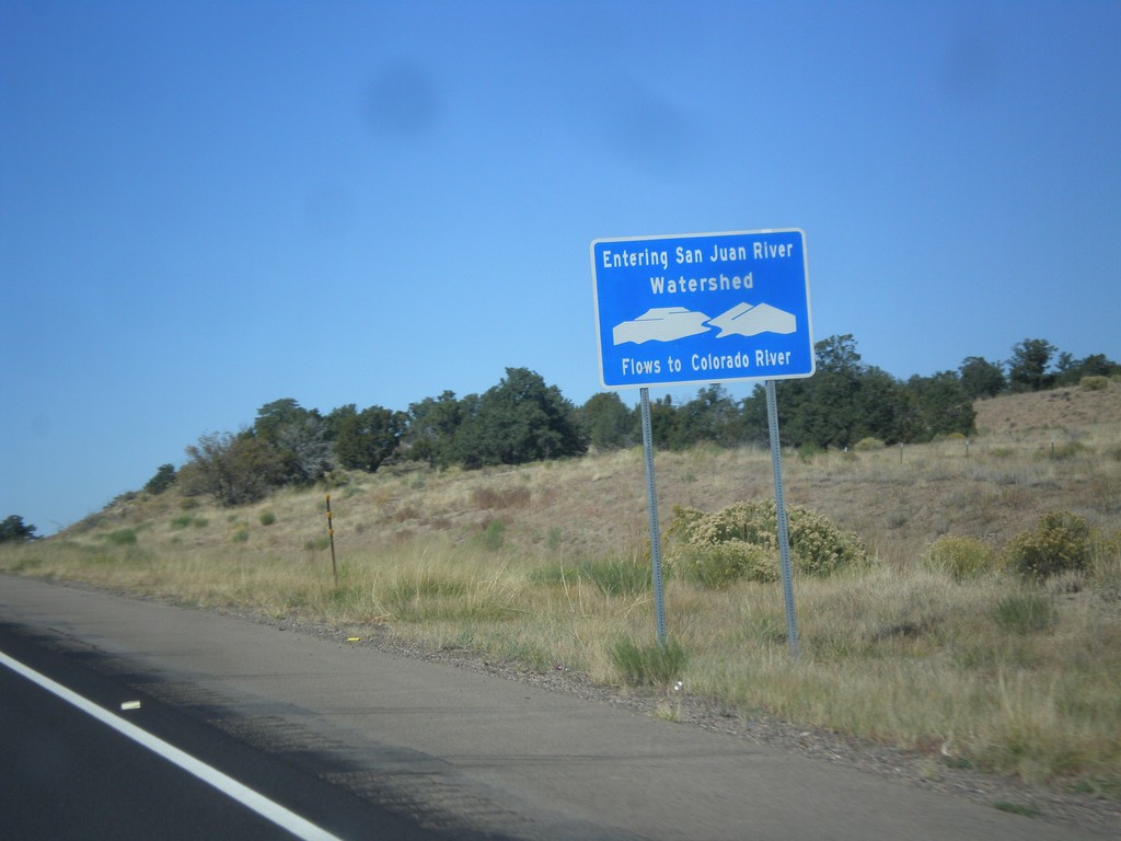
US-550 North - San Juan River Watershed
Entering the San Juan River watershed at the Continental Divide on US-550 north. The San Juan River flows into the Colorado River.
Taken 10-15-2012
Cuba
Sandoval County
New Mexico
United States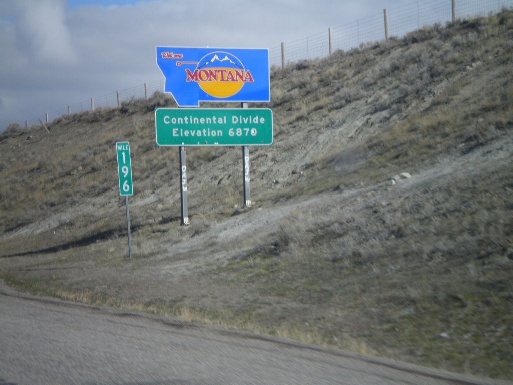
Welcome To Montana - I-15 North
Welcome to Montana on I-15 North at the Idaho-Montana state line on Monida Pass. Monida Pass is the Continental Divide.
Taken 05-02-2010
 Humphrey
Clark County
Idaho
United States
Humphrey
Clark County
Idaho
United States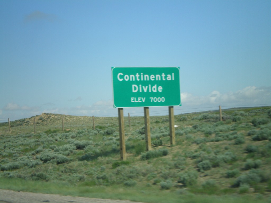
I-80 West - Continental Divide (East)
I-80 west at the eastern Continental Divide, 7000 Feet. I-80 west crosses the Great Divide Basin.
Taken 05-29-2007


 Rawlins
Carbon County
Wyoming
United States
Rawlins
Carbon County
Wyoming
United States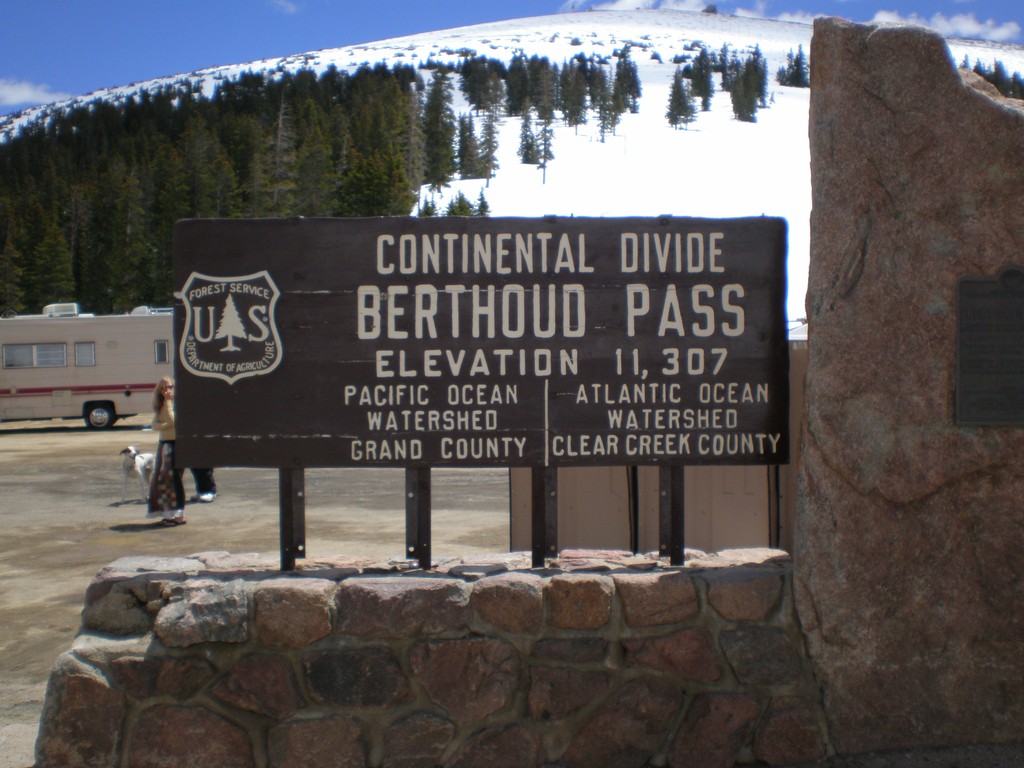
US-40 - Berthoud Pass
US-40 at Berthoud Pass. Continental Divide and Grand-Clear Creek County Line.
Taken 05-25-2007
 Winter Park
Grand County
Colorado
United States
Winter Park
Grand County
Colorado
United States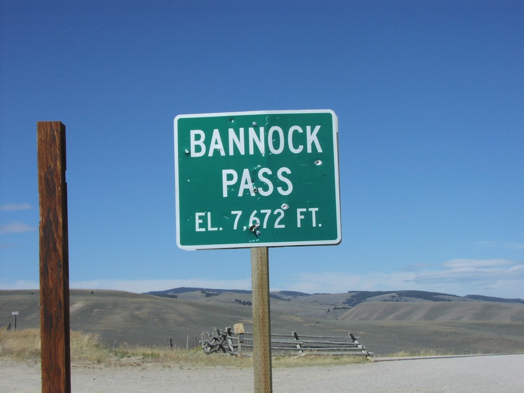
ID-29 - Bannock Pass - ID/MT Border
Bannock Pass at end of ID-29 on ID-MT Border
Taken 09-01-2004
 Leadore
Lemhi County
Idaho
United States
Leadore
Lemhi County
Idaho
United States