Signs Tagged With Canyonlands National Park
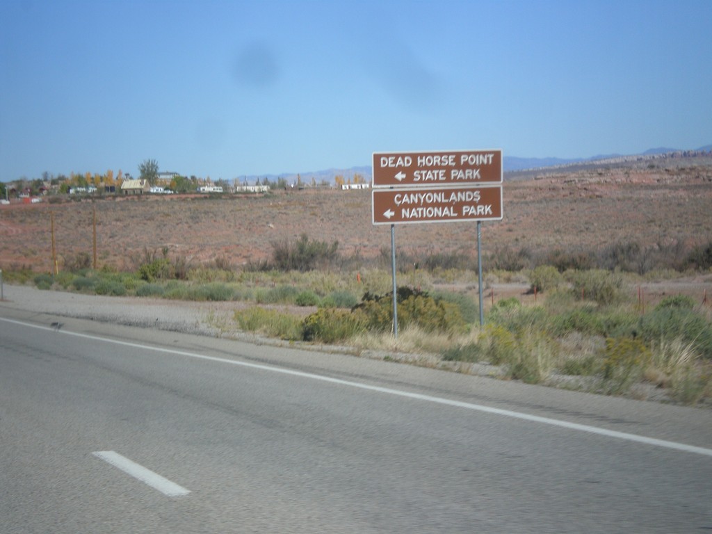
US-191 North Approaching UT-313
US-191 north approaching UT-313. Use UT-313 west for Dead Horse Point State Park, and Canyonlands National Park (Island In The Sky Unit).
Taken 10-17-2012

 Moab
Grand County
Utah
United States
Moab
Grand County
Utah
United States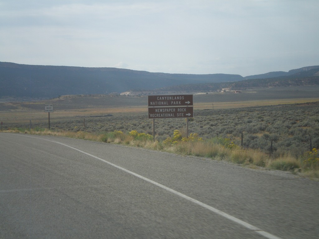
US-191 South Approaching UT-211
US-191 South approaching UT-211 west. Use UT-211 west for Canyonlands National Park (Needles District), and Newspaper Rock Recreational Site.
Taken 10-02-2011
 Monticello
San Juan County
Utah
United States
Monticello
San Juan County
Utah
United States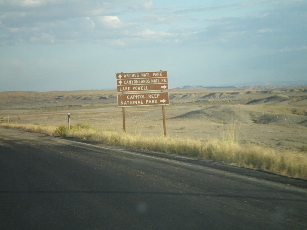
US-6 East/US-191 South Approaching I-70
Federal lands directions on US-6 East/US-191 South approaching I-70. Use I-70 west for Capitol Reef National Park and Lake Powell. Use I-70/US-6 East/US-191 South for Canyonlands National Park and Arches National Park.
Taken 10-01-2011


 Green River
Emery County
Utah
United States
Green River
Emery County
Utah
United States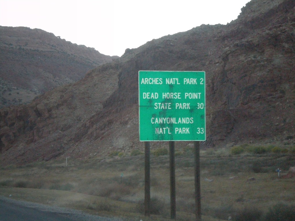
US-191 North - National Parks Distance Marker
Distance marker on US-191 north to Arches NP, Dead Horse Point SP, and Canyonlands NP.
Taken 10-23-2008
Moab
Grand County
Utah
United States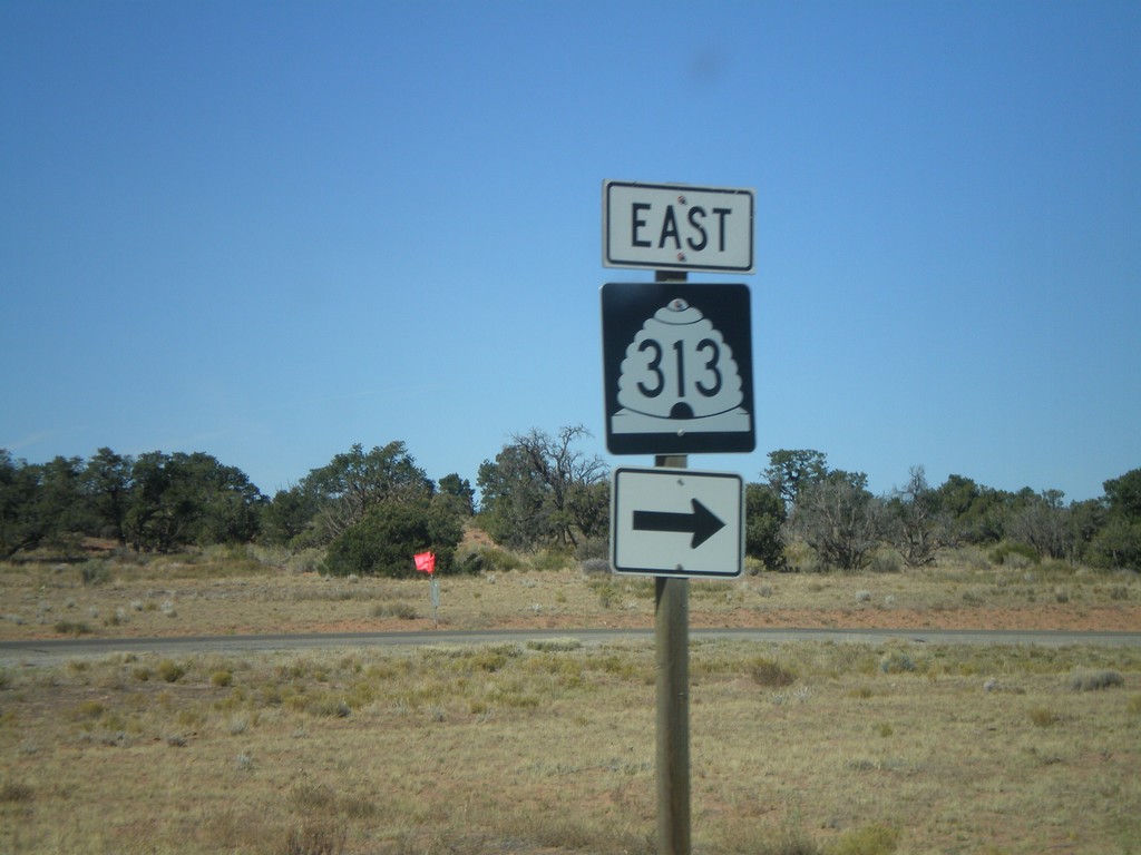
UT-313 East at Canyonlands National Park
UT-313 east at Canyonlands NP access road.
Taken 10-22-2008
Moab
Grand County
Utah
United States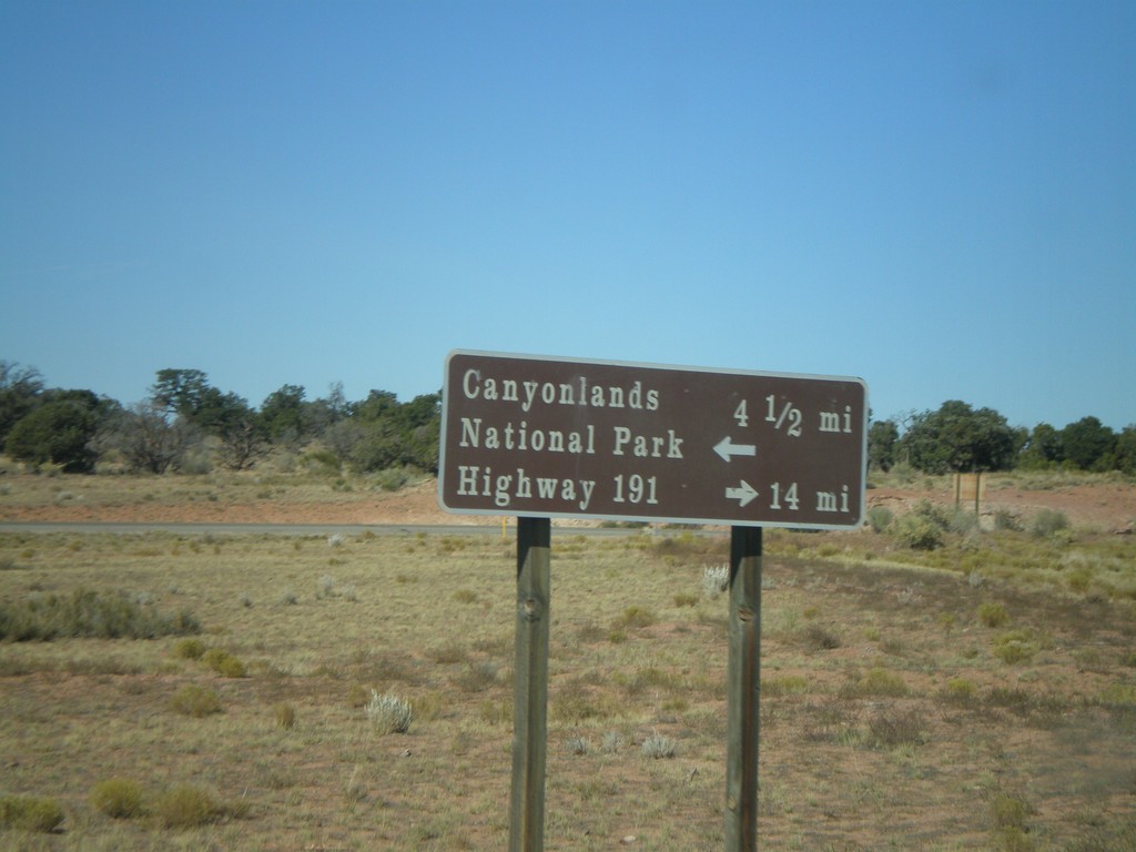
UT-313 at Canyonlands National Park Jct.
UT-313 north approaching Canyonlands NP access road. Turn right to continue on UT-313 to US-191.
Taken 10-22-2008
Moab
Grand County
Utah
United States