Signs Tagged With Big Green Sign
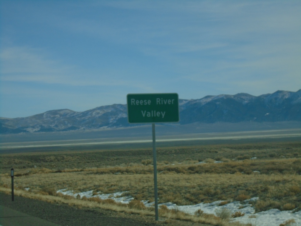
US-50 East - Reese River Valley
Entering the Reese River Valley on US-50 east.
Taken 01-15-2022
 Austin
Lander County
Nevada
United States
Austin
Lander County
Nevada
United States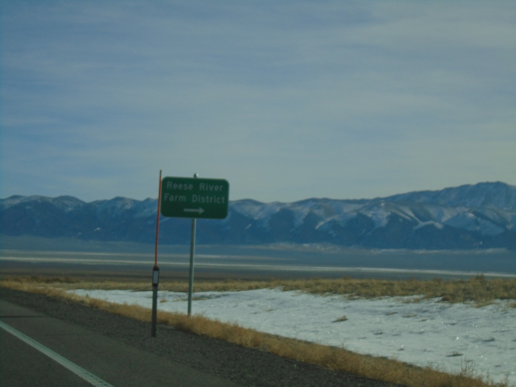
US-50 East - Reese River/Farm District
US-50 East at junction to Reese River/Farm District
Taken 01-15-2022
Austin
Lander County
Nevada
United States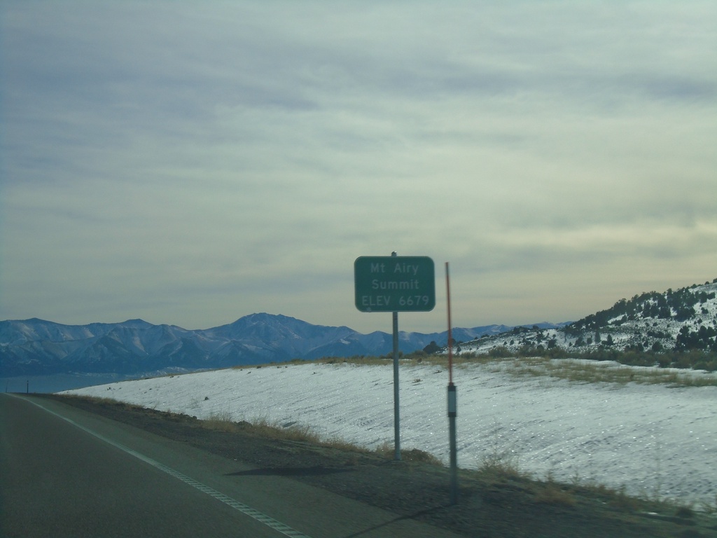
US-50 East - Mount Airy Summit
US-50 East at Mount Airy Summit - Elevation 6679 Feet. Mount Airy Summit is a pass in the Shoshone Mountains.
Taken 01-15-2022
Austin
Lander County
Nevada
United States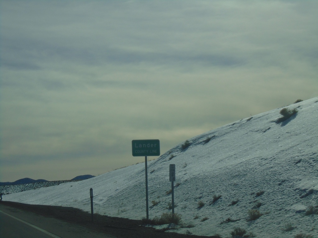
US-50 East - Lander County
Lander County Line on US-50 west at New Pass Summit.
Taken 01-15-2022
Fallon
Lander County
Nevada
United States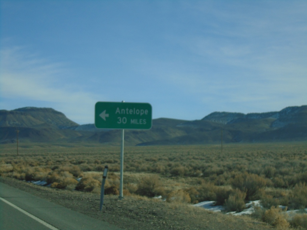
US-50 East - Antelope Junction
US-50 East approaching Antelope junction.
Taken 01-15-2022
Fallon
Churchill County
Nevada
United States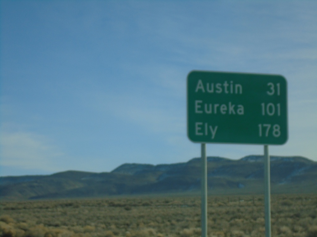
US-50 East - Distance Marker
Distance marker on US-50 east. Distance to Austin, Eureka, and Ely.
Taken 01-15-2022
Fallon
Churchill County
Nevada
United States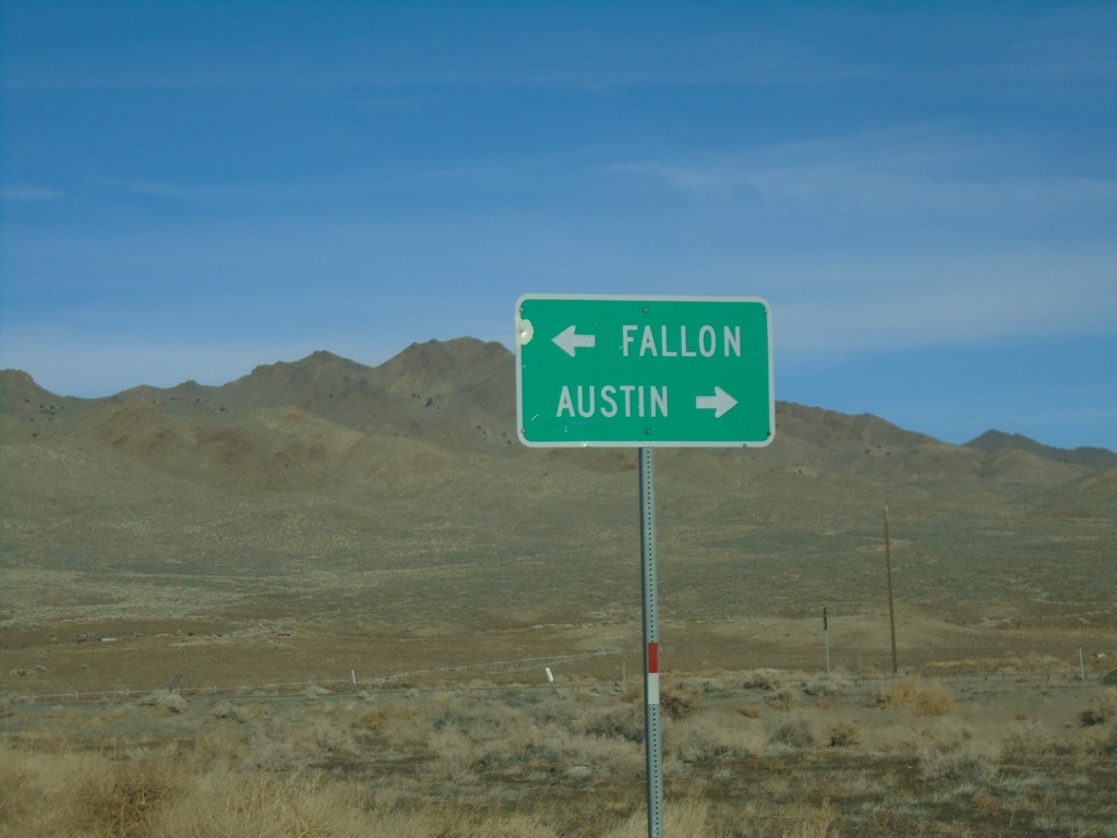
End NV-361 North at US-50
End NV-361 North at US-50 - Middlegate Junction. Use US-50 west for Fallon; US-50 east for Austin.
Taken 01-15-2022
 Fallon
Churchill County
Nevada
United States
Fallon
Churchill County
Nevada
United States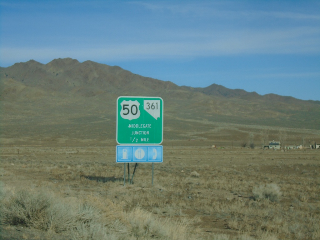
NV-361 North Approaching US-50 - Middlegate Junction
NV-361 North approaching US-50 - Middlegate Junction.
Taken 01-15-2022
Fallon
Churchill County
Nevada
United States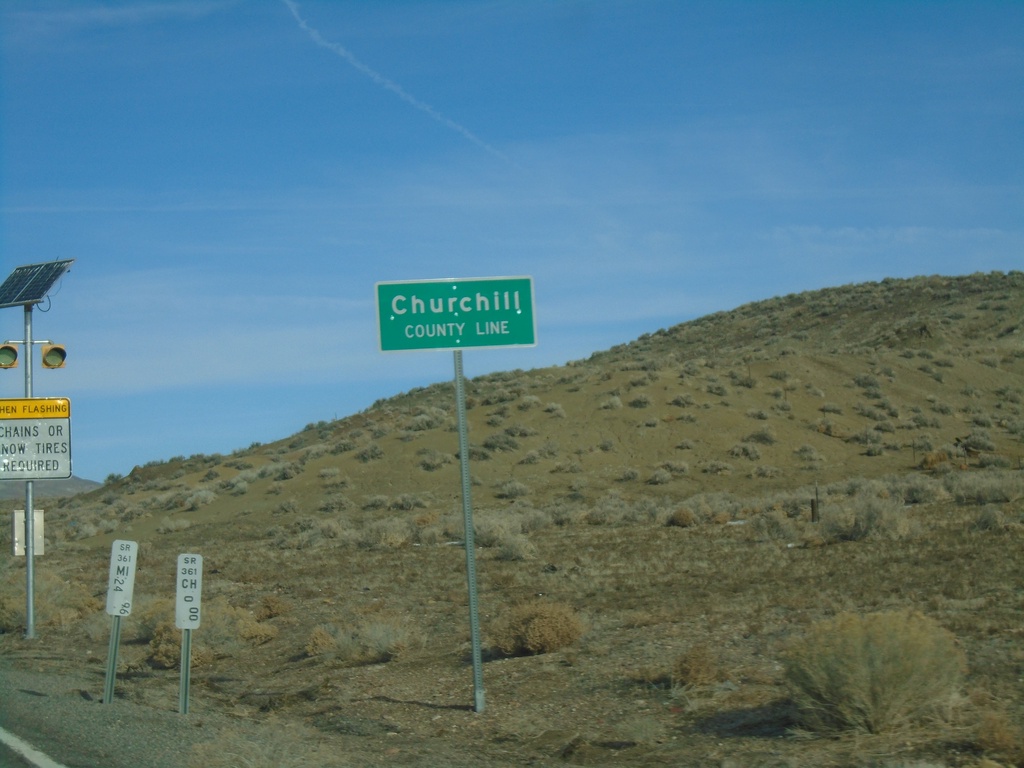
NV-361 North - Churchill County
Churchill County Line on NV-361 North. Milemarkers for both Mineral County and Churchill County are posted below the county line sign.
Taken 01-15-2022
Churchill County
Nevada
United States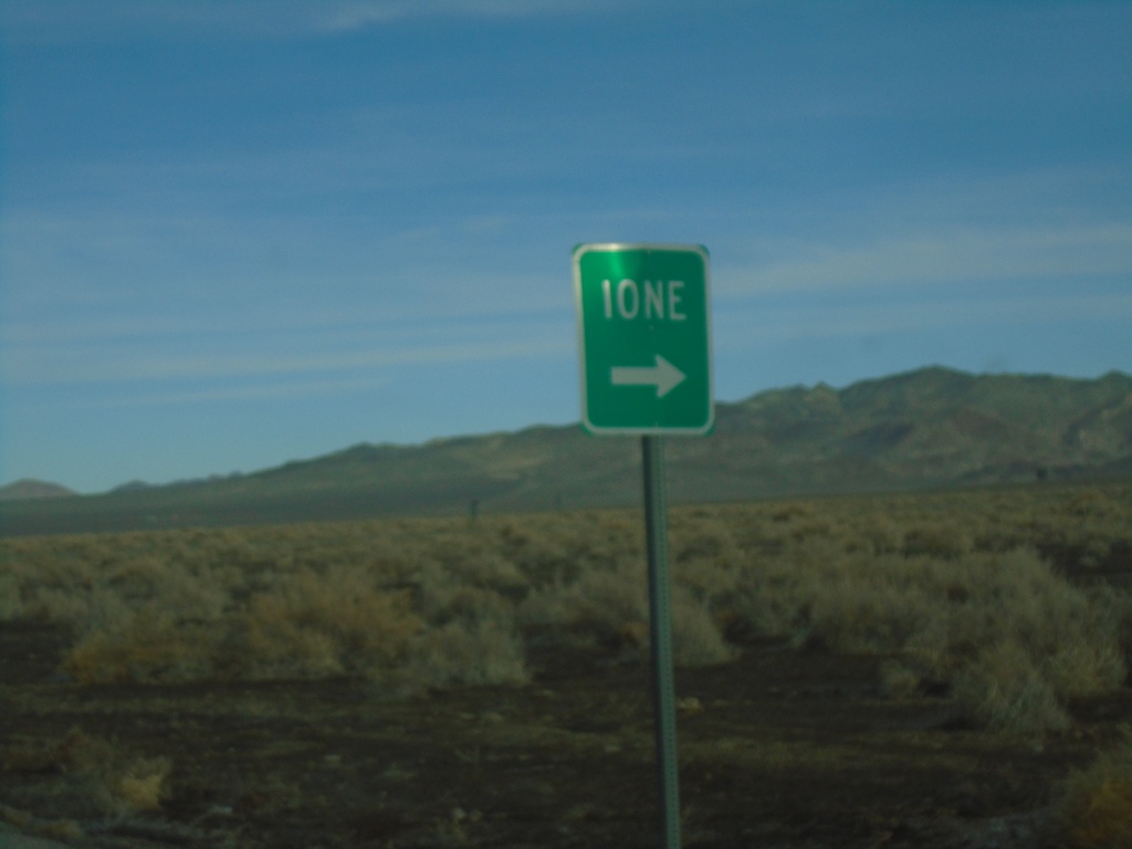
NV-361 North Approaching NV-844
NV-361 North approaching NV-844 east to Ione.
Taken 01-15-2022
 Gabbs
Nye County
Nevada
United States
Gabbs
Nye County
Nevada
United States