Signs Tagged With Big Green Sign
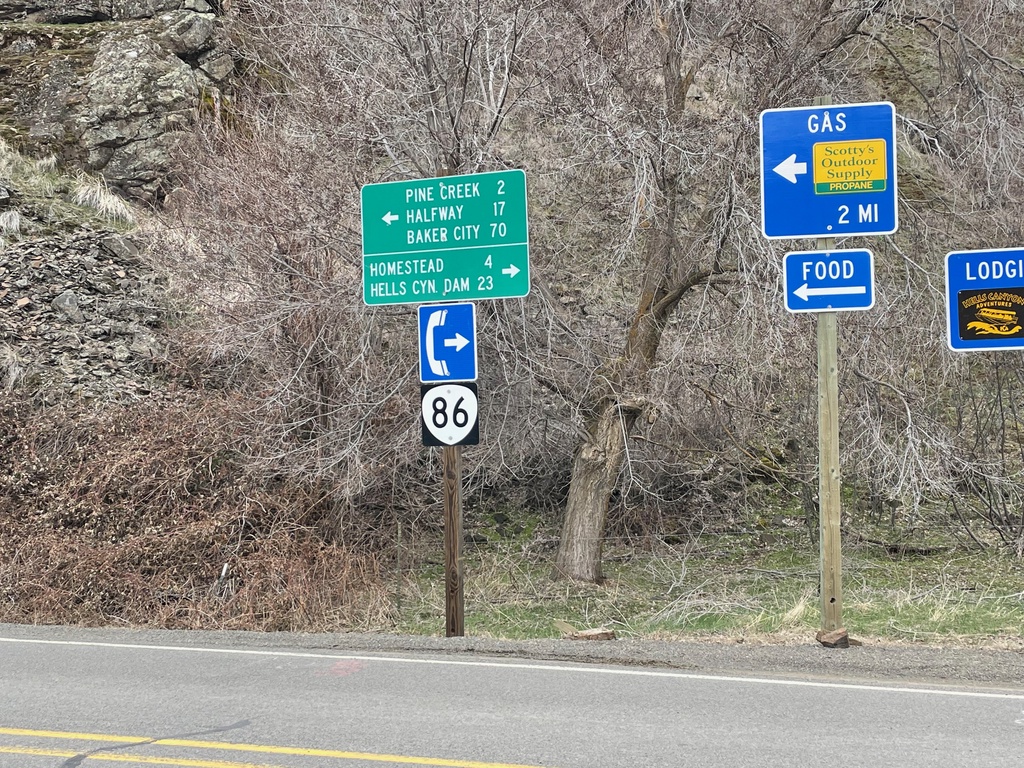
End Brownlee-Oxbow Highway at OR-86
End Brownlee-Oxbow Highway at OR-86. Use OR-86 west to Baker City, Halfway, and Pine Creek. Use OR-86 east to Homestead and Hells Canyon Dam. OR-86 ends a short distance to the east at the Snake River.
Taken 03-19-2022
 Oxbow
Baker County
Oregon
United States
Oxbow
Baker County
Oregon
United States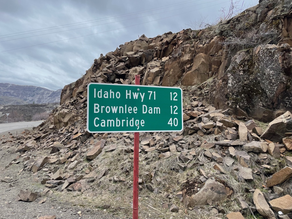
Oxbow-Brownlee Highway South - Distance Marker
Distance Marker on Oxbow-Brownlee Highway south. Distance to Idaho Highway 71, Brownlee Dam, and Cambridge (Idaho). The Oxbow-Brownlee Highway is managed by Idaho Power and connects OR-86 and ID-71, and is part of a network of roads connecting the three Hells Canyon dams.
Taken 03-19-2022
Halfway Baker County Oregon United States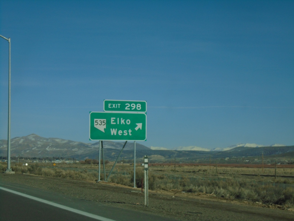
I-80 East - Exit 298
I-80 east at Exit 298 - NV-535/Elko West. The NV-535 shield was added to the Exit 298 freeway junction in 2021. Prior to that the text read Elko West without any route markers.
Taken 01-15-2022

 Elko
Elko County
Nevada
United States
Elko
Elko County
Nevada
United States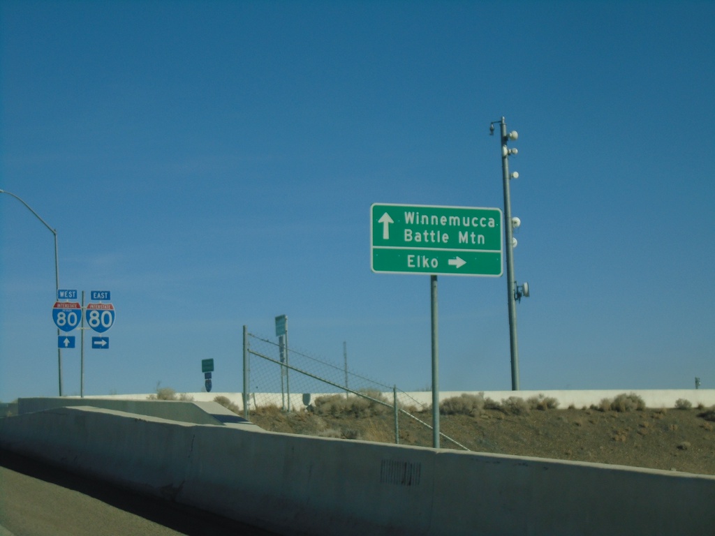
NV-305 North at I-80 - Battle Mountain
NV-305 North at I-80 in Battle Mountain. Turn right for I-80 East to Elko; continue over freeway for I-80 West to Winnemucca and for NV-305 North to Battle Mountain.
Taken 01-15-2022
 Battle Mountain
Lander County
Nevada
United States
Battle Mountain
Lander County
Nevada
United States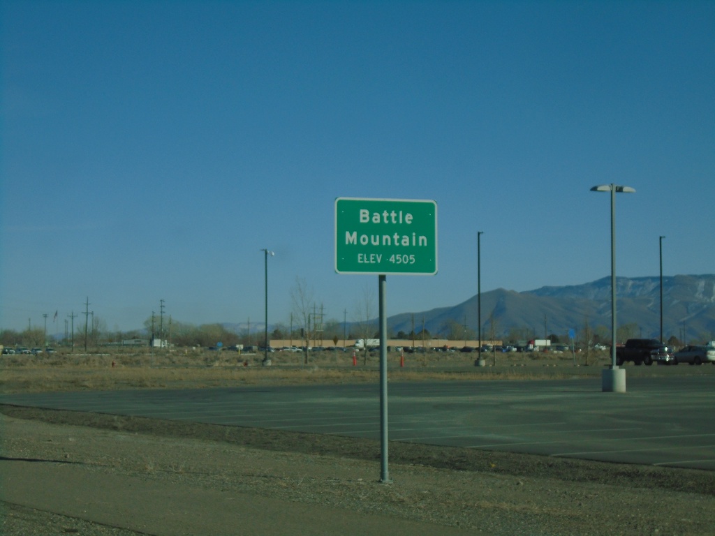
NV-305 North - Battle Mountain
Entering Battle Mountain on NV-305 North. Elevation 4505 Feet. Battle Mountain is the unincorporated county seat of Lander County.
Taken 01-15-2022
Battle Mountain
Lander County
Nevada
United States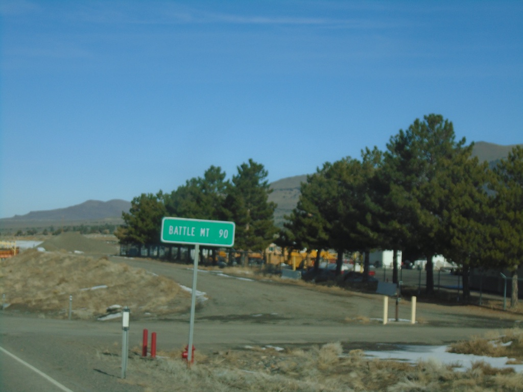
NV-305 North - Distance Marker
Distance marker on NV-305 north. Distance to Battle Mountain.
Taken 01-15-2022
Austin
Lander County
Nevada
United States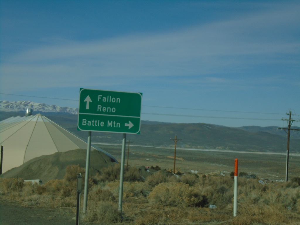
US-50 West at NV-305 North
US-50 west at NV-305 north to Battle Mountain. Continue west on US-50 for Fallon and Reno.
Taken 01-15-2022
 Austin
Lander County
Nevada
United States
Austin
Lander County
Nevada
United States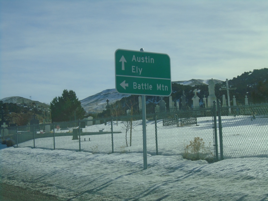
US-50 East at NV-305 North
US-50 East at NV-305 north to Battle Mountain. Continue east on US-50 for Austin and Ely.
Taken 01-15-2022
Austin
Lander County
Nevada
United States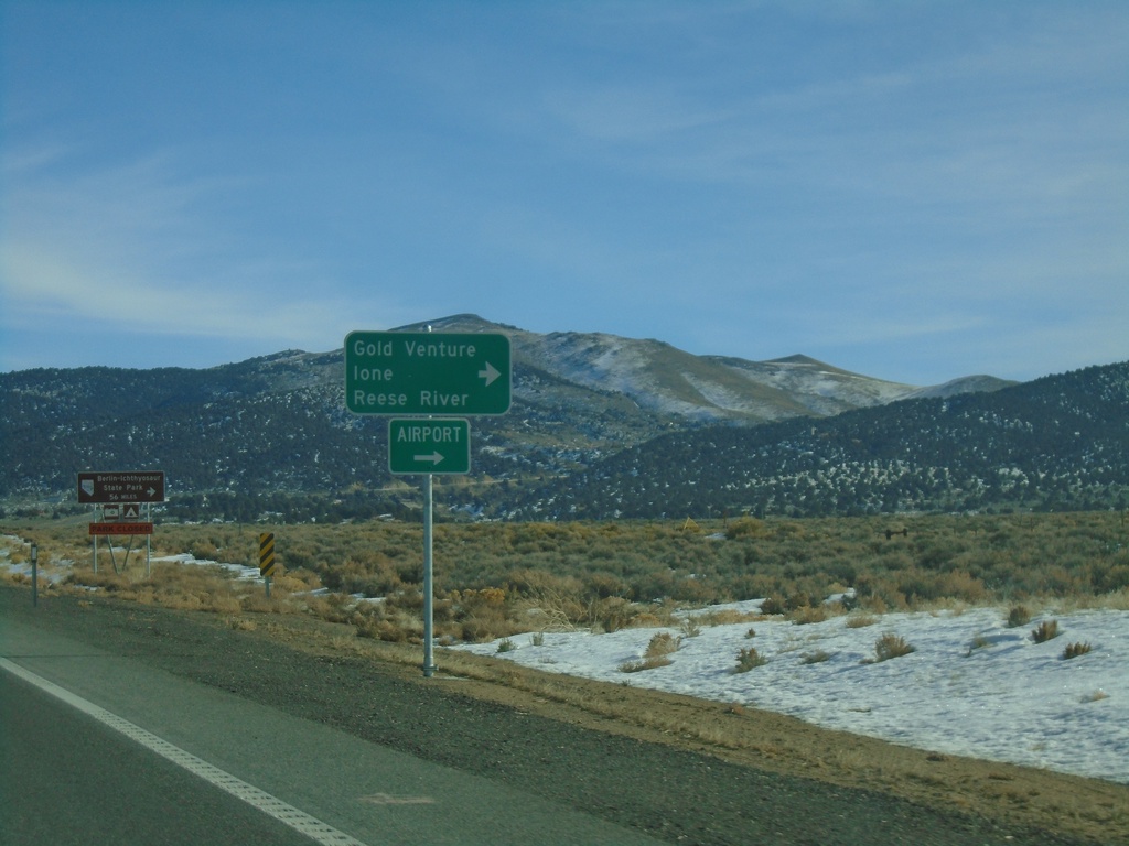
US-50 East at NV-722
US-50 East at NV-722 West to Gold Venture, Ione, and Reese River.
Taken 01-15-2022
 Austin
Lander County
Nevada
United States
Austin
Lander County
Nevada
United States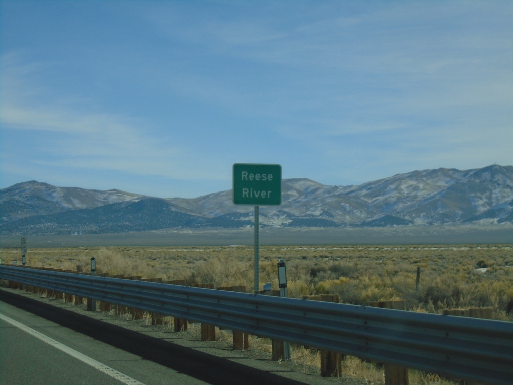
US-50 East - Reese River
US-50 east at the Reese River in Lander County. The Reese River starts in the Toyiabe Range, south of here, and flows north to the Humboldt River near Battle Mountain.
Taken 01-15-2022
Austin
Lander County
Nevada
United States