Signs Tagged With Big Green Sign
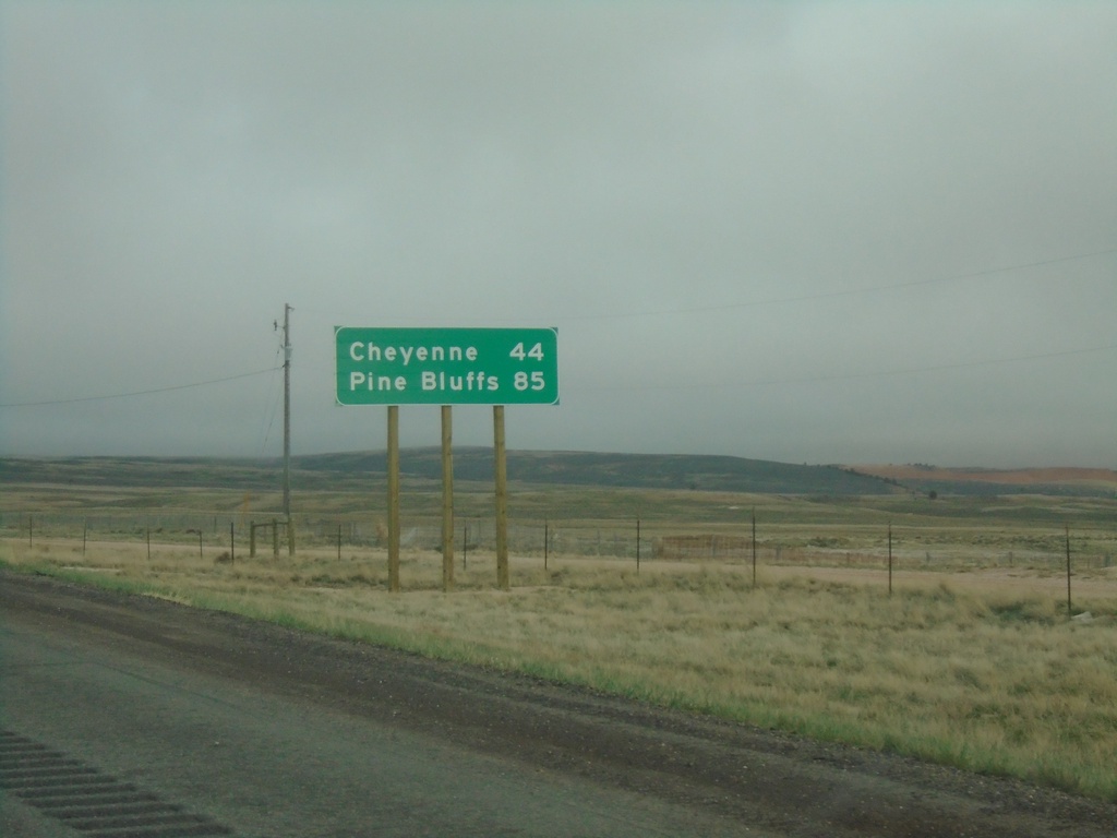
I-80 East - Distance Marker
Distance marker on I-80 east. Distance to Cheyenne and Pine Bluffs. Pine Bluffs is on the border with Nebraska.
Taken 04-29-2022
 Laramie
Albany County
Wyoming
United States
Laramie
Albany County
Wyoming
United States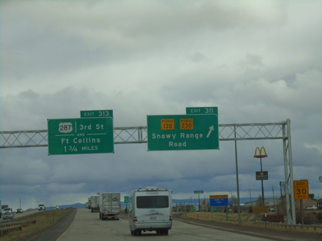
I-80 East - Exits 311 and 313
I-80 East at Exit 311 - WY-130/WY-230/Snowy Range Road. Approaching Exit 313 - US-287/3rd St./Fort Collins (Colorado).
Taken 04-29-2022


 Laramie
Albany County
Wyoming
United States
Laramie
Albany County
Wyoming
United States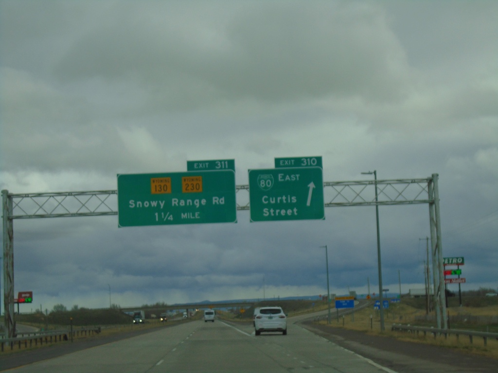
I-80 East - Exits 310 and 311
I-80 east at Exit 310 - BL-80/Curtis St. Approaching Exit 311 - WY-130/WY-230/Snowy Range Road.
Taken 04-29-2022
 Laramie
Albany County
Wyoming
United States
Laramie
Albany County
Wyoming
United States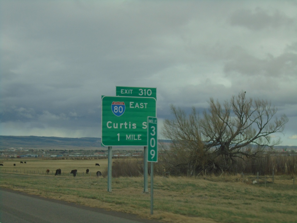
I-80 East - Exit 310
I-80 East approaching Exit 310 - BL-80/Curtis St. This is the western end of the Laramie business loop. The BL-80 shield is incorrectly displayed as an interstate shield.
Taken 04-29-2022
Laramie
Albany County
Wyoming
United States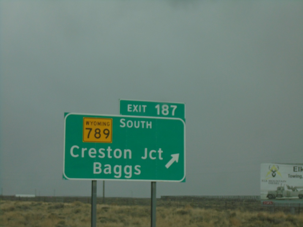
I-80 East - Exit 187
I-80 East at Exit 187 - WY-789 South/Creston Jct/Baggs. WY-789 north joins I-80/US-30 east to Rawlins.
Taken 04-29-2022

 Creston
Sweetwater County
Wyoming
United States
Creston
Sweetwater County
Wyoming
United States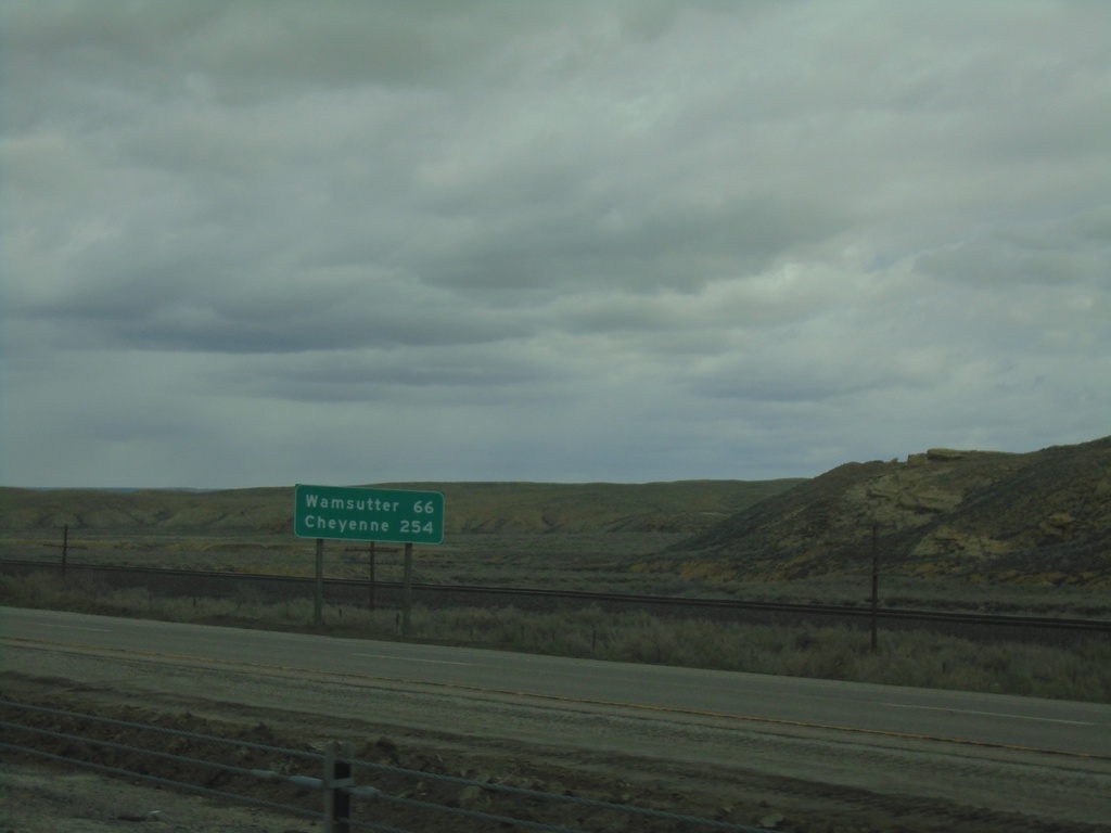
I-80 East - Distance Marker
Distance marker on I-80 east. Distance to Wamsutter and Cheyenne.
Taken 04-29-2022
Rock Springs
Sweetwater County
Wyoming
United States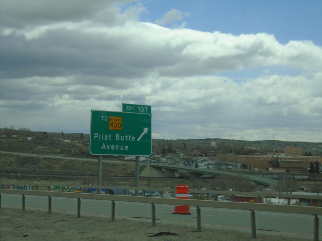
I-80 East - Exit 107
I-80 east approaching Exit 107 - To WY-430/Pilot Butte Ave. This is the eastern end of the Rock Springs business loop.
Taken 04-29-2022

 Rock Springs
Sweetwater County
Wyoming
United States
Rock Springs
Sweetwater County
Wyoming
United States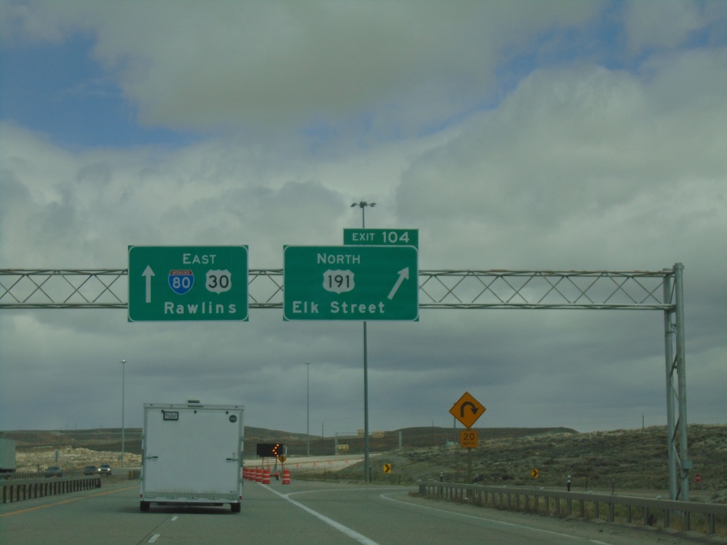
I-80 East - Exit 104
I-80/US-30 East/US-191 North at Exit 104 - US-191 North/Elk St. Continue east on I-80/US-30 for Rawlins.
Taken 04-29-2022
 Rock Springs
Sweetwater County
Wyoming
United States
Rock Springs
Sweetwater County
Wyoming
United States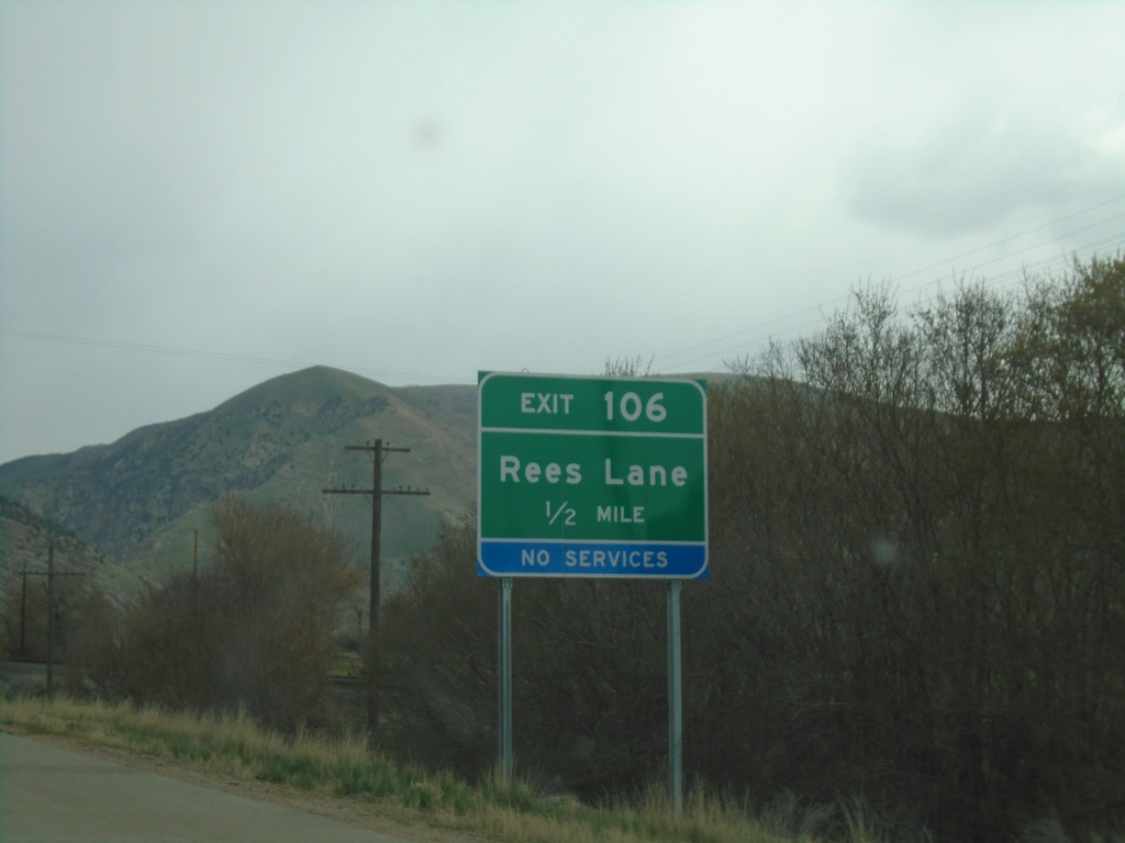
I-84 East Exit 106
I-84 east approaching Exit 106 - Rees Lane. This exit was recently renamed from Ranch Exit.
Taken 04-29-2022
 Morgan
 County
Utah
United States
Morgan
Morgan County
Utah
United States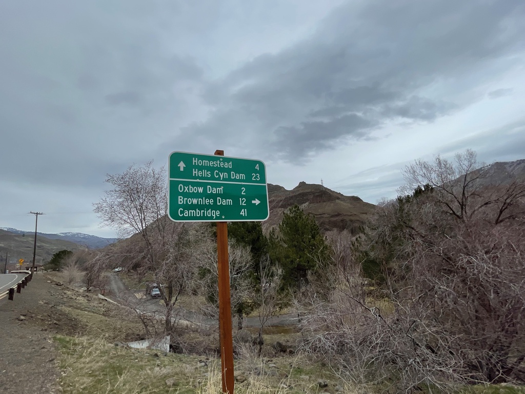
OR-86 East at Brownlee-Oxbow Highway
OR-86 East at Brownlee-Oxbow Highway. Turn right on Brownlee-Oxbow Highway to Oxbow Dam, Brownlee Dam, and Cambridge (Idaho). Continue east on OR-86 for Homestead and Hells Canyon Dam.
Taken 03-19-2022
 Halfway
Baker County
Oregon
United States
Halfway
Baker County
Oregon
United States