Signs Tagged With Big Green Sign
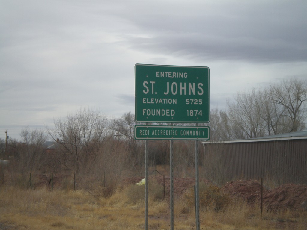
US-191 South/AZ-61 West - Entering St. Johns
Entering St. Johns on US-191 South/AZ-61 West. Elevation 5725 Feet. Founded in 1874. St. Johns is the county seat of Apache County.
Taken 02-24-2011

 Saint Johns
Apache County
Arizona
United States
Saint Johns
Apache County
Arizona
United States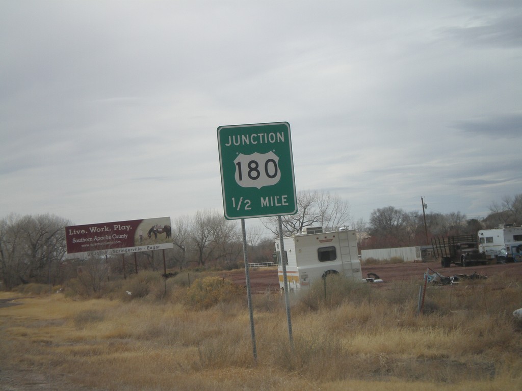
US-191 South/AZ-61 West Approaching US-180
US-191 South/AZ-61 West approaching US-180.
Taken 02-24-2011
 Saint Johns
Apache County
Arizona
United States
Saint Johns
Apache County
Arizona
United States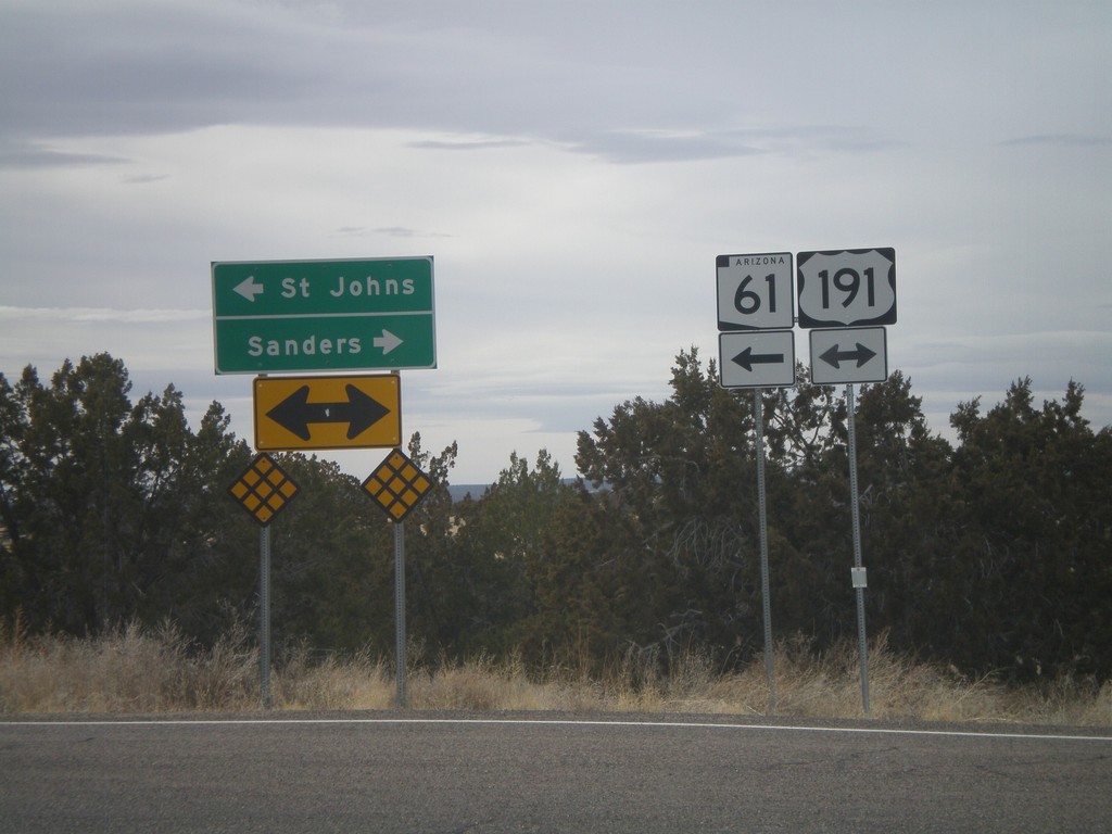
AZ-61 West at US-191
AZ-61 west at US-191. AZ-61 west joins US-191 south to St. Johns. Use US-191 South/AZ-61 West for St. Johns. Use US-191 North for Sanders.
Taken 02-24-2011
Saint Johns
Apache County
Arizona
United States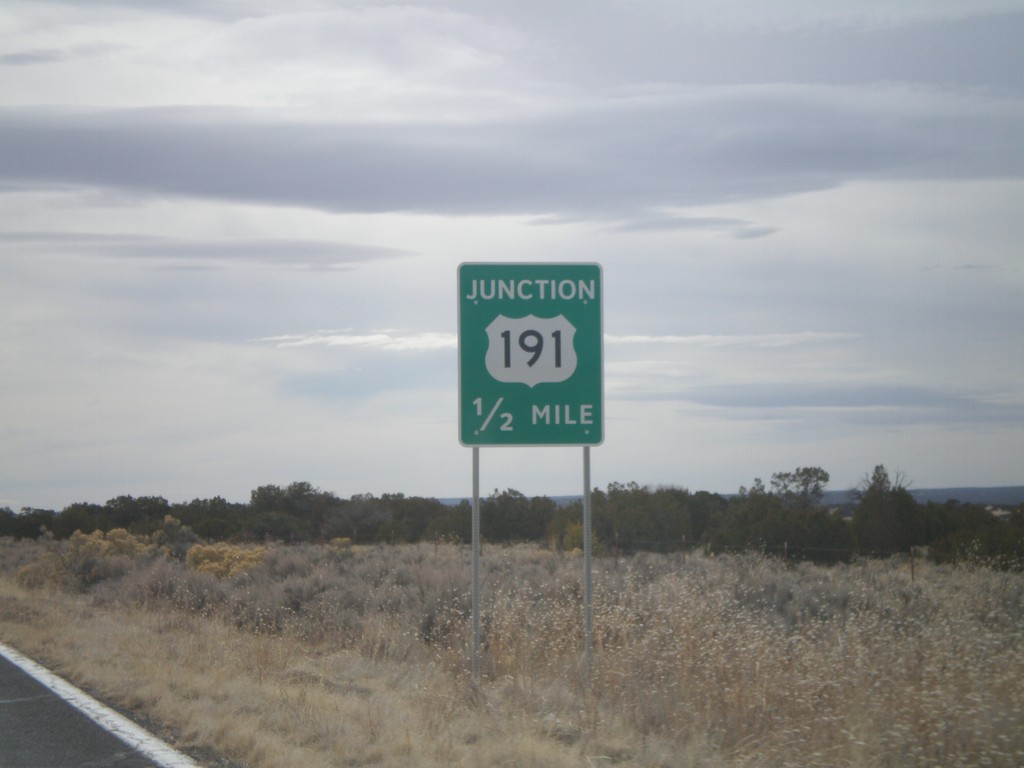
AZ-61 West Approaching US-191
AZ-61 west approaching US-191. AZ-61 west joins US-191 south to St. Johns.
Taken 02-24-2011
Saint Johns
Apache County
Arizona
United States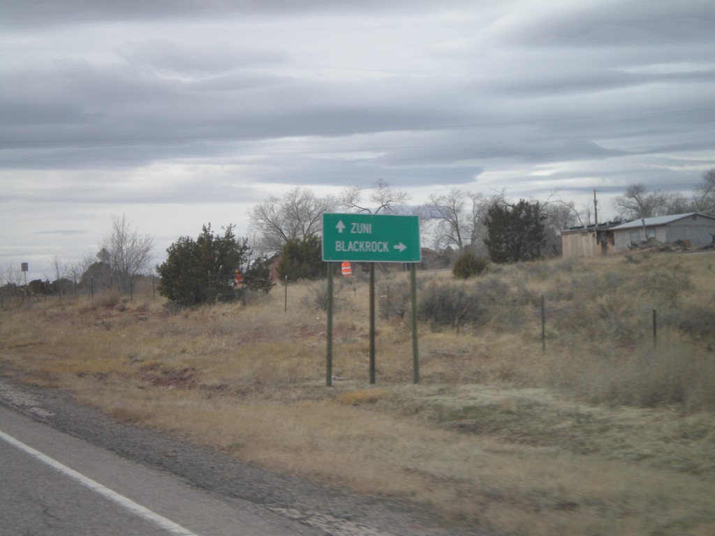
NM-53 West - Black Rock Jct.
NM-53 at Black Rock jct. Turn right for Black Rock. Continue west on NM-53 for Zuni.
Taken 02-24-2011
 Black Rock
McKinley County
New Mexico
United States
Black Rock
McKinley County
New Mexico
United States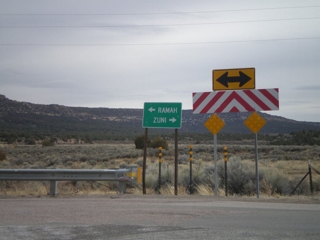
End NM-602 South at NM-53
End NM-602 South at NM-53. Use NM-53 west for Zuni; NM-53 east for Ramah.
Taken 02-24-2011
 Black Rock
McKinley County
New Mexico
United States
Black Rock
McKinley County
New Mexico
United States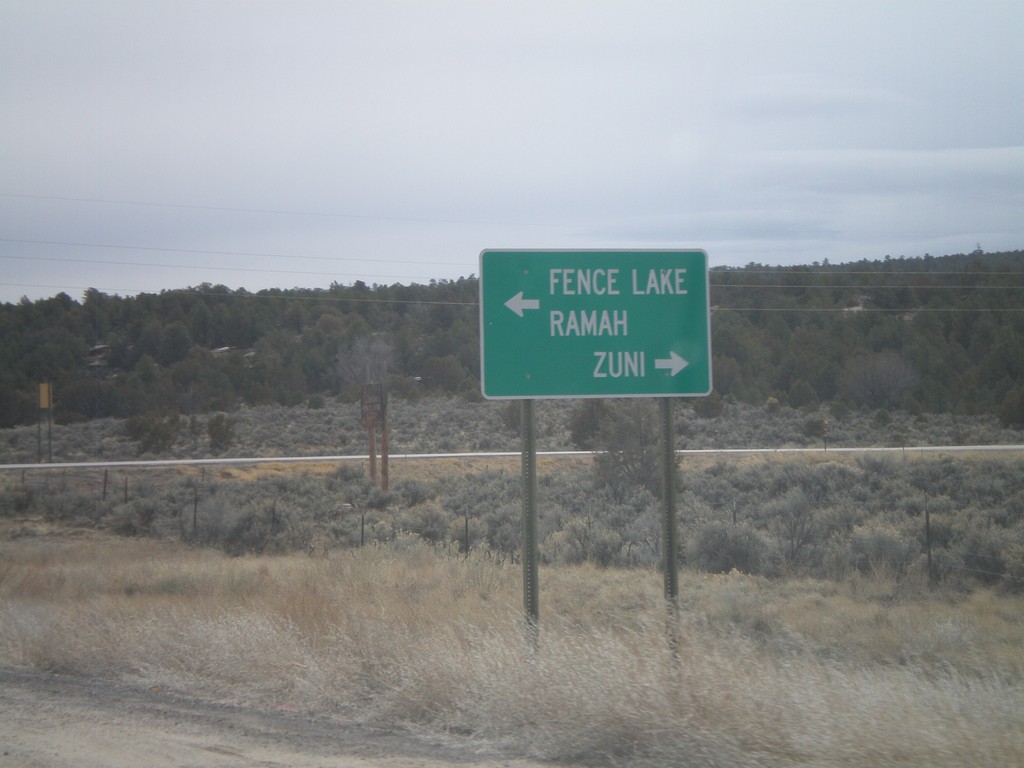
End NM-602 South At NM-53
End NM-602 South at NM-53. Use NM-53 west for Zuni; use NM-53 east for Ramah and Fence Lake.
Taken 02-24-2011
Zuni
McKinley County
New Mexico
United States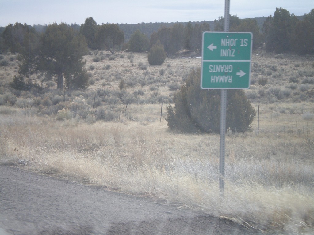
NM-602 South at Zuni-4
NM-602 south at Zuni-4 south. At the time of this photograph, Zuni-4 was closed for bridge repair, so the guide sign was turned upside town. During normal times, use Zuni-4 south for Zuni and St. John. Continue south on NM-602 for Ramah and Grants.
Taken 02-24-2011
 Zuni
McKinley County
New Mexico
United States
Zuni
McKinley County
New Mexico
United States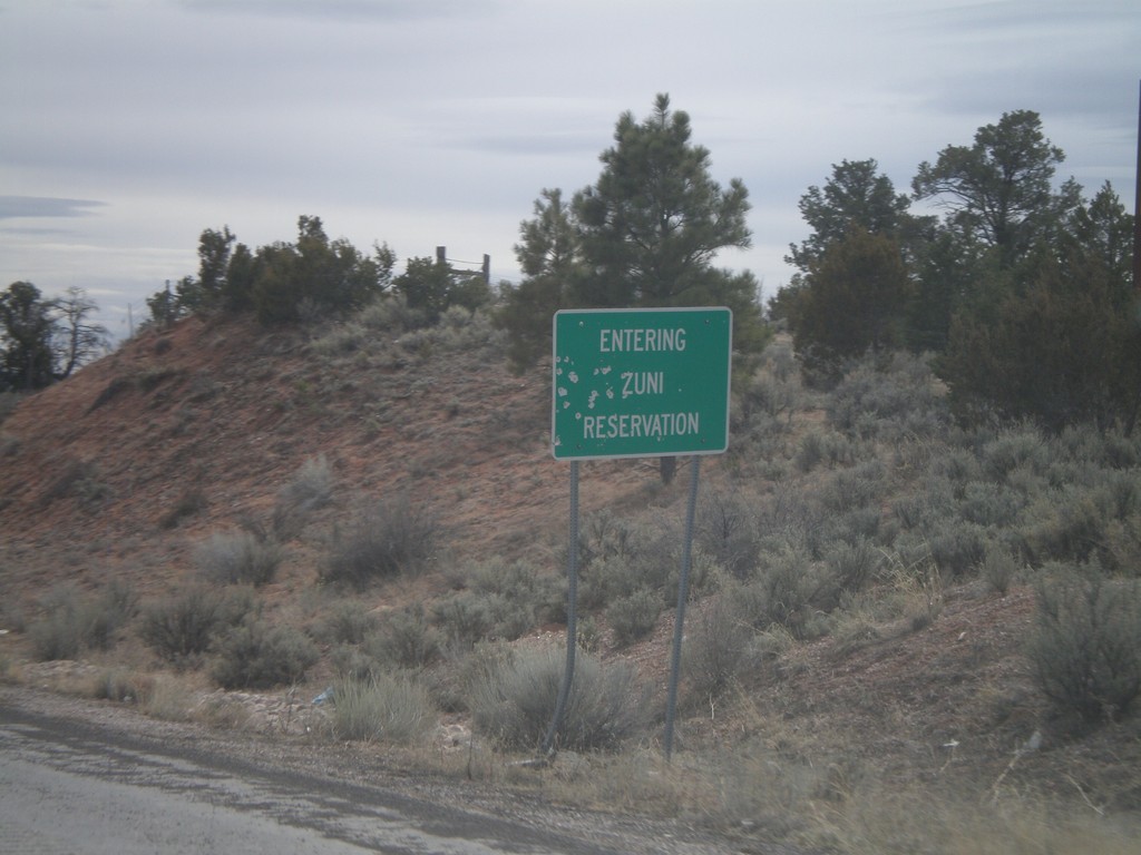
NM-602 South - Entering Zuni Reservation
Entering Zuni Reservation on NM-602 south.
Taken 02-24-2011
Vanderwagen
McKinley County
New Mexico
United States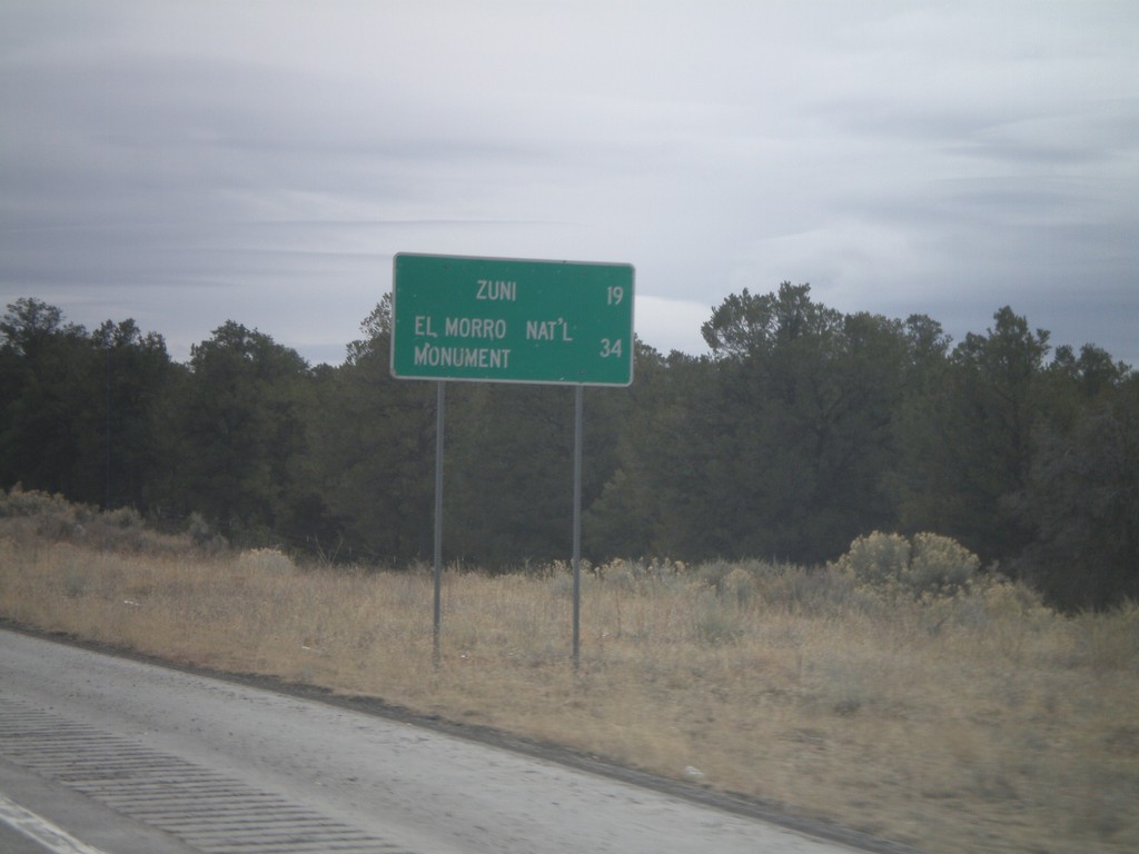
NM-602 South - Distance Marker
Distance marker on NM-602 south to Zuni, and El Morro National Monument.
Taken 02-24-2011
Vanderwagen
McKinley County
New Mexico
United States