Signs Tagged With Big Green Sign
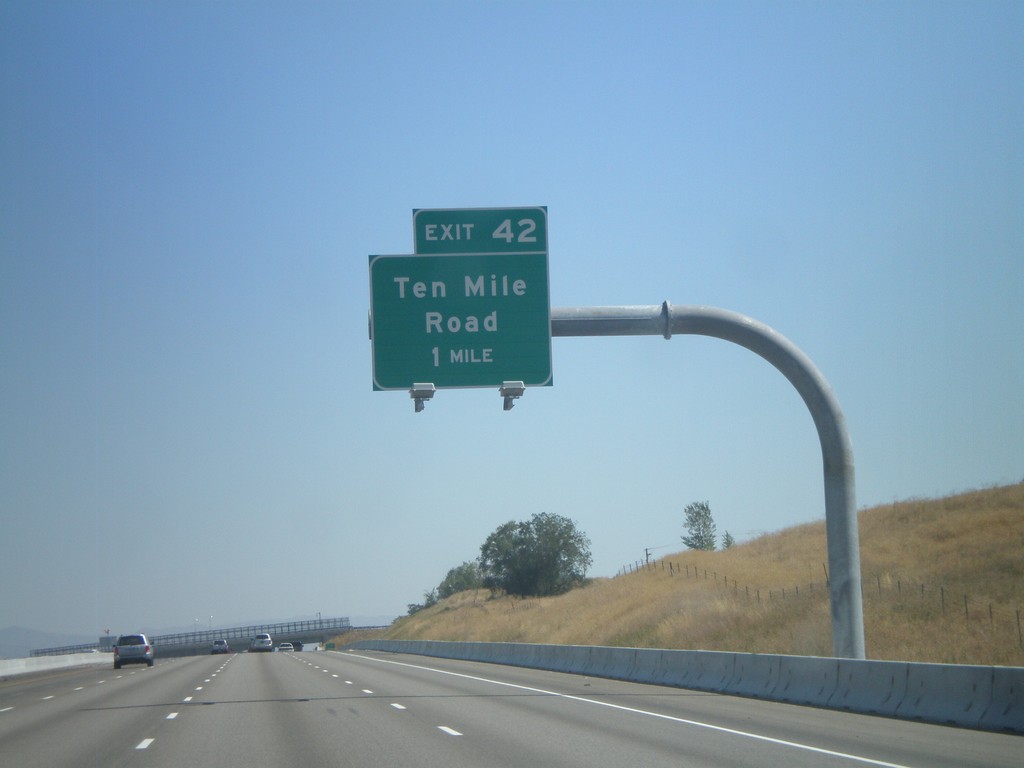
I-84 East Approaching Exit 42
I-84 east approaching Exit 42 - Ten Mile Road.
Taken 09-04-2011


 Meridian
Ada County
Idaho
United States
Meridian
Ada County
Idaho
United States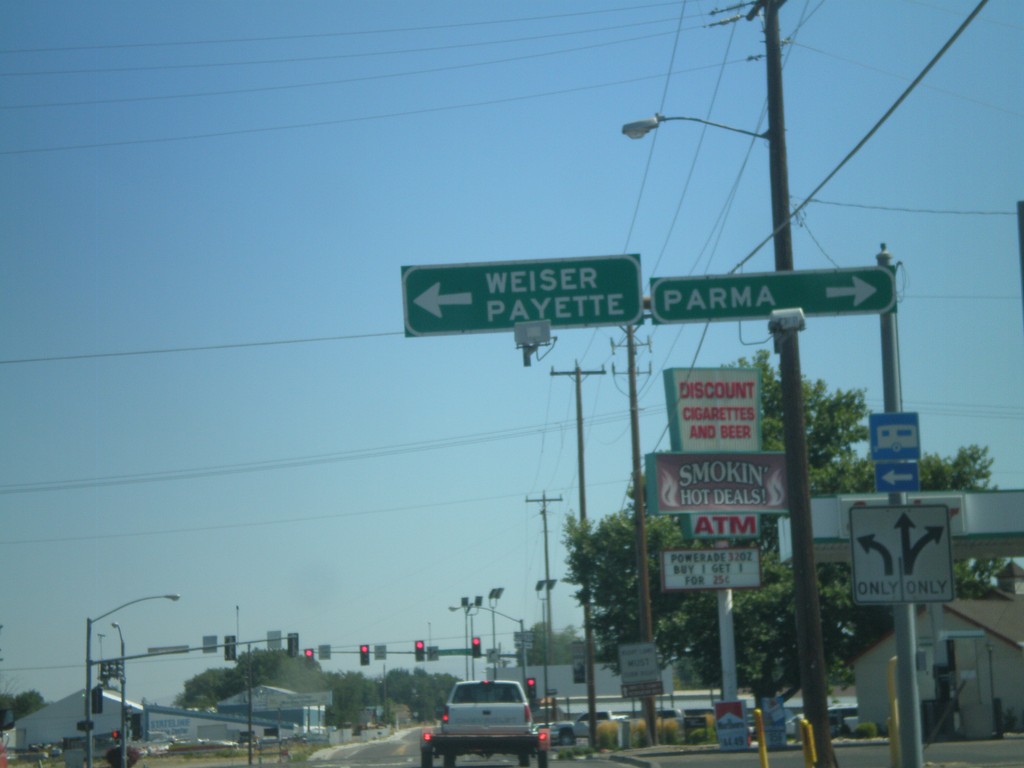
US-30 East Approaching US-95
US-30 East approaching US-95. Turn left for US-95 North to Weiser and Payette. Turn right for US-95 South/US-30 East for Parma. US-30 joins US-95 South through Fruitland.
Taken 09-04-2011
 Fruitland
Payette County
Idaho
United States
Fruitland
Payette County
Idaho
United States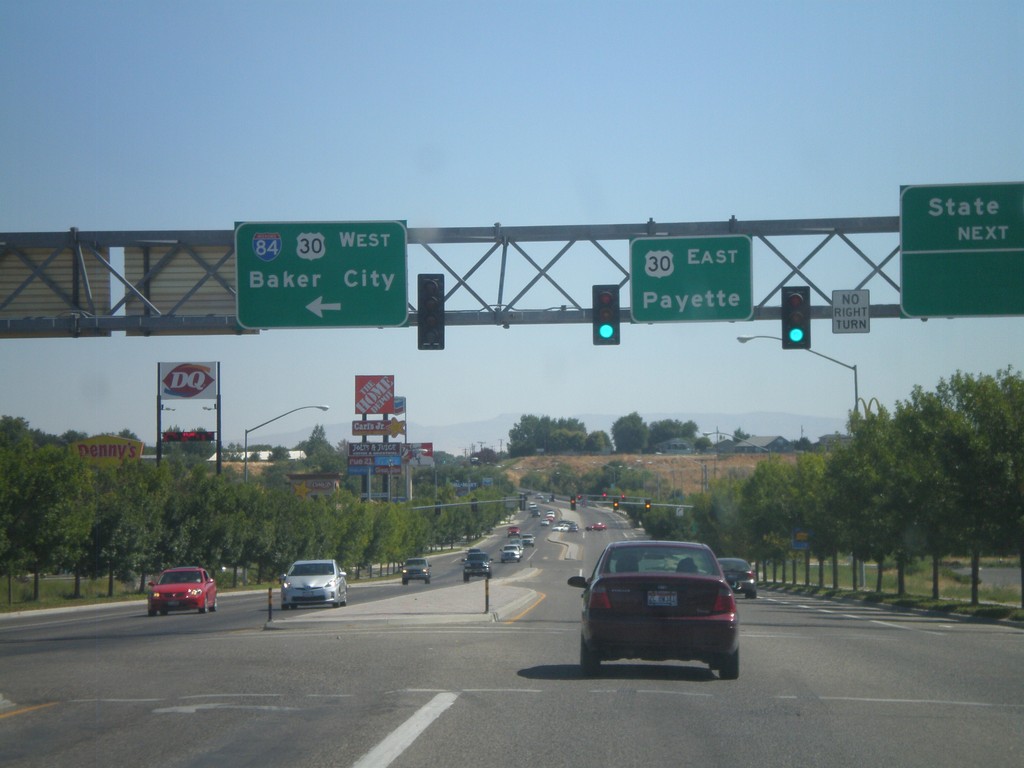
End Bus. US-30 At I-84/US-30
End Business US-30 at I-84 and US-30. Turn left for I-84/US-30 West to Baker City. Continue ahead for US-30 east to Payette (Idaho). The bluff in the background of the picture is in Idaho.
Taken 09-04-2011
 Ontario
Malheur County
Oregon
United States
Ontario
Malheur County
Oregon
United States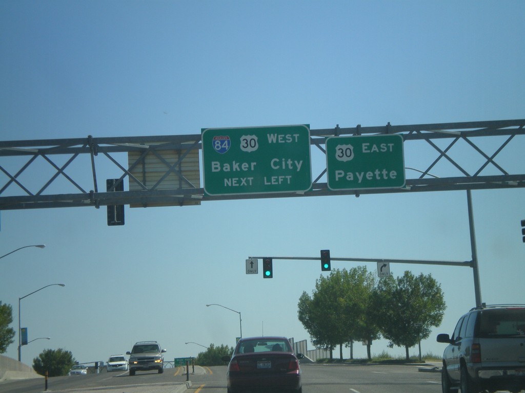
End Business US-30 at I-84 and US-30
End Business US-30 East at I-84 and US-30. Turn left for I-84/US-30 West for Baker City. Continue ahead for US-30 East to Payette (Idaho).
Taken 09-04-2011
Ontario
Malheur County
Oregon
United States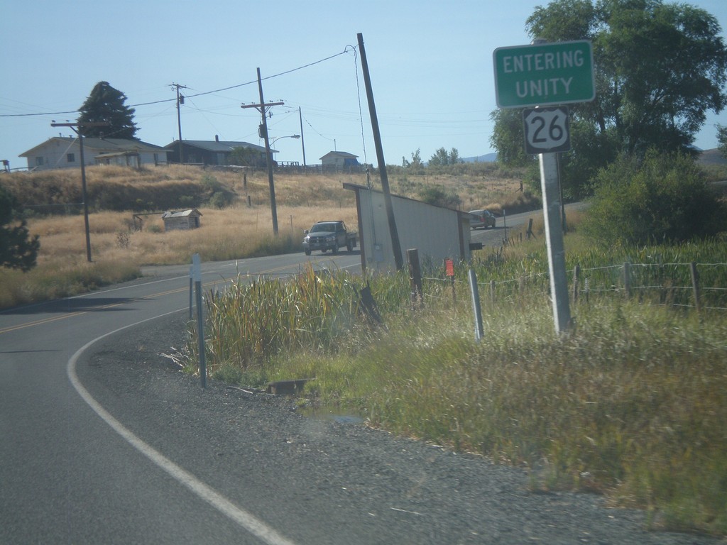
US-26 East - Entering Unity
Entering Unity Oregon on US-26 east.
Taken 09-04-2011
 Unity
Baker County
Oregon
United States
Unity
Baker County
Oregon
United States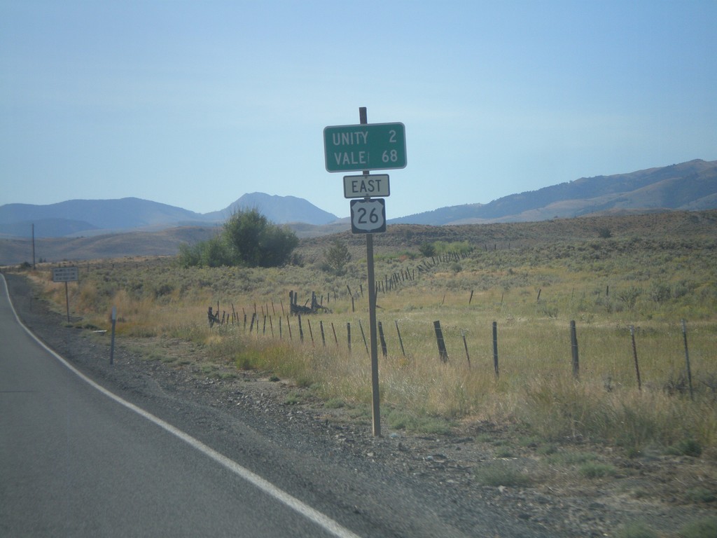
US-26 East - Distance Marker
Distance marker on US-26 east to Unity and Vale.
Taken 09-04-2011
Unity
Baker County
Oregon
United States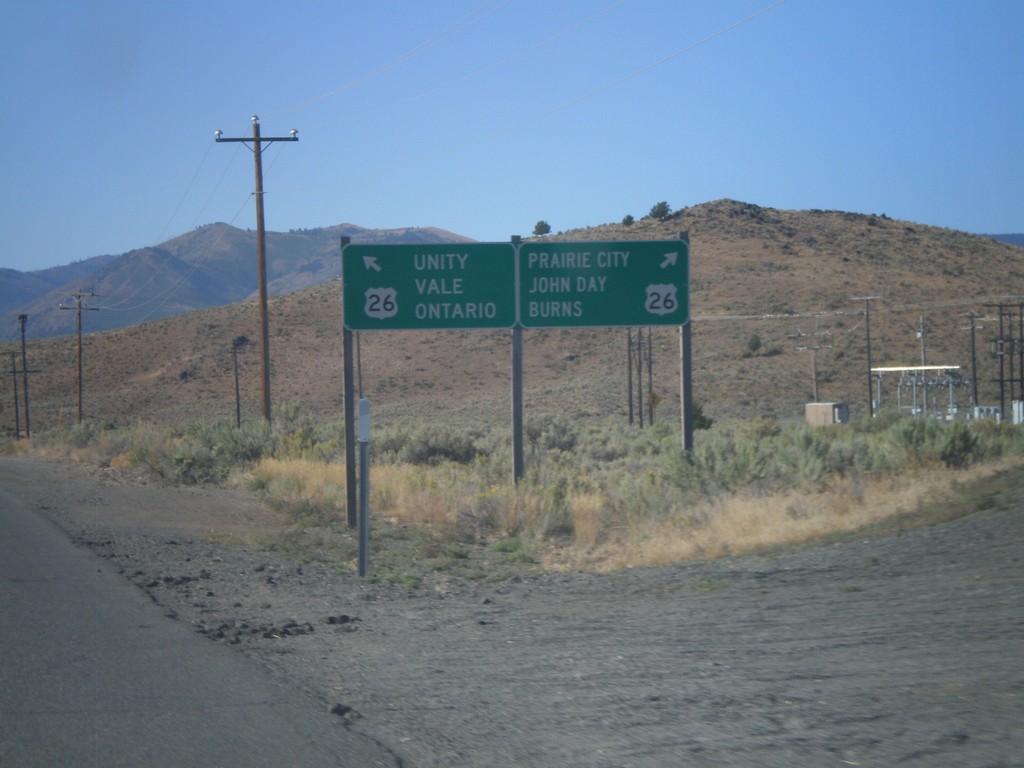
End OR-245 West at US-26
End OR-245 West at US-26. Use US-26 west for Burns, John Day, and Prairie City. Use US-26 east for Unity, Vale and Ontario.
Taken 09-04-2011
 Unity
Baker County
Oregon
United States
Unity
Baker County
Oregon
United States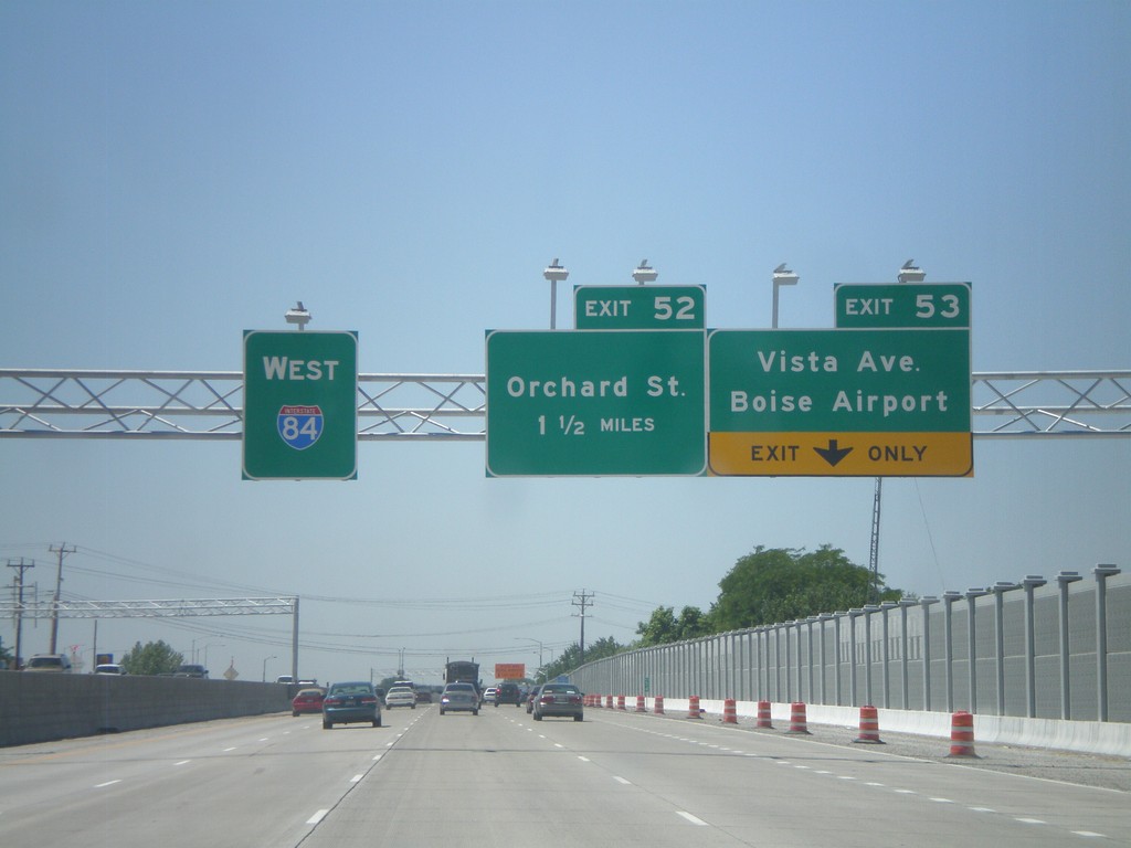
I-84 West - Exits 53 and 52
I-84 west at Exit 53 - Vista Ave./Boise Airport and approaching Exit 52 - Orchard St.
Taken 07-05-2011
Boise
Ada County
Idaho
United States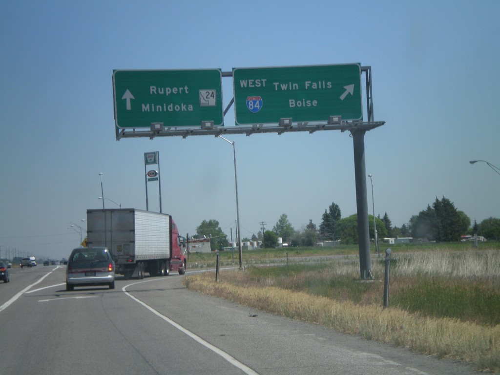
End BL-84 East at ID-24/I-84
End BL-84 (Burley and Heyburn) at I-84 west and ID-24. Use I-84 west for Twin Falls and Boise. Use ID-24 for Rupert and Minidoka.
Taken 07-05-2011

 Heyburn
Minidoka County
Idaho
United States
Heyburn
Minidoka County
Idaho
United States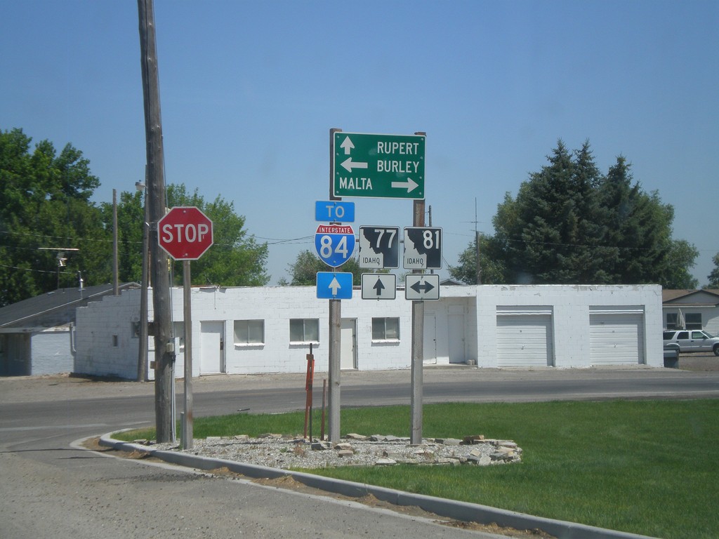
ID-77 North at ID-81
ID-77 north at ID-81. Use ID-77 north for Rupert and I-84; ID-81 south to Malta; and ID-81 north to Burley.
Taken 07-05-2011

 Declo
Cassia County
Idaho
United States
Declo
Cassia County
Idaho
United States