Signs Tagged With Big Green Sign
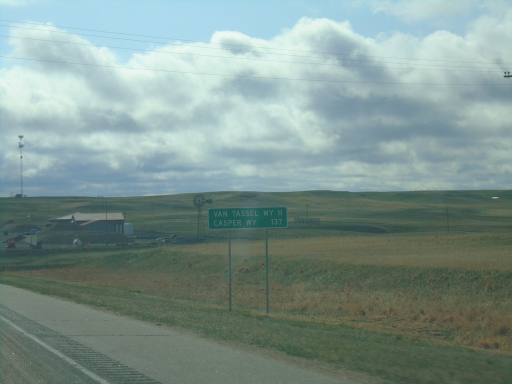
US-20 West - Distance Marker
Distance marker on US-20 west. Distance to Van Tassel, WY and Casper, WY. This is the last distance marker on US-20 westbound in Nebraska.
Taken 05-02-2022
 Harrison
Sioux County
Nebraska
United States
Harrison
Sioux County
Nebraska
United States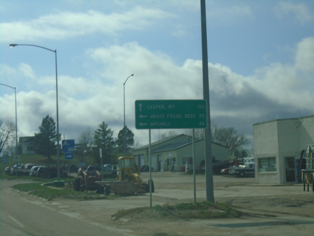
US-20 West Approaching NE-29
US-20 West approaching NE-29 in Harrison. Use US-20 West to Casper, WY. South NE-29 South for Agate Fossil Beds and Mitchell. This is the first appearance of Casper, WY on a distance marker or junction along US-20 in Nebraska.
Taken 05-02-2022
 Harrison
Sioux County
Nebraska
United States
Harrison
Sioux County
Nebraska
United States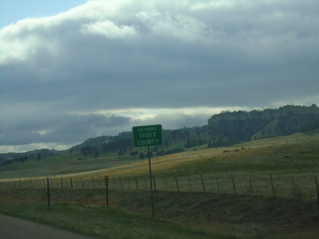
US-20 West - Sioux County
Entering Sioux County on US-20 west. Sioux County is in the northwest corner of Nebraska.
Taken 05-02-2022
Harrison
Sioux County
Nebraska
United States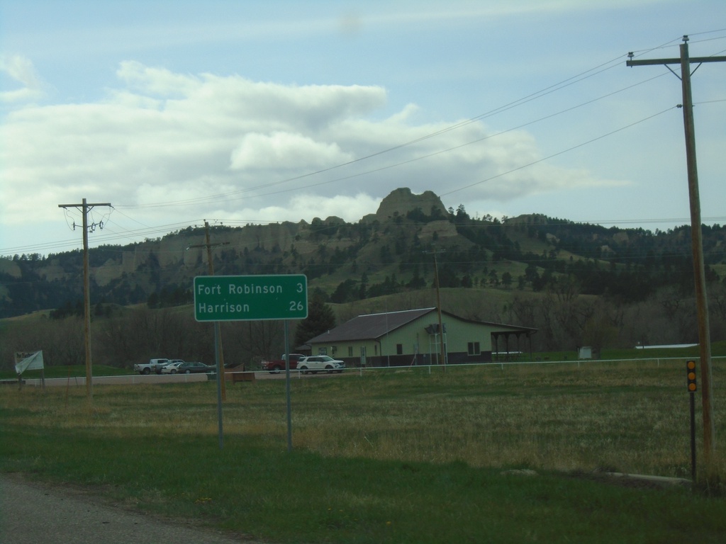
US-20 West - Distance Marker
Distance marker on US-20 west. Distance to Fort Robinson and Harrison. The Red Cloud Buttes are in the background.
Taken 05-02-2022
Crawford
Dawes County
Nebraska
United States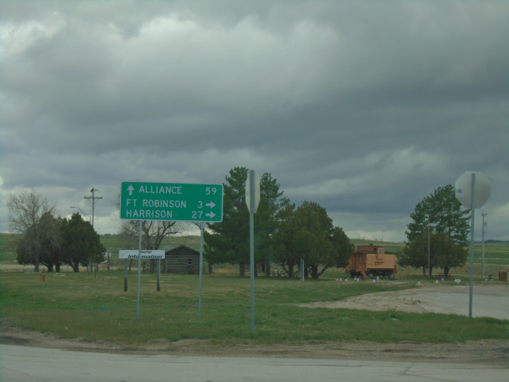
US-20 West/NE-71 South/NE-2 East at NE-71/NE-2
US-20 West/NE-71 South/NE-2 East at NE-71/NE-2 in Crawford. Use NE-71 South/NE-2 East to Alliance; use US-20 West for Fort Robinson and Harrison.
Taken 05-02-2022

 Crawford
Dawes County
Nebraska
United States
Crawford
Dawes County
Nebraska
United States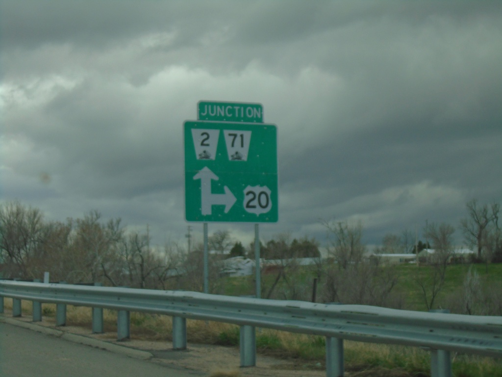
US-20 West/NE-2 East/NE-71 South at NE-2/NE-71
US-20 West/NE-2 East/NE-71 South at NE-2/NE-71 in Crawford.
Taken 05-02-2022
Crawford
Dawes County
Nebraska
United States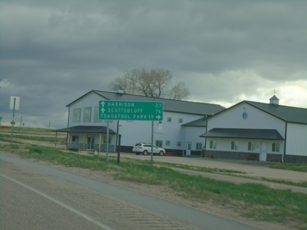
US-20 West Approaching NE-2/NE-71
US-20 West approaching NE-2/NE-71 in Crawford. Use NE-2 West/NE-71 South to Toadstool Park. Continue on US-20 West/NE-2 East/NE-71 South to Harrison (via US-20), and Scotts Bluff (via NE-71/NE-2).
Taken 05-02-2022
Crawford
Dawes County
Nebraska
United States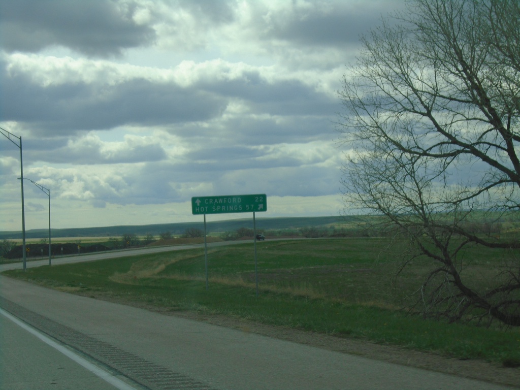
US-20 West/US-385 North at US-20/US-385 Split
US-20 West/US-385 North at US-20/US-385 split in Dawes County. Use US-385 North to Hot Springs, SD; continue west on US-20 for Crawford.
Taken 05-02-2022
 Chadron
Dawes County
Nebraska
United States
Chadron
Dawes County
Nebraska
United States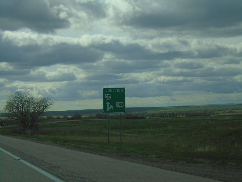
US-20 West/US-385 North Approaching US-20/US-385 Split
US-20 West/US-385 North approaching US-20/US-385 split in Dawes County.
Taken 05-02-2022
Chadron
Dawes County
Nebraska
United States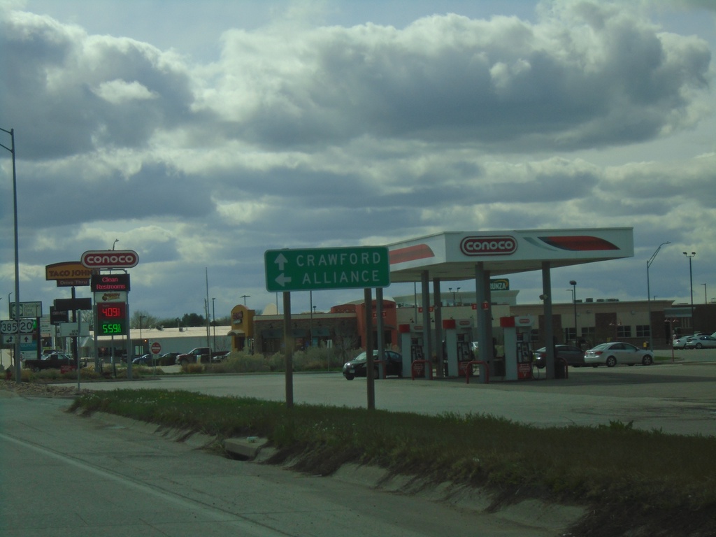
US-20 West Approaching US-385 South to Alliance
US-20 West approaching US-385 South to Alliance. Continue on US-20 west to Crawford. US-385 North joins US-20 westbound.
Taken 05-02-2022
Chadron
Dawes County
Nebraska
United States