Signs Tagged With Big Green Sign
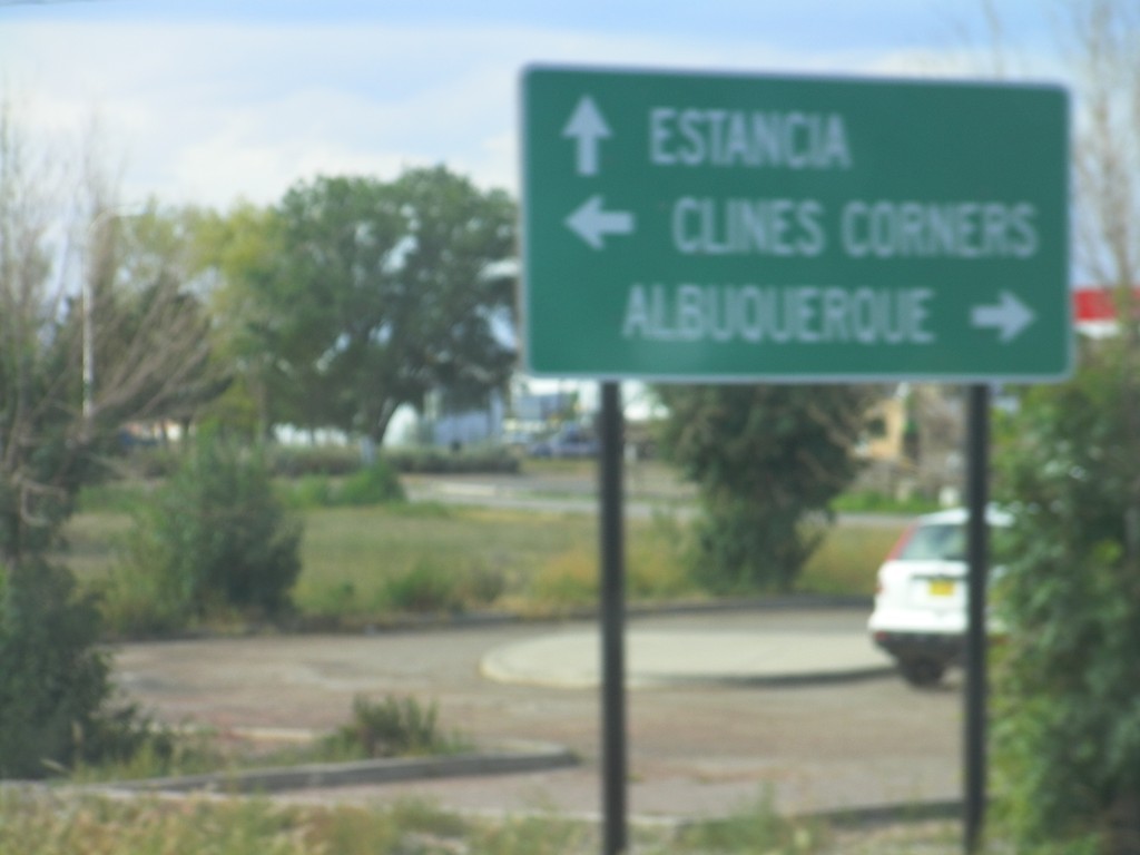
NM-41 South at BL-40
NM-41 south at BL-40 in Moriarty. Use BL-40 west for Albuquerque; use BL-40 east for Clines Corners. Continue south on NM-41 for Estancia.
Taken 10-04-2011

 Moriarty
Torrance County
New Mexico
United States
Moriarty
Torrance County
New Mexico
United States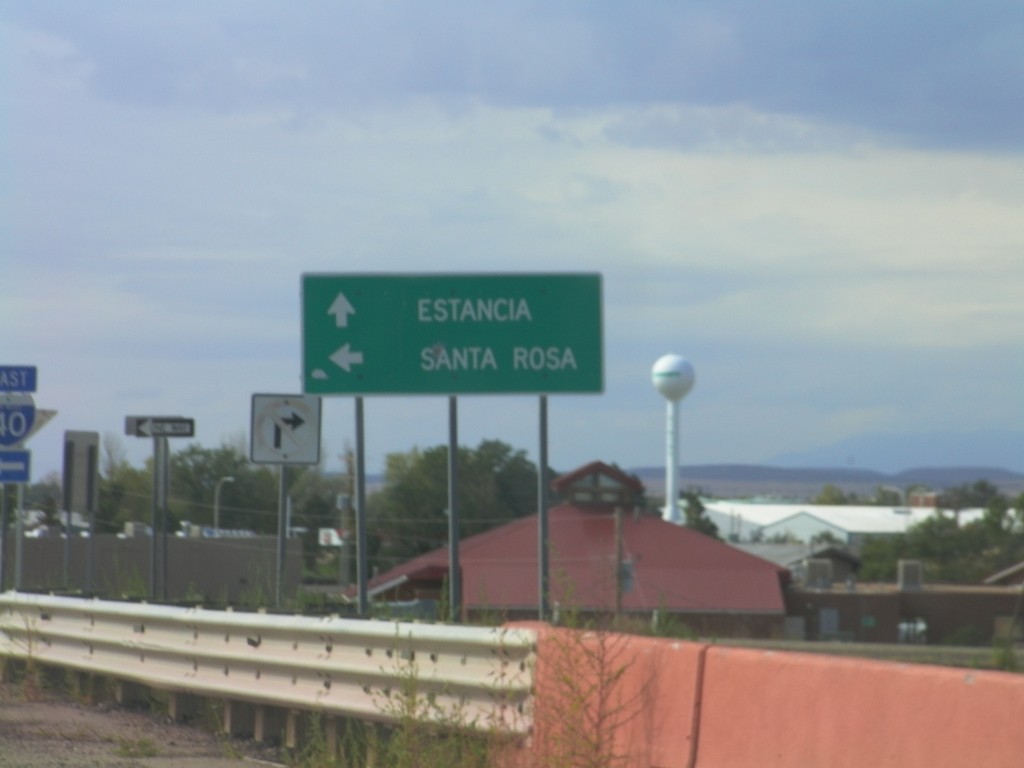
NM-41 South at I-40 East
NM-41 South at I-40 East onramp to Santa Rosa. Continue south on NM-41 for Estancia.
Taken 10-04-2011
 Moriarty
Torrance County
New Mexico
United States
Moriarty
Torrance County
New Mexico
United States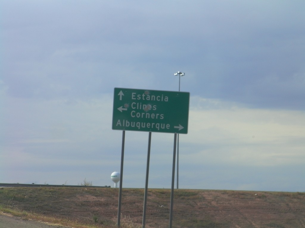
NM-41 South at I-40
NM-41 south at I-40 (Exit 196) junction. Use I-40 west for Albuquerque; use I-40 east for Clines Corners. Continue south on NM-41 for Estancia.
Taken 10-04-2011
Moriarty
Torrance County
New Mexico
United States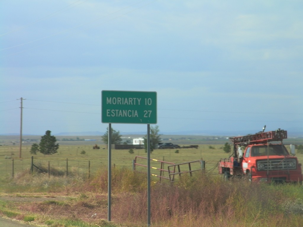
NM-41 South - Distance Marker
Distance marker on NM-41 south to Moriarty and Estancia.
Taken 10-04-2011
Santa Fe County
New Mexico
United States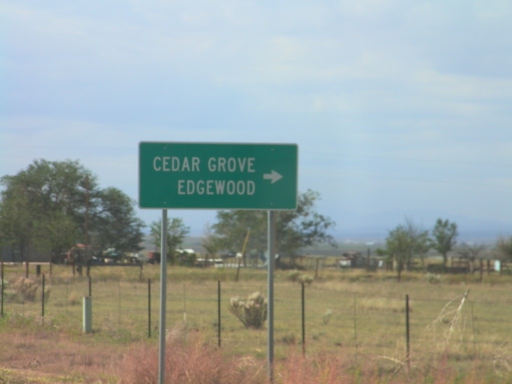
NM-41 South at NM-472
NM-41 south at NM-472 west to Cedar Grove and Edgewood.
Taken 10-04-2011
 Santa Fe County
New Mexico
United States
Santa Fe County
New Mexico
United States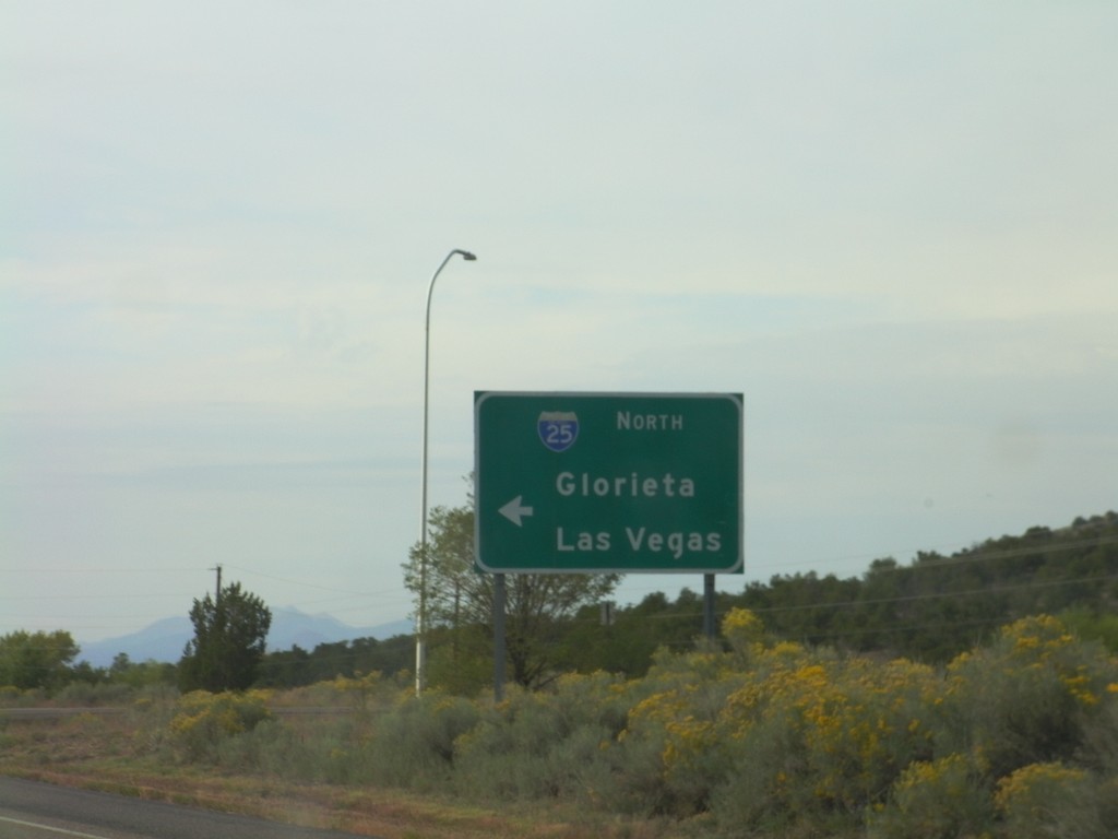
US-285 South at I-25 North
US-285 south at I-25 North (and US-84) onramp to Glorieta and Las Vegas.
Taken 10-04-2011


 Santa Fe
 County
New Mexico
United States
Santa Fe
Santa Fe County
New Mexico
United States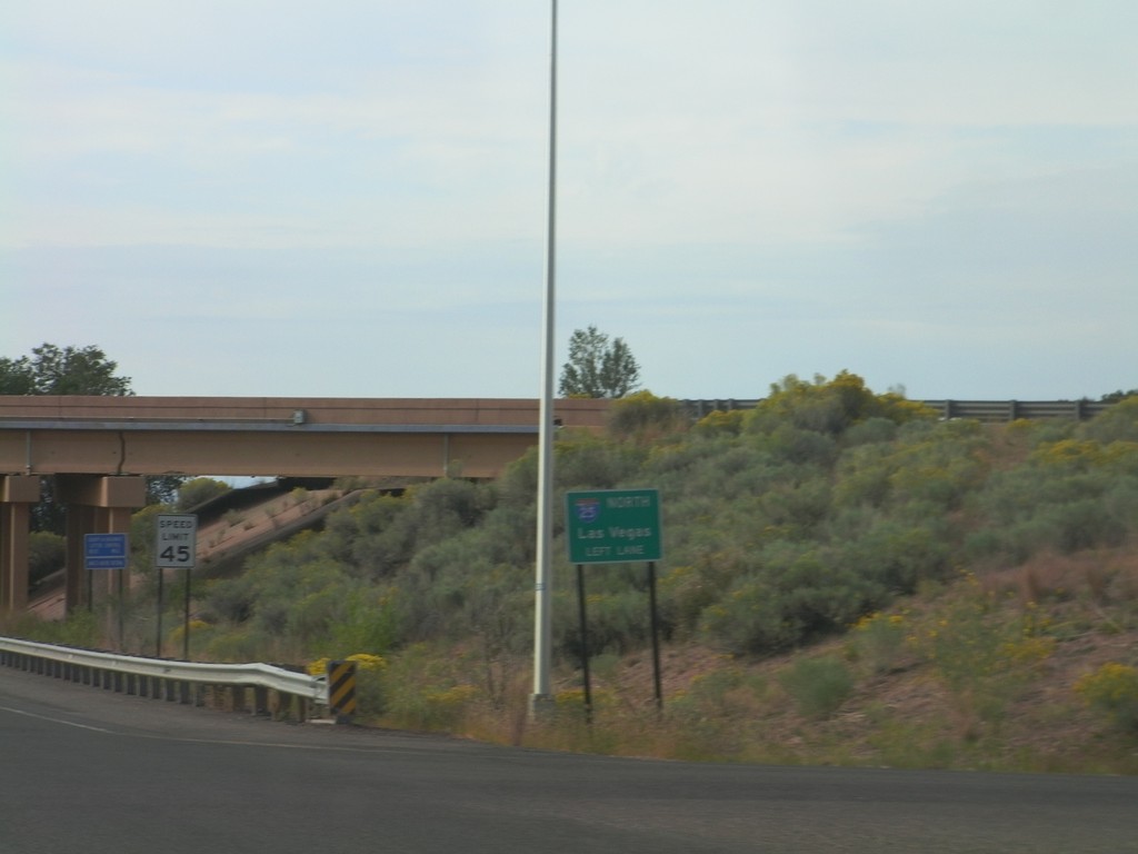
US-285 South Approaching I-25 North
US-285 South Approaching I-25 (and US-84) north to Las Vegas.
Taken 10-04-2011
Santa Fe
Santa Fe County
New Mexico
United States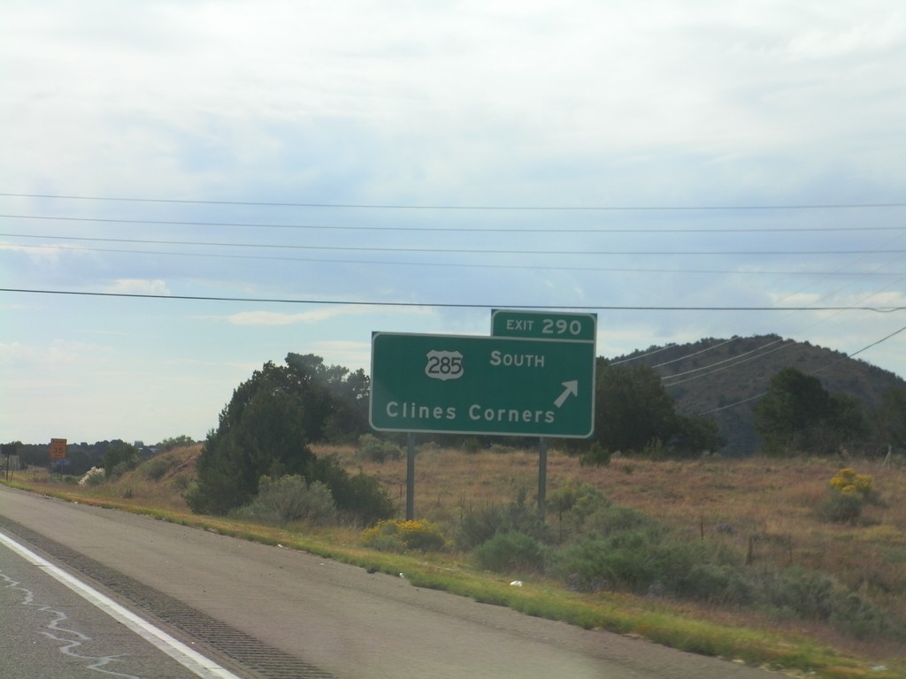
I-25 North - Exit 290
I-25 north at Exit 290 - US-285 South/Clines Corner. US-285 leaves I-25 south here.
Taken 10-04-2011
Santa Fe
Santa Fe County
New Mexico
United States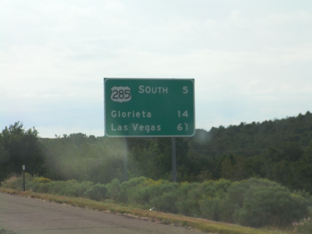
I-25 North - Distance Marker
Distance marker on I-25 north, leaving Santa Fe. Distance to US-285 Jct., Glorieta, and Las Vegas.
Taken 10-04-2011
Santa Fe
Santa Fe County
New Mexico
United States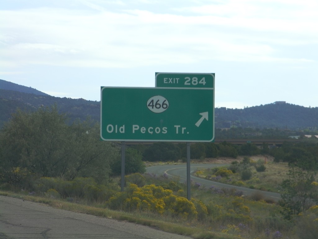
I-25 North - Exit 284
I-25 north at Exit 284 - NM-466/Old Pecos Trail.
Taken 10-04-2011
 Santa Fe
 County
New Mexico
United States
Santa Fe
Santa Fe County
New Mexico
United States