Signs Tagged With Big Green Sign
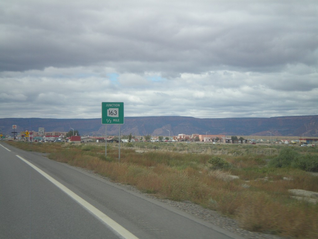
US-160 West Approachign US-163
US-160 west approaching US-163. US-163 is incorrectly marked here as AZ-163.
Taken 10-08-2011

 Kayenta
Navajo County
Arizona
United States
Kayenta
Navajo County
Arizona
United States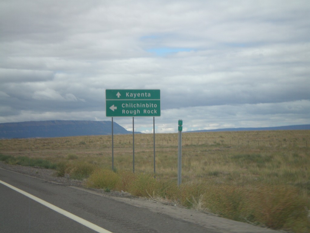
US-160 West at Navajo IR-59
US-160 West at Navajo IR-59 south to Chilchinbito and Round Rock. Continue west on US-160 for Kayenta.
Taken 10-08-2011
 Kayenta
Navajo County
Arizona
United States
Kayenta
Navajo County
Arizona
United States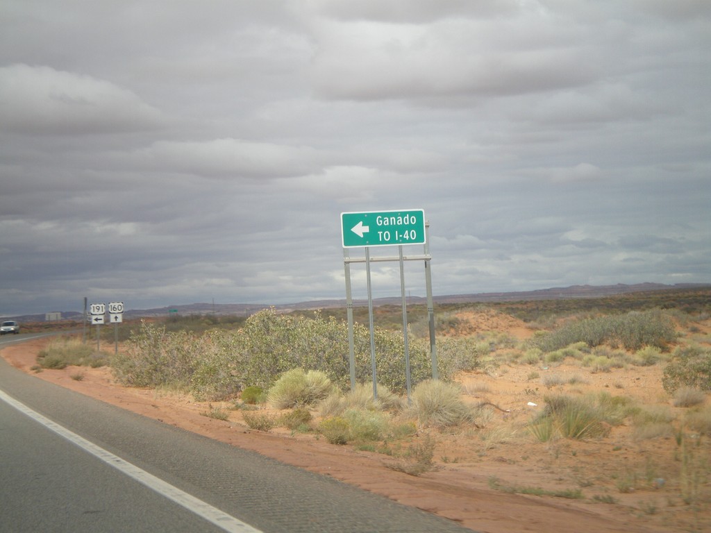
US-160 West/US-191 South Approaching US-191 South
US-160 West/US-191 South approaching US-191 south to I-40 and Ganado. The US-191 and US-160 shields are in the background of the photo.
Taken 10-08-2011

 Teec Nos Pos
Apache County
Arizona
United States
Teec Nos Pos
Apache County
Arizona
United States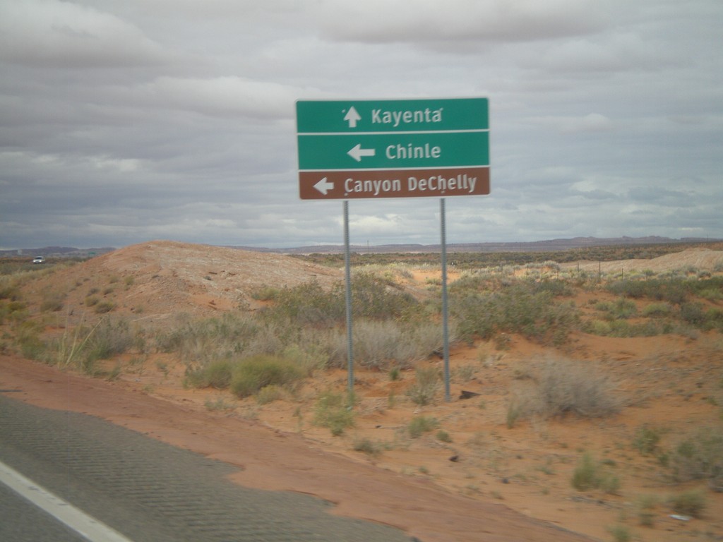
US-160 West/US-191 South Approaching US-191 South
US-160 West/US-191 South approaching US-191 South to Chile, and Canyon De Chelly (National Monument). Continue west on US-160 for Kayenta.
Taken 10-08-2011
Teec Nos Pos
Apache County
Arizona
United States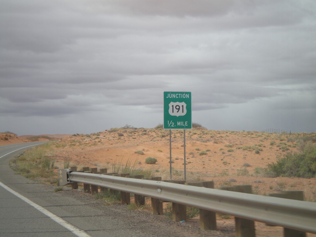
US-160 West/US-191 South Approaching US-191 South
US-160 West/US-191 South approaching US-191 South.
Taken 10-08-2011
Teec Nos Pos
Apache County
Arizona
United States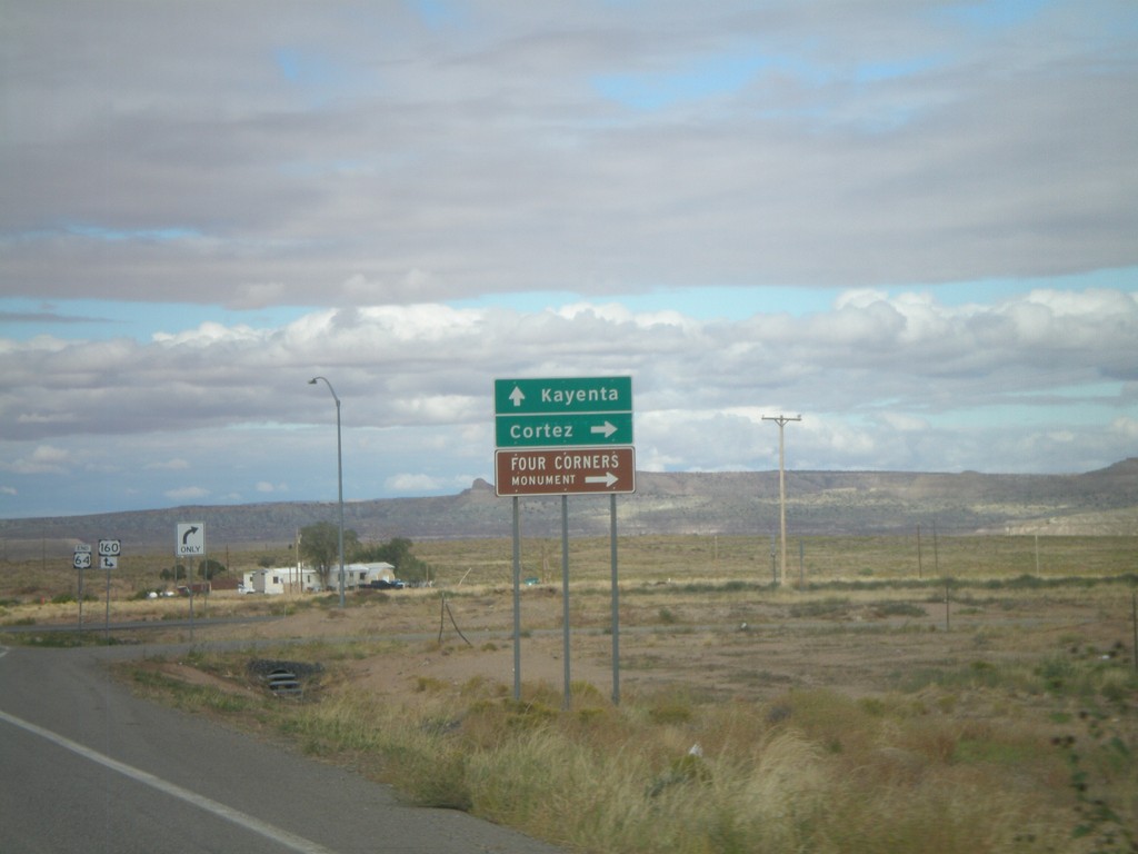
End US-64 West Approaching US-160
End US-6A4 west approaching US-160. Turn right for US-160 east to Cortez (Colorado) and Four Corners National Monument. Continue ahead for US-160 east to Kayenta.
Taken 10-08-2011
 Teec Nos Pos
Apache County
Arizona
United States
Teec Nos Pos
Apache County
Arizona
United States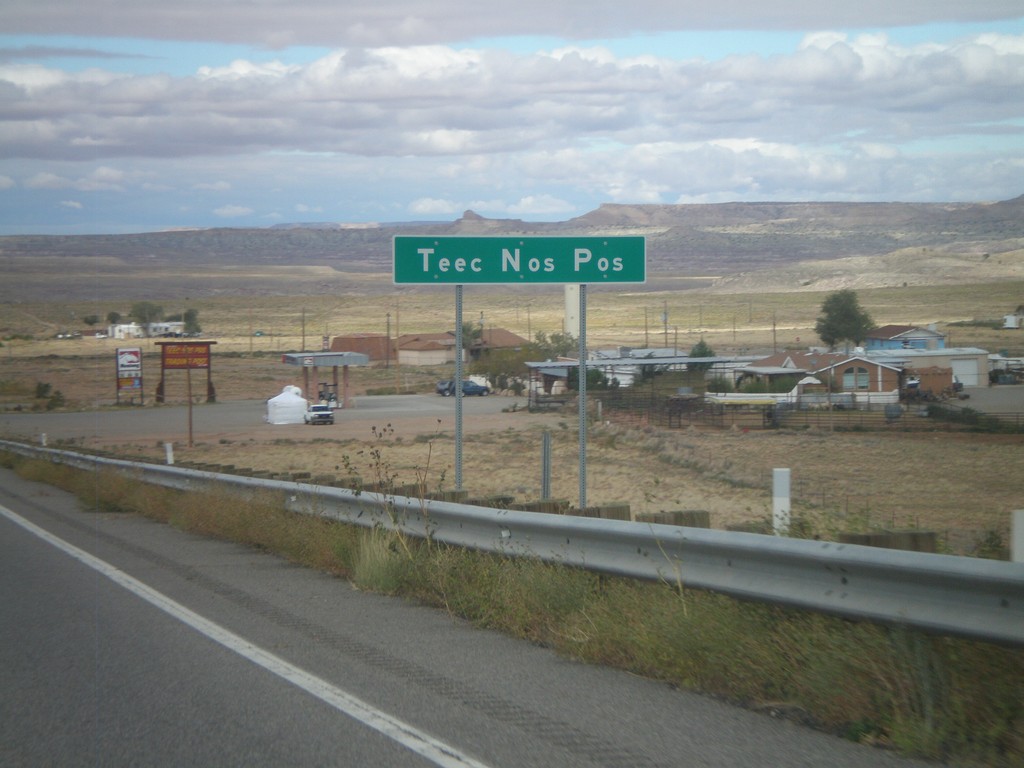
US-64 West - Teec Nos Pos
Entering Teec Nos Pos on US-64 west. This is the first community in Arizona on US-64 west, and also the closest community to Four Corners.
Taken 10-08-2011
Teec Nos Pos
Apache County
Arizona
United States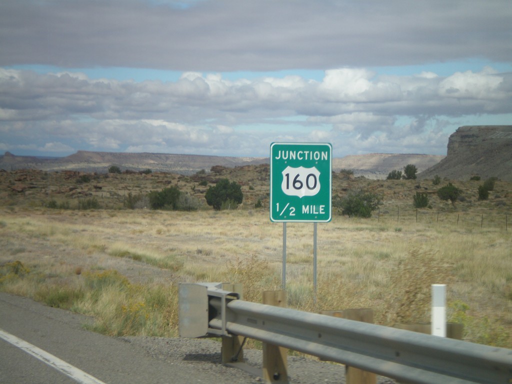
US-64 West Approaching US-160
US-64 West approaching US-160. This is the western end of US-64. The eastern end of US-64 is in Nags Head, North Carolina.
Taken 10-08-2011
Teec Nos Pos
Apache County
Arizona
United States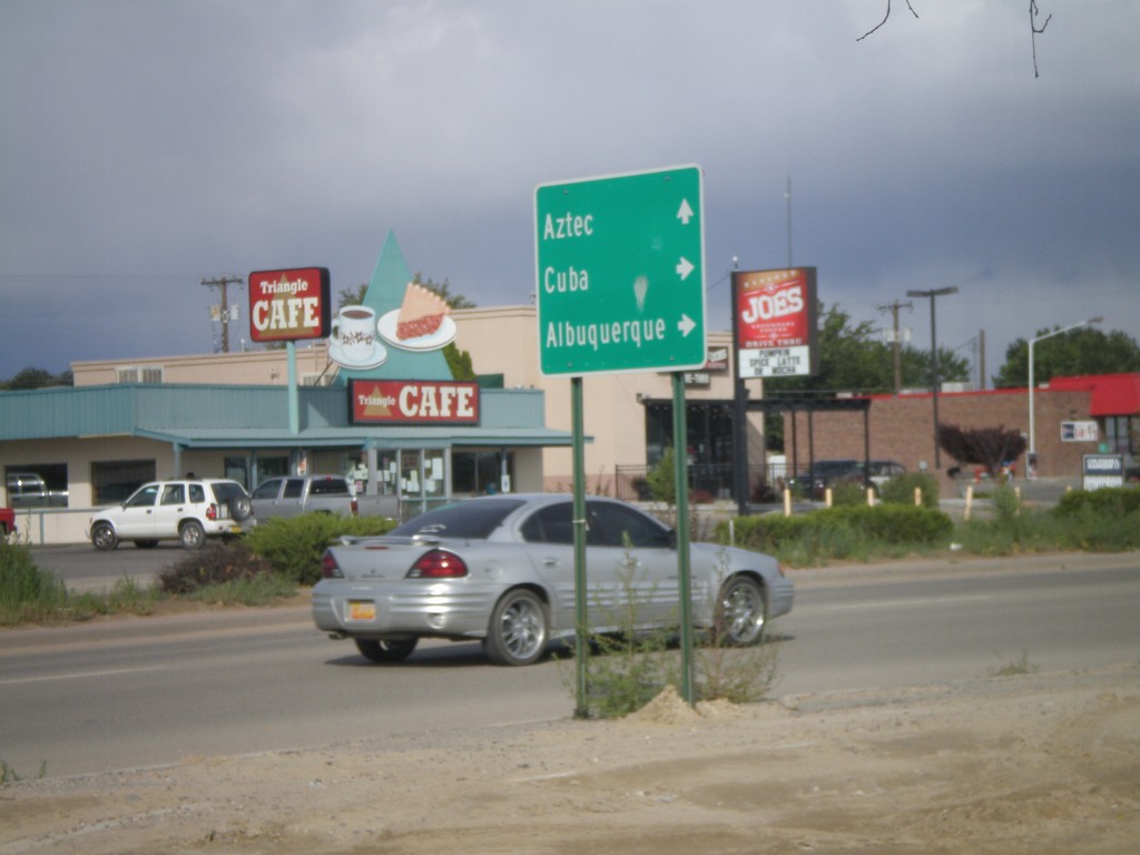
US-64 East at US-550 South
US-64 east at US-550 South. US-550 joins US-64 east through Bloomfield. Turn south on US-550 for Cuba and Albuquerque; continue ahead on US-64 East/US-550 North for Aztec.
Taken 10-07-2011
 Bloomfield
San Juan County
New Mexico
United States
Bloomfield
San Juan County
New Mexico
United States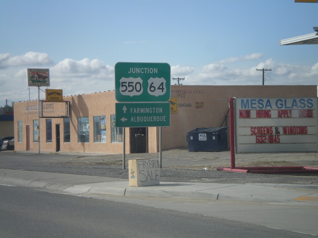
US-64 West/US-550 South at US-550 South
US-64 West/US-550 South at US-550 South. Turn left on US-550 south for Albuquerque. Continue ahead for US-64 west to Farmington.
Taken 10-07-2011
Bloomfield
San Juan County
New Mexico
United States