Signs Tagged With Big Green Sign
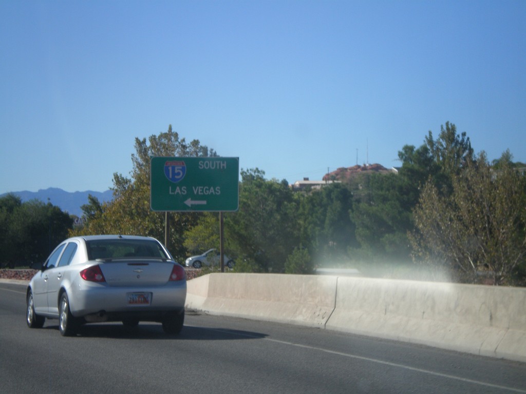
Begin UT-34/BL-15 at I-15 South
Begin UT-34/BL-15 at I-15 South to Las Vegas (Nevada). This is the northern end of the St. George Business Loop.
Taken 10-09-2011


 St. George
Washington County
Utah
United States
St. George
Washington County
Utah
United States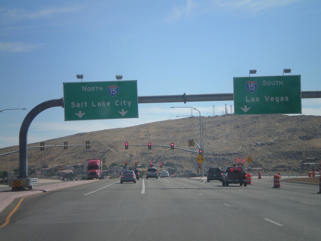
UT-18/BL-15 South at I-15
UT-18/BL-15 South at I-15. Use I-15 south for Las Vegas (Nevada); use I-15 north for Salt Lake City.
Taken 10-09-2011
 St. George
Washington County
Utah
United States
St. George
Washington County
Utah
United States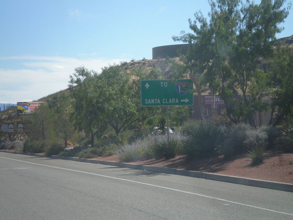
UT-18 South Approaching UT-8
UT-18 South approaching UT-8 west to Santa Clara. Continue south on UT-18 for I-15.
Taken 10-09-2011
 St. George
Washington County
Utah
United States
St. George
Washington County
Utah
United States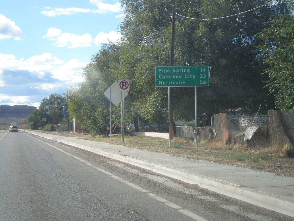
AZ-389 West - Distance Marker
Distance marker on AZ-389 west in Fredonia. Distance to Pipe Spring, Colorado City, and Hurricane (Utah).
Taken 10-08-2011
 Fredonia
Coconino County
Arizona
United States
Fredonia
Coconino County
Arizona
United States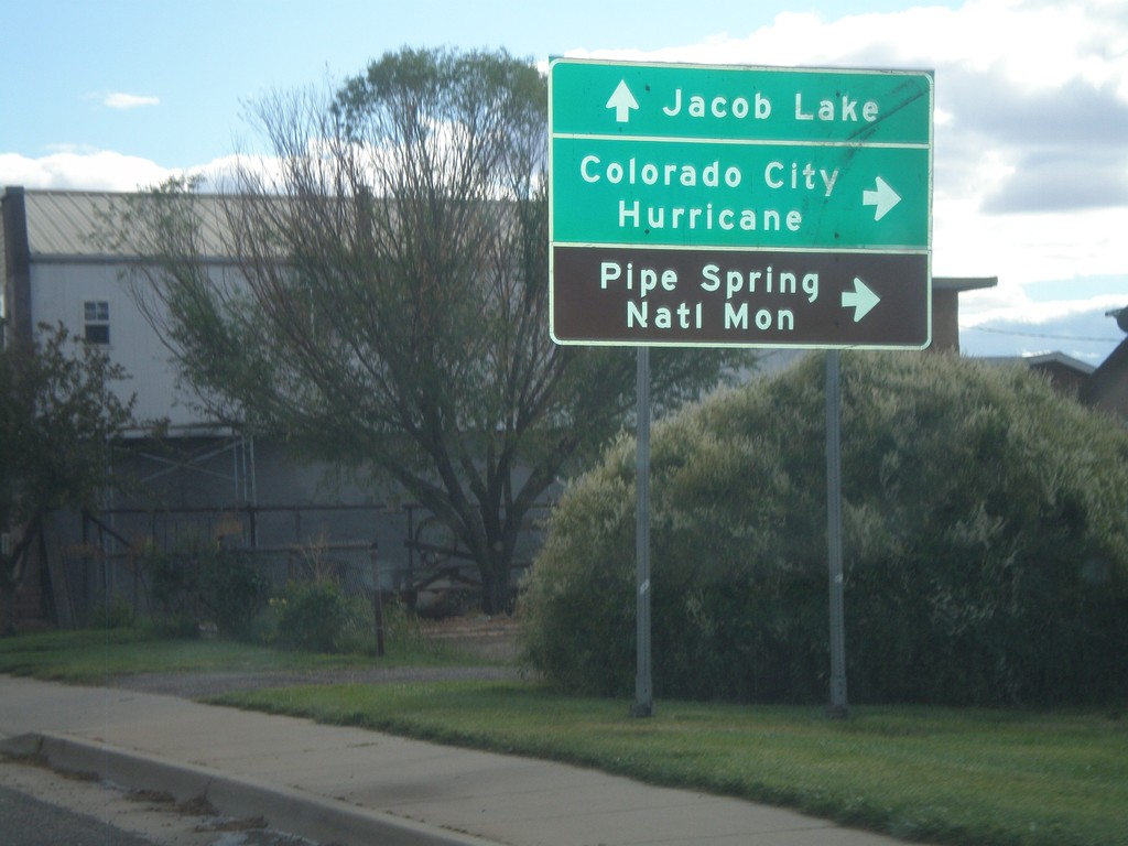
US-89A South at AZ-389
US-89A South at AZ-389 in Fredonia. Turn right on AZ-389 west for Colorado City, Hurricane (Utah), and Pipe Spring National Monument. Continue south on US-89A for Jacob Lake.
Taken 10-08-2011
 Fredonia
Coconino County
Arizona
United States
Fredonia
Coconino County
Arizona
United States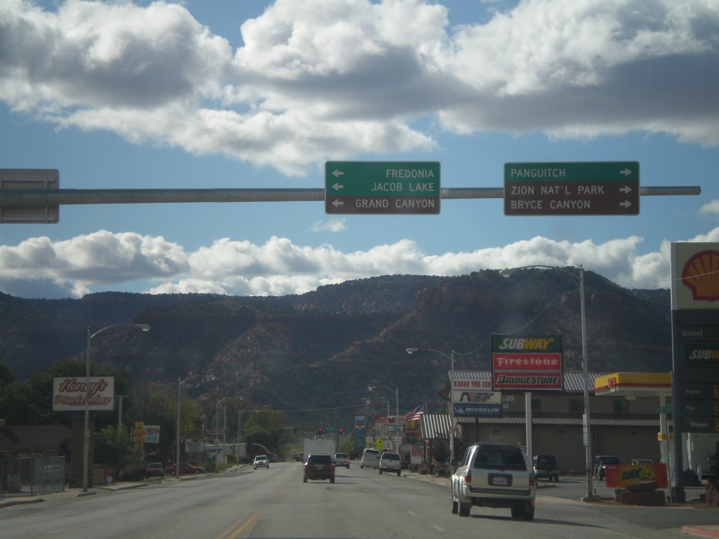
US-89 North Approaching US-89A
US-89 North approaching US-89A. Use US-89A south for Fredonia, Jacob Lake, and Grand Canyon (all destinations in Arizona). Continue north on US-89 north for Panguitch, Zion National Park, and Bryce Canyon National Park.
Taken 10-08-2011
 Kanab
Kane County
Utah
United States
Kanab
Kane County
Utah
United States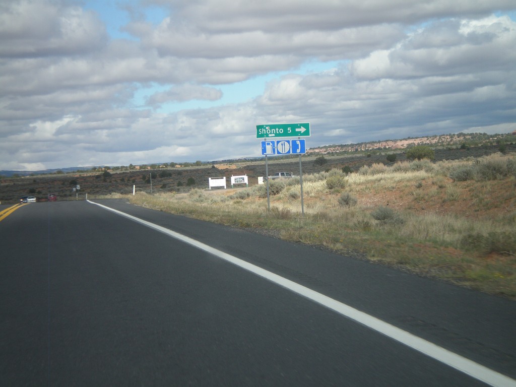
AZ-98 North at Shonto Jct.
AZ-98 North at Shonto Jct. Food, gas, and phone access available in Shonto.
Taken 10-08-2011
 Shonto
Navajo County
Arizona
United States
Shonto
Navajo County
Arizona
United States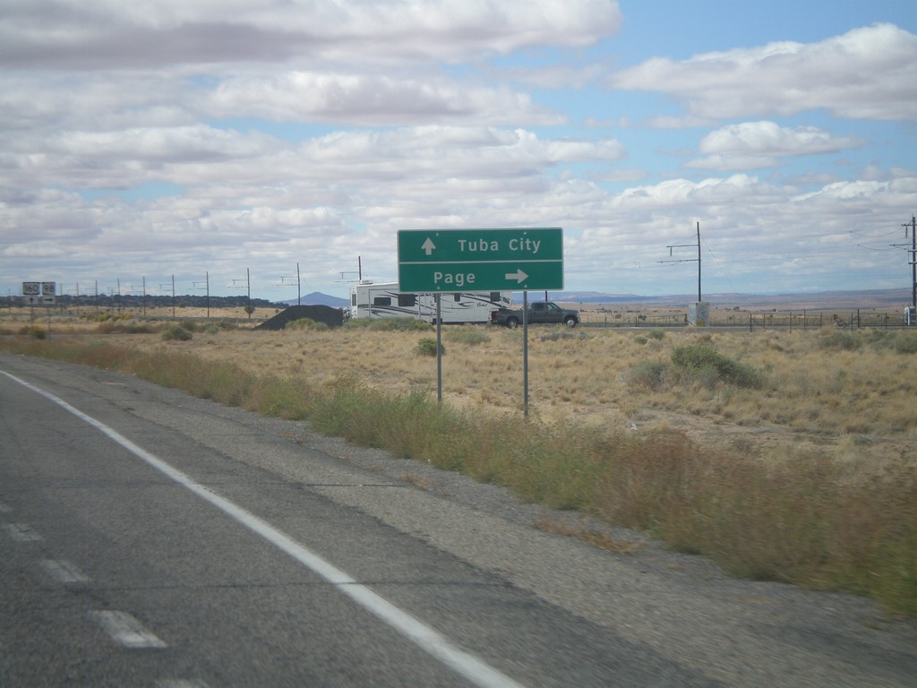
US-160 West at AZ-98
US-160 west at AZ-98 north to Page. Continue west on US-160 to Tuba City.
Taken 10-08-2011
 Shonto
Navajo County
Arizona
United States
Shonto
Navajo County
Arizona
United States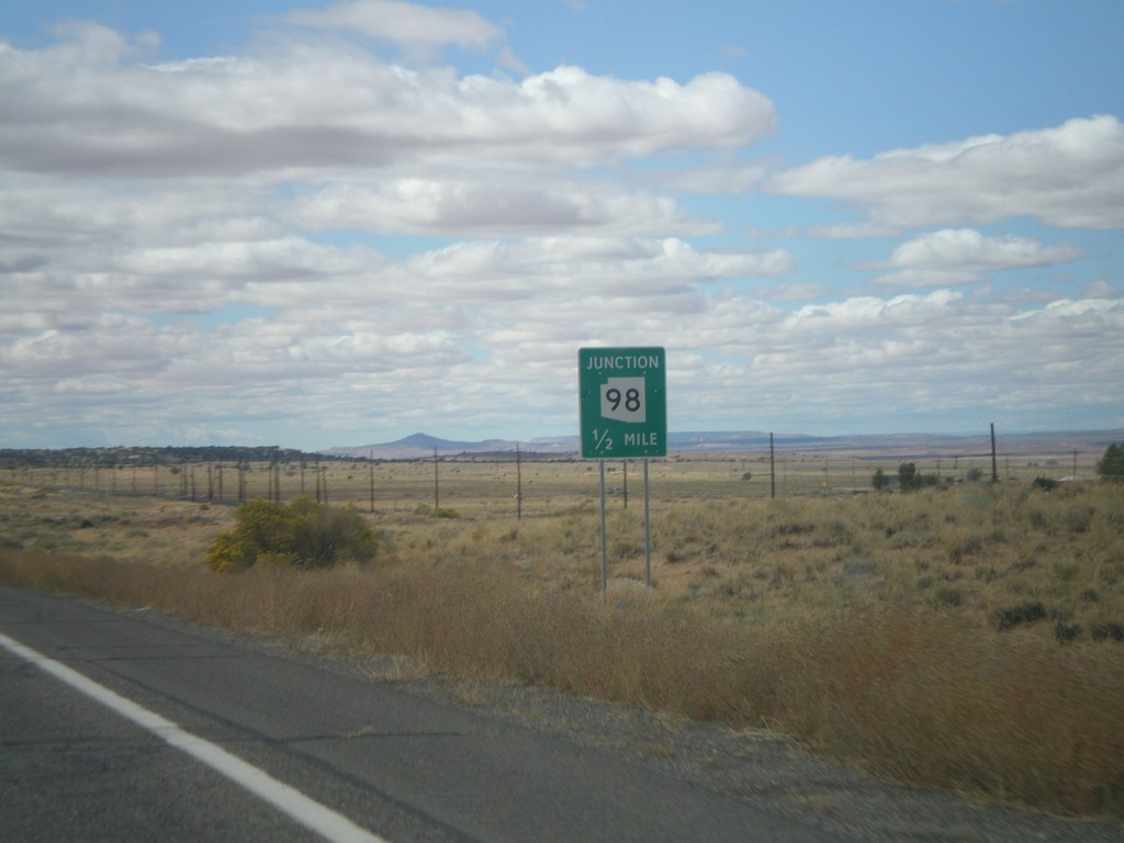
US-160 West Approaching AZ-98
US-160 west approaching AZ-98.
Taken 10-08-2011
Shonto
Navajo County
Arizona
United States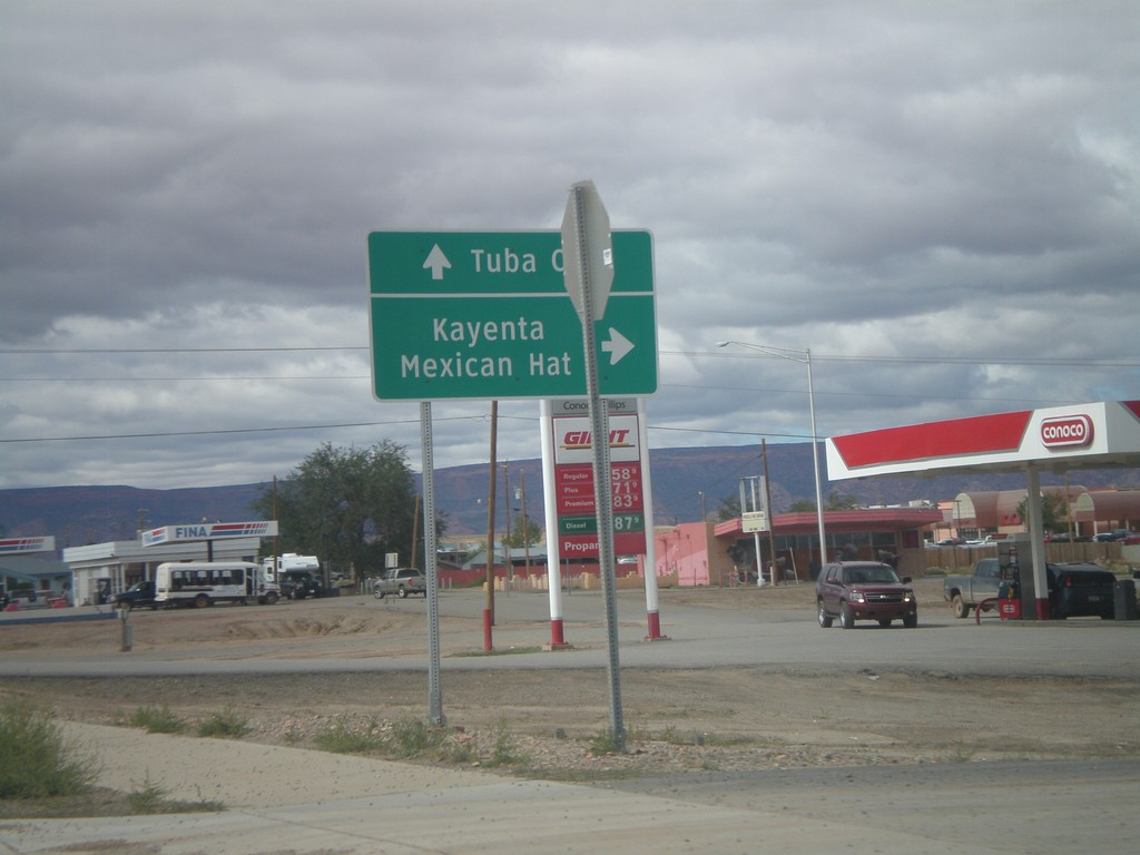
US-160 West at US-163
US-160 West at US-163 in Kayenta. Use US-163 north for Kayenta and Mexican Hat. Use US-160 west for Tuba City. This is the western end of US-163.
Taken 10-08-2011
 Kayenta
Navajo County
Arizona
United States
Kayenta
Navajo County
Arizona
United States