Signs Tagged With Big Green Sign
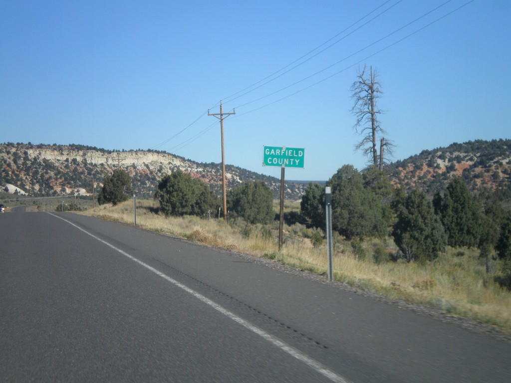
US-89 North - Garfield County
Entering Garfield County on US-89 north.
Taken 10-13-2011
 Alton
Kane County
Utah
United States
Alton
Kane County
Utah
United States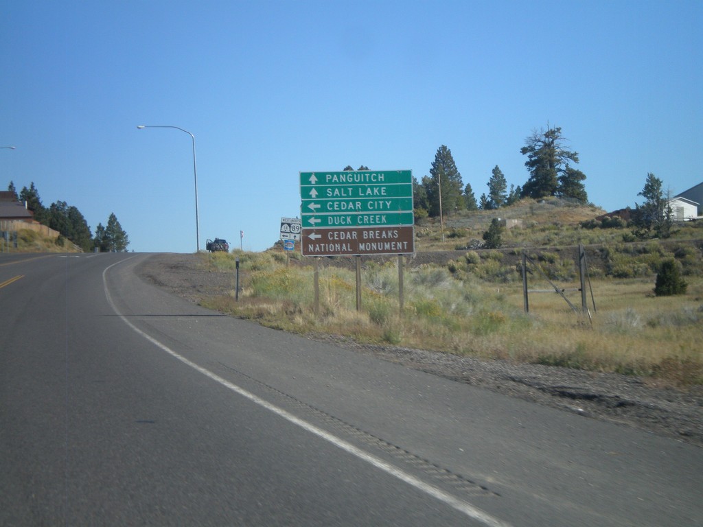
US-89 North Approaching UT-14
US-89 North approaching UT-14 at Long Valley Junction. Use UT-14 west for Cedar City, Duck Creek, and Cedar Breaks National Monument. Continue north on US-89 for Panguitch and Salt Lake.
Taken 10-13-2011
 Alton
Kane County
Utah
United States
Alton
Kane County
Utah
United States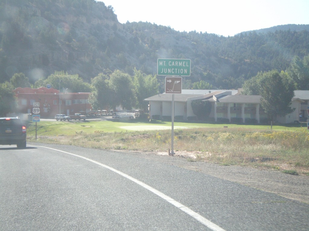
UT-9 East - Mt. Carmel Junctino
Mt. Carmel Junction on UT-9 east.
Taken 10-13-2011
 Orderville
Kane County
Utah
United States
Orderville
Kane County
Utah
United States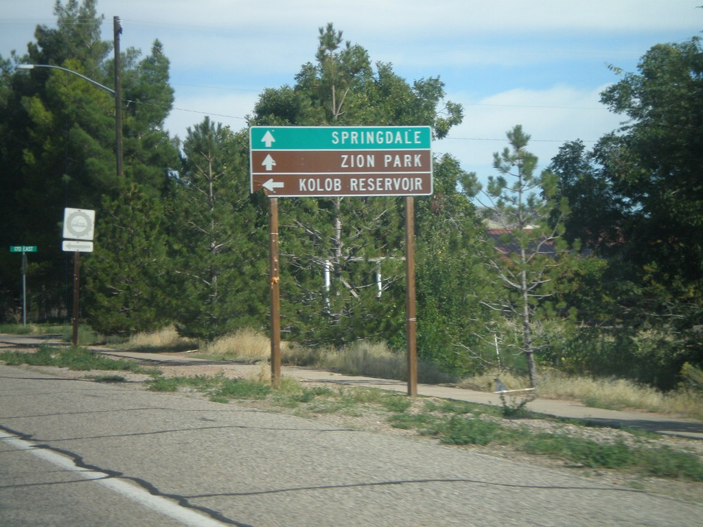
UT-9 East - Kolob Reservoir Jct.
UT-9 East at turnoff to Kolob Reservoir. Continue ahead on UT-9 for Zion National Park and Springdale.
Taken 10-10-2011
Virgin
Washington County
Utah
United States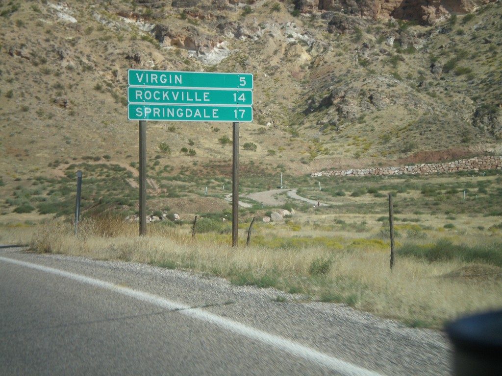
UT-9 East - Distance Marker
Distance marker on UT-9 east for Virgin, Rockville, and Springdale. Springdale is at the west entrance to Zion National Park.
Taken 10-10-2011
La Verkin
Washington County
Utah
United States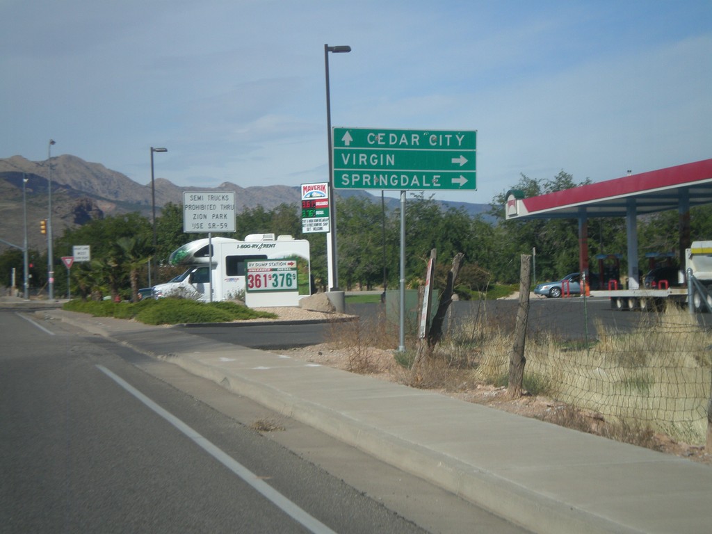
UT-9 East Approaching UT-17
UT-9 East approaching UT-17. Use UT-9 east for Virgin and Springdale; use UT-17 north for Cedar City.
Taken 10-10-2011
 La Verkin
Washington County
Utah
United States
La Verkin
Washington County
Utah
United States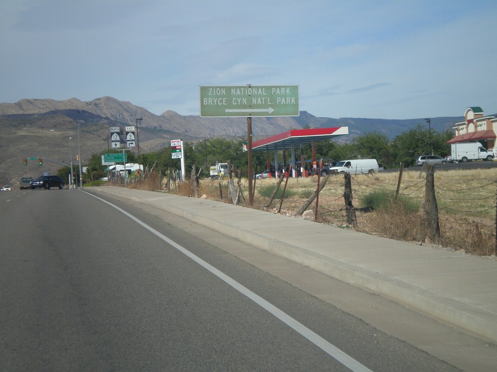
UT-9 East Approaching UT-17
UT-9 east approaching UT-17. Use UT-9 east (right turn) for Bryce Canyon and Zion National Parks.
Taken 10-10-2011
La Verkin
Washington County
Utah
United States
UT-9 East at UT-59
UT-9 east at UT-59. Use UT-59 east for Grand Canyon National Park and Lake Powell. Continue east on UT-9 for Zion National Park.
Taken 10-10-2011
 Hurricane
Washington County
Utah
United States
Hurricane
Washington County
Utah
United States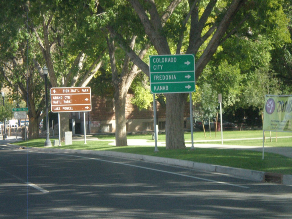
UT-9 East Approaching UT-59
UT-9 east approaching UT-59. Use UT-59 east for Colorado City (AZ), Fredonia (AZ), and Kanab.
Taken 10-10-2011
Hurricane
Washington County
Utah
United States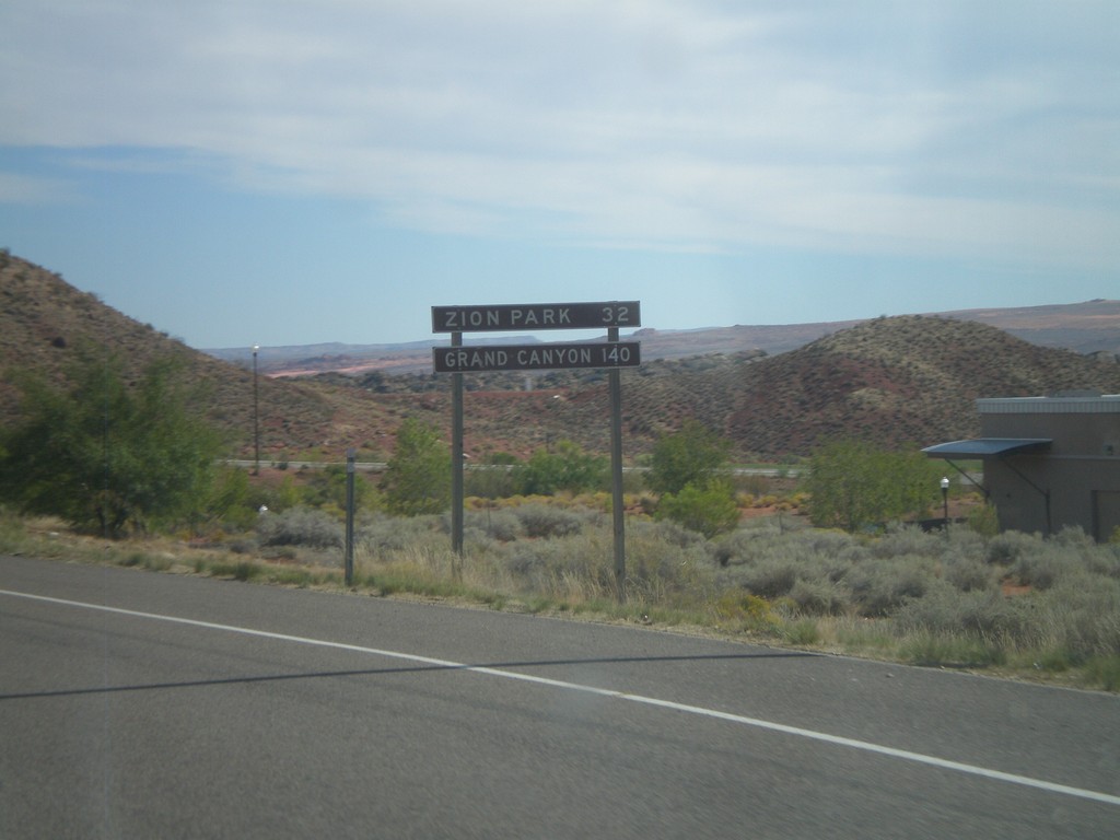
Distance Marker on UT-9 East
Distance Marker on UT-9 east. Distance to Zion (National) Park and Grand Canyon (National Park).
Taken 10-10-2011
Hurricane
Washington County
Utah
United States