Signs Tagged With Big Green Sign
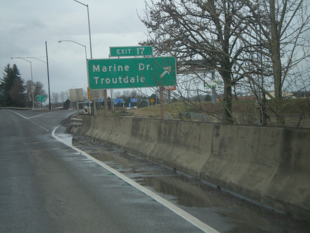
I-84 West - Exit 17
I-84 west at Exit 17 - Marine Drive/Troutdale. This is the first exit westbound in the Portland Metropolitan Area. Directly east of here is the Columbia River Gorge National Scenic Area.
Taken 02-18-2012

 Troutdale
Multnomah County
Oregon
United States
Troutdale
Multnomah County
Oregon
United States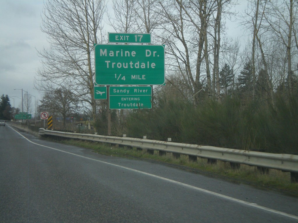
I-84 West - Exit 17
I-84 west approaching Exit 17 - Marine Drive/Troutdale. Entering Troutdale and crossing the Sandy River. The Sandy River is the boundary of the Columbia River Gorge National Scenic Area.
Taken 02-18-2012
Troutdale
Multnomah County
Oregon
United States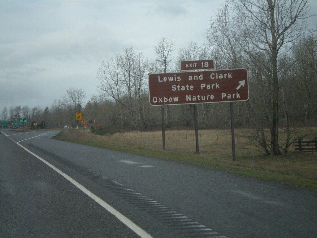
I-84 West - Exit 18
I-84 west at Exit 18 - Lewis and Clark State Park/Oxbow Nature Park.
Taken 02-18-2012
Troutdale
Multnomah County
Oregon
United States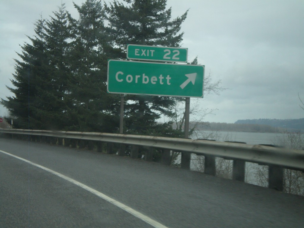
I-84 West - Exit 22
I-84 west at Exit 22 - Corbett. The Columbia River is in the background of the photograph.
Taken 02-18-2012
Corbett
Multnomah County
Oregon
United States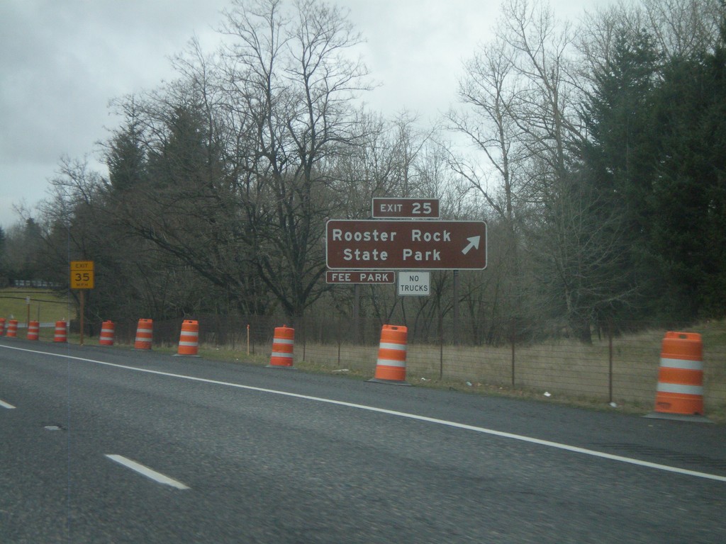
I-84 West - Exit 25
I-84 west at Exit 25 - Rooster Rock State Park
Taken 02-18-2012
Corbett
Multnomah County
Oregon
United States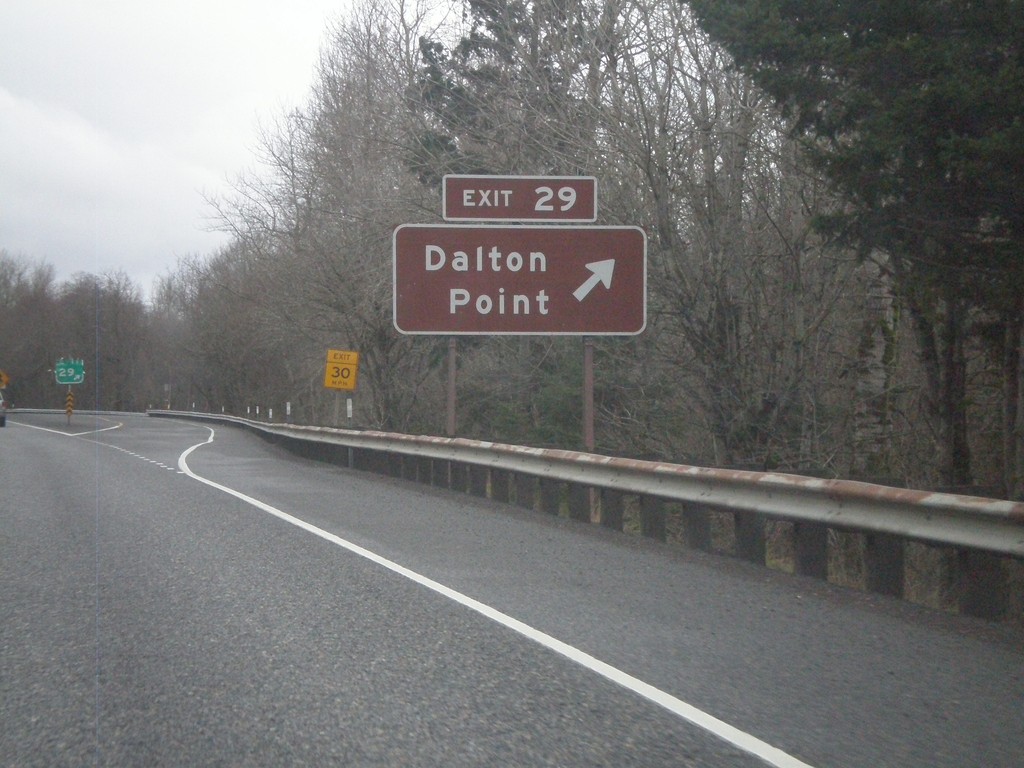
I-84 West - Exit 29
I-84 west at Exit 29 - Dalton Point. Access to Dalton Point State Recreation Park, located on the Columbia River.
Taken 02-18-2012
Bridal Veil
Multnomah County
Oregon
United States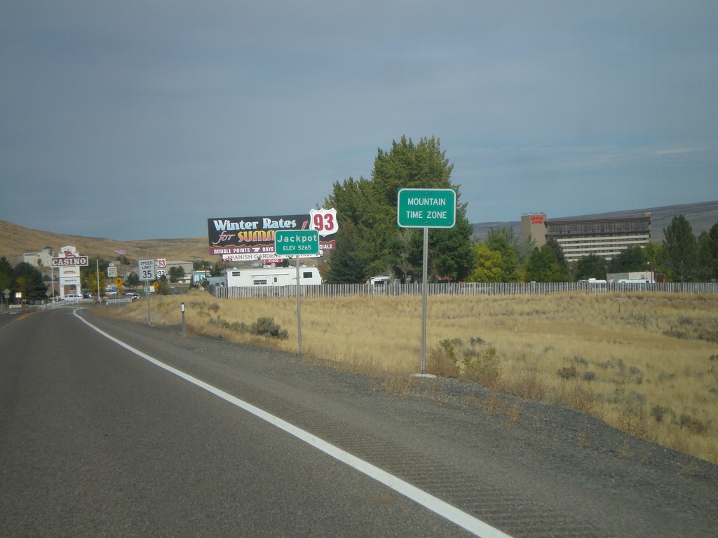
US-93 North - Entering Jackpot and Mountain Time
Entering Mountain Time Zone and Jackpot on US-93 north. Most of Nevada is on Pacific Time, except for a few of the border towns, bordering states in Mountain Time. Jackpot is on the border with Idaho.
Taken 10-15-2011
 Jackpot
Elko County
Nevada
United States
Jackpot
Elko County
Nevada
United States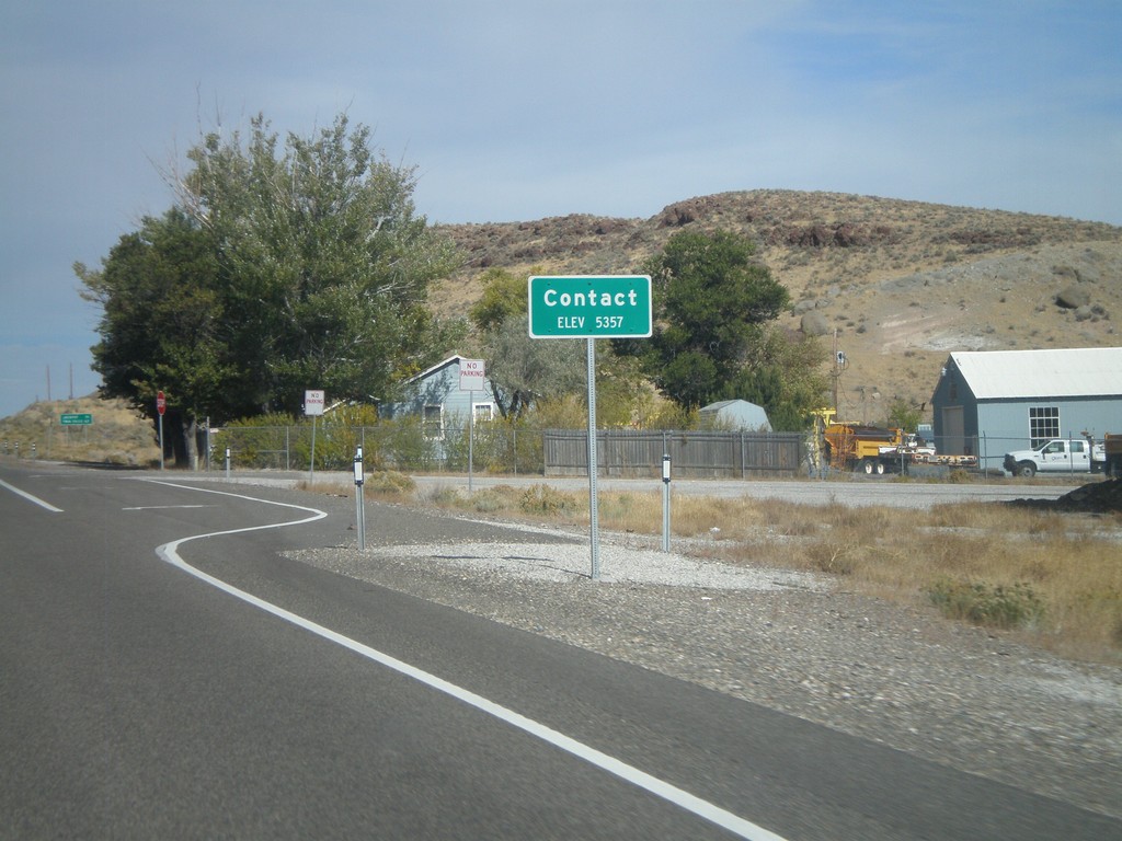
US-93 North - Contact
Entering Contact on US-93 north. The only thing in Contact is a Nevada DOT Highway Maintenance Station.
Taken 10-15-2011
Jackpot
Elko County
Nevada
United States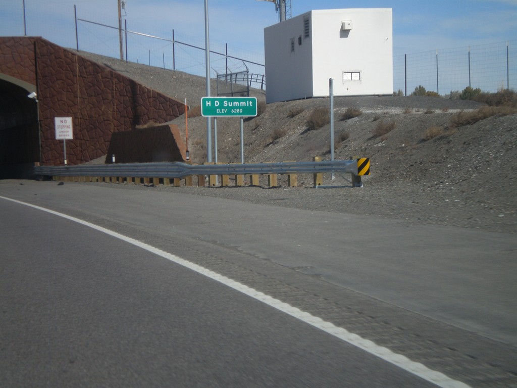
US-93 North - H-D Summit
US-93 north at H-D Summit - Elevation 6,280. The overpass in the background is a recently installed wildlife crossing over the highway. H-D Summit is the northern end of the Great Basin on US-93. North of here all water flows into the Snake River system.
Taken 10-15-2011
Melandco
Elko County
Nevada
United States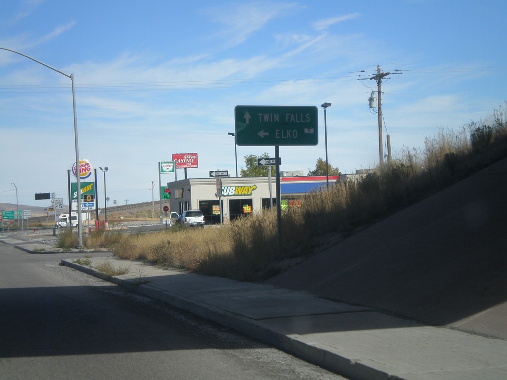
US-93 North at I-80 West
US-93 north at I-80 west (Exit 352). Turn right for I-80 west to Elko. Continue straight for US-93 north to Twin Falls (Idaho).
Taken 10-15-2011

 Wells
Elko County
Nevada
United States
Wells
Elko County
Nevada
United States