Signs Tagged With Big Green Sign
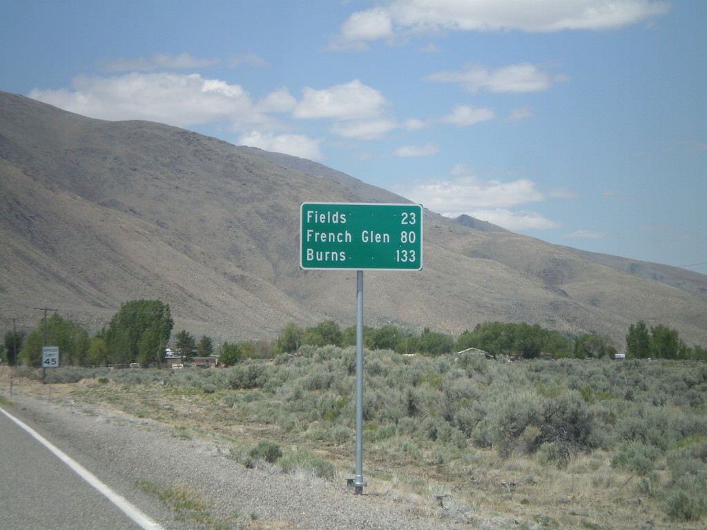
NV-292 North - Distance Marker
Distance marker entering Denio on NV-292 north. Distance to Fields, French Glen, and Burns. All three destinations are in Oregon. The Oregon-Nevada state line is at the north end of Denio.
Taken 05-28-2012
 Denio
Humboldt County
Nevada
United States
Denio
Humboldt County
Nevada
United States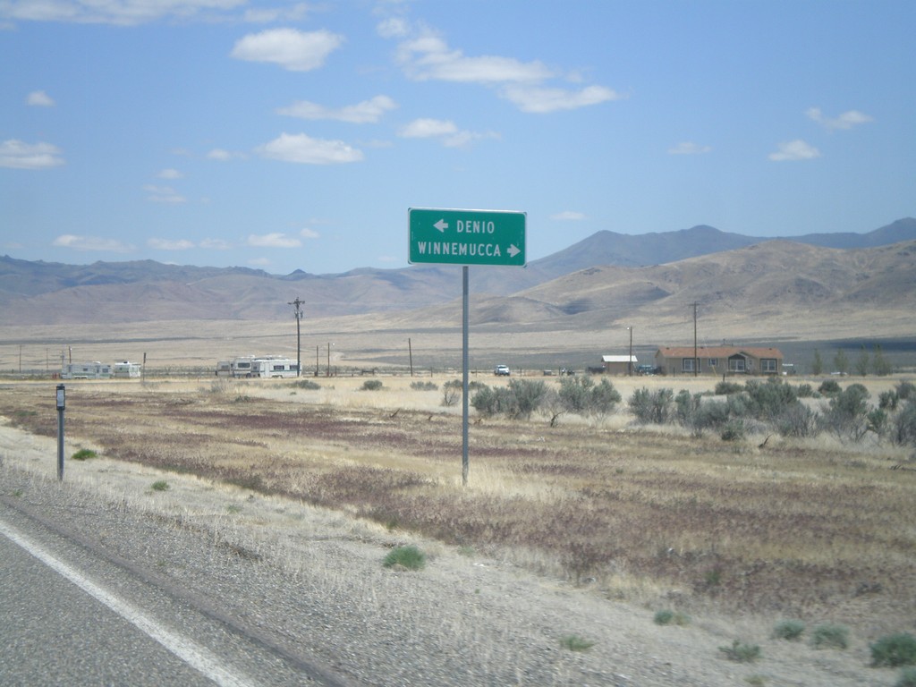
NV-140 East at NV-292 - Denio Junction
NV-140 east at NV-292 in Denio Junction. Turn left on NV-292 north for Denio. Turn right to continue east on NV-140 for Winnemucca.
Taken 05-28-2012
 Denio
Humboldt County
Nevada
United States
Denio
Humboldt County
Nevada
United States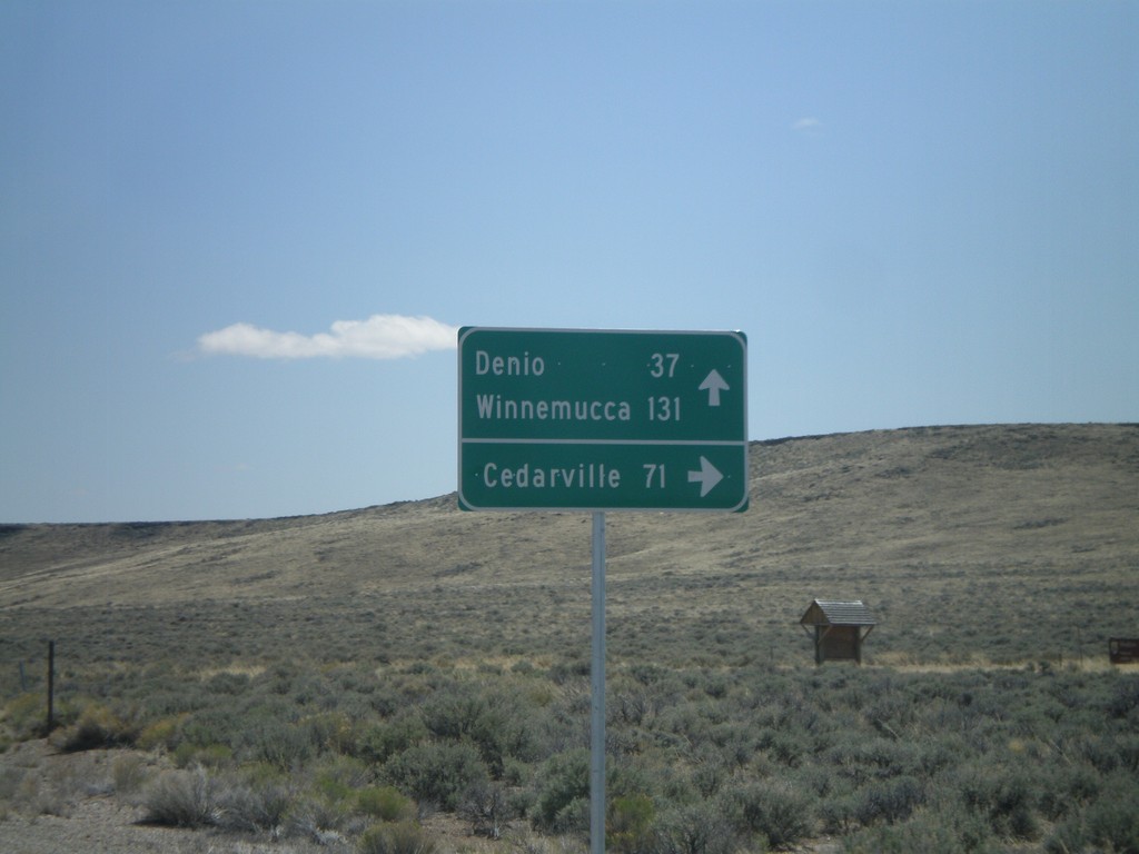
NV-140 East - Sheldon National Wildlife Refuge Jct.
NV-140 east at junction to Sheldon National Wildlife Refuge and Cedarville (California). Continue east on NV-140 for Denio and Winnemucca.
Taken 05-28-2012
Humboldt County
Nevada
United States
NV-140 East - Sage Hen Hills Summit
NV-140 east -Sage Hen Hills Summit - Elevation 6,349 Feet.
Taken 05-28-2012
Humboldt County
Nevada
United States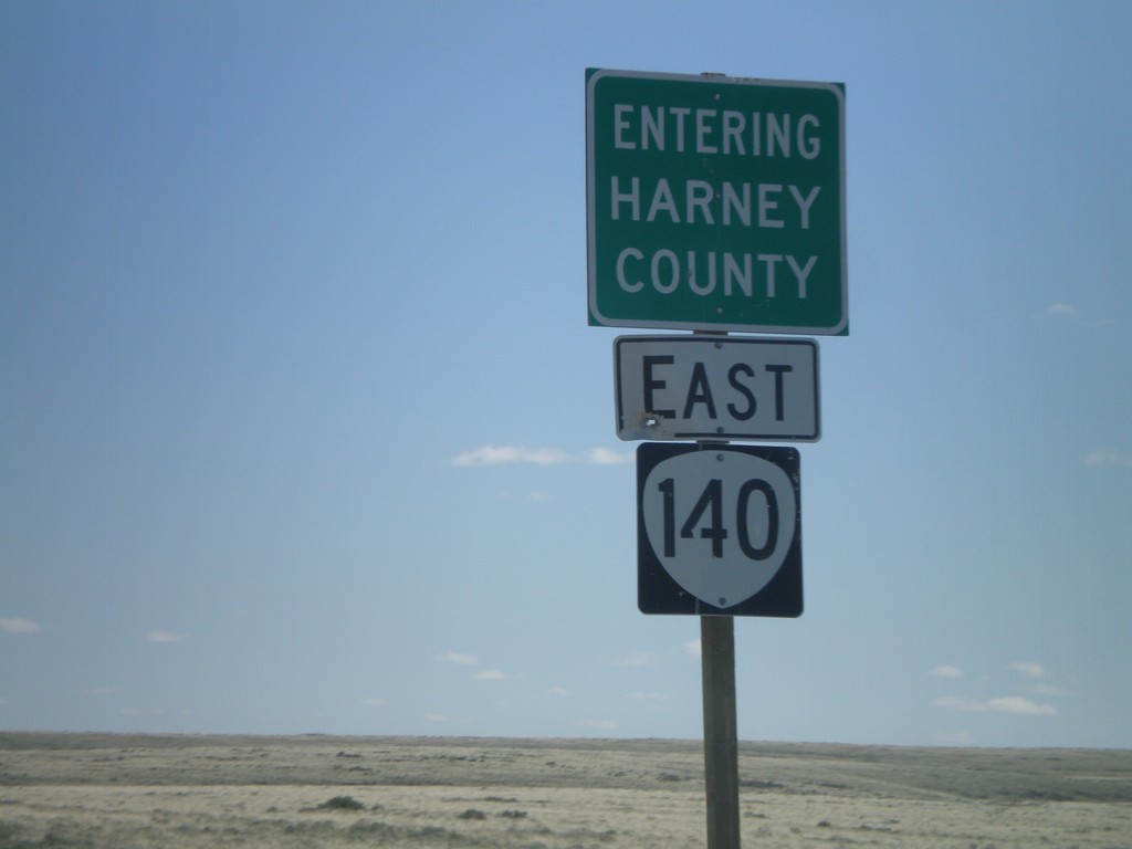
OR-140 East - Entering Harney County
Entering Harney County on OR-140 east. Taken at the Harney-Lake County Line. OR-140 briefly enters Harney County before leaving Oregon.
Taken 05-28-2012
 Lake County
Oregon
United States
Lake County
Oregon
United States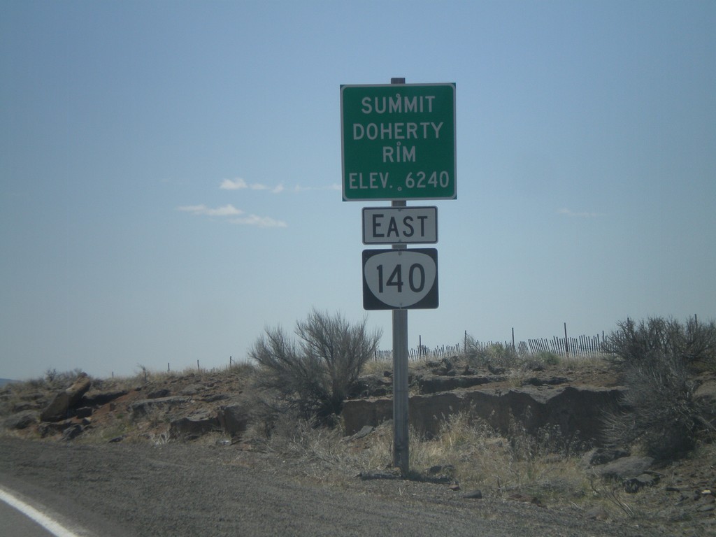
OR-140 East - Summit - Doherty Rim
Doherty Rim Summit, Elevation 6,240 Feet on OR-140 east in rural Lake County.
Taken 05-28-2012
Adel
Lake County
Oregon
United States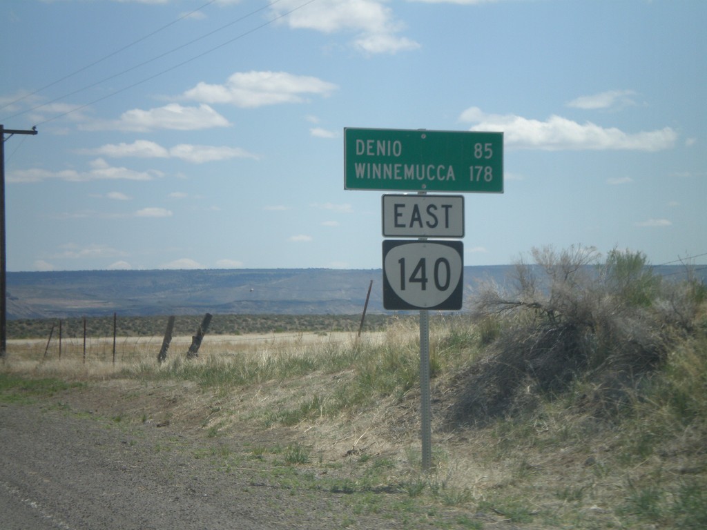
OR-140 East - Distance Marker
Distance marker to Denio and Winnemucca (both in Nevada) along OR-140 east, leaving Adel.
Taken 05-28-2012
Adel
Lake County
Oregon
United States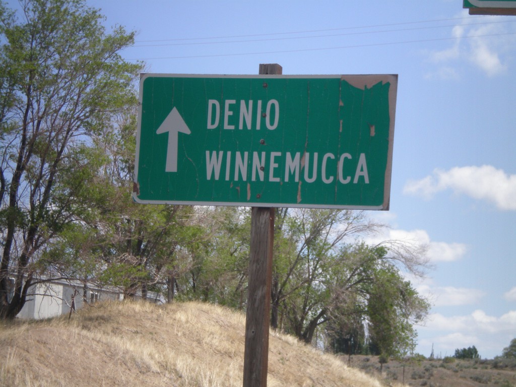
OR-140 East - Denio and Winnemucca
Use OR-140 east to Denio and Winnemucca (both in Nevada) in Adel.
Taken 05-28-2012
Adel
Lake County
Oregon
United States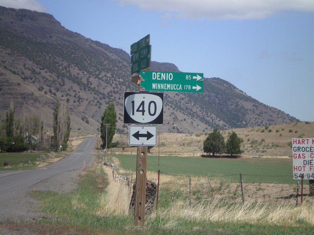
Twentymile Road North at OR-140
Twentymile Road north at OR-140 in Adel. Turn right on OR-140 for Denio and Winnemucca (both in Nevada). Westbound destinations on fingerboard are broken off.
Taken 05-28-2012
Adel
Lake County
Oregon
United States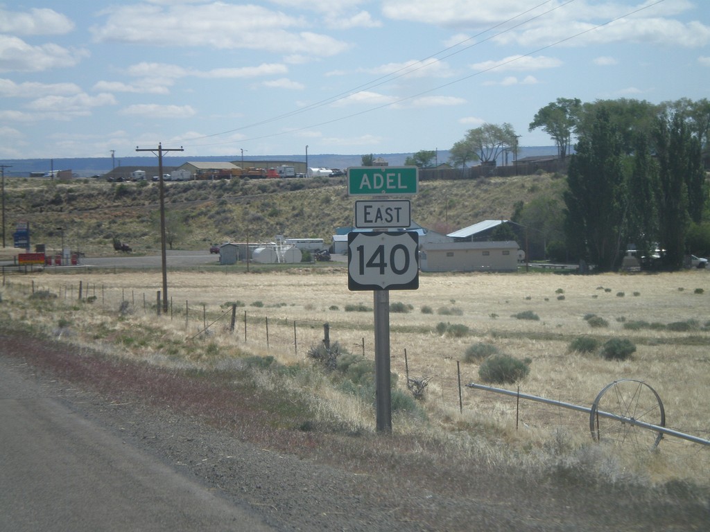
OR-140 East - Entering Adel
Entering Adel on OR-140 east. Adel is a small community in southeastern Lake County, Oregon. The OR-140 shield is incorrectly signed with a US highway type marker.
Taken 05-28-2012
Adel
Lake County
Oregon
United States