Signs Tagged With Big Green Sign
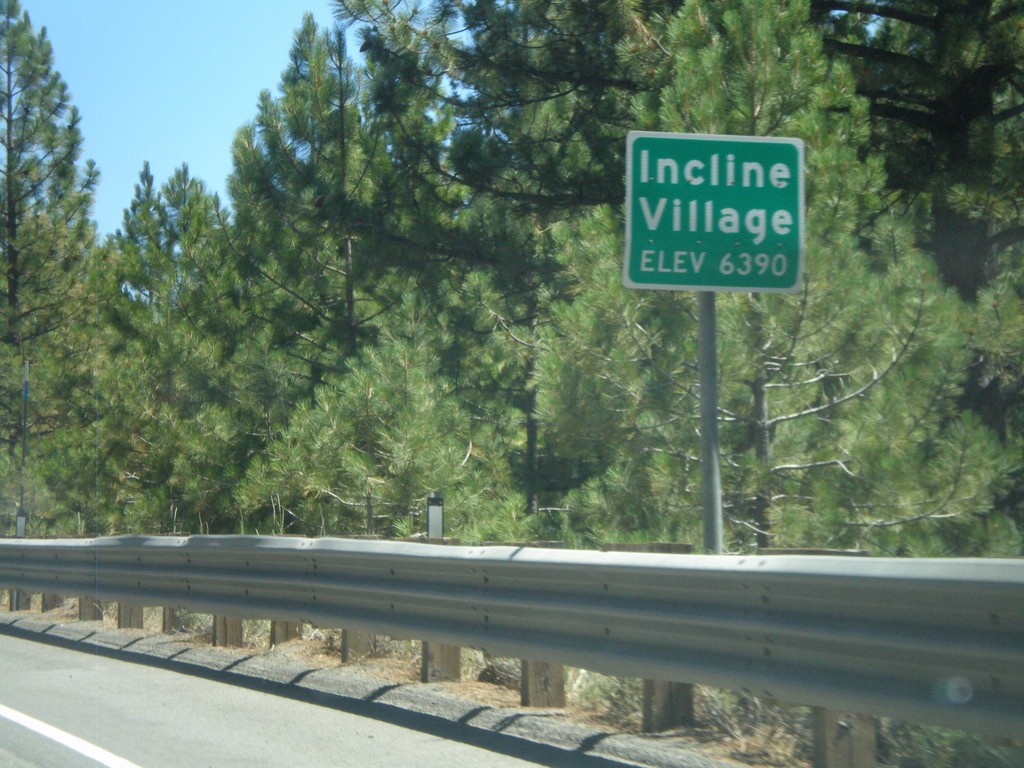
NV-28 East - Incline Village
Entering Incline Village (Elevation 6390) on NV-28 east. Incline Village is a community on the Nevada side of Lake Tahoe on the north shore.
Taken 07-28-2012
 Incline Village
Washoe County
Nevada
United States
Incline Village
Washoe County
Nevada
United States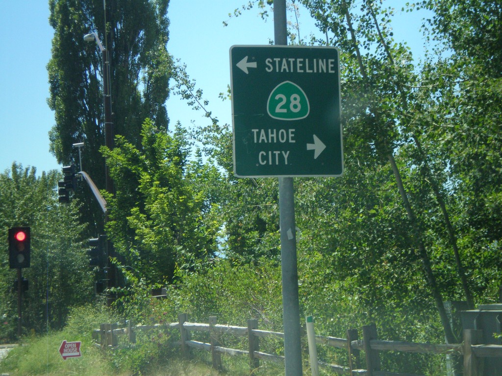
End CA-267 South at CA-28
End CA-267 south at CA-28 in Kings Beach. Turn right for CA-28 west to Tahoe City; turn left for CA-28 east to Stateline.
Taken 07-28-2012

 Kings Beach
Placer County
California
United States
Kings Beach
Placer County
California
United States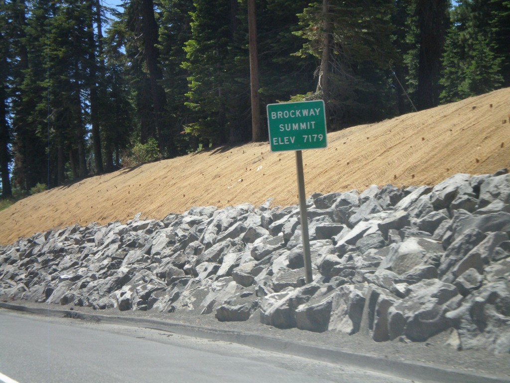
CA-267 South - Brockway Summit
CA-267 South - Brockway Summit (Elevation 7179 Feet). Brockway Summit divides the Truckee area from the Tahoe Basin. CA-267 south quickly descends into Lake Tahoe.
Taken 07-28-2012
Truckee
Placer County
California
United States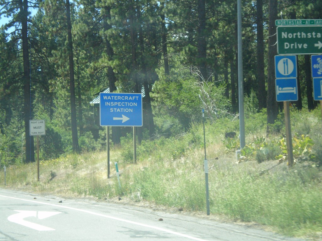
CA-267 South at Northstar Road
CA-267 South at Northstar Road. Turn right for Northstar-At-Tahoe Ski Area and for (Lake Tahoe) Watercraft Inspection. All watercraft launching in Lake Tahoe need to be inspected prior to launching.
Taken 07-28-2012
Truckee
Placer County
California
United States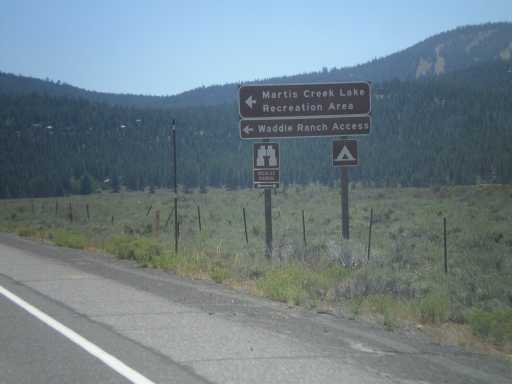
CA-267 South at Martis Creek Lake Jct.
CA-267 south at Martis Creek Lake Jct. Turn left for Martis Creek Lake Recreation Area, and Waddle Ranch Access. The ski slopes of Northstar-At-Tahoe are visible on the upper right side of the picture.
Taken 07-28-2012
Truckee
Placer County
California
United States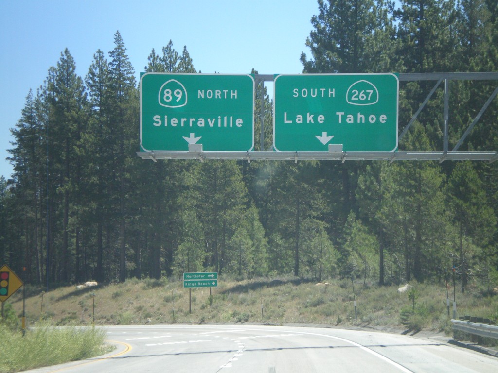
I-80 East Exit 188B Offramp at CA-89/CA-267
I-80 east Exit 188B offramp at CA-89/CA-267 junction. Turn left for CA-89 north to Sierraville. Turn right for CA-267 south to Lake Tahoe.
Taken 07-28-2012

 Truckee
Nevada County
California
United States
Truckee
Nevada County
California
United States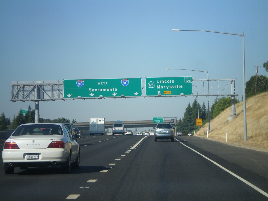
I-80 West - Exit 106
I-80 west at Exit 106 - CA-65/Lincoln/Marysville. Continue west on I-80 for Sacramento.
Taken 07-27-2012
 Rocklin
Placer County
California
United States
Rocklin
Placer County
California
United States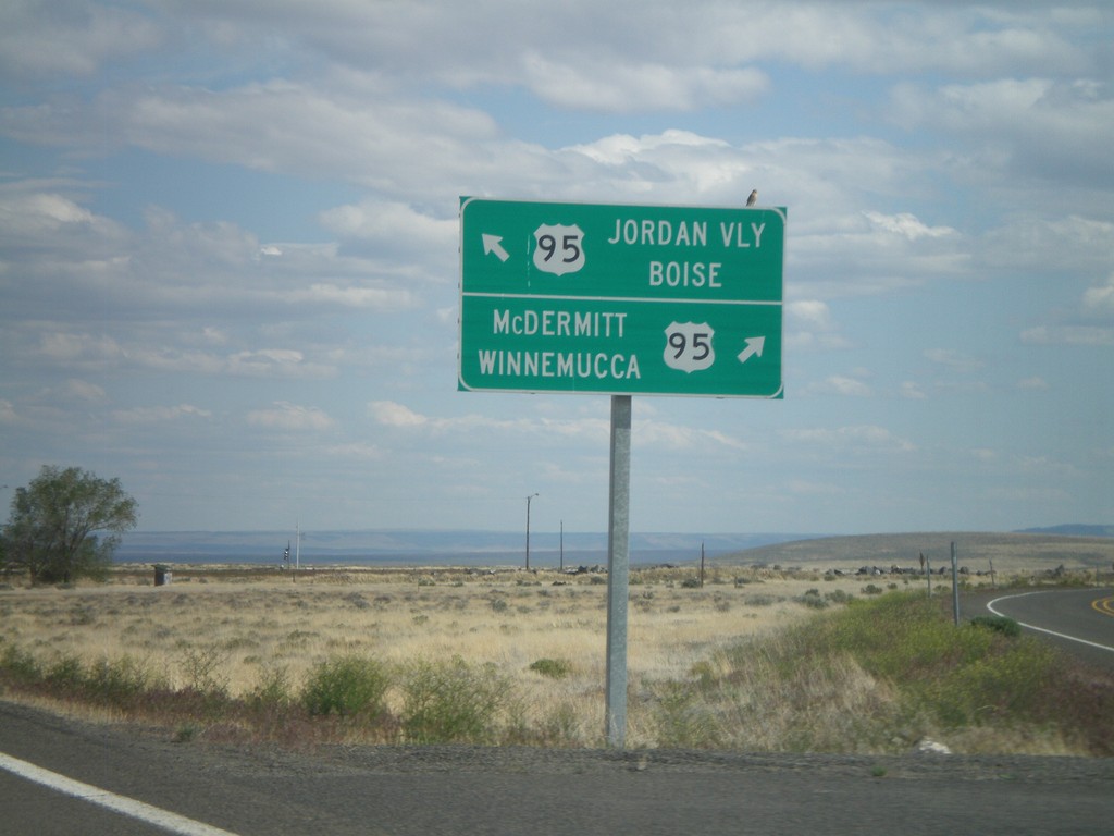
End OR-78 East at US-95
End OR-78 east at US-95. Turn right for US-95 south to McDermitt and Winnemucca (Nevada). Merge left for US-95 north to Jordan Valley and Boise (Idaho).
Taken 05-28-2012

 Jordan Valley
Malheur County
Oregon
United States
Jordan Valley
Malheur County
Oregon
United States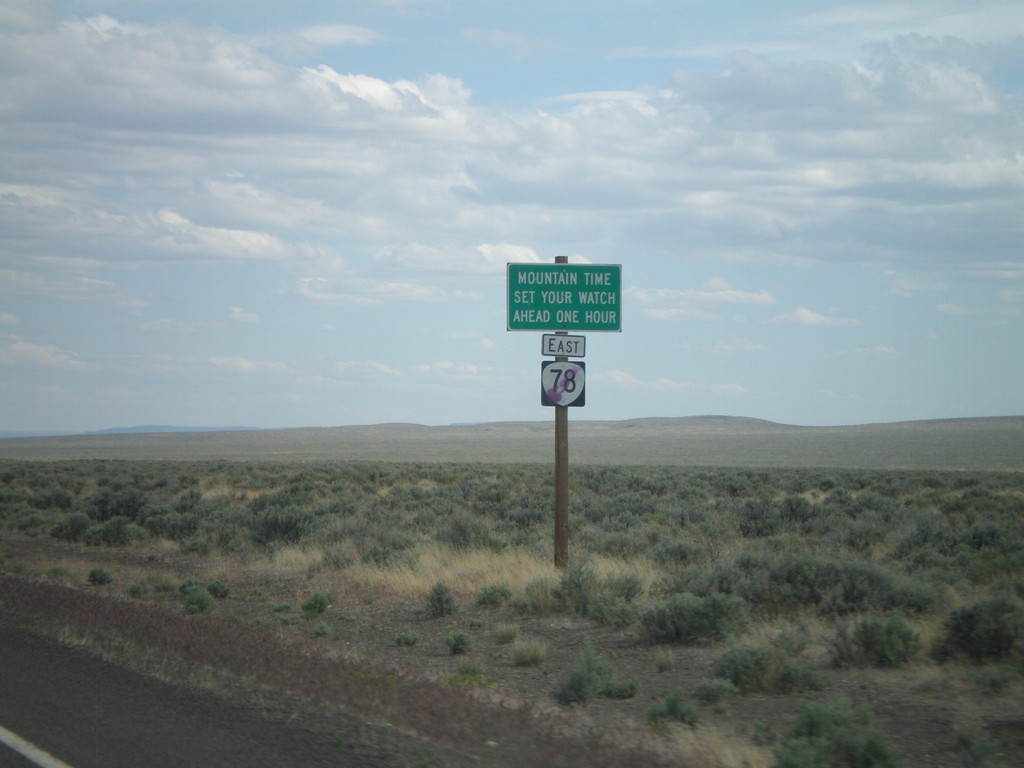
OR-78 East - Mountain Time Zone
Entering Mountain Time Zone on OR-78 east.
Taken 05-28-2012
Jordan Valley
Malheur County
Oregon
United States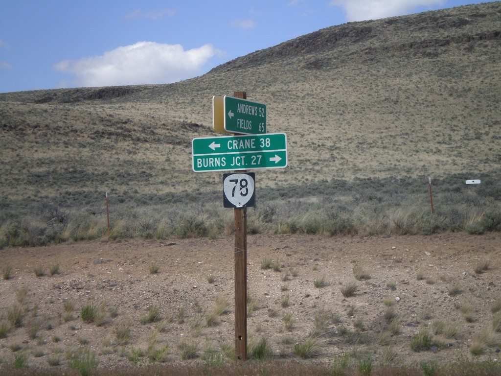
End Eastside Steens Mountain Road at OR-78
End Eastside Steens Mountain Road at OR-78. Turn right on OR-78 for Burns Junction; turn left on OR-78 for Crane. The eastside Steens Mountain road follows the east side of Steens Mountain south to Andrews, Fields, and eventually into Denio, Nevada.
Taken 05-28-2012
Jordan Valley
Malheur County
Oregon
United States