Signs Tagged With Big Green Sign
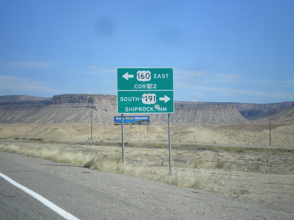
US-160 East at US-491
US-160 east at US-491. Turn right for US-491 south to Shiprock, New Mexico. Turn left for US-491 north and US-160 east to Cortez. US-160 joins US-491 north to Cortez.
Taken 10-10-2012

 Towaoc
Montezuma County
Colorado
United States
Towaoc
Montezuma County
Colorado
United States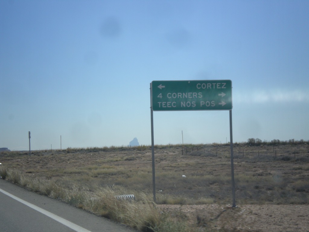
End CO-41 East at US-160
End CO-41 at US-160. Turn right on US-160 west for 4 Corners, and Teec Nos Pos (Arizona). Turn left for Cortez.
Taken 10-10-2012
 Montezuma County
Colorado
United States
Montezuma County
Colorado
United States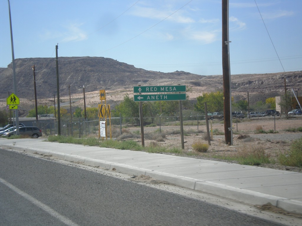
UT-162 East - Montezuma Creek
UT-162 east at Red Mesa Road in Montezuma Creek. Continue straight for Red Mesa; turn left to continue east on UT-162 to Aneth.
Taken 10-10-2012
 Montezuma Creek
San Juan County
Utah
United States
Montezuma Creek
San Juan County
Utah
United States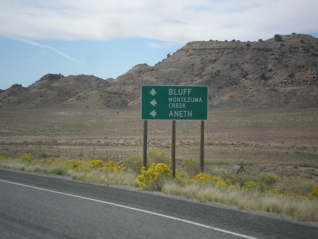
US-191 South Approaching UT-262
US-191 south approaching UT-262 west. Use UT-262 west for Montezuma Creek and Aneth. Continue south on US-191 for Bluff.
Taken 10-10-2012

 Blanding
San Juan County
Utah
United States
Blanding
San Juan County
Utah
United States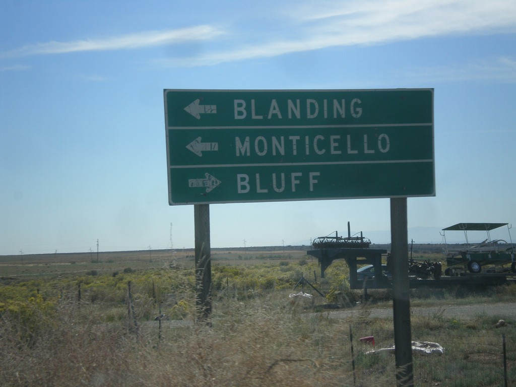
End UT-95 East at US-191
End UT-95 East at US-191. Turn right for Bluff; left for Blanding and Monticello.
Taken 10-10-2012
 Blanding
San Juan County
Utah
United States
Blanding
San Juan County
Utah
United States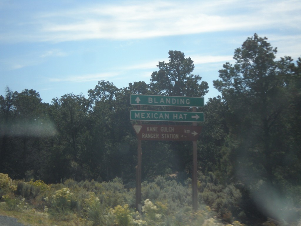
UT-95 West at UT-261
UT-95 east at UT-261. Turn right for Mexican Hat; continue east towards Blanding.
Taken 10-10-2012
 Lake Powell
San Juan County
Utah
United States
Lake Powell
San Juan County
Utah
United States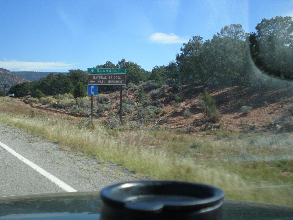
UT-95 East Approaching UT-275
UT-95 East Approaching UT-275 north to Natural Bridges National Monument. Continue east on UT-95 for Blanding.
Taken 10-10-2012
 Lake Powell
San Juan County
Utah
United States
Lake Powell
San Juan County
Utah
United States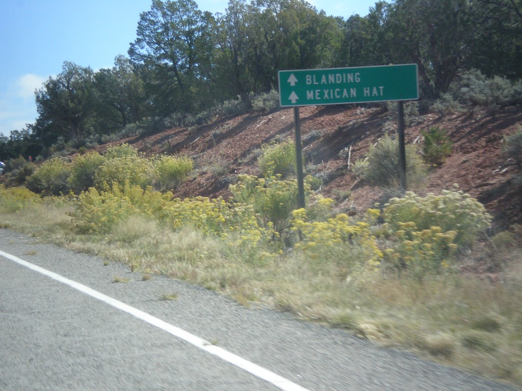
UT-95 East Approaching UT-276
UT-95 East approaching UT-276. Continue east on UT-95 for Mexican Hat and Blanding.
Taken 10-10-2012
 Lake Powell
San Juan County
Utah
United States
Lake Powell
San Juan County
Utah
United States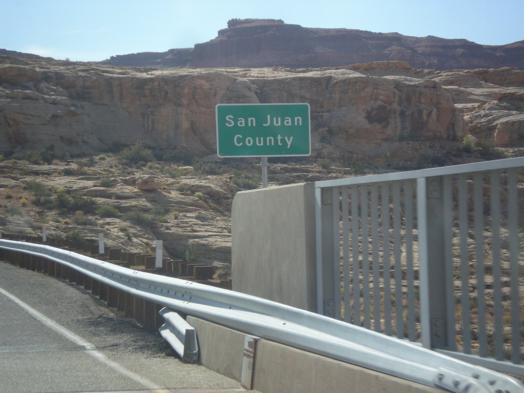
UT-95 East - San Juan County
Entering San Juan County on UT-95 east, crossing the Colorado River. This is the backwaters of Lake Powell, near Hite Marina.
Taken 10-10-2012
Lake Powell
San Juan County
Utah
United States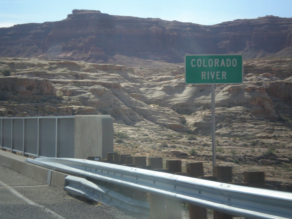
UT-95 East - Colorado River
Colorado River crossing on UT-95 east. This is the backwaters of Lake Powell.
Taken 10-10-2012
Lake Powell
Garfield County
Utah
United States