Signs Tagged With Big Green Sign
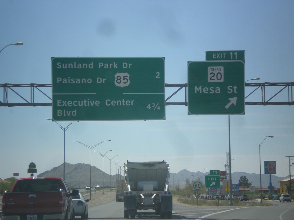
I-10 East - Exit 11
I-10 east at Exit 11 - TX-20/Mesa St. Next exits are - US-85/Sunland Park Drive/Paisano Drive and Executive Center Blvd.
Taken 04-15-2013


 El Paso
 County
Texas
United States
El Paso
El Paso County
Texas
United States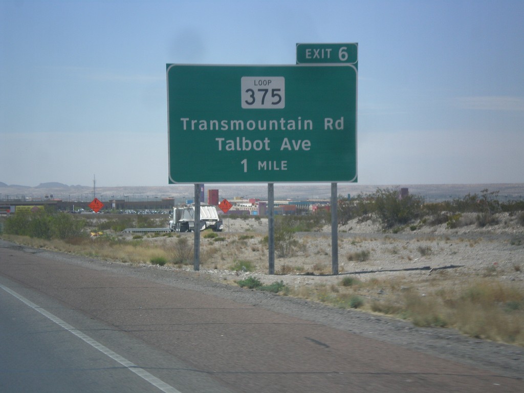
I-10 East Approaching Exit 6
I-10 east approaching Exit 6 - TX-375 Loop/Talbot Ave/Transmountain Road. This is the the northwestern end of the TX-375 Loop, which crosses the Franklin Mountains, and loops around Fort Bliss, before turning into the Border Freeway.
Taken 04-15-2013
 Canutillo
El Paso County
Texas
United States
Canutillo
El Paso County
Texas
United States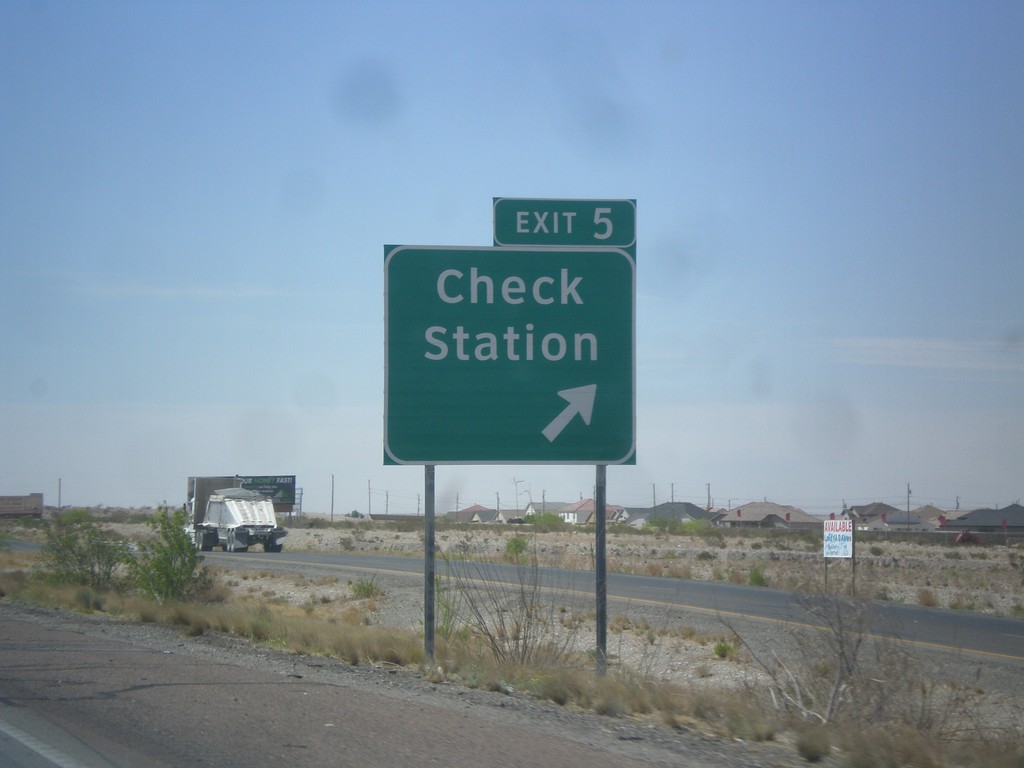
I-10 East - Exit 5
I-10 east at Exit 5 - Check Station.
Taken 04-15-2013
Canutillo
El Paso County
Texas
United States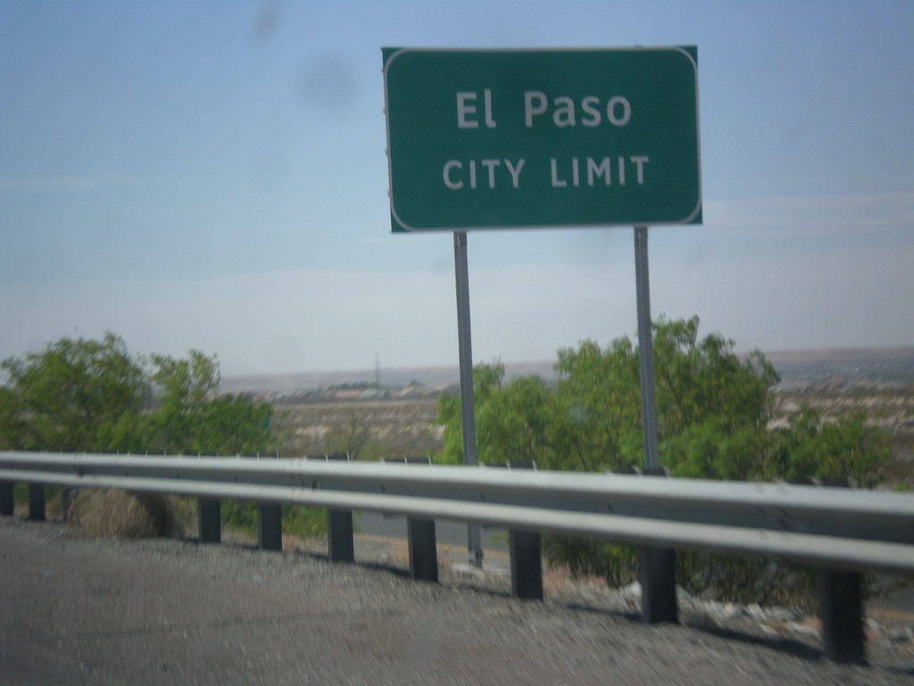
I-10 East - El Paso City Limit
Entering El Paso, Texas on I-10 east.
Taken 04-15-2013
Canutillo
El Paso County
Texas
United States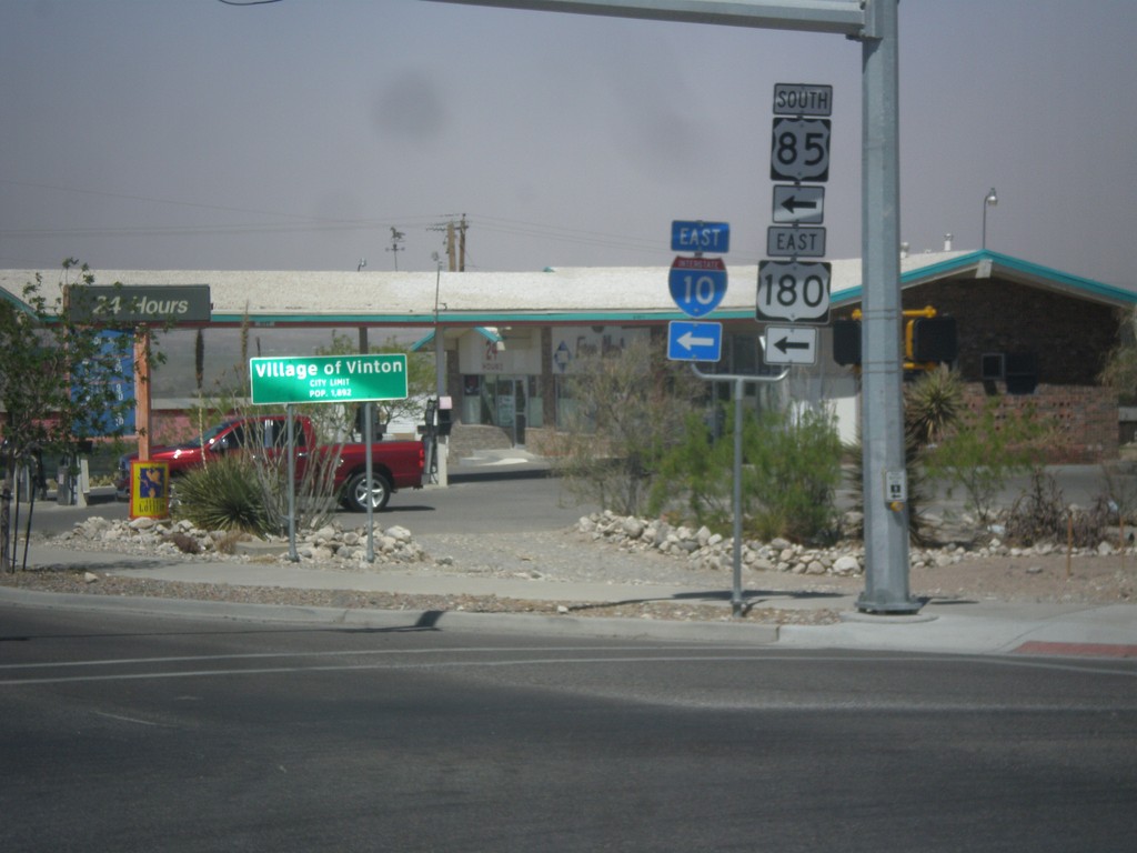
TX-37 Spur West at I-10 Onramp
TX-37 Spur West at I-10/US-180 East/US-85 South. This is the onramp for Exit 2 on I-10. In the background of the photo is the city limit sign for the Village of Vinton.
Taken 04-15-2013

 Anthony
El Paso County
Texas
United States
Anthony
El Paso County
Texas
United States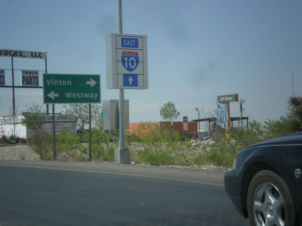
I-10 East at TX-37 Spur
I-10 East, Exit 2 offramp at TX-37 Spur. Turn left on TX-37 Spur for Westway; turn right on TX-37 Spur for Vinton. Continue ahead for I-10.
Taken 04-15-2013
Vinton
El Paso County
Texas
United States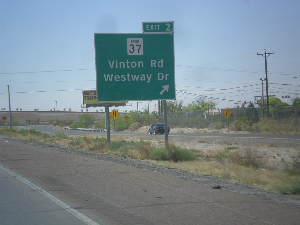
I-10 East - Exit 2
I-10 east at Exit 2 - TX-37 Spur/Vinton Road/Westway Drive.
Taken 04-15-2013
Canutillo
El Paso County
Texas
United States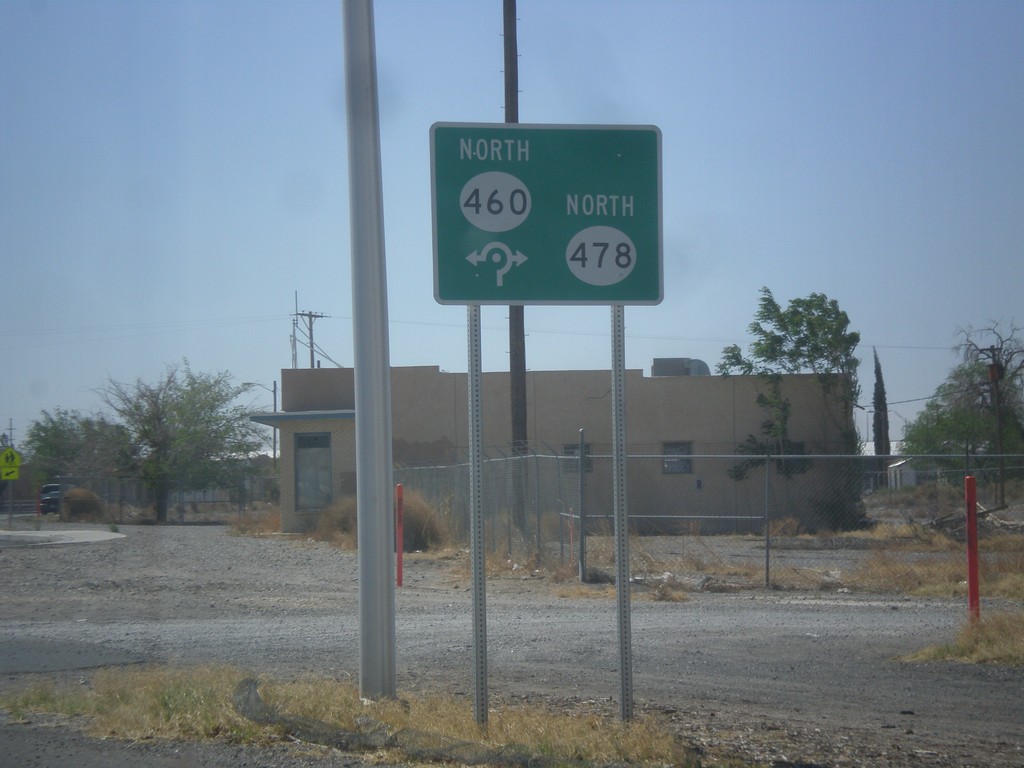
NM-478 South at NM-478/NM-460 Roundabout
NM-478/NM-478 roundabout on NM-478 south.
Taken 04-15-2013

 Anthony
Doña Ana County
New Mexico
United States
Anthony
Doña Ana County
New Mexico
United States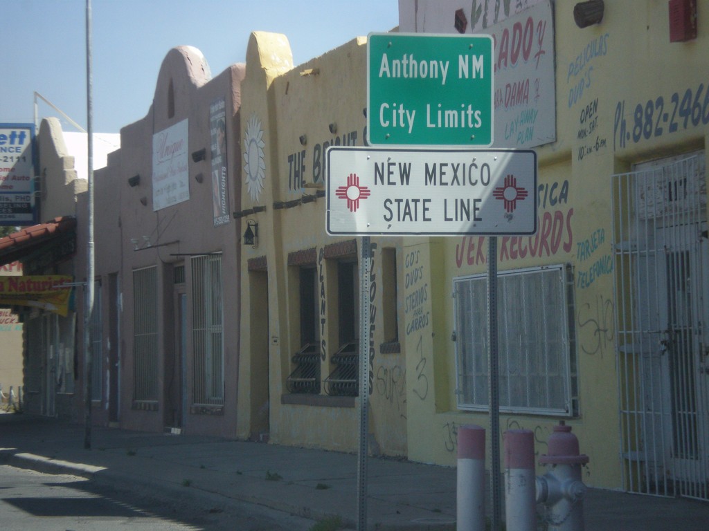
NM-460 North - New Mexico State Line
New Mexico State Line and Anthony, NM city limits on NM-460 north. Taken at the Texas-New Mexico state line on the border between Anthony, NM and Anthony, TX.
Taken 04-15-2013
Anthony
Doña Ana County
New Mexico
United States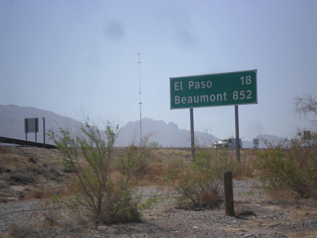
I-10 East - Distance Marker
First distance marker along I-10 east in Texas. Distance to El Paso and Beaumont. Beaumont is at the opposite side of Texas on the Louisiana state line - 852 miles away.
Taken 04-15-2013
Anthony
El Paso County
Texas
United States