Signs Tagged With Big Green Sign
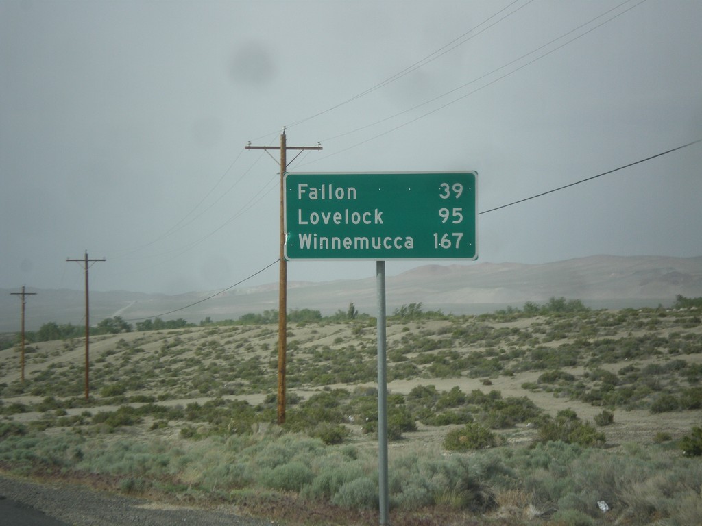
US-95 North - Distance Marker
Distance marker on US-95 north. Distance to Fallon, Lovelock, and Winnemucca. This sign was upgraded to the Clearview font since the last time I photographed it in 2006.
Taken 05-05-2014
 Schurz
Mineral County
Nevada
United States
Schurz
Mineral County
Nevada
United States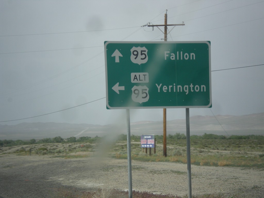
US-95 North at Alt. US-95 North
US-95 North at Alt. US-95 North to Yerington. Continue north on US-95 for Fallon. Alt. US-95 rejoins US-95 north of Fallon at I-80.
Taken 05-05-2014
 Schurz
Mineral County
Nevada
United States
Schurz
Mineral County
Nevada
United States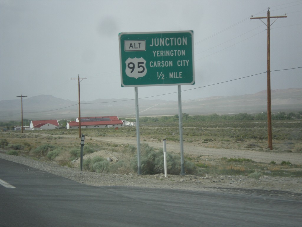
US-95 North Approaching Alt. US-95
US-95 north Approaching Alt. US-95 to Carson City and Yerington.
Taken 05-05-2014
Schurz
Mineral County
Nevada
United States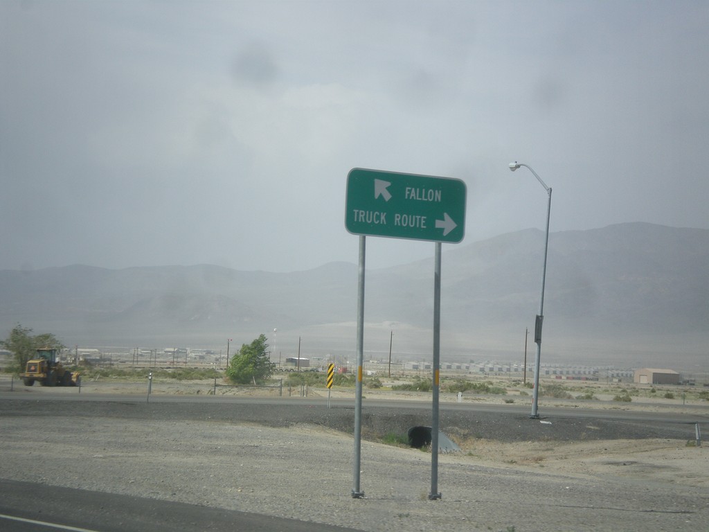
US-95 North at Hawthorne Truck Route
US-95 north at Hawthorne Truck Route. Merge right for the Truck Route, merge left for US-95 north towards Fallon.
Taken 05-05-2014
Hawthorne
Mineral County
Nevada
United States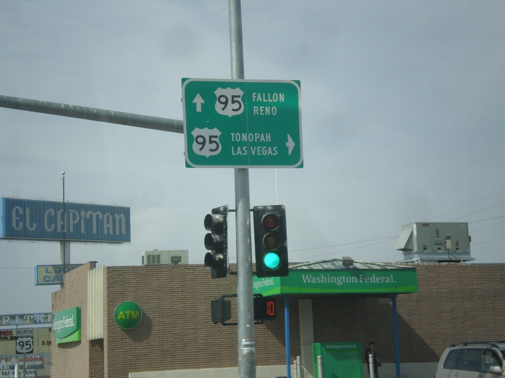
End NV-359 at US-95
End NV-359 at US-95. Turn right for US-95 south to Tonopah and Las Vegas. Continue straight for US-95 north to Fallon and Reno.
Taken 05-05-2014
 Hawthorne
Mineral County
Nevada
United States
Hawthorne
Mineral County
Nevada
United States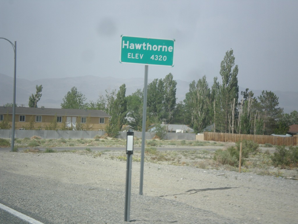
NV-359 North - Hawthorne
Hawthorne - Elevation 4,320 Feet on NV-359 North.
Taken 05-05-2014
Hawthorne
Mineral County
Nevada
United States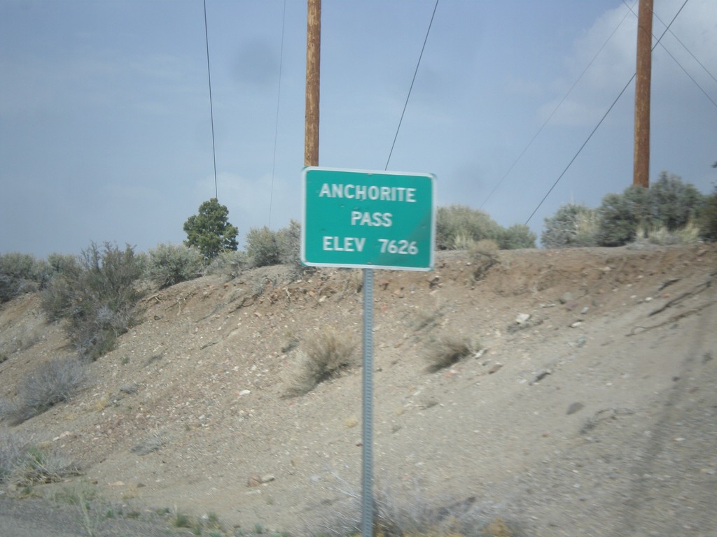
NV-359 North - Anchorite Pass
Anchorite Pass - Elevation 7,626 Feet on NV-359 North.
Taken 05-05-2014
Mina
Mineral County
Nevada
United States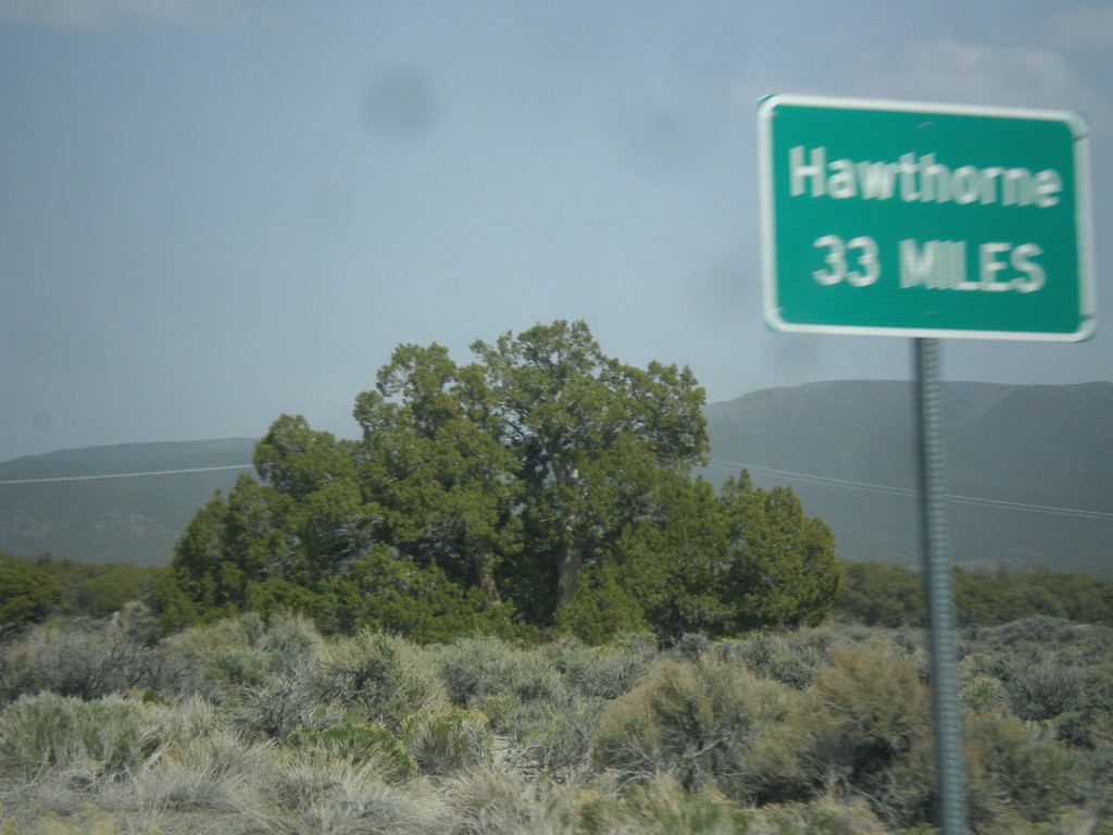
NV-359 North - Distance Marker
Distance marker on NV-359 north. Distance to Hawthorne. This sort of sign is common in Nevada where there is only one city listed as a destination.
Taken 05-05-2014
Mina
Mineral County
Nevada
United States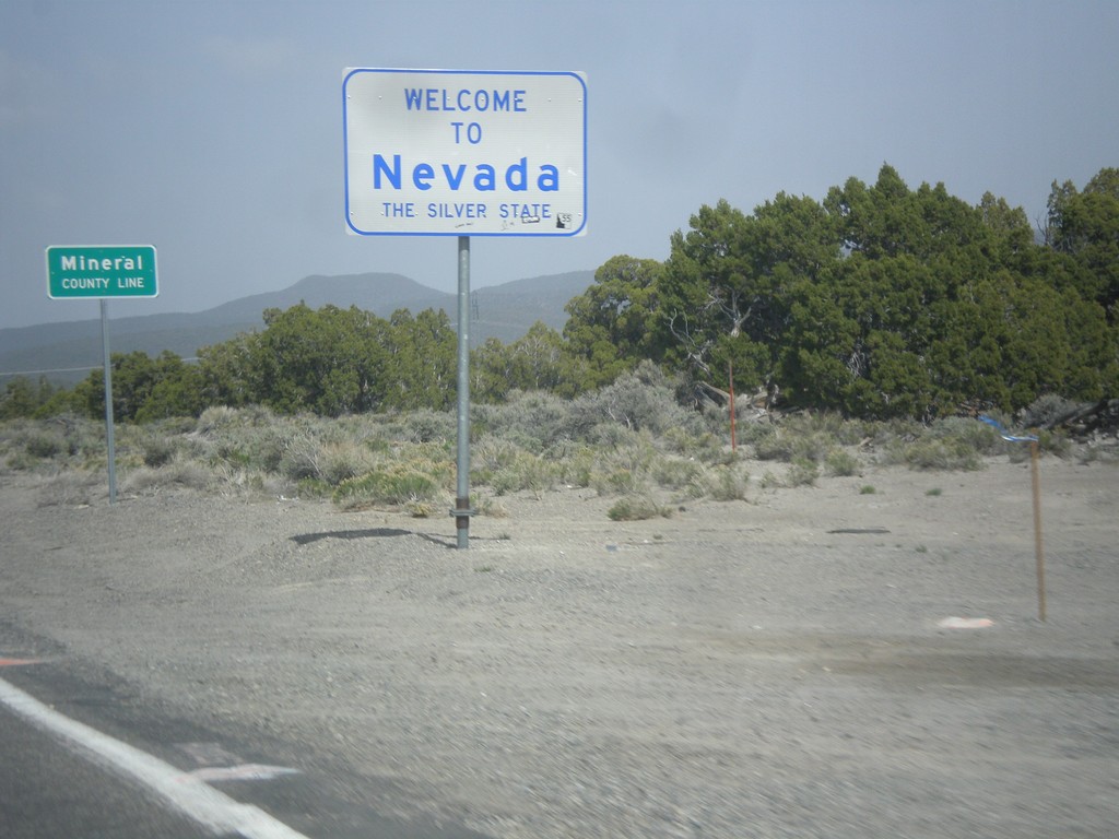
Welcome To Nevada - NV-359 North
Welcome to Nevada - The Silver State, Mineral County Line on NV-359 north. Taken at the Nevada - California state line.
Taken 05-05-2014
Mina
Mineral County
Nevada
United States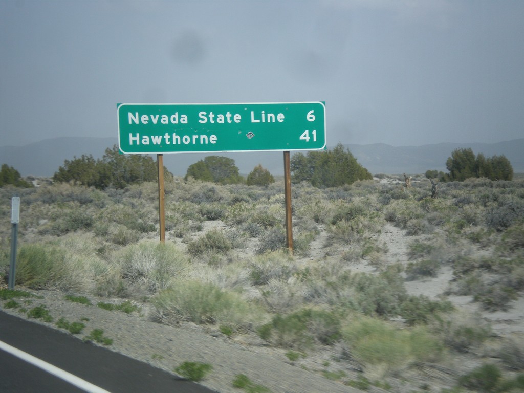
CA-167 East - Distance Marker
Distance marker on CA-167 east. Distance to Nevada State Line and Hawthorne (Nevada).
Taken 05-05-2014
 Lee Vining
Mono County
California
United States
Lee Vining
Mono County
California
United States