Signs Tagged With Big Green Sign
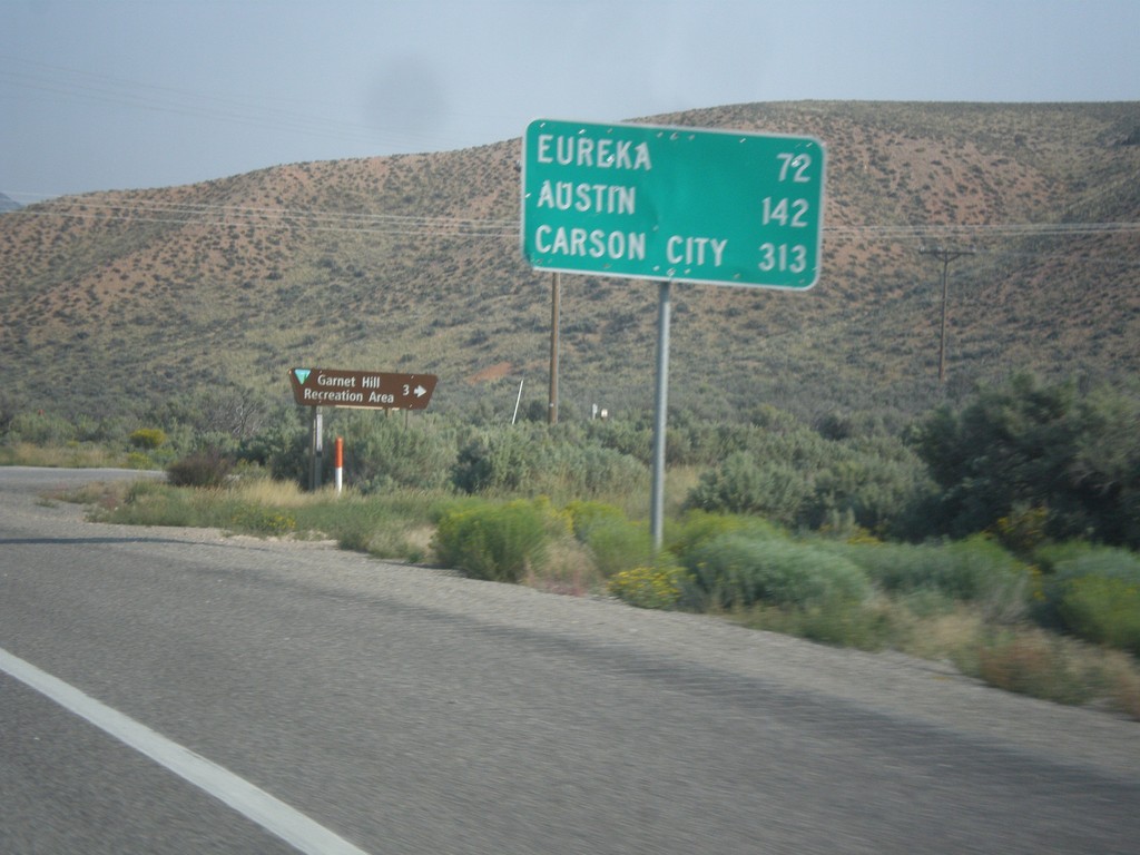
US-50 West - Distance Marker
Distance marker on US-50 west. Distance to Eureka, Austin, and Carson City.
Taken 08-31-2014
 Ruth
White Pine County
Nevada
United States
Ruth
White Pine County
Nevada
United States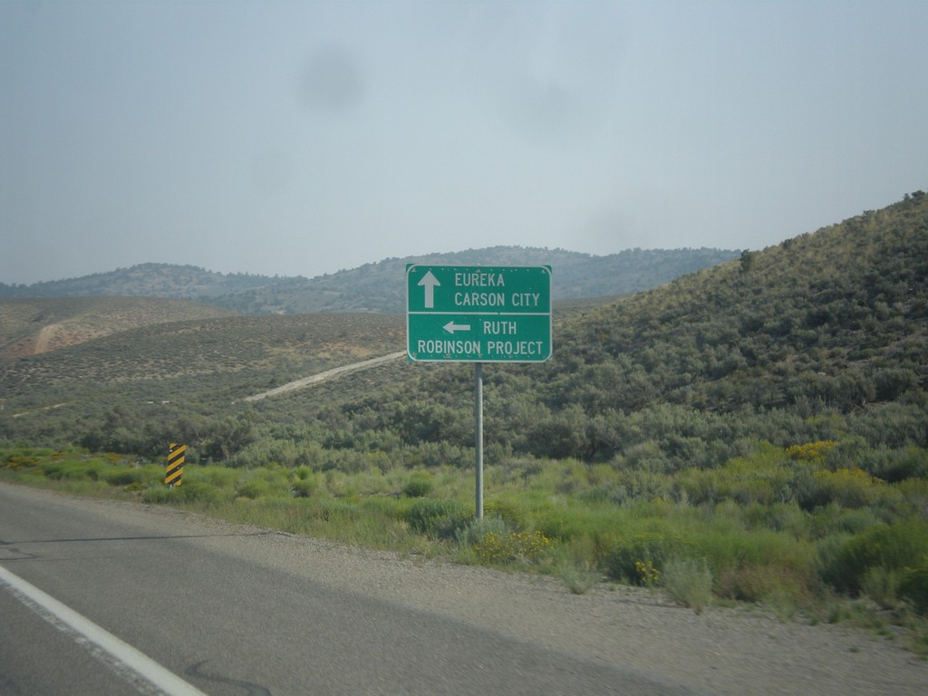
US-50 West - Ruth Jct.
US-50 west at junction to Ruth and Robinson Project. The Robinson Project is a large copper mine.
Taken 08-31-2014
Ruth
White Pine County
Nevada
United States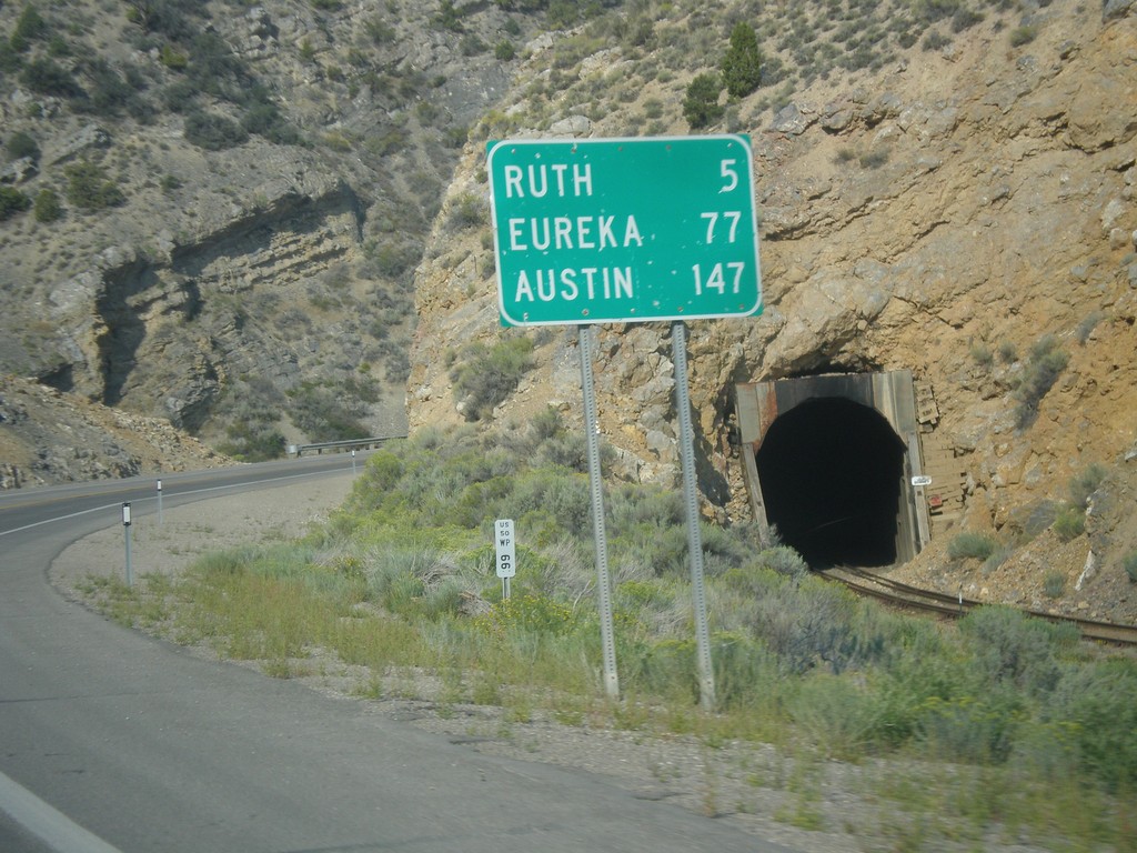
US-50 West - Distance Marker
Distance marker on US-50 west. Distance to Ruth, Eureka, and Austin.
Taken 08-31-2014
Ely
White Pine County
Nevada
United States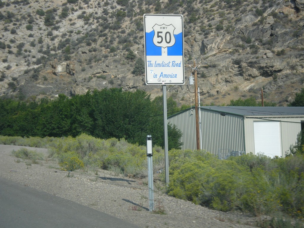
US-50 West - The Loneliest Road In America
The Loneliest Road in America on US-50 west. Taken at the west edge of Ely.
Taken 08-31-2014
Ely
White Pine County
Nevada
United States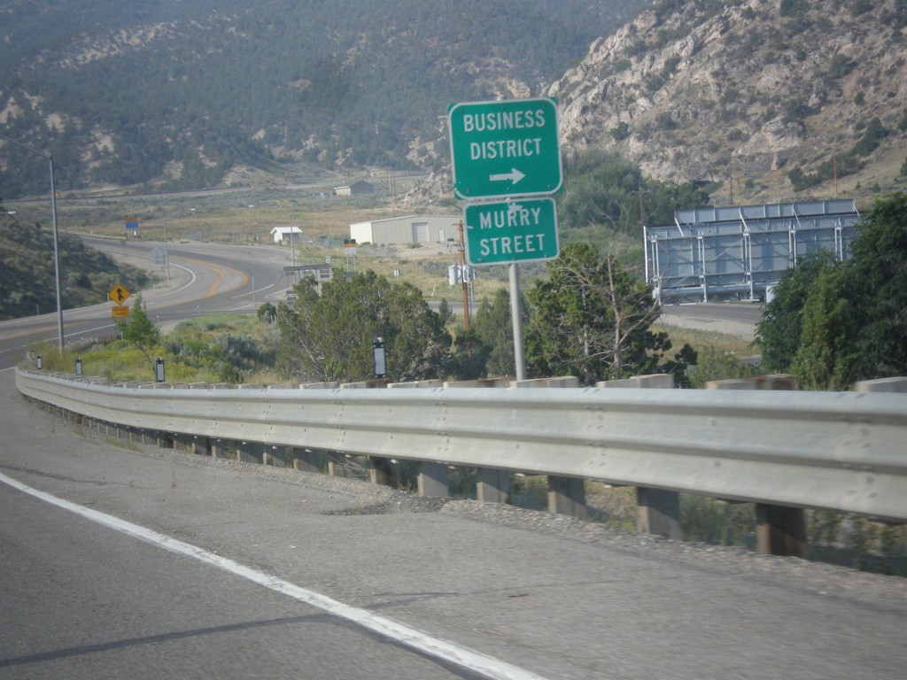
US-6 West - Murry St.
US-6 west approaching Murry St. into the Ely Business District. Murry St. used to be the former route of US-6 into Ely.
Taken 08-31-2014
 Ely
White Pine County
Nevada
United States
Ely
White Pine County
Nevada
United States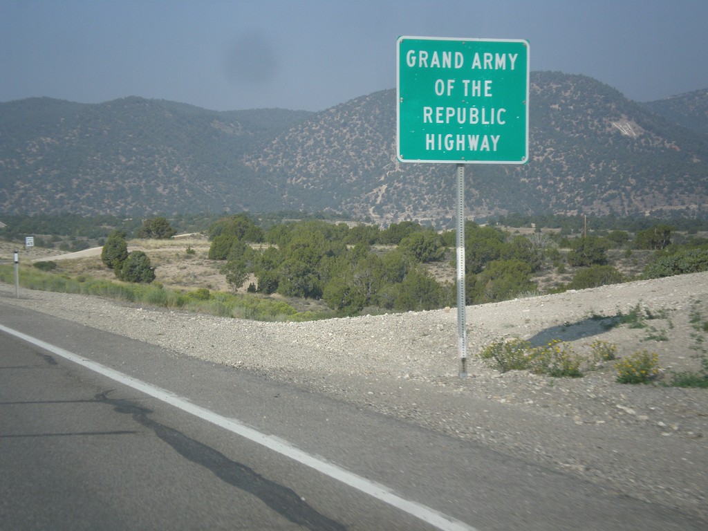
US-6 West - Grand Army of the Republic Highway
US-6 west - Grand Army of the Republic Highway.
Taken 08-31-2014
Ely
White Pine County
Nevada
United States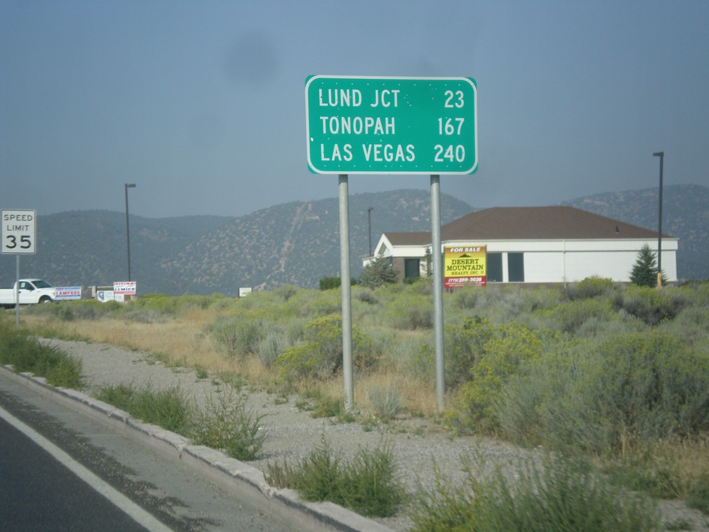
US-6 West - Distance Marker
Distance marker on US-6 west. Distance to Lund Jct., Tonopah, and Las Vegas (via NV-318).
Taken 08-31-2014
Ely
White Pine County
Nevada
United States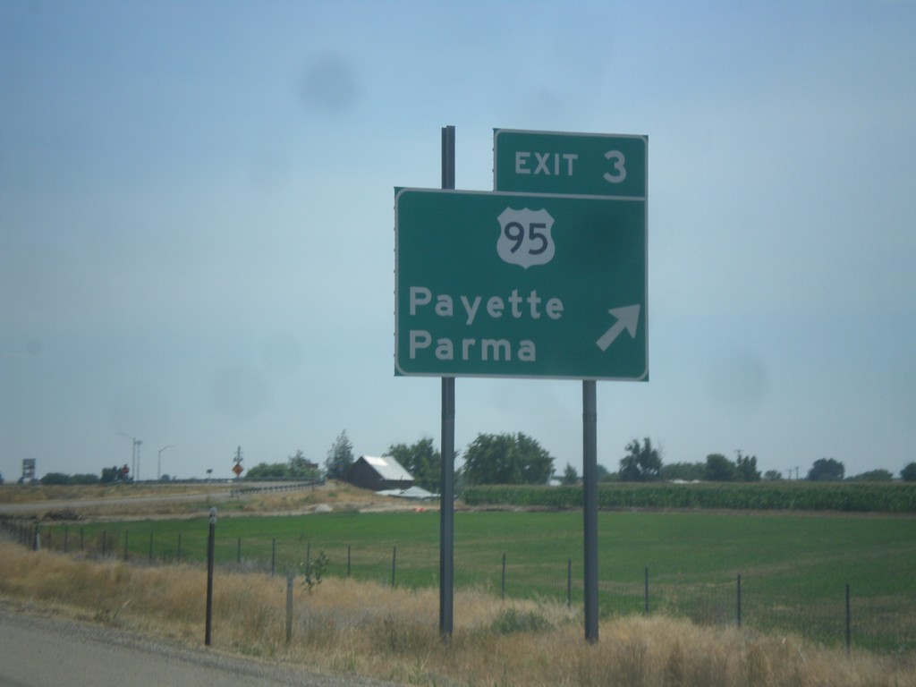
I-84 East - Exit 3
I-84 east at Exit 3 - US-95/Payette/Parma. First Idaho exit.
Taken 07-27-2014

 Fruitland
Payette County
Idaho
United States
Fruitland
Payette County
Idaho
United States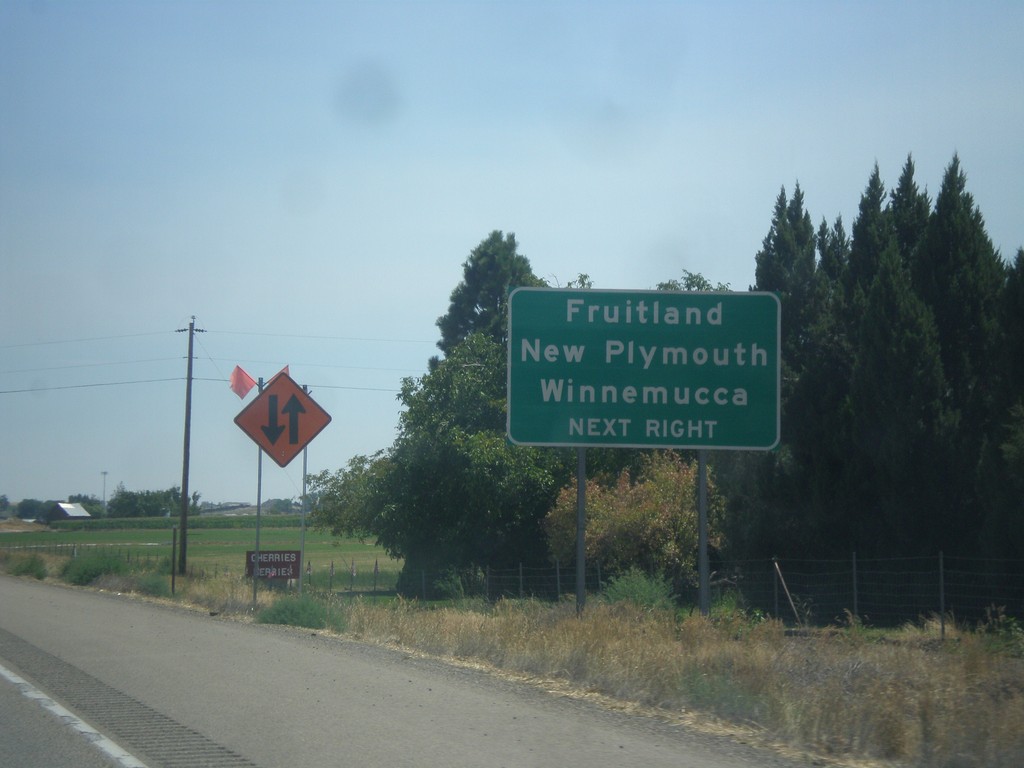
I-84 East Approaching Exit 3
I-84 east approaching Exit 3. Use Exit 3 for Fruitland, New Plymouth, and Winnemucca (Nevada).
Taken 07-27-2014
Fruitland
Payette County
Idaho
United States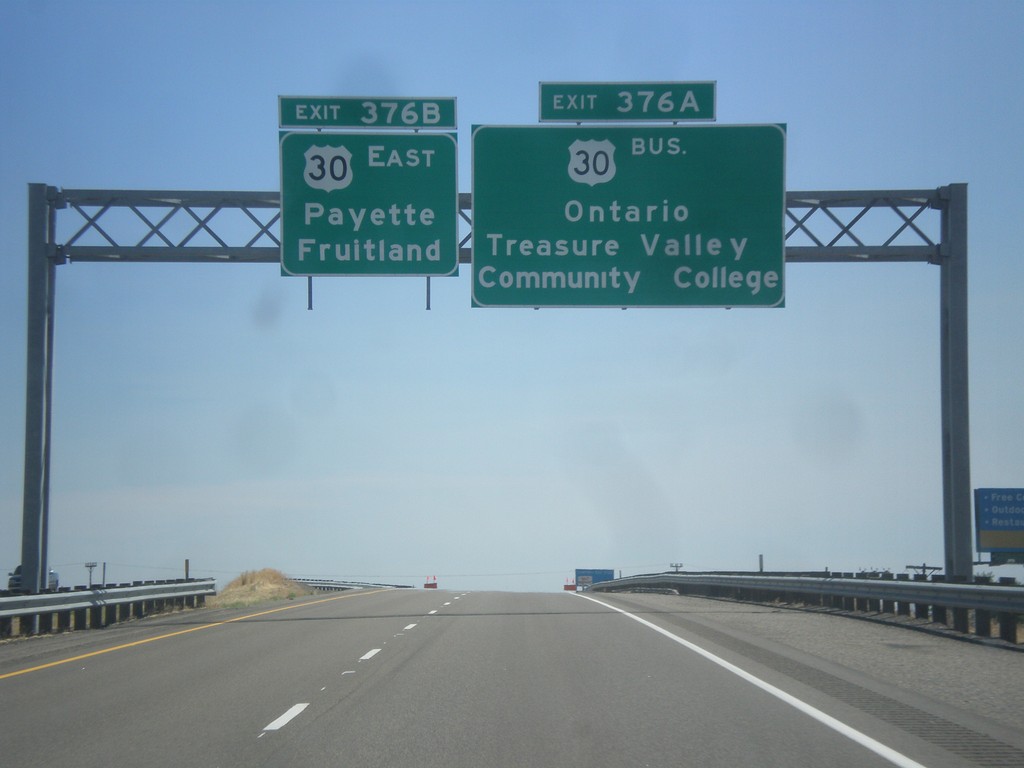
I-84 East - Exits 376A and B
I-84 east approaching Exit 376A - Bus. US-30/Ontario/Treasure Valley Community College. Approaching Exit 376B - US-30 East/Fruitland/Payette. Both Fruitland and Payette are in Idaho.
Taken 07-27-2014

 Ontario
Malheur County
Oregon
United States
Ontario
Malheur County
Oregon
United States