Signs Tagged With Big Green Sign
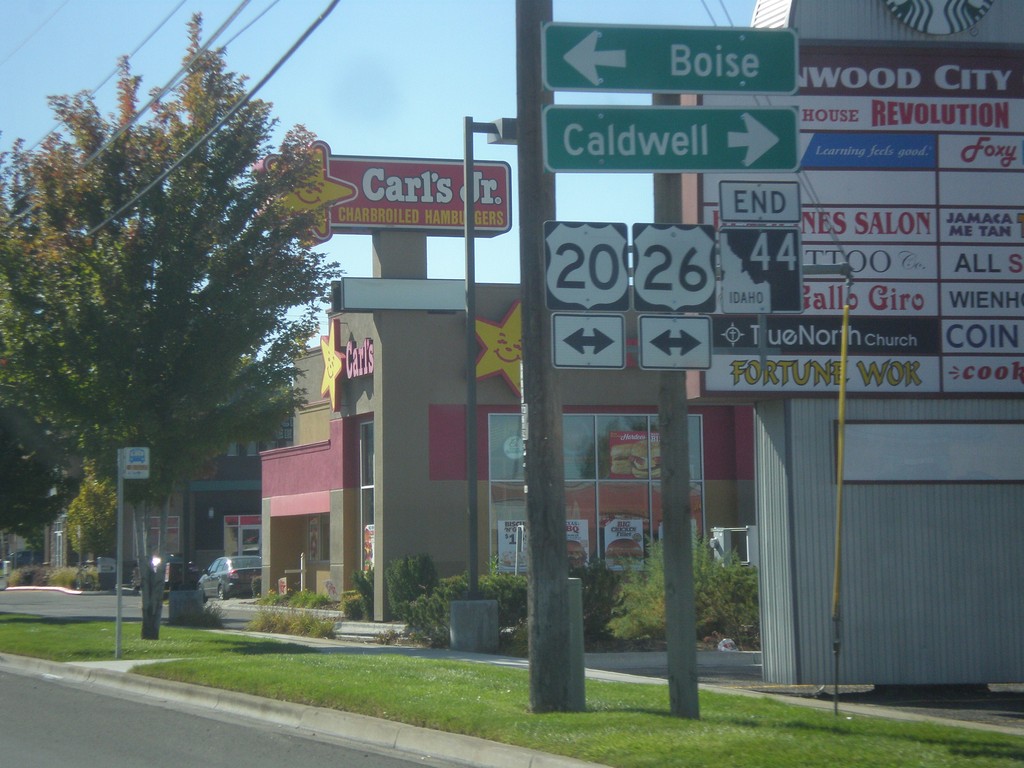
End ID-44 South at US-20/US-26
End ID-44 south (Glenwood St.) at US-20/US-26 (Chinden Blvd.). Turn right for US-20/US-26 west to Caldwell; left to Boise.
Taken 10-05-2014


 Garden City
Ada County
Idaho
United States
Garden City
Ada County
Idaho
United States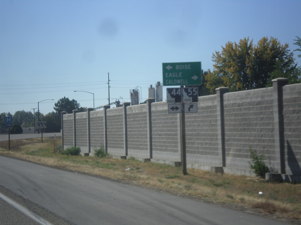
ID-55 South at ID-44
ID-55 south at ID-44. Use ID-44 west for Boise; use ID-44 East/ID-55 South for Eagle and Caldwell.
Taken 10-05-2014
 Eagle
Ada County
Idaho
United States
Eagle
Ada County
Idaho
United States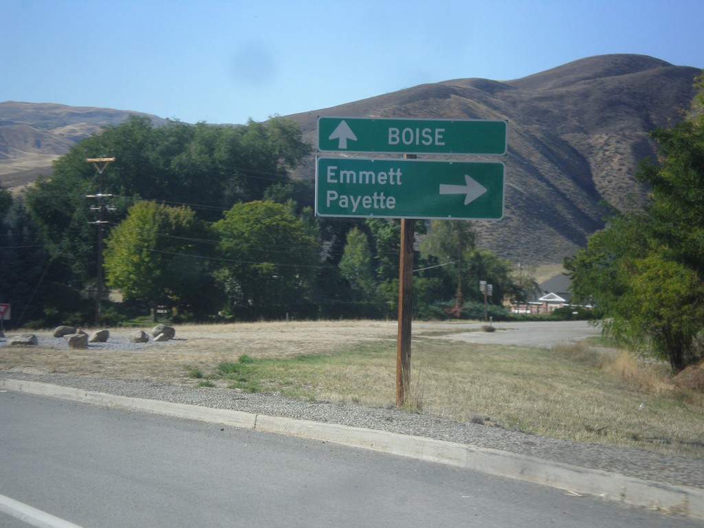
ID-55 South at ID-52
ID-55 south at ID-52 west to Emmett and Payette. Continue south on ID-55 for Boise.
Taken 10-05-2014
 Horseshoe Bend
Boise County
Idaho
United States
Horseshoe Bend
Boise County
Idaho
United States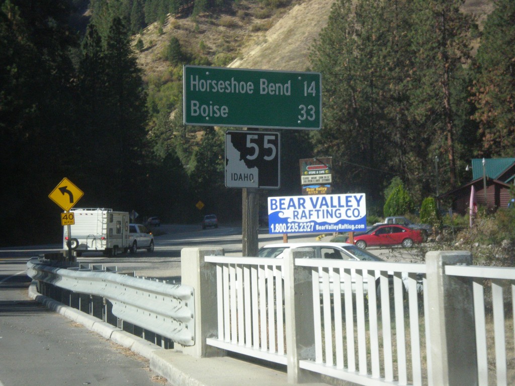
ID-55 South - Distance Marker
Distance marker on ID-55 south. Distance to Horseshoe Bend and Boise.
Taken 10-05-2014
Banks
Boise County
Idaho
United States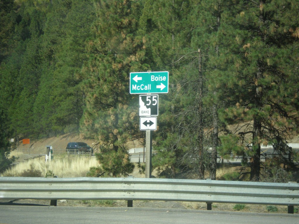
End Banks-Lowman Highway at ID-55
End Banks-Lowman Highway at ID-55. Use ID-55 north for McCall; ID-55 south for Boise.
Taken 10-05-2014
Banks
Boise County
Idaho
United States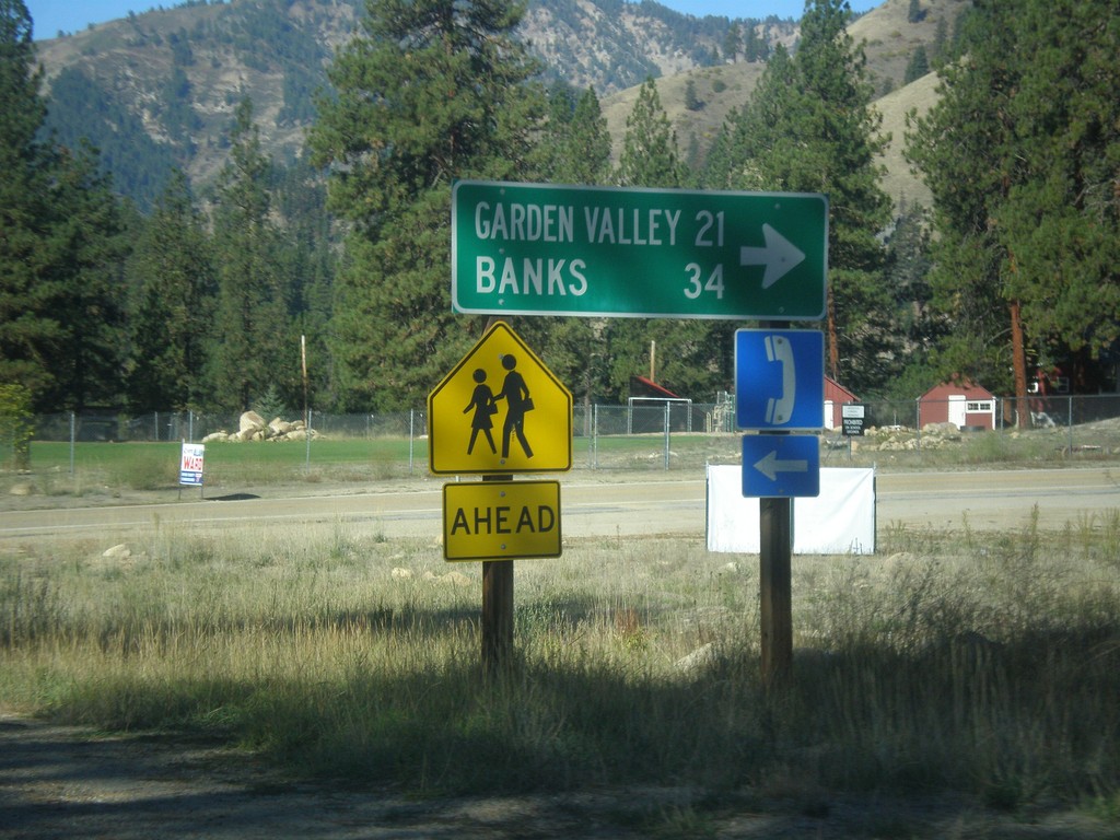
ID-21 South - Banks-Lowman Highway Jct.
ID-21 South at Banks-Lowman Highway Jct. Use the Banks-Lowman Highway for Garden Valley and Banks.
Taken 10-05-2014
 Lowman
Boise County
Idaho
United States
Lowman
Boise County
Idaho
United States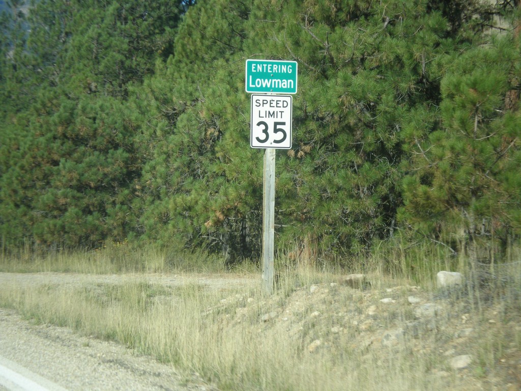
ID-21 South - Entering Lowman
Entering Lowman on ID-21 south.
Taken 10-05-2014
Lowman
Boise County
Idaho
United States
ID-21 South - Grandjean Jct.
ID-21 south at Grandjean Jct.
Taken 10-05-2014
Lowman
Boise County
Idaho
United States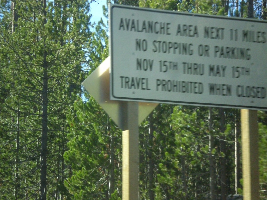
ID-21 South - Avalanche Area
Entering Avalanche Zone on ID-21 south. This area south of Banner Summit has frequent avalanches in the winter, which causes road closures.
Taken 10-05-2014
Lowman
Boise County
Idaho
United States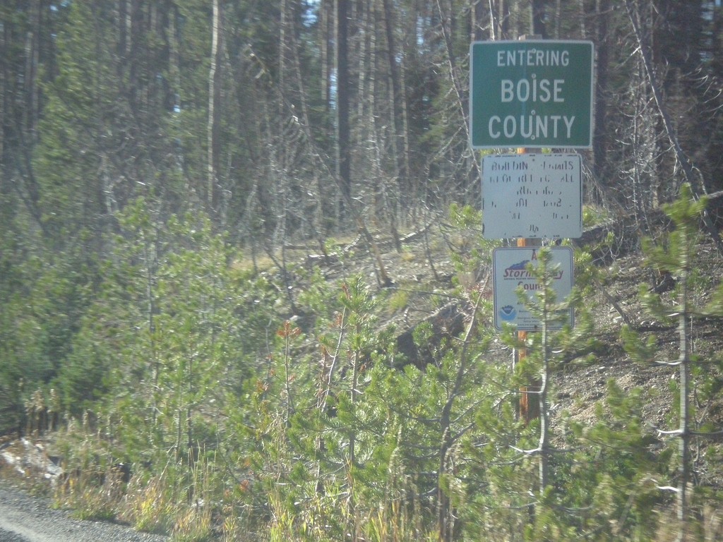
ID-21 - Entering Boise County
Entering Boise County along ID-21 south. The Boise-Custer County Line is located on Banner Summit - Elevation 7037 Feet.
Taken 10-05-2014
Lowman
Boise County
Idaho
United States