Signs Tagged With Big Green Sign
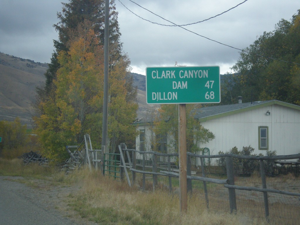
ID-29 East - Distance Marker
Distance marker on ID-29 east. Distance to Clark Canyon Dam (I-15 Jct. in Montana) and Dillon (Montana).
Taken 10-03-2015
 Leadore
Lemhi County
Idaho
United States
Leadore
Lemhi County
Idaho
United States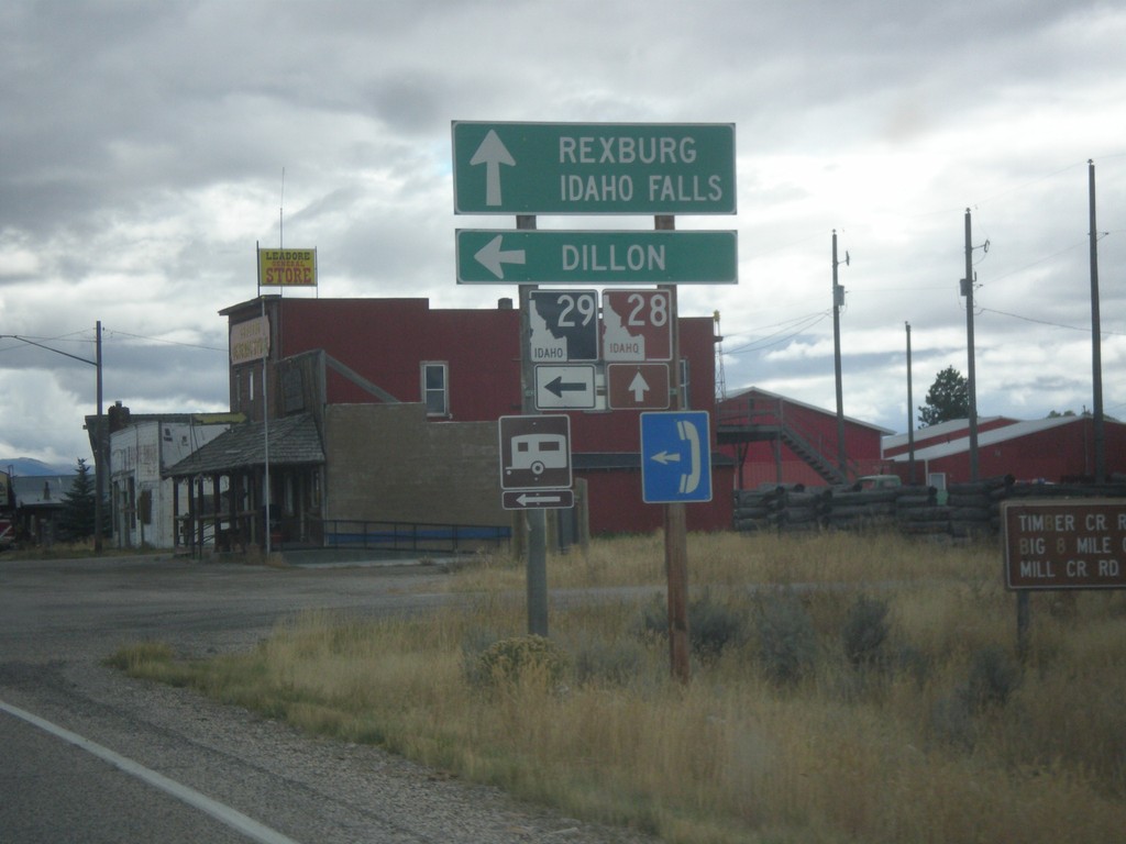
ID-28 South at ID-29
ID-28 south at ID-29 east to Dillon (Montana). Continue south on ID-28 for Rexburg and Idaho Falls.
Taken 10-03-2015
 Leadore
Lemhi County
Idaho
United States
Leadore
Lemhi County
Idaho
United States
ID-28 South - Leadore
Entering Leadore - Population 105 on ID-28 south.
Taken 10-03-2015
Leadore
Lemhi County
Idaho
United States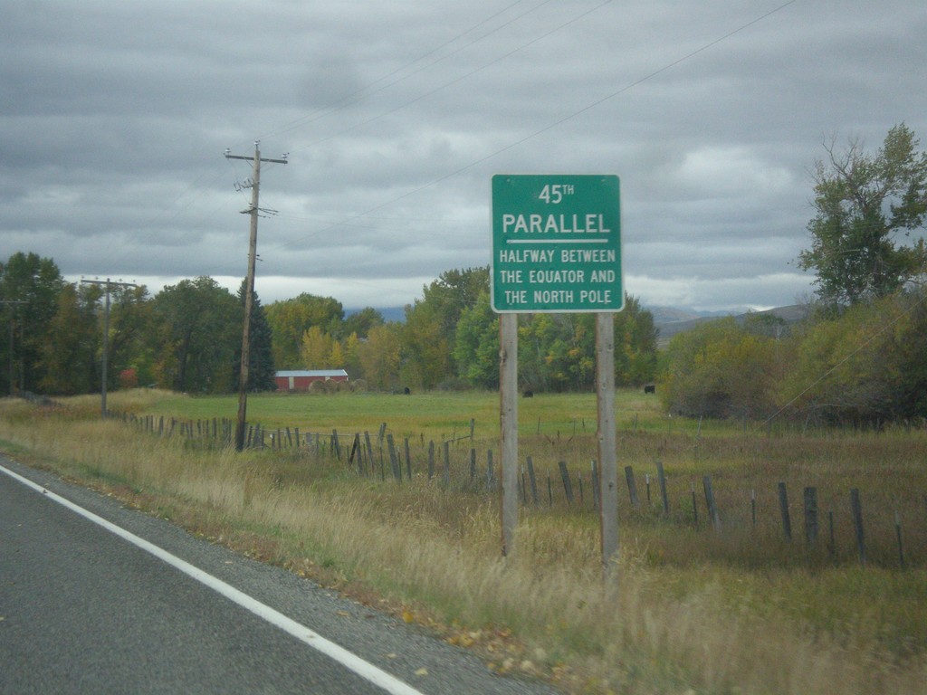
ID-28 South - 45th Parallel
ID-28 South - 45th Parallel - Halfway Between The Equator and North Pole.
Taken 10-03-2015
Tendoy
Lemhi County
Idaho
United States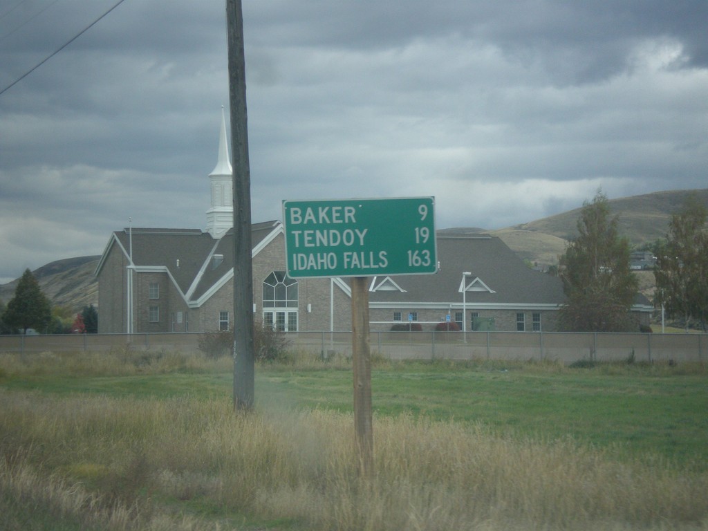
ID-28 South - Distance Marker
Distance marker on ID-28 south in Salmon. Distance to Baker, Tendoy, and Idaho Falls.
Taken 10-03-2015
Salmon
Lemhi County
Idaho
United States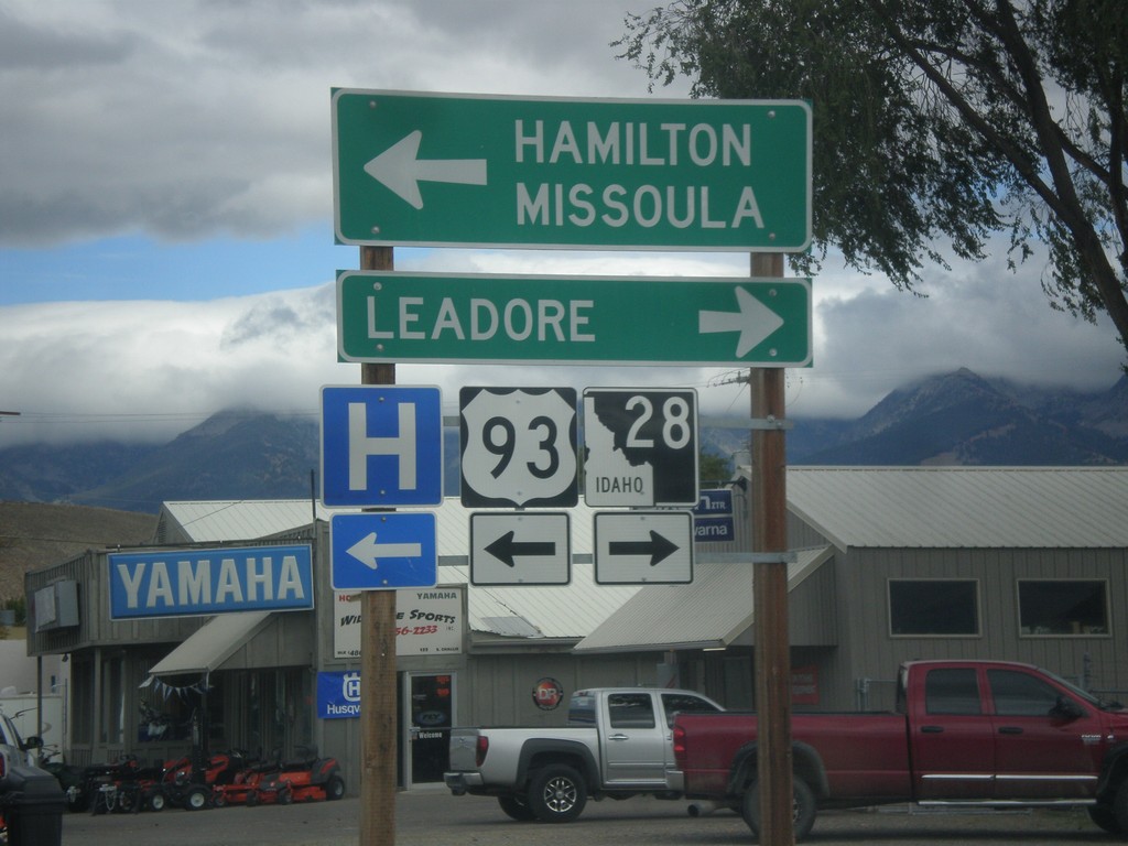
US-93 North at ID-28
US-93 North at ID-28 south to Leadore. Turn left to continue north on US-93 to Hamilton (MT) and Missoula (MT).
Taken 10-03-2015
 Salmon
Lemhi County
Idaho
United States
Salmon
Lemhi County
Idaho
United States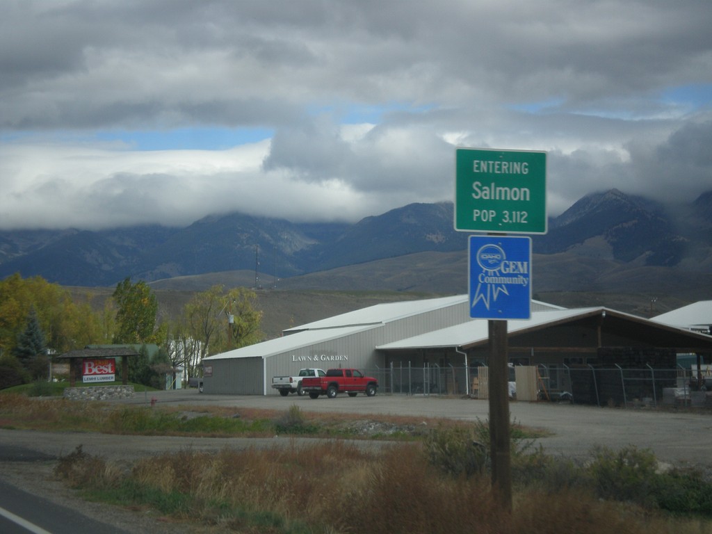
US-93 North - Entering Salmon
Entering Salmon - Population 3,112 on US-93 north. Salmon is the county seat of Lemhi County.
Taken 10-03-2015
Salmon
Lemhi County
Idaho
United States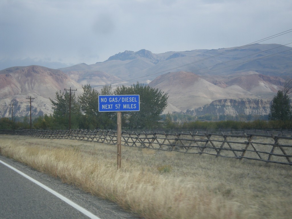
US-93 North - No Gas Next 57 Miles
US-93 North - No Gas/Diesel Next 57 Miles (in Salmon). Taken on the north end of Challis.
Taken 10-03-2015
Challis
Custer County
Idaho
United States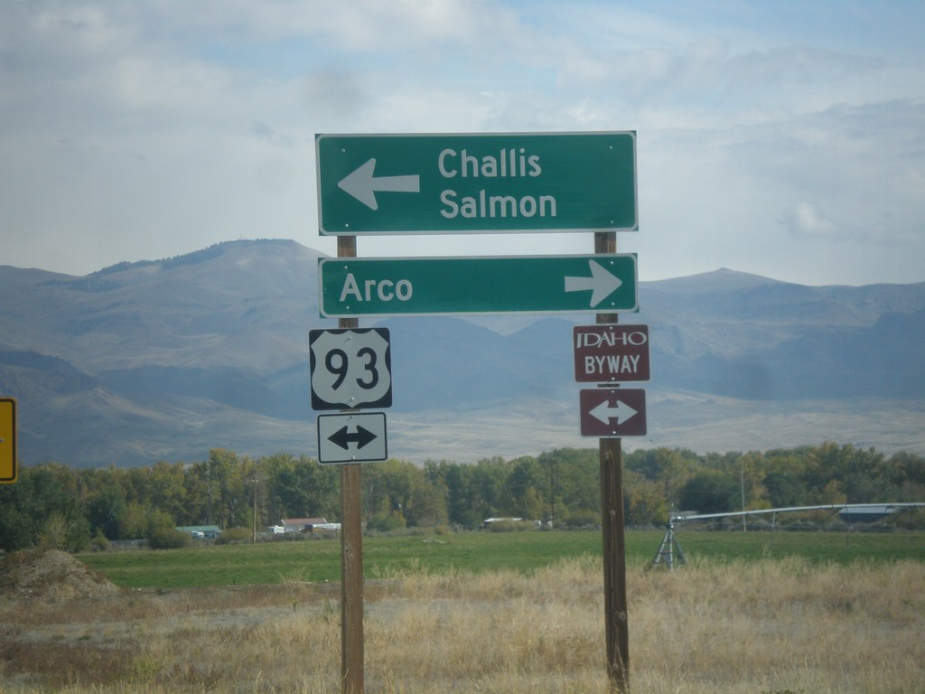
End ID-75 North at US-93
End ID-75 at US-93. Turn left for US-93 north to Challis and Salmon. Turn right for US-93 south to Arco. US-93 north is part of the Salmon River Scenic Byway; US-93 south is part of the Peaks to Craters Scenic Byway.
Taken 10-03-2015
 Challis
Custer County
Idaho
United States
Challis
Custer County
Idaho
United States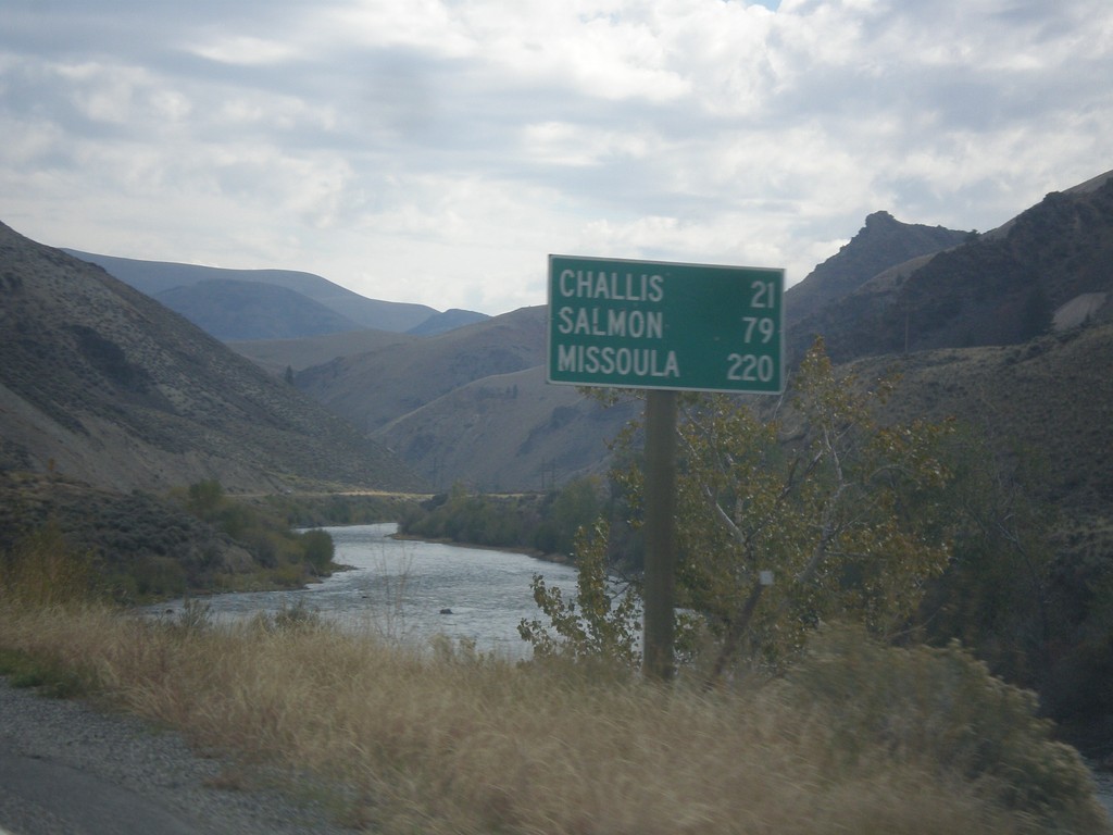
ID-75 North - Distance Marker
Distance marker on ID-75 north. Distance to Challis, Salmon, and Missoula (Montana). The Salmon River is in the background.
Taken 10-03-2015
Clayton
Custer County
Idaho
United States