Signs Tagged With Big Green Sign
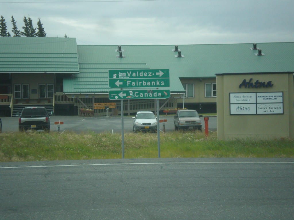
AK-1 North at AK-4 - Glenallen
AK-1 North (Glenn HIghway) at AK-4 (Richardson Highway) in Glenallen. Use AK-4 south for Valdez; AK-4 North/AK-1 North for Fairbanks and Canada (via AK-2 - Alaska Highway).
Taken 07-22-2016

 Glennallen
Copper River Census Area
Alaska
United States
Glennallen
Copper River Census Area
Alaska
United States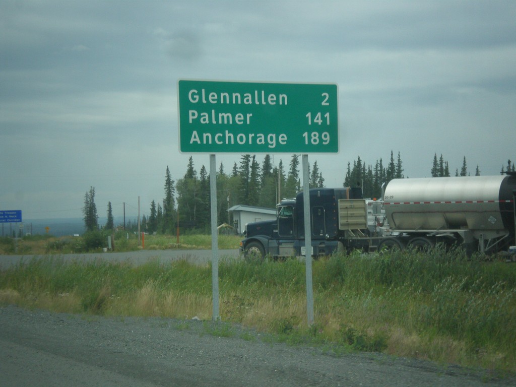
AK-1 South - Distance Marker
Distance marker on AK-1 south. Distance to Glenallen, Palmer, and Anchorage.
Taken 07-22-2016
Glennallen
Copper River Census Area
Alaska
United States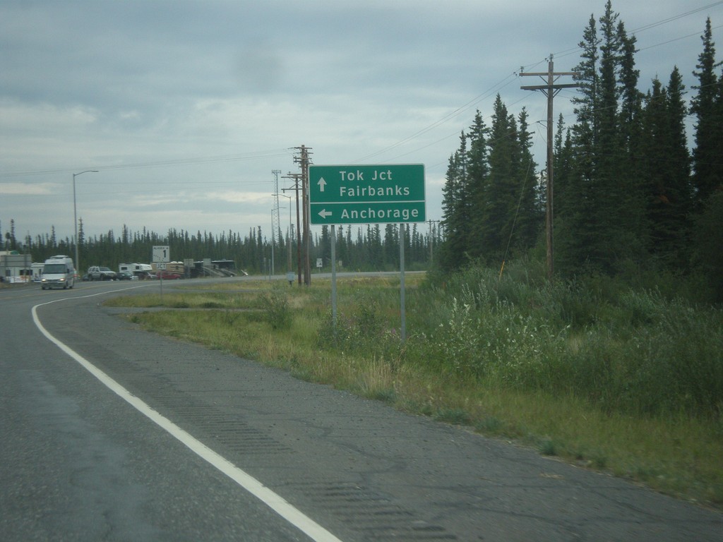
AK-4 North Approaching AK-1
AK-4 North (Richardson Highway) approaching AK-1 (Glenn Highway). AK-1 joins AK-4 northhbound to Gakona Junction. Use AK-1 south to Anchorage; use AK-1 North/AK-4 North to Tok Jct. and Fairbanks.
Taken 07-22-2016
Glennallen
Copper River Census Area
Alaska
United States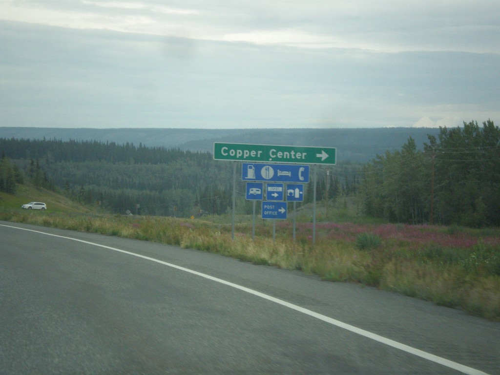
AK-4 North - Copper Center Jct.
AK-4 north at Copper Center Jct. This is the south end of the loop into the community of Copper Center.
Taken 07-22-2016
Copper Center
Copper River Census Area
Alaska
United States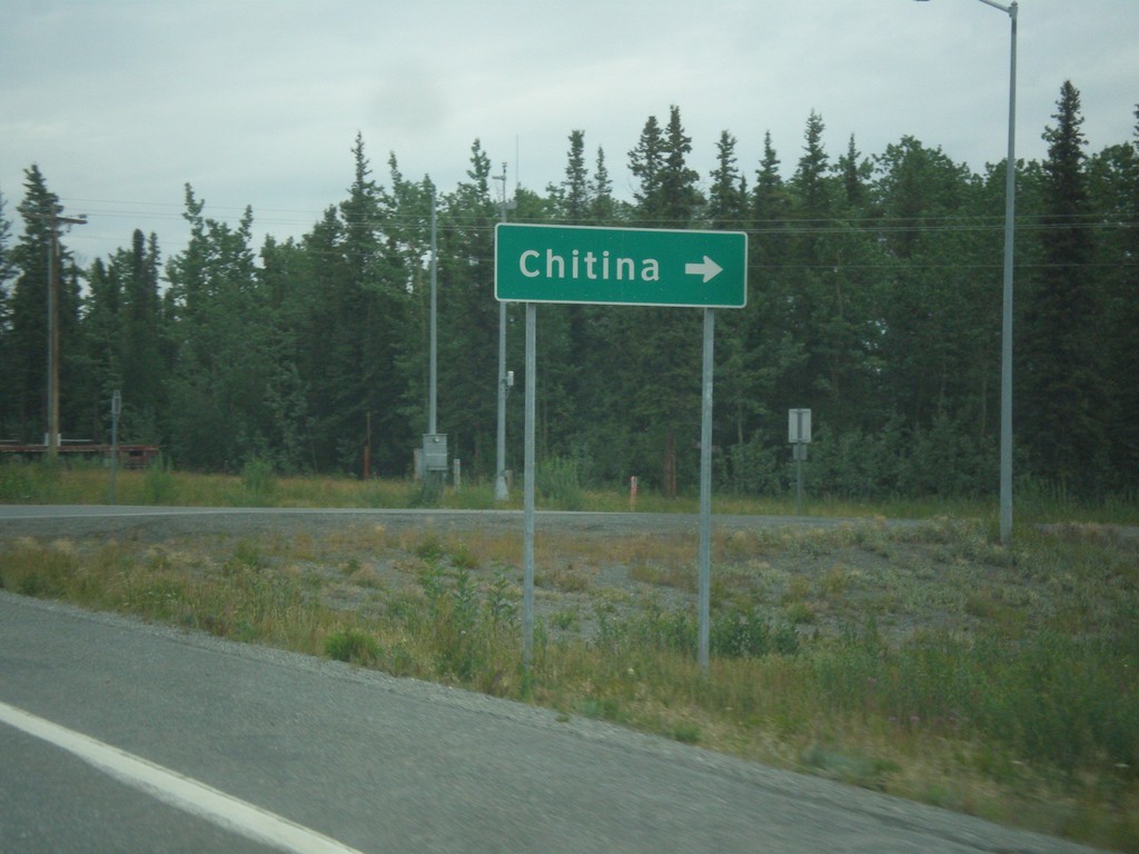
AK-4 North at AK-10 East
AK-4 North (Richardson Highway) at AK-10 East (Edgerton Highway) to Chitina.
Taken 07-22-2016
 Copper Center
Copper River Census Area
Alaska
United States
Copper Center
Copper River Census Area
Alaska
United States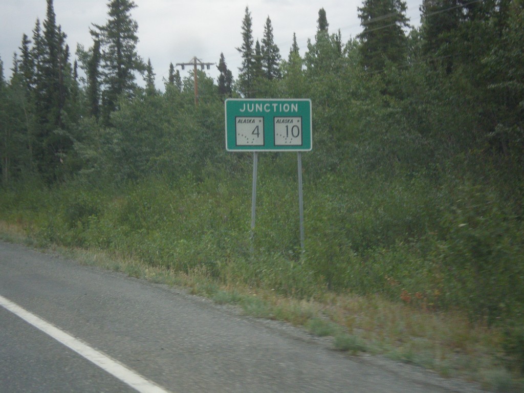
AK-4 North Approaching AK-10
AK-4 North (Richardson Highway) approaching AK-10 (Edgerton Highway).
Taken 07-22-2016
Copper Center
Copper River Census Area
Alaska
United States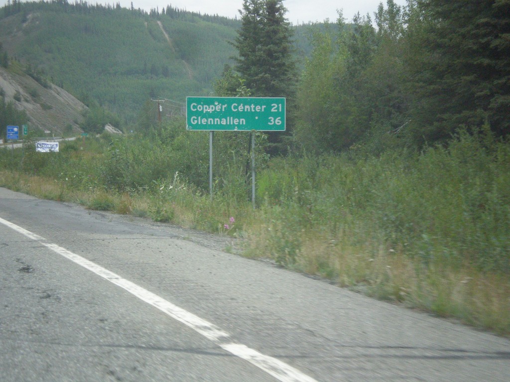
AK-4 North - Distance Marker
Distance marker on AK-4 north (Richardson Highway). Distance to Copper Center and Glenallen.
Taken 07-22-2016
Copper Center
Copper River Census Area
Alaska
United States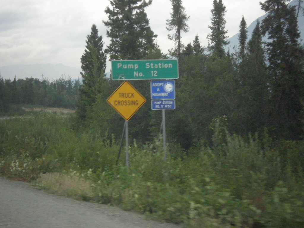
AK-4 North - Pump Station Number 12
AK-4 north (Richardson Highway) at Pump Station Number 12. This is a pump station for the Trans Alaska Pipeline.
Taken 07-22-2016
Copper Center
Copper River Census Area
Alaska
United States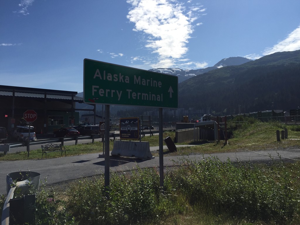
Portage Glacier Highway at Ferry Terminal
End Portage Glacier Highway at the Whittier Ferry Terminal for the Alaska Marine Highway system.
Taken 07-20-2016
Whittier Chugach Alaska United States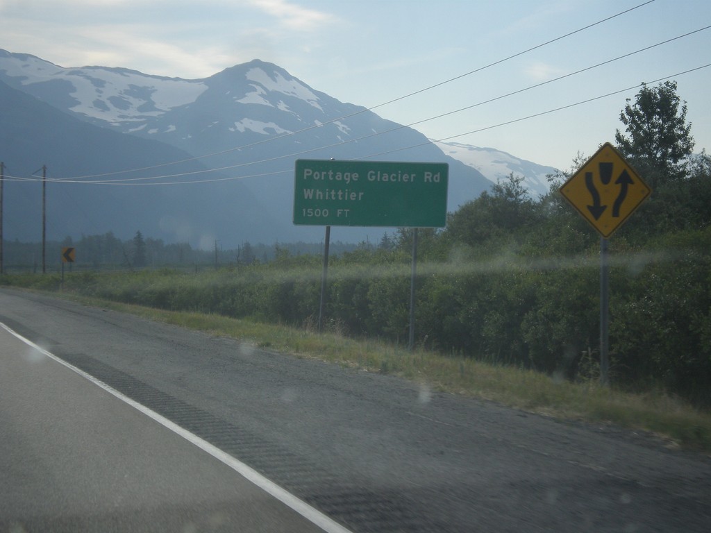
AK-1 North - Portage Glacier Jct.
AK-1 north (Seward Highway) approaching Portage Glacier Rd./Whittier Jct.
Taken 07-20-2016
Anchorage
Anchorage Municipality
Alaska
United States