Signs Tagged With Big Green Sign
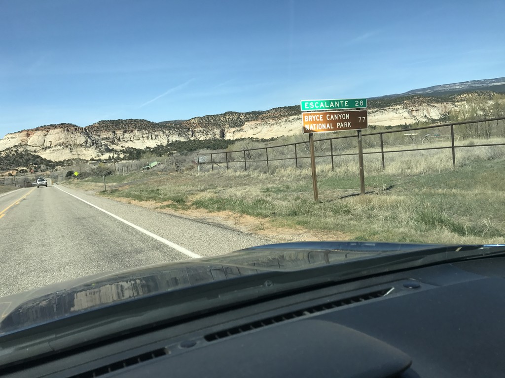
UT-12 West - Distance Marker
Distance marker on UT-12 west. Distance to Escalante, and Bryce Canyon National Park.
Taken 03-29-2017
 Boulder
Garfield County
Utah
United States
Boulder
Garfield County
Utah
United States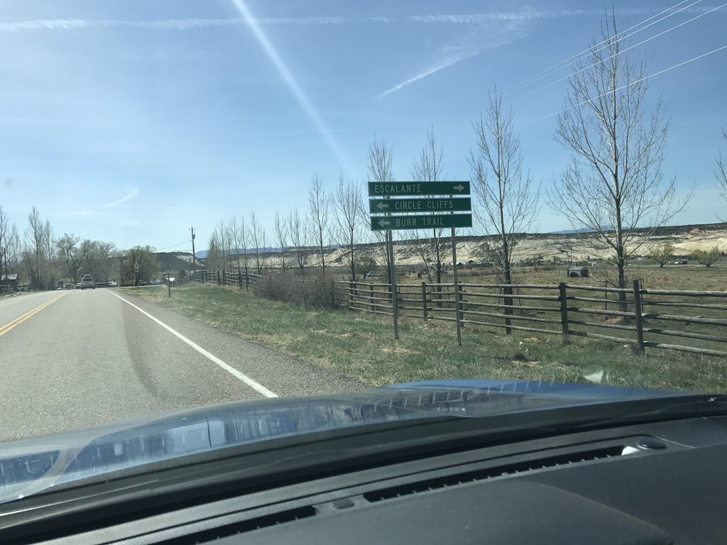
UT-12 West - Burr Trail Jct.
UT-12 West at Burr Trail Jct. Turn left for the Burr Trail to the Circle Cliffs. Turn right to continue west on UT-12.
Taken 03-29-2017
Boulder
Garfield County
Utah
United States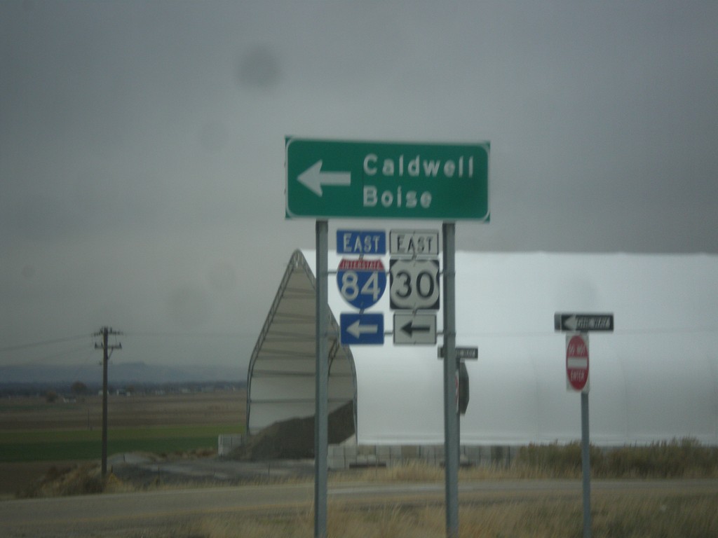
End ID-44 West at I-84 Onramp at Exit 25
End of ID-44 at I-84/US-30 junction to Caldwell and Boise.
Taken 11-19-2016


 Caldwell
Canyon County
Idaho
United States
Caldwell
Canyon County
Idaho
United States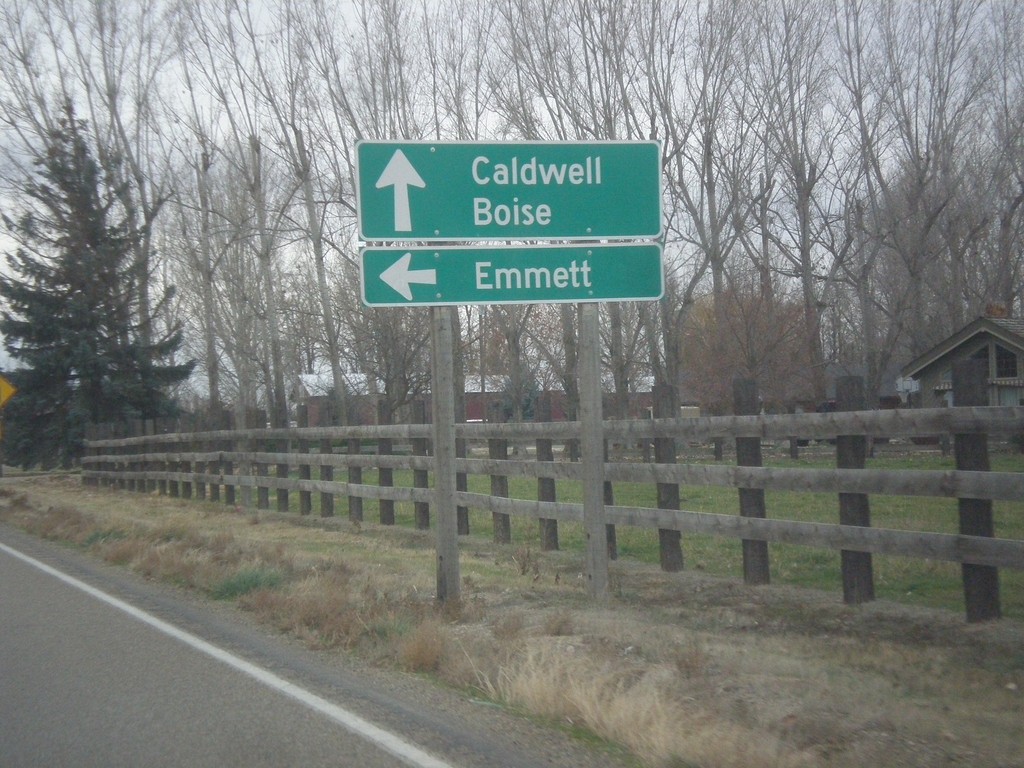
US-30 East at ID-72
US-30 East at ID-72 East to Emmett. Continue east on US-30 for Caldwell and Boise.
Taken 11-19-2016
New Plymouth
Payette County
Idaho
United States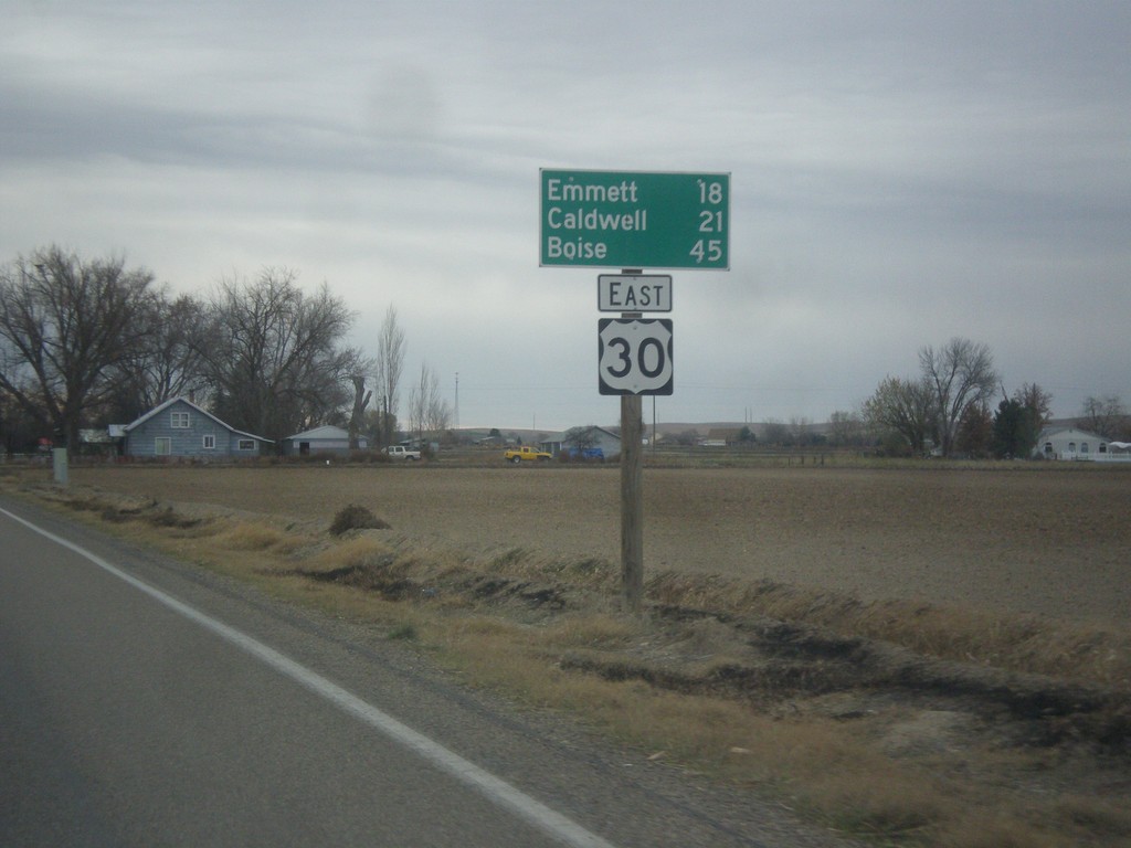
US-30 East - Distance Marker
Distance marker on US-30 east. Distance to Emmett (via ID-72), Caldwell, and Boise.
Taken 11-19-2016
New Plymouth
Payette County
Idaho
United States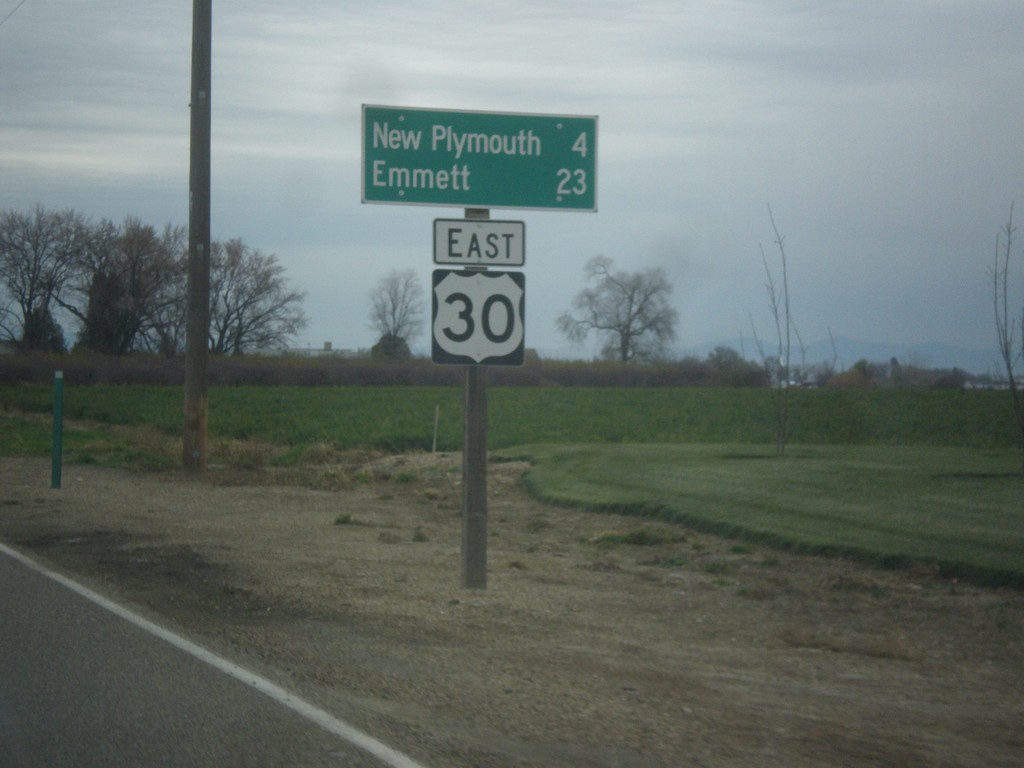
US-30 East - Distance Marker
Distance marker on US-30 east. Distance to New Plymouth and Emmett.
Taken 11-19-2016
Fruitland
Payette County
Idaho
United States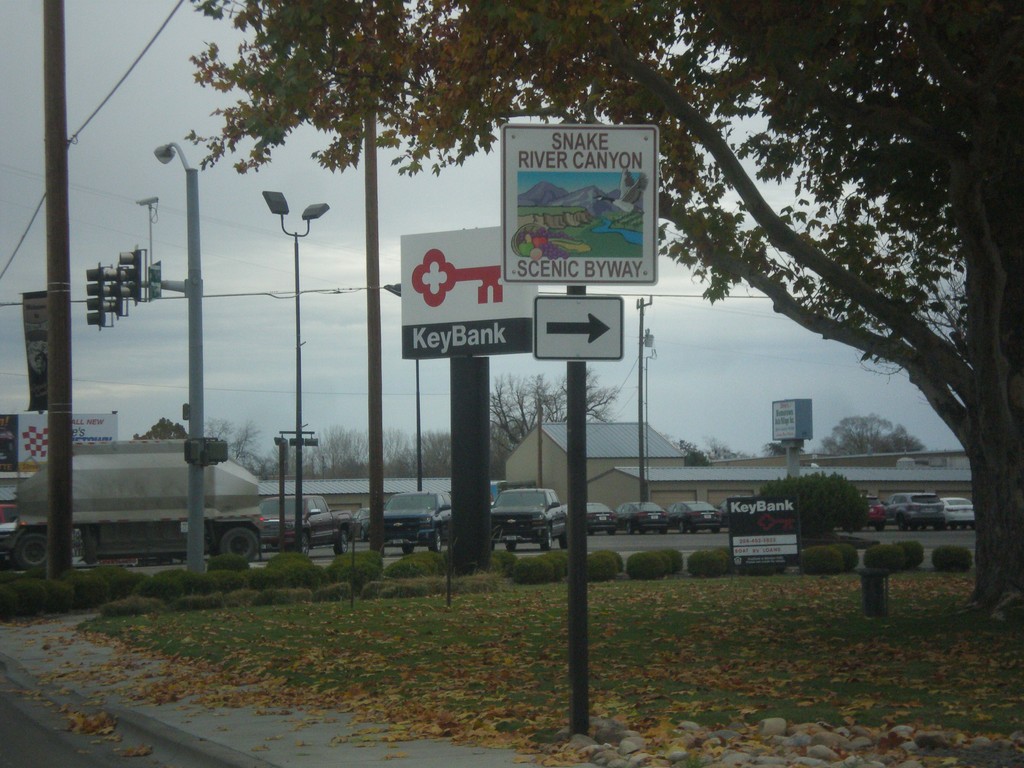
US-30 East Approaching US-95 - Snake River Canyon Scenic Byway
US-30 East approaching US-95. Turn right to continue on the Snake River Canyon Scenic Byway.
Taken 11-19-2016
 Fruitland
Payette County
Idaho
United States
Fruitland
Payette County
Idaho
United States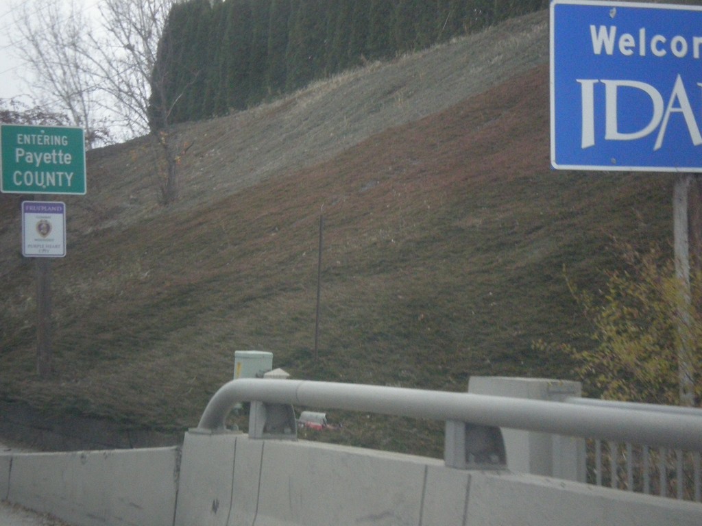
US-30 East - Entering Idaho
Welcome To Idaho on US-30 East. Entering Payette County.
Taken 11-19-2016
Fruitland
Payette County
Idaho
United States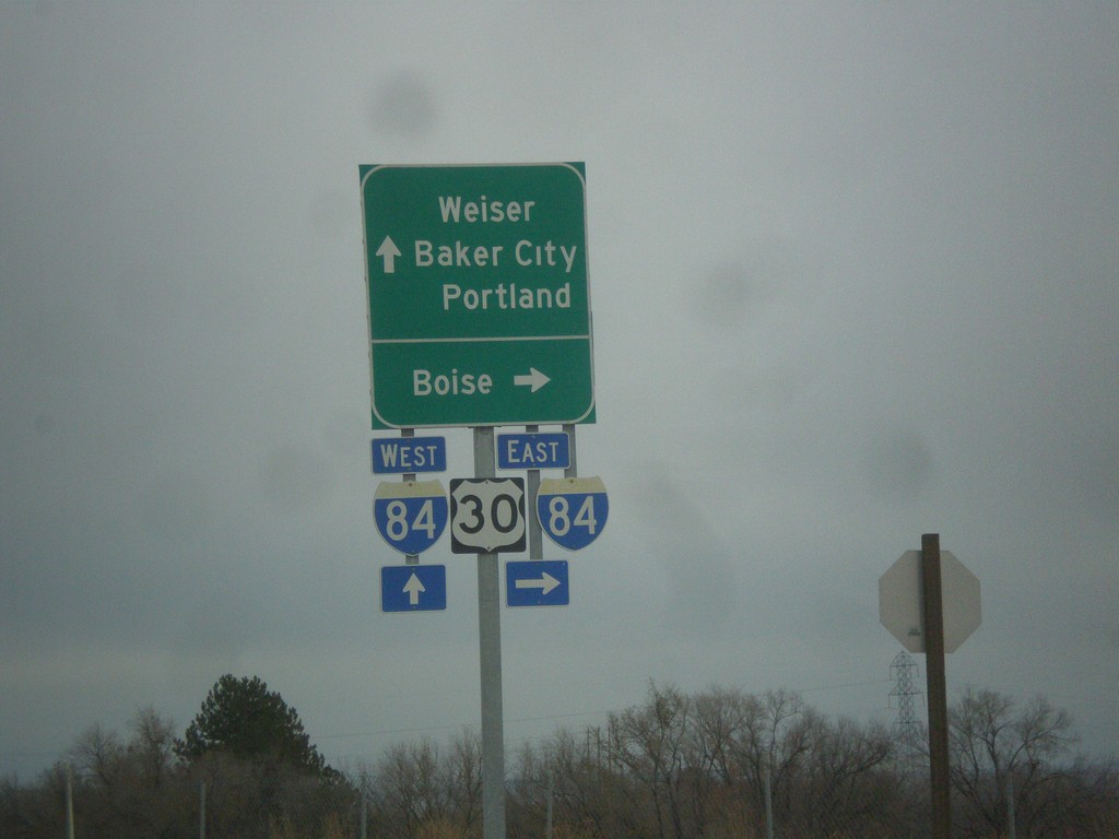
OR-201 North at I-84/US-30 (Exit 374)
OR-201 north at I-84/US-30 East to Boise (Idaho). Continue over the freeway for I-84/US-30 West to Baker City and Portland. Continue north on OR-201 for Weiser (Idaho).
Taken 11-19-2016


 Ontario
Malheur County
Oregon
United States
Ontario
Malheur County
Oregon
United States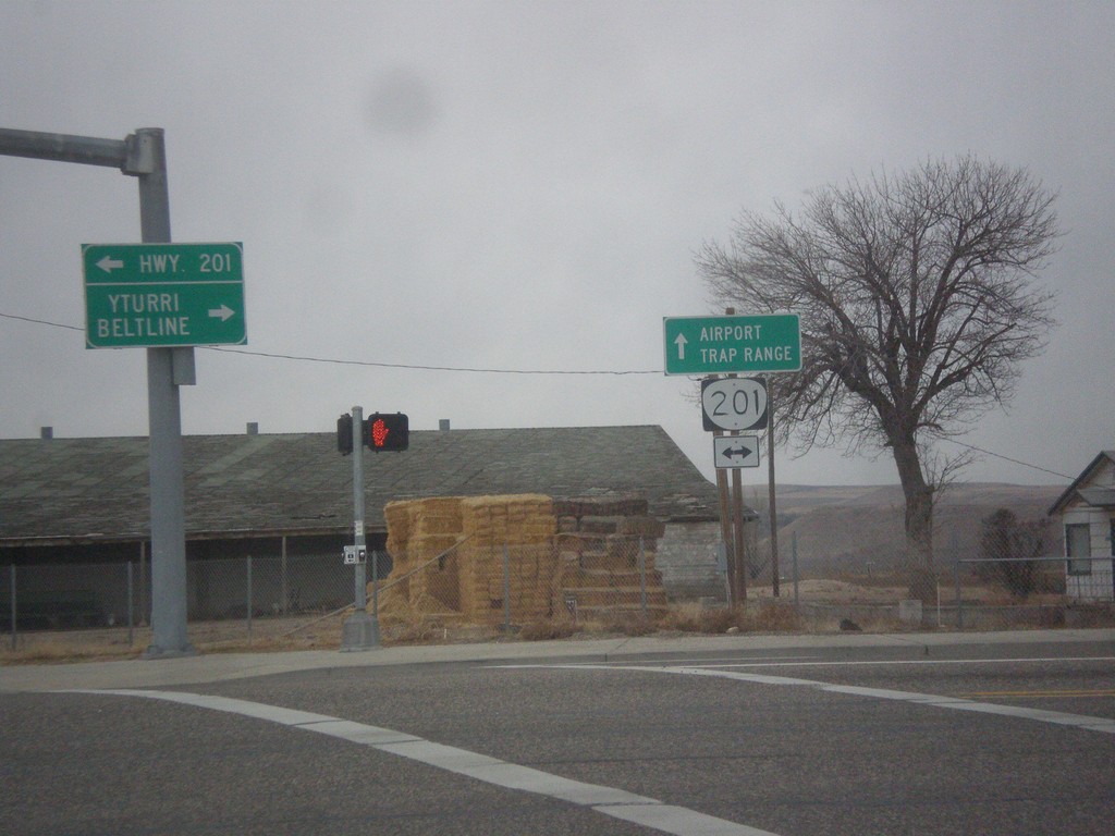
SW 4th Ave. West at OR-201
SW 4th Ave. West at OR-201. Continue straight on SW 4th Ave. for the Ontario Airport and Trap Range.
Taken 11-19-2016
Ontario
Malheur County
Oregon
United States