Signs Tagged With Big Green Sign
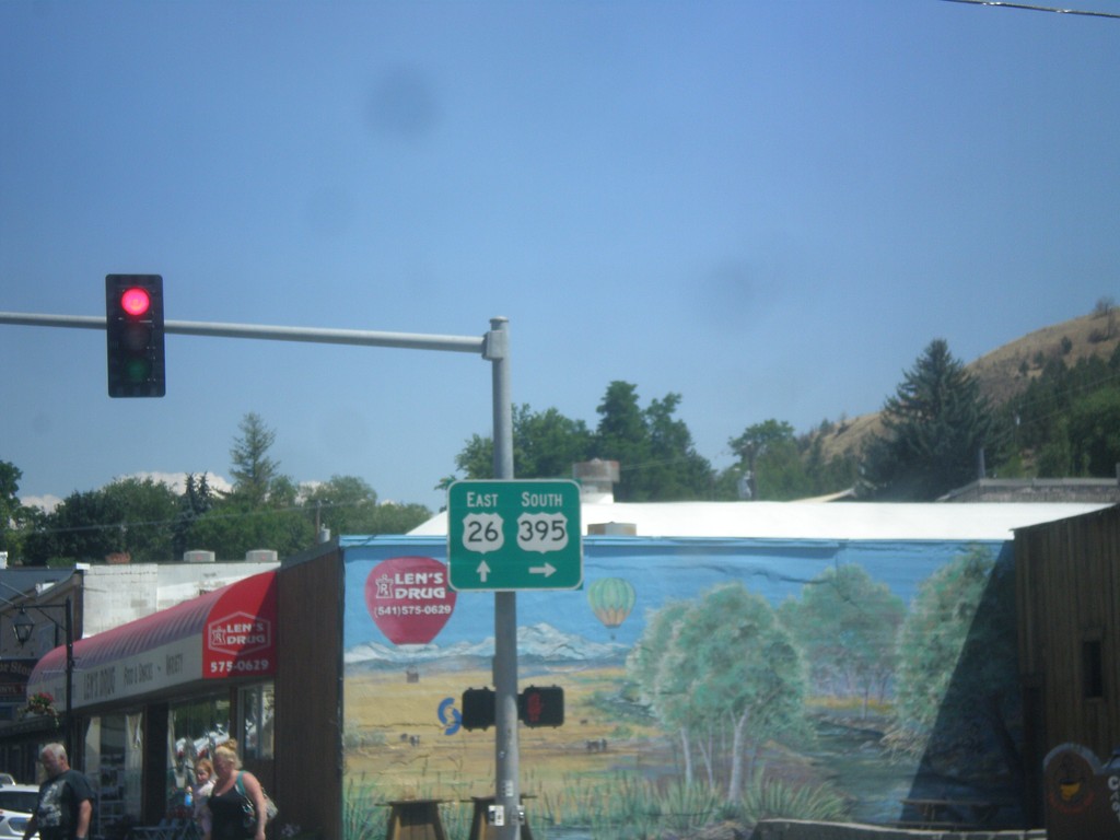
US-26 East/US-395 South Split - John Day
US-26 East/US-395 South Split in John Day. Turn right for US-395 south; continue straight for US-26 east. US-395 north joins US-26 westbound to Mount Vernon.
Taken 07-15-2017

 John Day
Grant County
Oregon
United States
John Day
Grant County
Oregon
United States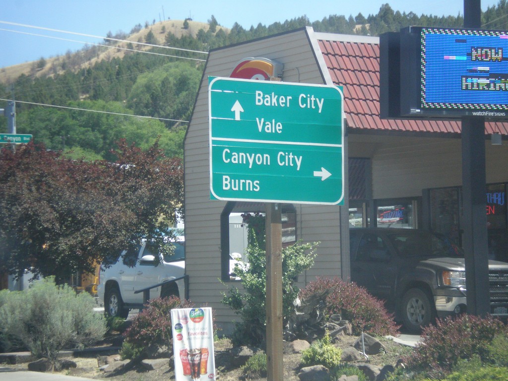
US-26 East/US-395 South Split - John Day
US-26 East/US-395 Split in John Day. Turn right for US-395 south to Canyon City and Burns. Continue east on US-26 for Baker City (via OR-7), and Vale.
Taken 07-15-2017
John Day
Grant County
Oregon
United States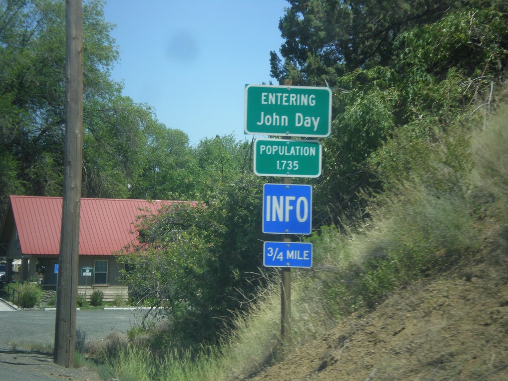
US-26 East - John Day
Entering John Day - Population 1735 on US-26 east.
Taken 07-15-2017
John Day
Grant County
Oregon
United States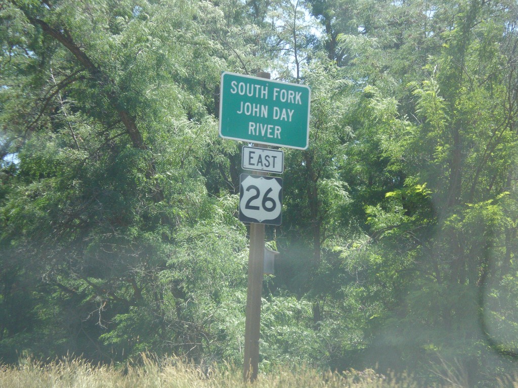
US-26 East - South Fork John Day River
US-26 East at the South Fork John Day River bridge.
Taken 07-15-2017
Dayville
Grant County
Oregon
United States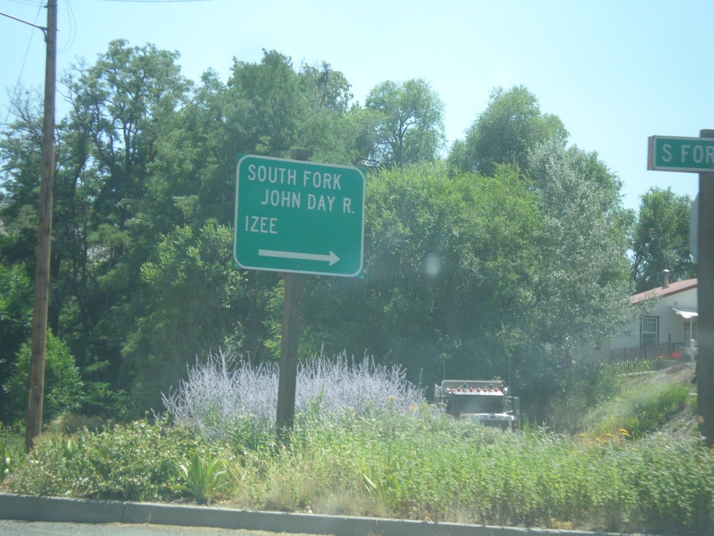
US-26 East - South Fork Road
US-26 East at South Fork (John Day River) Road in Dayville. Turn right for the South Fork John Day River and Izee.
Taken 07-15-2017
Dayville
Grant County
Oregon
United States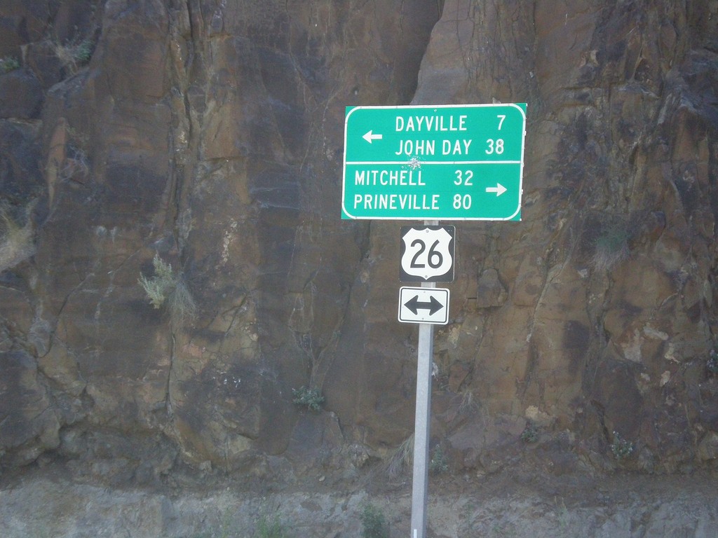
End OR-19 South at US-26
End OR-19 South at US-26 in Grant County. Turn right for US-26 West to Mitchell and Prineville (Ochoco Highway); turn left for US-26 East to Dayville and John Day (John Day Highway).
Taken 07-15-2017
 Dayville
Grant County
Oregon
United States
Dayville
Grant County
Oregon
United States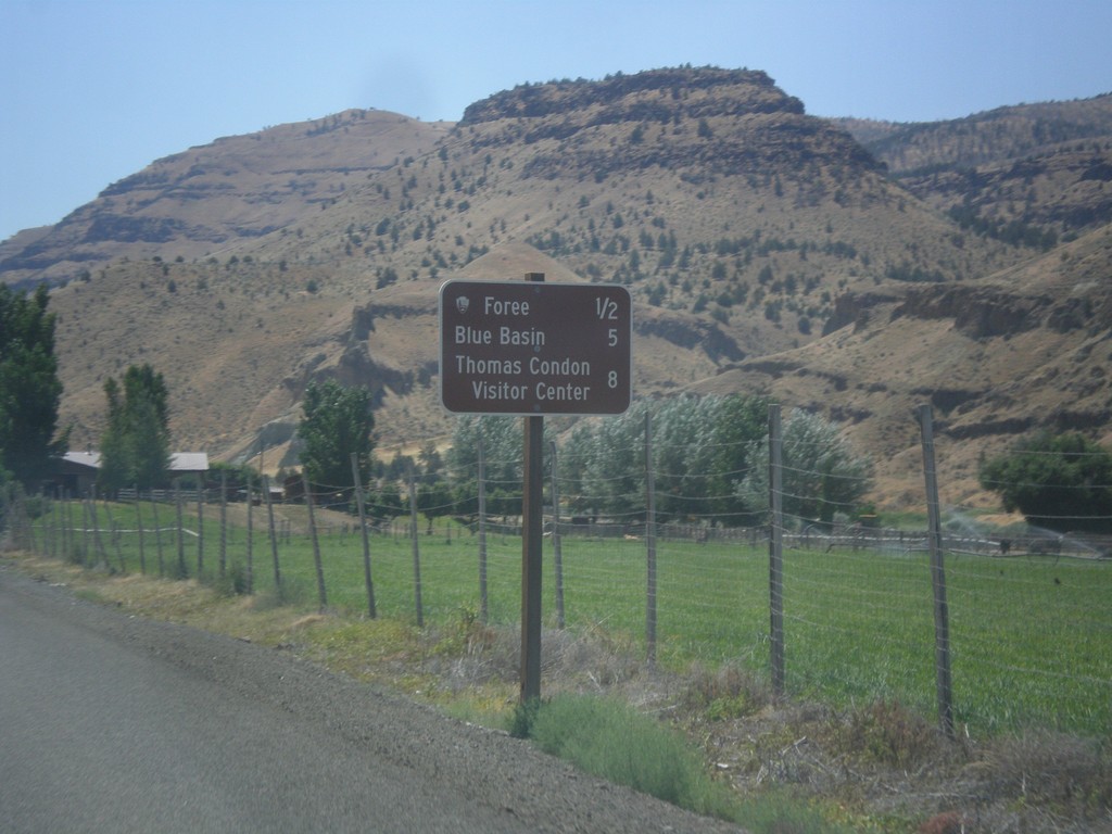
OR-19 South - John Day Fossil Beds NM Distance Marker
Distance Marker to sites in John Day Fossil Beds National Monument on OR-19 South - Foree, Blue Basin, and Thomas Condon Visitors Center.
Taken 07-15-2017
John Day
Grant County
Oregon
United States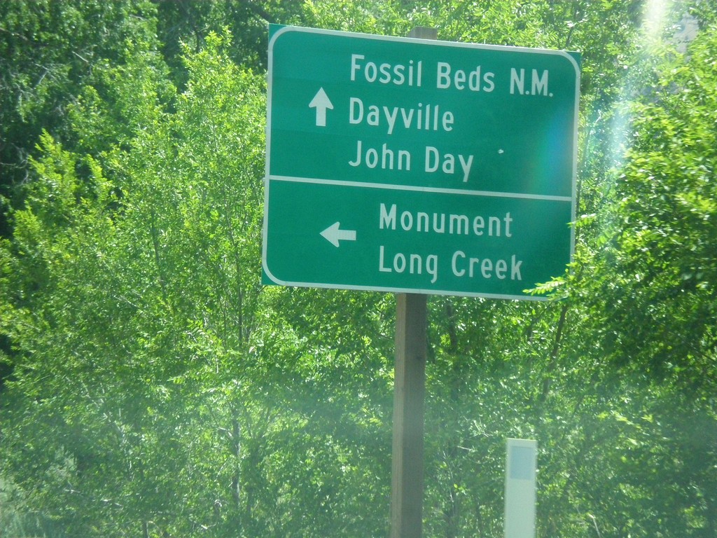
OR-19 South at OR-402 Junction
OR-19 South at OR-402 east to Monument and Long Creek. Continue south on OR-19 for (John Day) Fossil Beds National Monument, Dayville, and John Day.
Taken 07-15-2017
 Kimberly
Grant County
Oregon
United States
Kimberly
Grant County
Oregon
United States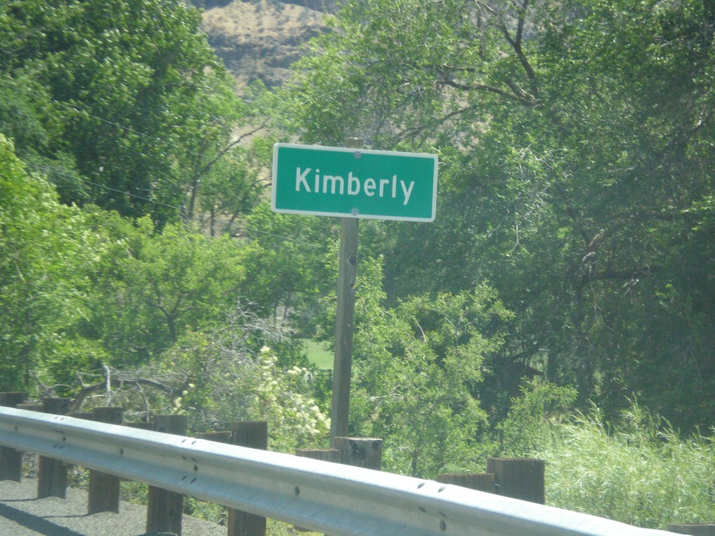
OR-19 South - Kimberly
Entering Kimberly on OR-19 south.
Taken 07-15-2017
Kimberly
Grant County
Oregon
United States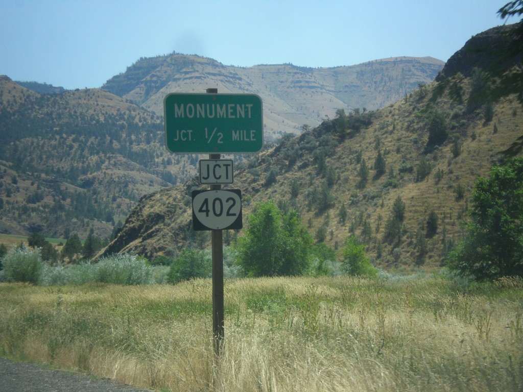
OR-19 South Approaching OR-402
OR-19 South approaching OR-402 to Monument.
Taken 07-15-2017
Kimberly
Grant County
Oregon
United States