Signs Tagged With Big Green Sign
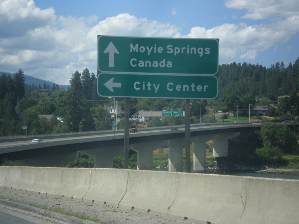
US-95 North/US-2 East at Bus. US-95 Jct.
US-95 North/US-2 East at Bus. US-95 Jct. to (Bonners Ferry) City Center. Continue ahead for Moyie Springs (via US-2) and Canada (via US-95). The Kootenai River bridge is in the background of the photo.
Taken 07-23-2017


 Bonners Ferry
Boundary County
Idaho
United States
Bonners Ferry
Boundary County
Idaho
United States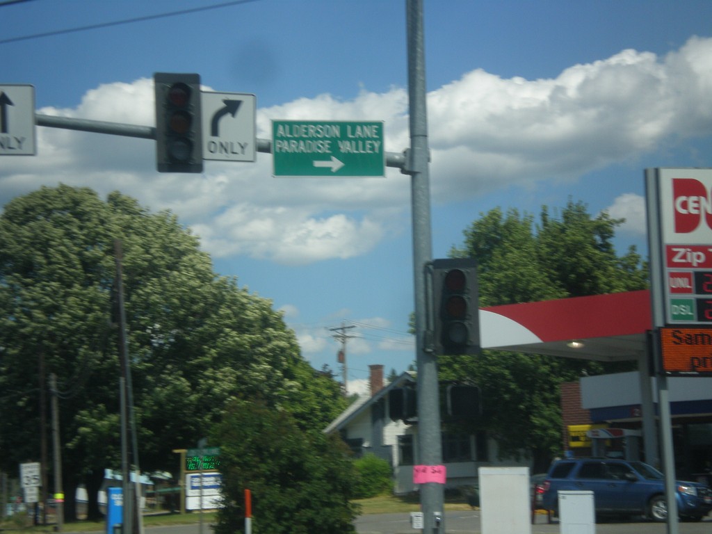
US-95 North/US-2 East - Alderson Ln
US-95 North/US-2 East at Alderson Ln. Turn right for Alderson Lake and Paradise Valley.
Taken 07-23-2017
Bonners Ferry
Boundary County
Idaho
United States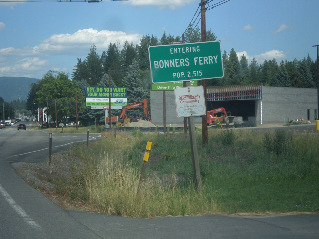
US-95 North/US-2 East - Bonners Ferry
Entering Bonners Ferry on US-95 North/US-2 East. Bonners Ferry is the county seat of Boundary County, Idaho which is the northernmost county in Idaho.
Taken 07-23-2017
Bonners Ferry
Boundary County
Idaho
United States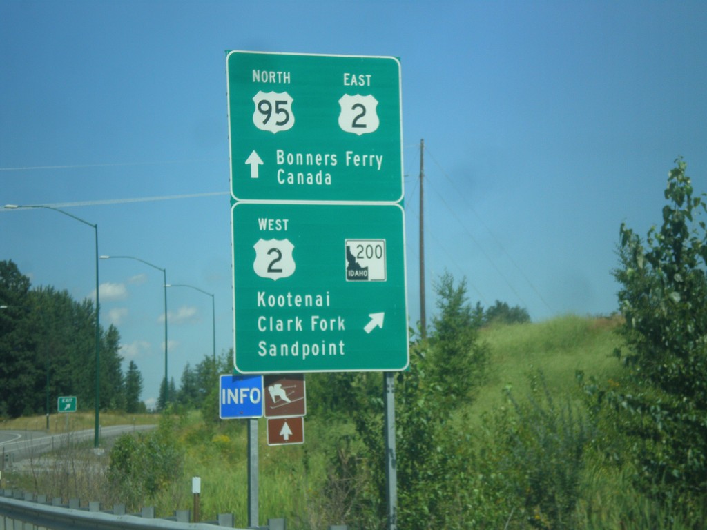
US-95 North at US-2/ID-200 Interchange
US-95 North at US-2/ID-200 interchange in Ponderay. Exit here for US-2 West/ID-200/Kootenai (via ID-200)/Clark Fork (via ID-200)/Sandpoint (via US-2). Continue ahead for US-95 North/US-2 East/Bonners Ferry/Canada. This is the northern end of the Sandpoint bypass.
Taken 07-23-2017
 Ponderay
Bonner County
Idaho
United States
Ponderay
Bonner County
Idaho
United States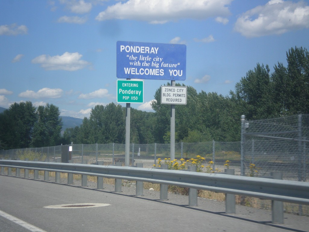
US-95 North - Ponderay
Entering Ponderay on US-95 north.
Taken 07-23-2017
Ponderay
Bonner County
Idaho
United States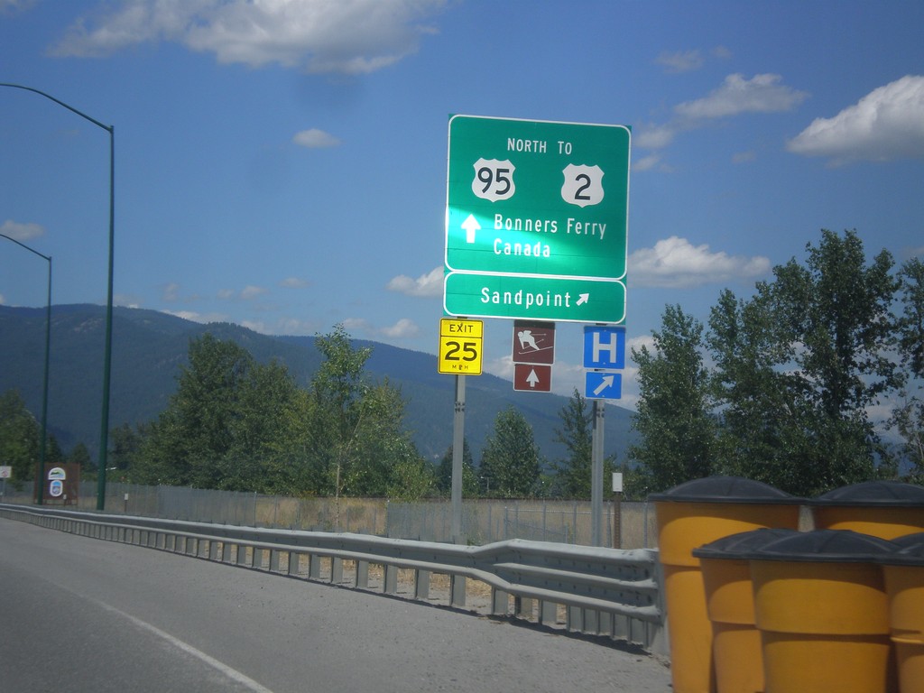
US-95 North - Sandpoint Exit
US-95 north at Sandpoint interchange. Continue north on US-95 north for US-2, Bonners Ferry, and Canada.
Taken 07-23-2017
Sandpoint
Bonner County
Idaho
United States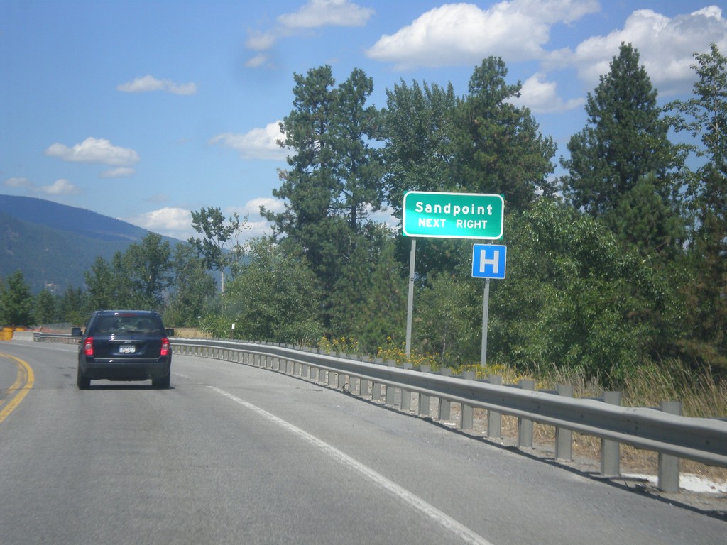
US-95 North - Sandpoint Next Right
US-95 North approaching south access to Sandpoint. Merge right for access to Sandpoint. This is the southern end of the Sandpoint bypass completed in 2012. Prior to the bypass, all US-95 traffic routed through downtown Sandpoint.
Taken 07-23-2017
Sandpoint
Bonner County
Idaho
United States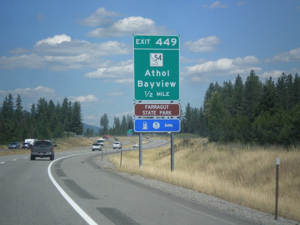
US-95 North - Exit 449
US-95 north approaching Exit 449 - ID-54/Athol/Bayview. Use Exit 449 for Farragut State Park.
Taken 07-23-2017
 Athol
Kootenai County
Idaho
United States
Athol
Kootenai County
Idaho
United States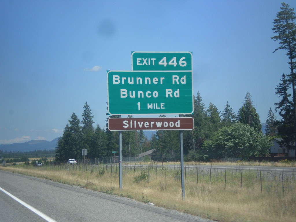
US-95 North - Exit 446
US-95 north approaching Exit 446 - Brunner Road/Bunco Road. Use Exit 446 for Silverwood theme park.
Taken 07-23-2017
Athol
Kootenai County
Idaho
United States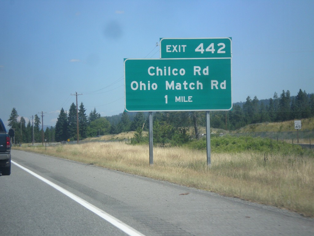
US-95 North - Exit 442
US-95 north approaching Exit 442 - Chilco Road/Ohio Match Road. This is the beginning of new US-95 alignment north of Coeur d’Alene.
Taken 07-23-2017
Rathdrum
Kootenai County
Idaho
United States