Signs Tagged With Big Green Sign
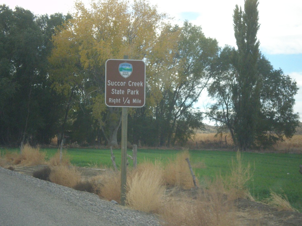
OR-201 South Approaching Succor Creek Road
OR-201 South approaching Succor Creek Road to Succor Creek State Park.
Taken 10-22-2017
 Adrian
Malheur County
Oregon
United States
Adrian
Malheur County
Oregon
United States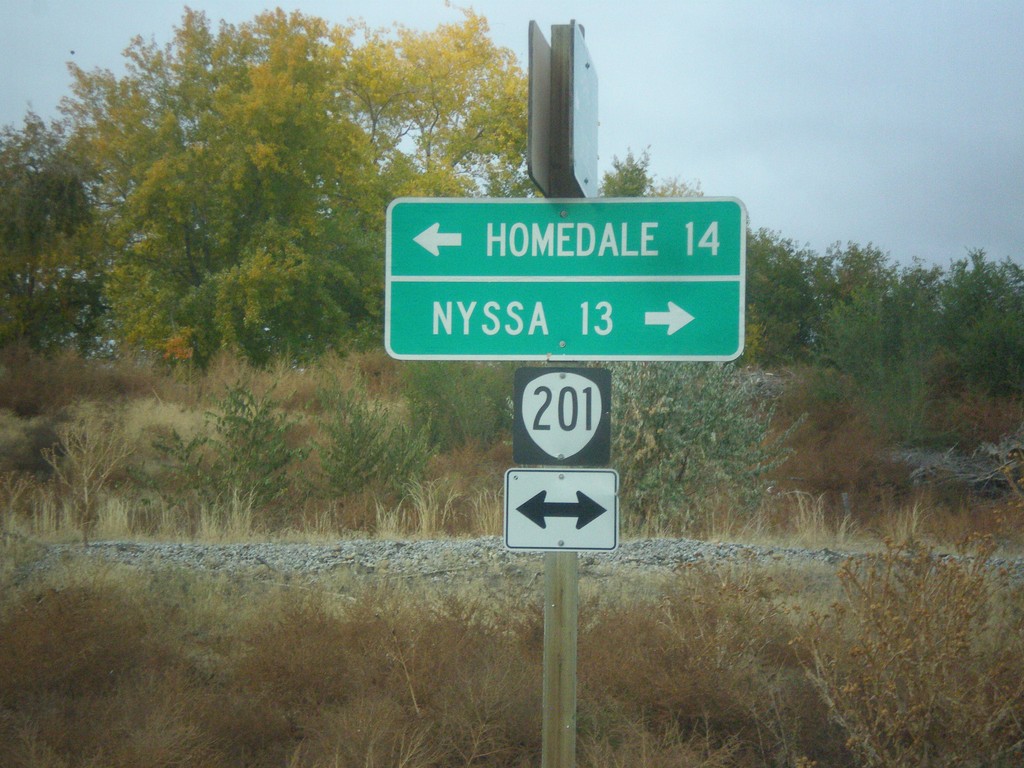
End OR-452 at OR-201
End OR-452 at OR-201 in Adrian. Turn left for OR-201 south to Homedale (Idaho); right for OR-201 north to Nyssa.
Taken 10-22-2017
 Adrian
Malheur County
Oregon
United States
Adrian
Malheur County
Oregon
United States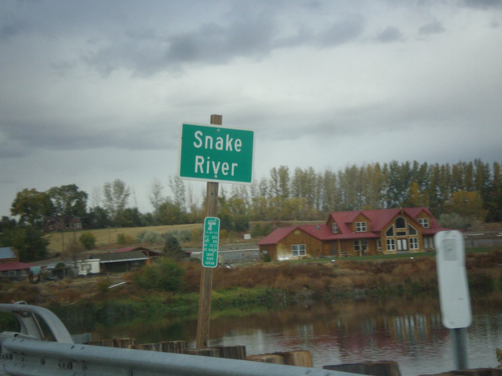
OR-452 West at the Snake River
OR-452 west at the Snake River. This small stretch of the Snake River near Adrian is the only part of the Snake River wholly within Oregon.
Taken 10-22-2017
Adrian
Malheur County
Oregon
United States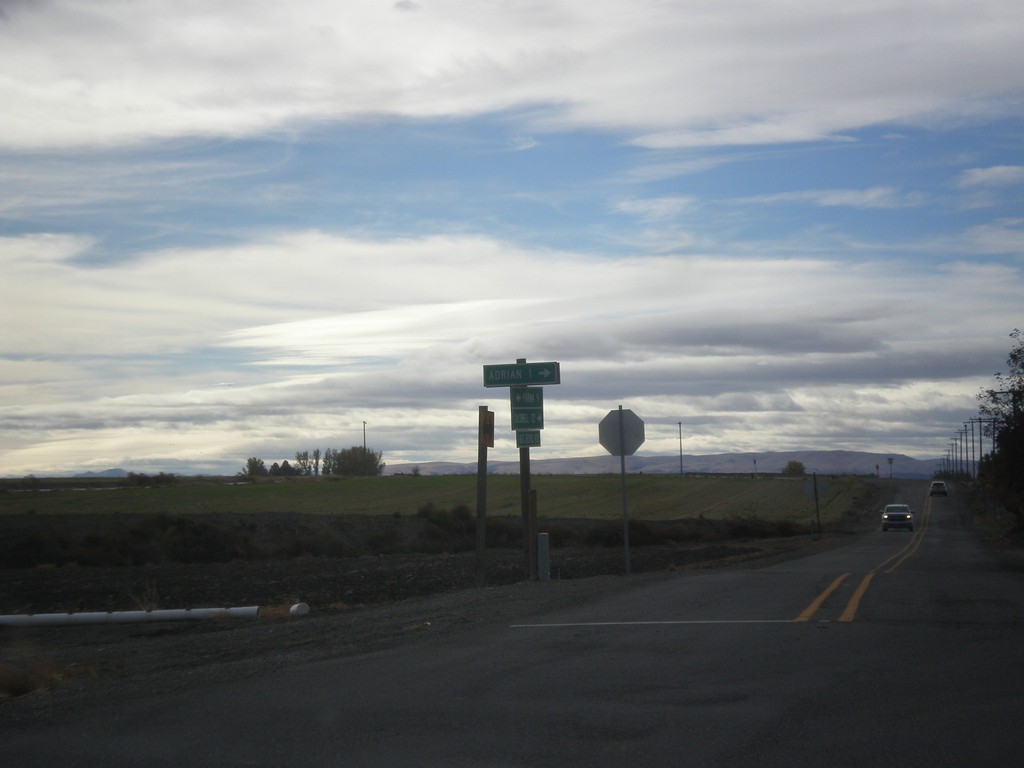
End OR-452 West at OR-454
End OR-452 West (unsigned) at OR-454 (unsigned). Turn right to continue west on OR-452 to Adrian. Continue straight for OR-454 West to (Big Bend Road) Caldwell (Idaho).
Taken 10-22-2017
 Adrian
Malheur County
Oregon
United States
Adrian
Malheur County
Oregon
United States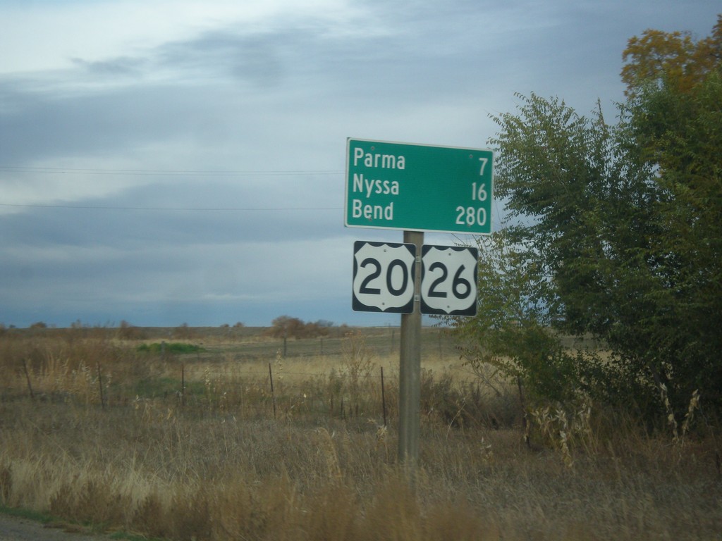
US-20/US-26 West Leaving Notus
Distance marker on US-20/US-26 west leaving Notus. Distance to Parma, Notus (Oregon), and Bend (Oregon). This is the first instance of Bend as a control city on US-20/US-26 Westbound.
Taken 10-22-2017

 Notus
Canyon County
Idaho
United States
Notus
Canyon County
Idaho
United States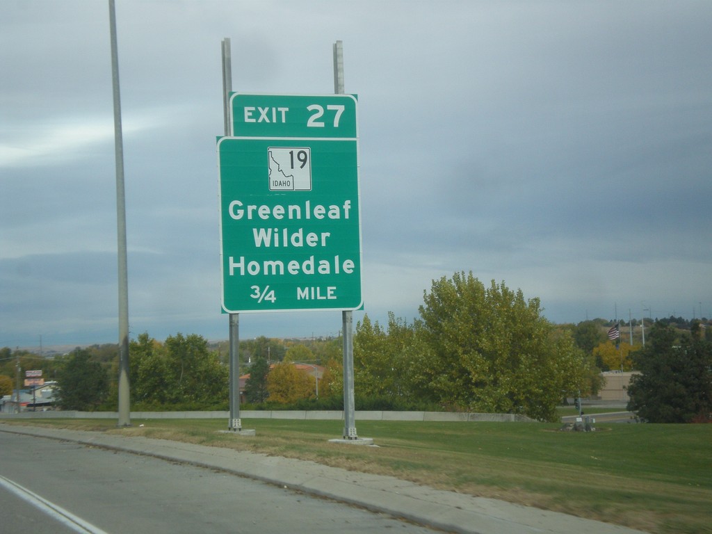
I-84 West - Exit 27
I-84 west approaching Exit 27 - ID-19/Grenleaf/Wilder/Homedale.
Taken 10-22-2017


 Caldwell
Canyon County
Idaho
United States
Caldwell
Canyon County
Idaho
United States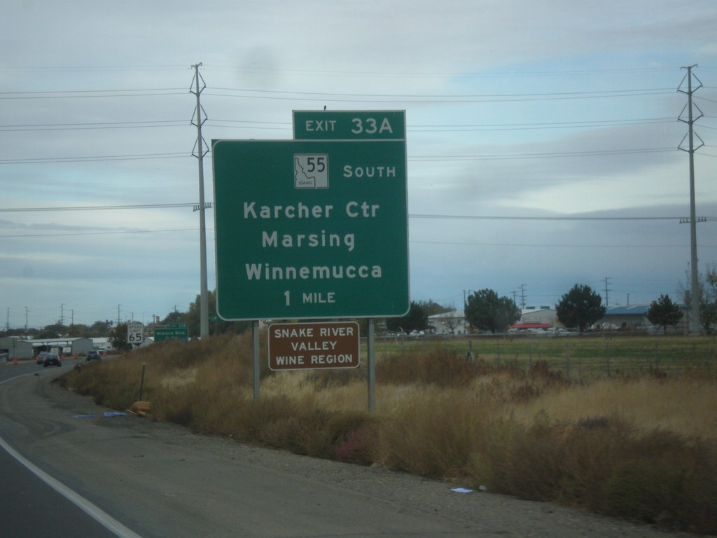
I-84 West - Exit 33A
I-84 west approaching Exit 33A - ID-55 South/Karcher Center/Marsing/Winnemucca. ID-55 south leaves I-84 westbound.
Taken 10-22-2017
 Nampa
Canyon County
Idaho
United States
Nampa
Canyon County
Idaho
United States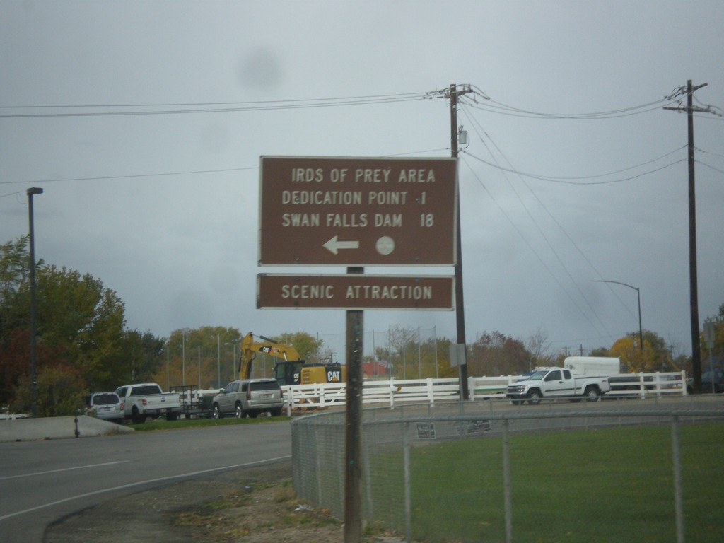
End ID-69 South at Swan Falls Road
End ID-69 South at Swan Falls Road. Turn left for Dedication Point, Birds of Prey Area and Swan Falls Dam.
Taken 10-21-2017
 Kuna
Ada County
Idaho
United States
Kuna
Ada County
Idaho
United States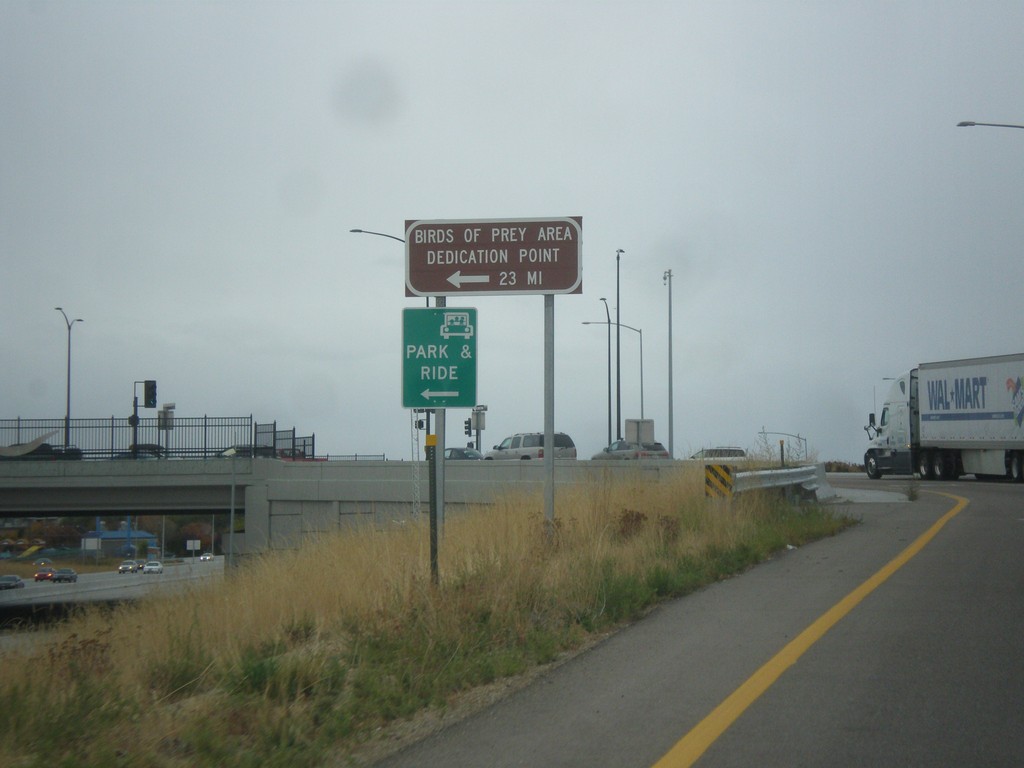
I-84 West Onramp (Exit 44) at ID-69
I-84 West onramp at ID-69. Turn left for Bird of Prey Area and Dedication Point.
Taken 10-21-2017
Meridian
Ada County
Idaho
United States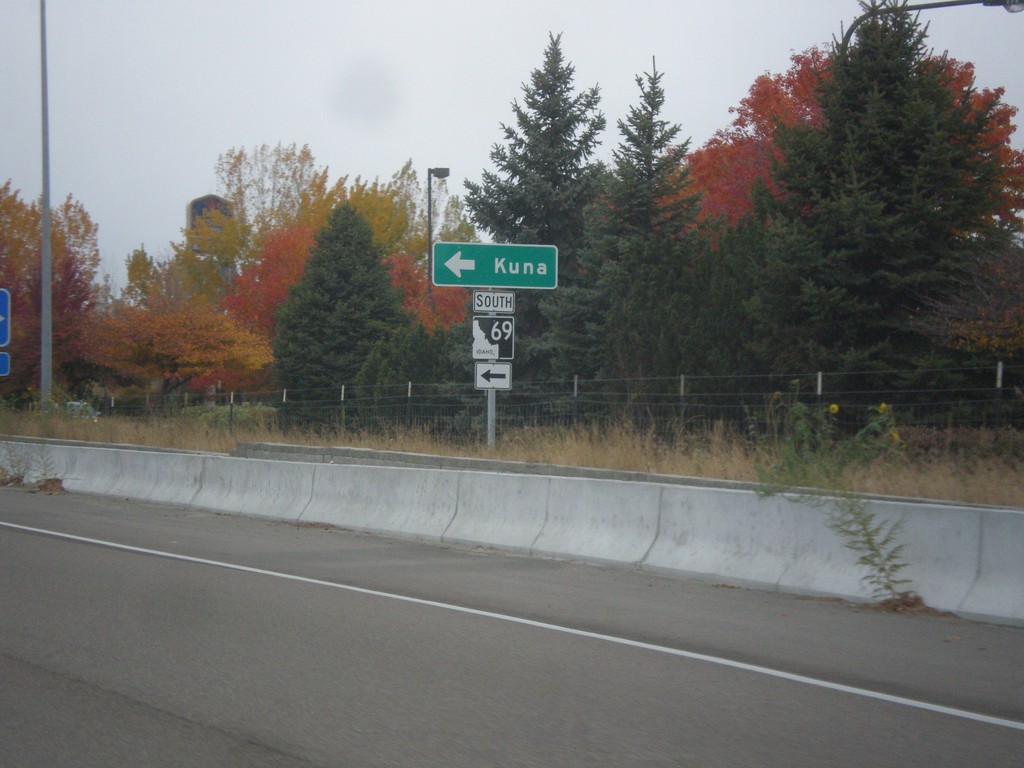
I-84 West - Exit 44 Offramp
I-84 east Exit 44 offramp at ID-69 junction. Turn left for ID-69 south to Kuna.
Taken 10-21-2017
Meridian
Ada County
Idaho
United States