Signs Tagged With Big Green Sign
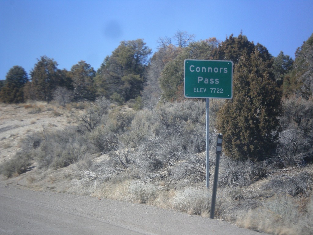
US-6/US-50 West/US-93 North - Connors Pass
US-6/US-50 West/US-93 North at Connors Pass - Elevation 7722 Feet. Connors Pass is a summit in the Schell Creek Range.
Taken 02-13-2018


 Ely
White Pine County
Nevada
United States
Ely
White Pine County
Nevada
United States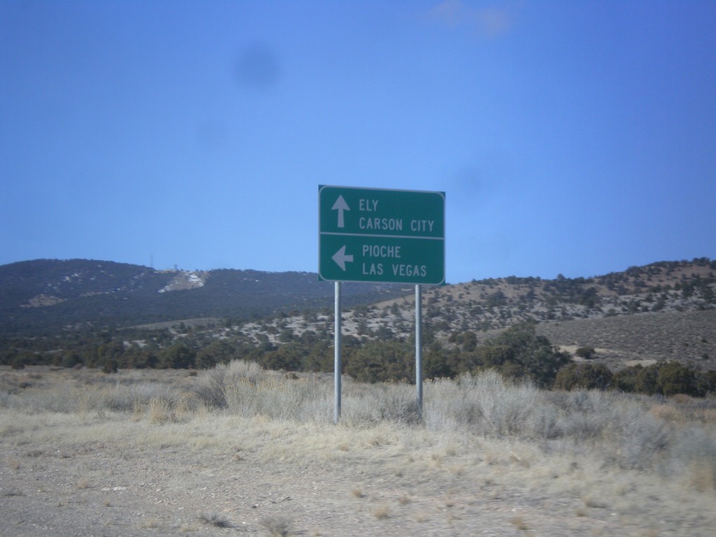
US-6/US-50 West Approaching US-93
US-6/US-50 West approaching US-93. Use US-93 south for Pioche and Las Vegas. Continue on US-6/US-50 West and US-93 North for Ely and Carson City (via US-50). US-93 joins US-6 and US-50 north to Ely.
Taken 02-13-2018
Majors Place
White Pine County
Nevada
United States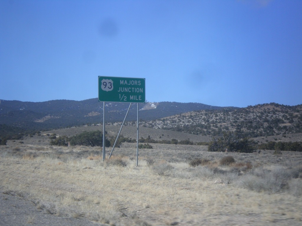
US-6/US-50 West Approaching US-93
US-6/US-50 West approaching US-93 - Majors Junction.
Taken 02-13-2018
Ely
White Pine County
Nevada
United States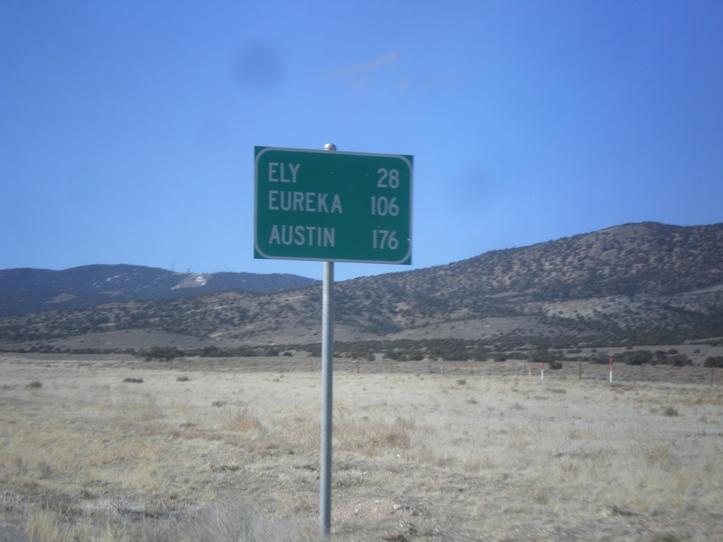
US-6/US-50 West - Distance Marker
Distance marker on US-6/US-50 west. Distance to Ely, Eureka, and Austin.
Taken 02-13-2018
Majors Place
White Pine County
Nevada
United States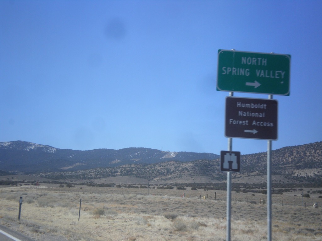
US-6/US-50 West Approaching NV-893
US-6/US-50 West approaching NV-893 to North Spring Valley and Humboldt National Forest access.
Taken 02-13-2018
 Ely
White Pine County
Nevada
United States
Ely
White Pine County
Nevada
United States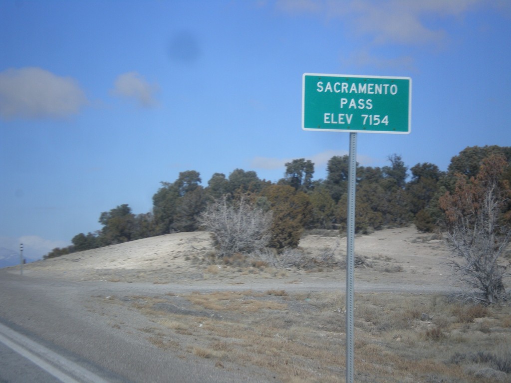
US-6/US-50 West - Sacramento Pass
Sacramento Pass on US-6/US-50 West - Elevation 7154 Feet. Sacramento Pass is a summit in the Snake Range.
Taken 02-13-2018
Osceola
White Pine County
Nevada
United States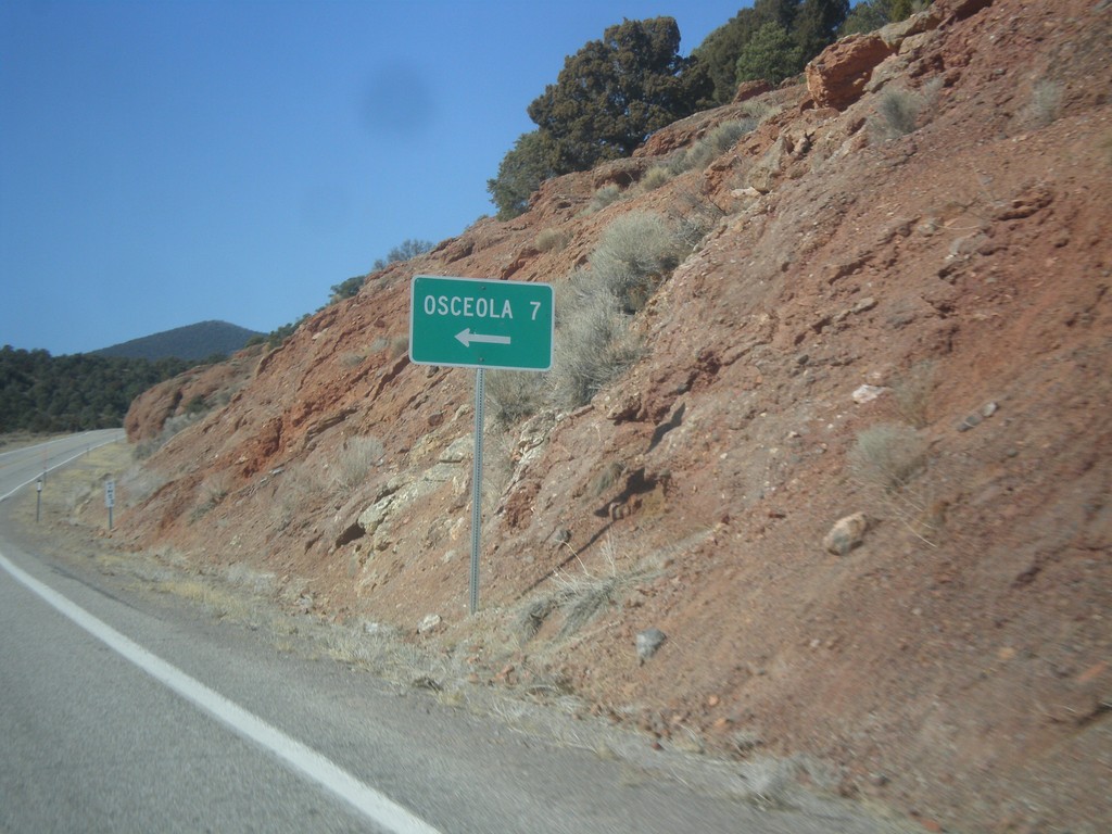
US-6/US-50 West - Osceola Jct.
US-6/US-50 West at Osceola Jct.
Taken 02-13-2018
Baker
White Pine County
Nevada
United States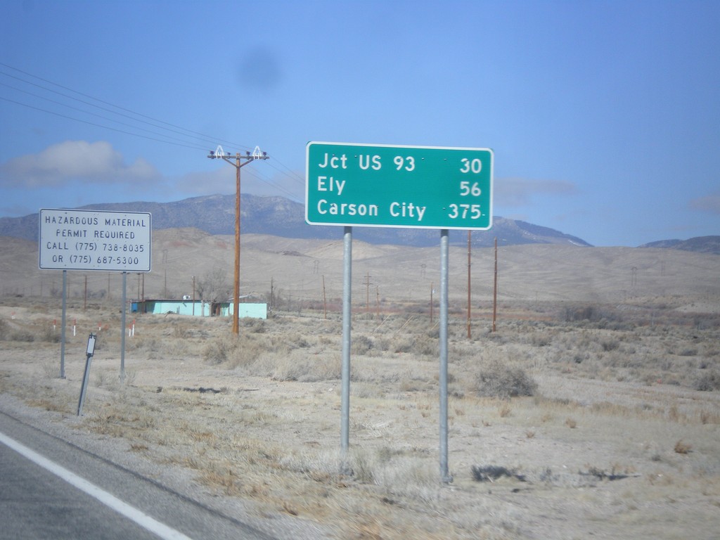
US-6/US-50 West - Distance Marker
Distance Marker on US-6/US-50 west. Distance to Jct. US-93, Ely, and Carson City (via US-50).
Taken 02-13-2018
Baker
White Pine County
Nevada
United States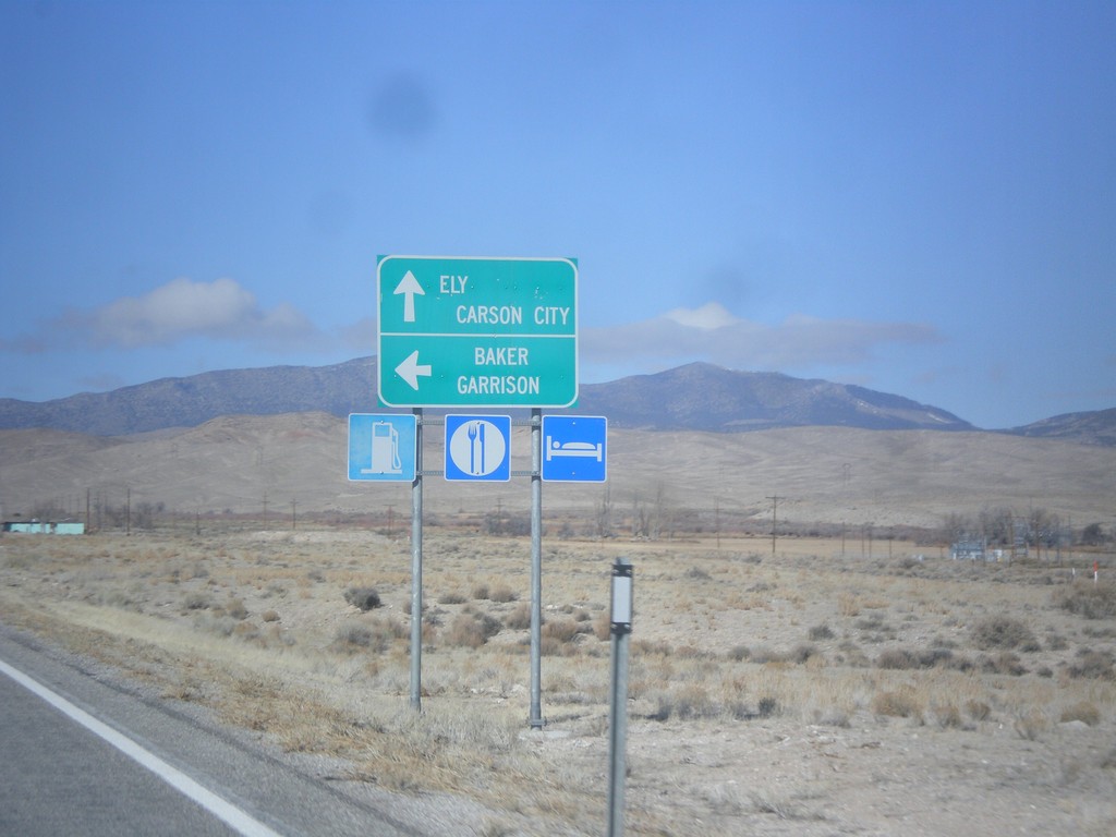
US-6/US-50 West at NV-487
US-6/US-50 West at NV-487 east to Baker and Garrison (Utah). Continue east on US-6/US-50 for Ely and Carson City (via US-50).
Taken 02-13-2018
 Baker
White Pine County
Nevada
United States
Baker
White Pine County
Nevada
United States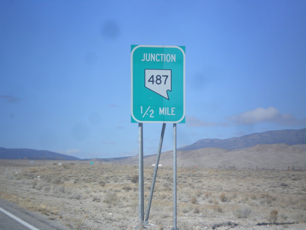
US-6/US-50 West Approaching NV-487
US-6/US-50 West approaching NV-487 in White Pine County.
Taken 02-13-2018
Baker
White Pine County
Nevada
United States