Signs Tagged With Big Green Sign
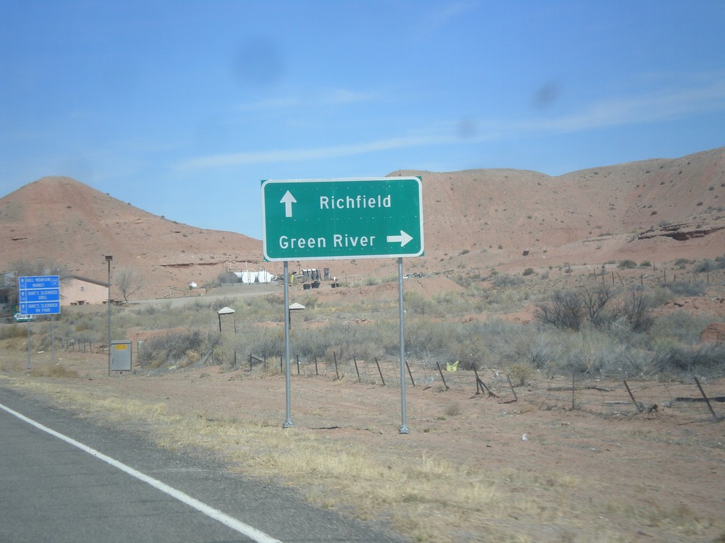
UT-95 West Approaching UT-24
UT-95 west approaching UT-24 in Hanksville. Use UT-24 east for Green River; use UT-24 west for Richfield.
Taken 03-29-2018

 Hanksville
Wayne County
Utah
United States
Hanksville
Wayne County
Utah
United States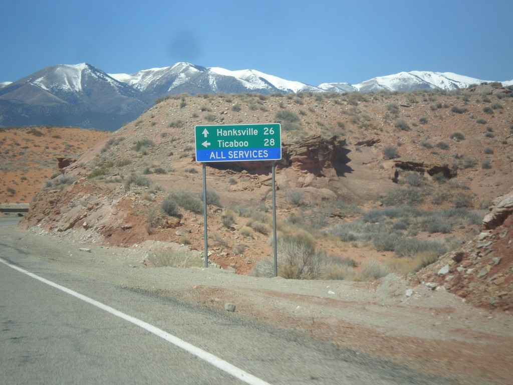
UT-95 West at UT-276
UT-95 west at UT-276 to Ticaboo. Continue west on UT-95 for Blanding.
Taken 03-29-2018
 Lake Powell
Garfield County
Utah
United States
Lake Powell
Garfield County
Utah
United States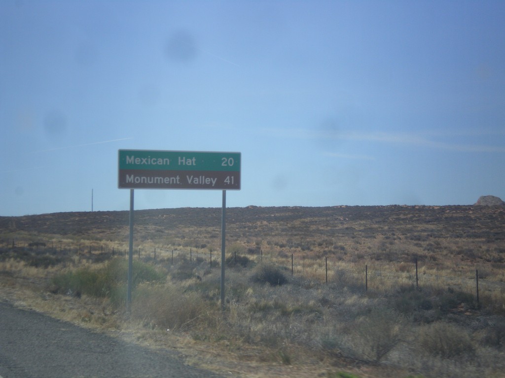
US-163 West - Distance Marker
First distance marker along US-163 west. Distance to Mexican Hat and Monument Valley (Navajo Tribal Park).
Taken 03-28-2018
 Bluff
San Juan County
Utah
United States
Bluff
San Juan County
Utah
United States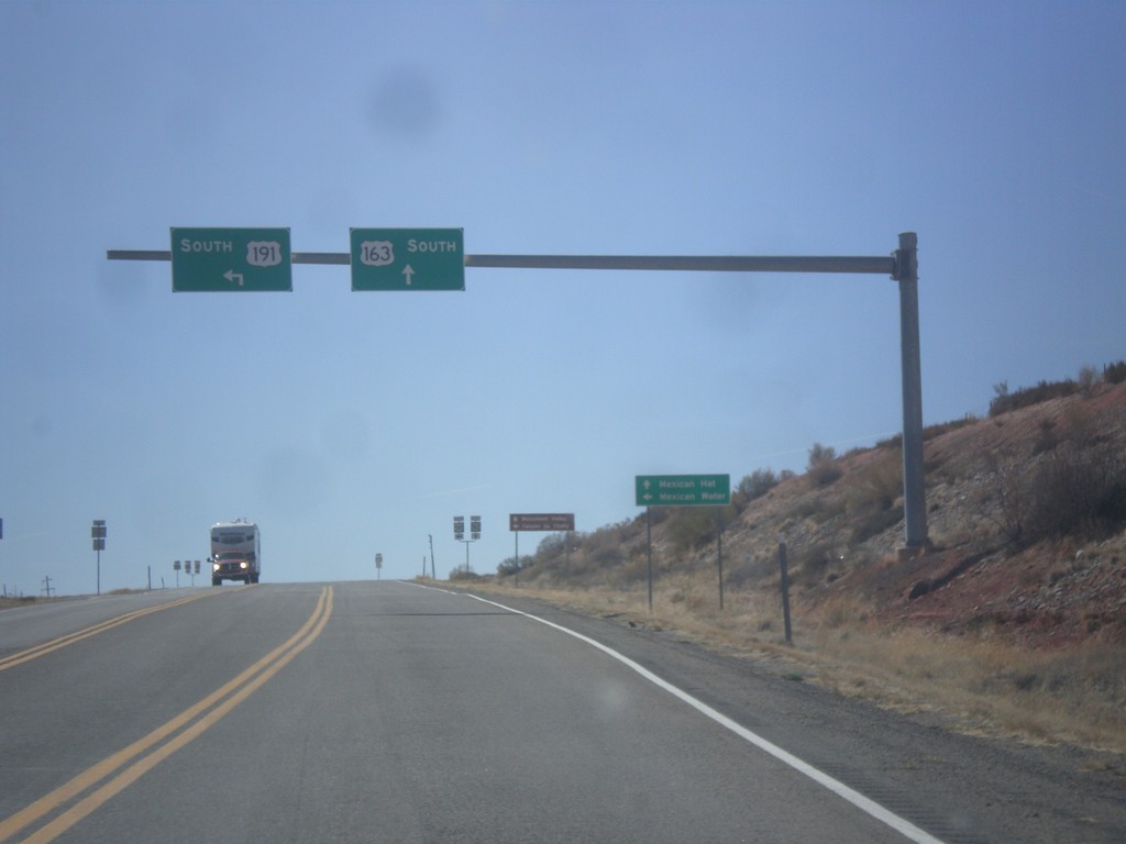
US-191 South at US-163
US-191 South at US-163 in San Juan County. Turn left to continue south on US-191 to Mexican Water (Arizona). Continue straight for US-163 west to Mexican Hat. This is the eastern end of US-163 west.
Taken 03-28-2018
 Bluff
San Juan County
Utah
United States
Bluff
San Juan County
Utah
United States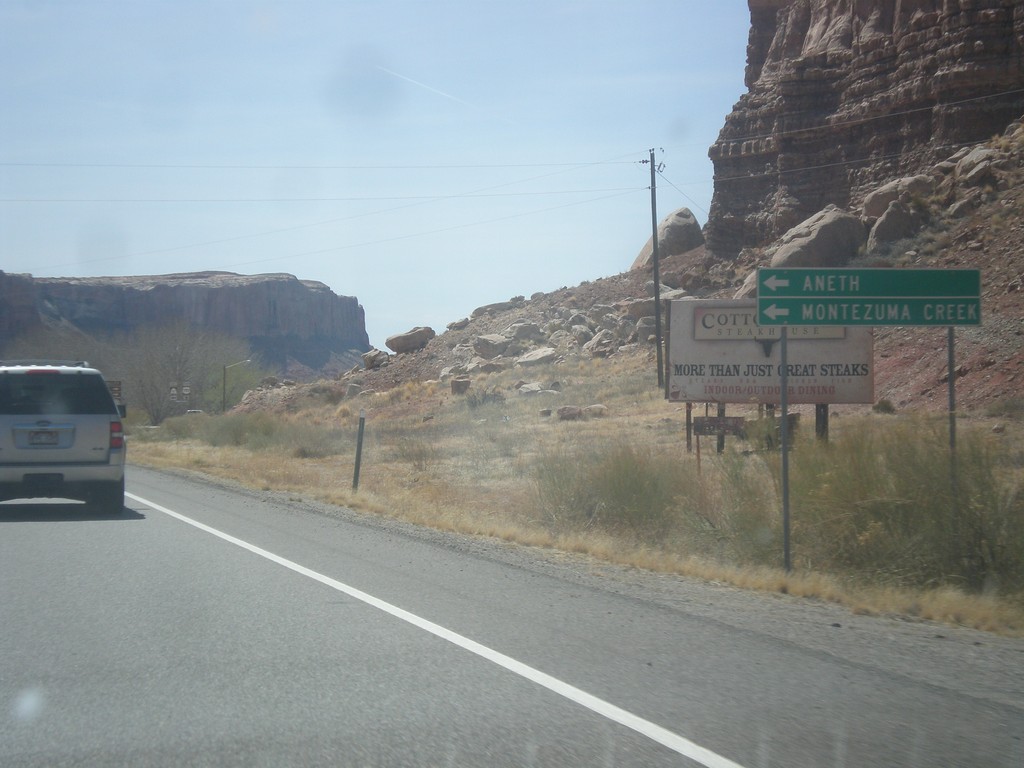
US-191 South Approaching UT-162
US-191 South approaching UT-162 in Bluff. Use UT-162 east for Montezuma Creek and Aneth.
Taken 03-28-2018
 Bluff
San Juan County
Utah
United States
Bluff
San Juan County
Utah
United States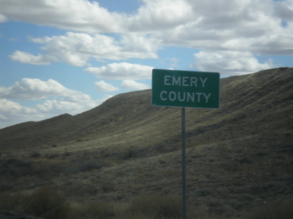
US-6 East/US-191 South - Emery County
Entering Emery County on US-6 East/US-191 South.
Taken 03-24-2018
 East Carbon
Carbon County
Utah
United States
East Carbon
Carbon County
Utah
United States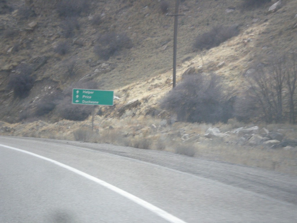
US-6 East at US-191
US-6 East at US-191 junction. Turn left for US-191 north to Duchesne. Continue ahead for US-6 East/US-191 South towards Helper and Price. US-191 joins US-6 east to the junction with I-70 near Green River. Thence from there US-191 follows I-70 and US-6 east to Crescent Junction.
Taken 03-24-2018
Helper
Carbon County
Utah
United States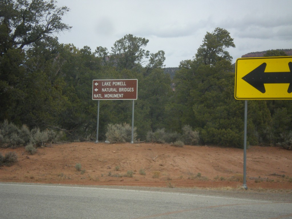
End UT-261 North at UT-95
End UT-261 North at UT-95 in San Juan County. Turn left for UT-95 west to Lake Powell and Natural Bridges National Monument.
Taken 03-24-2018
 Lake Powell
San Juan County
Utah
United States
Lake Powell
San Juan County
Utah
United States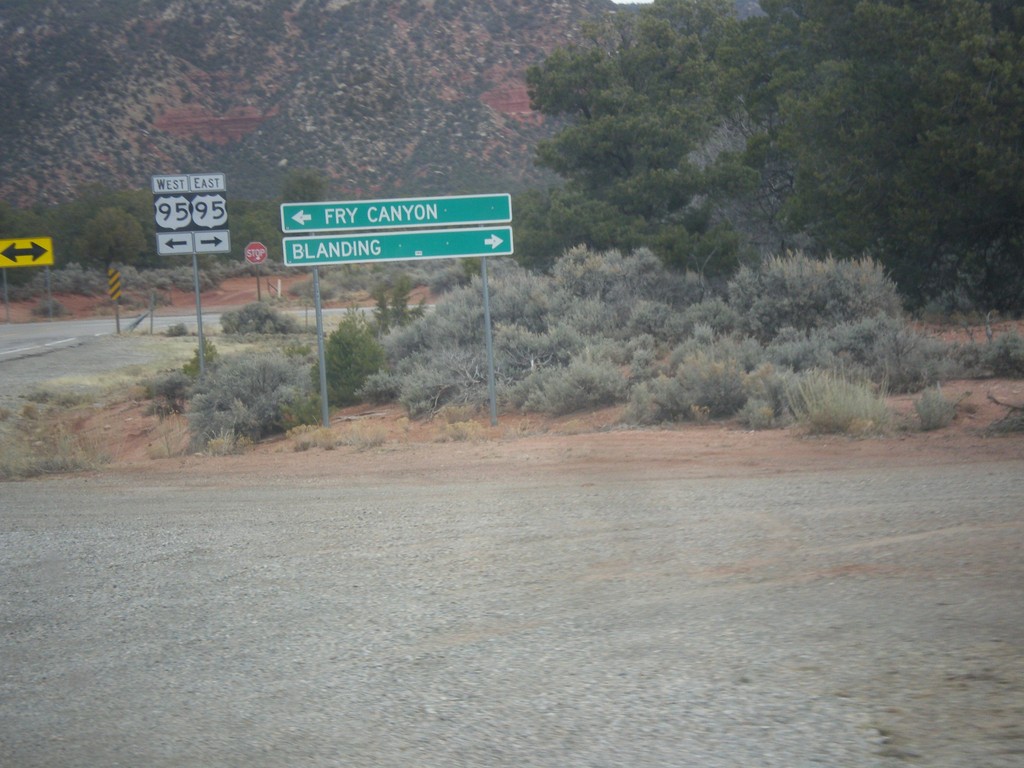
End UT-261 North at UT-95
End UT-261 North at UT-95 in San Juan County. Turn right on UT-95 east for Blanding; left on UT-95 west for Fry Canyon. The UT-95 shield is signed incorrectly as US-95.
Taken 03-24-2018
Lake Powell
San Juan County
Utah
United States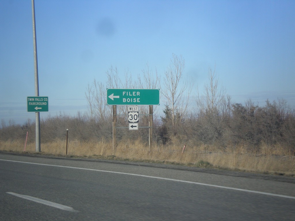
US-93 North at US-30 West
US-93 North at US-30 West to Filer and Boise.
Taken 02-13-2018

 Filer
Twin Falls County
Idaho
United States
Filer
Twin Falls County
Idaho
United States