Signs Tagged With Big Green Sign
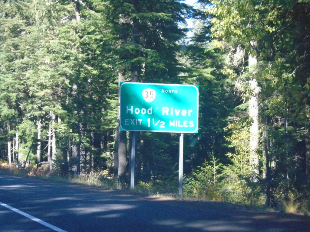
US-26 West Approaching OR-35
US-26 West approaching OR-35 North to Hood River.
Taken 10-13-2018

 Government Camp
Clackamas County
Oregon
United States
Government Camp
Clackamas County
Oregon
United States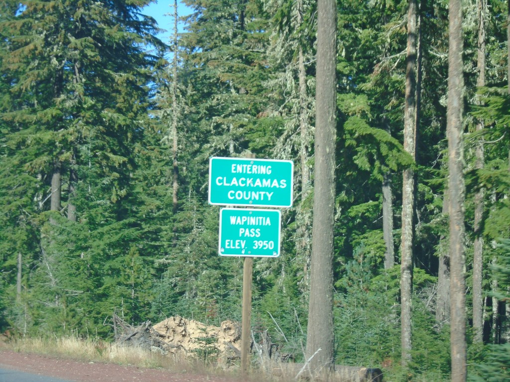
US-26 West - Clackamas County / Wapinita Pass
US-26 West at Clackamas County and Wapinita Pass - Elevation 3952 Feet. Wapinita Pass is at the crest of the Cascade Range.
Taken 10-13-2018
Government Camp
Clackamas County
Oregon
United States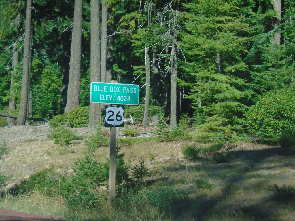
US-26 West - Blue Box Summit
US-26 West at Blue Box Summit - Elevation 4024 Feet.
Taken 10-13-2018
Government Camp
Wasco County
Oregon
United States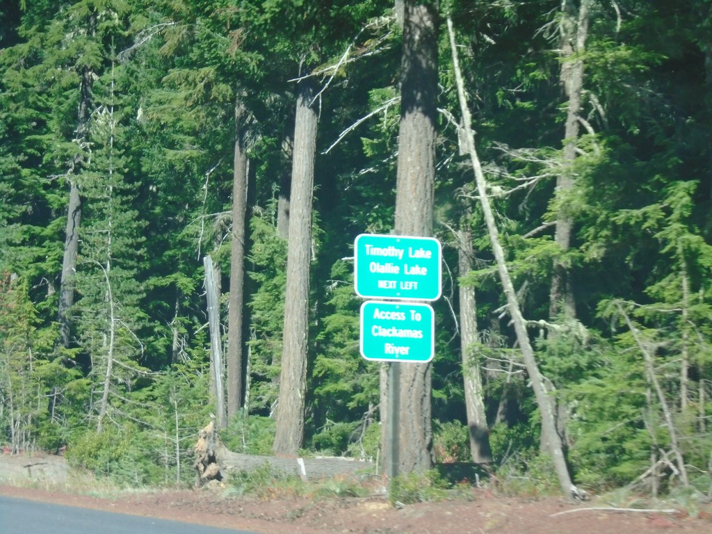
US-26 West - Timothy Lake/Olallie Lake Jct.
US-26 West approaching Timothy Lake/Olallie Lake Jct. (FS Road 42 - Skyline Road). Use FS Road 42 for access to the Clackamas River.
Taken 10-13-2018
Maupin
Wasco County
Oregon
United States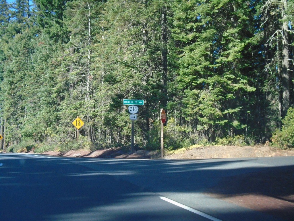
US-26 West at OR-216
US-26 West at OR-216 west to Maupin.
Taken 10-13-2018
 Maupin
Wasco County
Oregon
United States
Maupin
Wasco County
Oregon
United States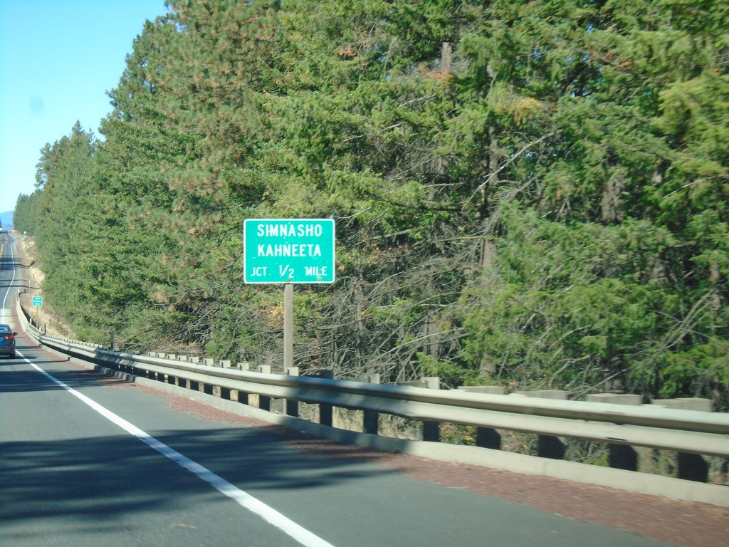
US-26 West Approaching Simhasho/Kahneeta Jct.
US-26 West approaching Simhasho/Kahneeta Jct.
Taken 10-13-2018
Warm Springs
Wasco County
Oregon
United States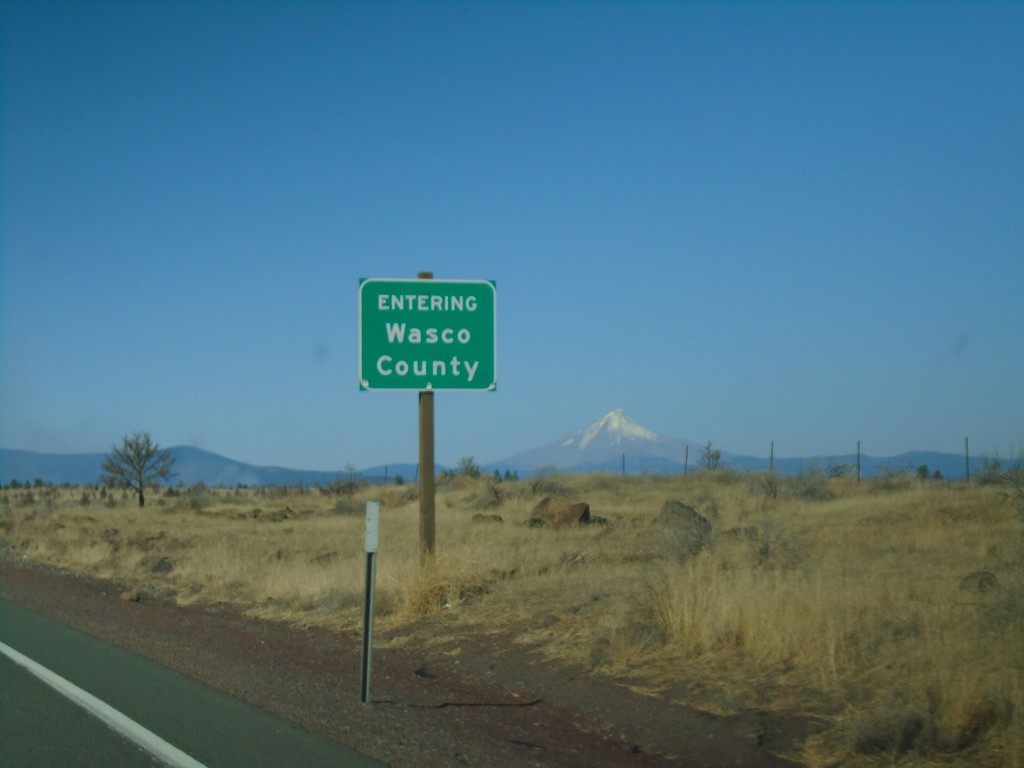
US-26 West - Wasco County
Entering Wasco County on US-26 west. Mount Hood is in the background.
Taken 10-13-2018
Warm Springs
Wasco County
Oregon
United States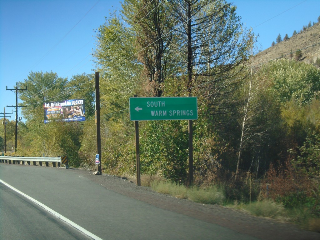
US-26 West - South Warm Springs
South Warm Springs junction on US-26 west.
Taken 10-13-2018
Warm Springs
Jefferson County
Oregon
United States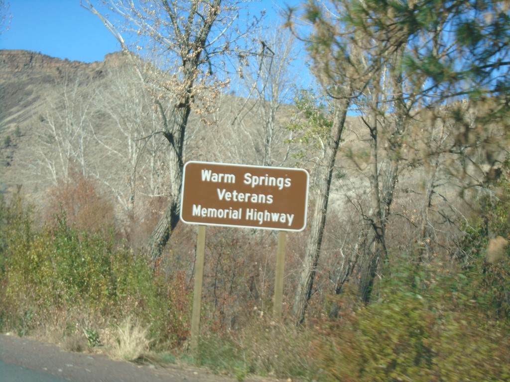
US-26 West - Warm Springs Veterans Mem. Highway
US-26 West - Warm Springs Veterans Memorial Highway. US-26 is designated the Warm Springs Veterans Memorial Highway through the Warm Springs Indian Reservation.
Taken 10-13-2018
Madras
Jefferson County
Oregon
United States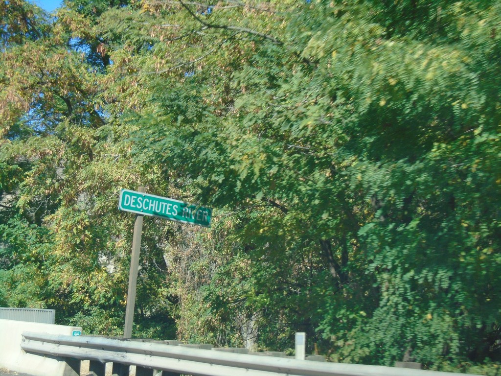
US-26 West - Deschutes River
Crossing the Deschutes River on US-26 West - Jefferson County.
Taken 10-13-2018
Madras
Jefferson County
Oregon
United States