Signs Tagged With Big Green Sign
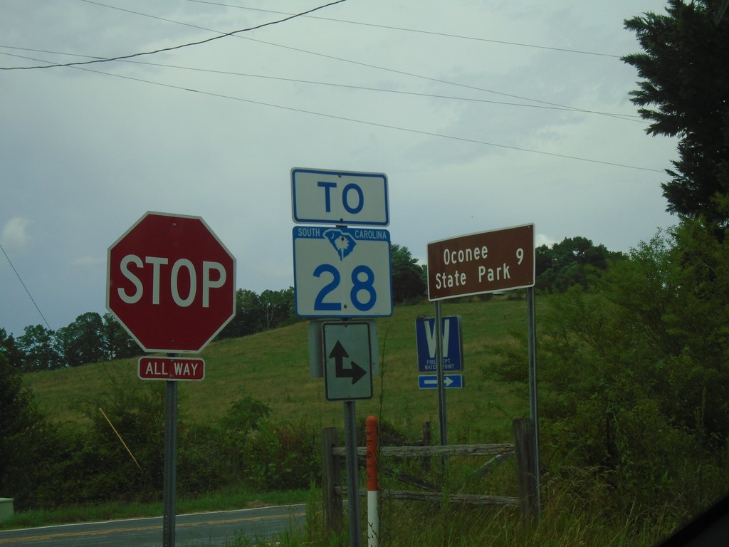
Chattoga Ridge Road at Whetstone Road
Chattoga Ridge Road at Whetstone Road. Use Chattoga Ridge Road or Whetstone Road for SC-28. Use Whetstone Road south for Oconee State Park.
Taken 06-22-2019
 Mountain Rest
Oconee County
South Carolina
United States
Mountain Rest
Oconee County
South Carolina
United States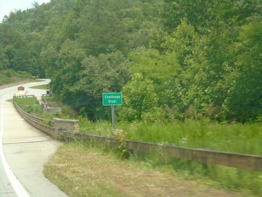
US-76 East - Chattooga River
Chattooga River on US-76 east. The Chattooga River is the boundary between Georgia and South Carolina.
Taken 06-22-2019
 Mountain Rest
Oconee County
South Carolina
United States
Mountain Rest
Oconee County
South Carolina
United States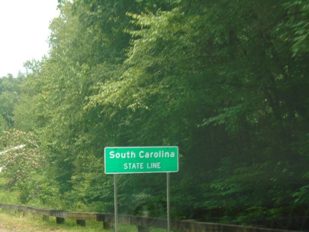
US-76 East - South Carolina
South Carolina State Line on US-76 east. Taken at the Georgia/South Carolina border.
Taken 06-22-2019
Mountain Rest
Oconee County
South Carolina
United States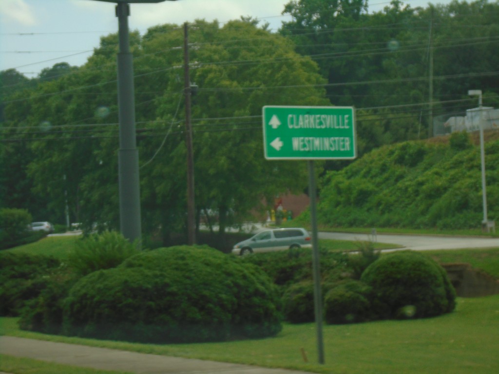
US-23/US-441/GA-15 South/US-76/GA-2 East at US-76/GA-2 Split
US-23/US-441/GA-15 South/US-76/GA-2 East at US-76/GA-2 Split in Clayton. Turn left for US-76/GA-2 East to Westminster (SC); continue south on US-441/US-23/GA-15 to Clarkesville.
Taken 06-22-2019


 Clayton
Rabun County
Georgia
United States
Clayton
Rabun County
Georgia
United States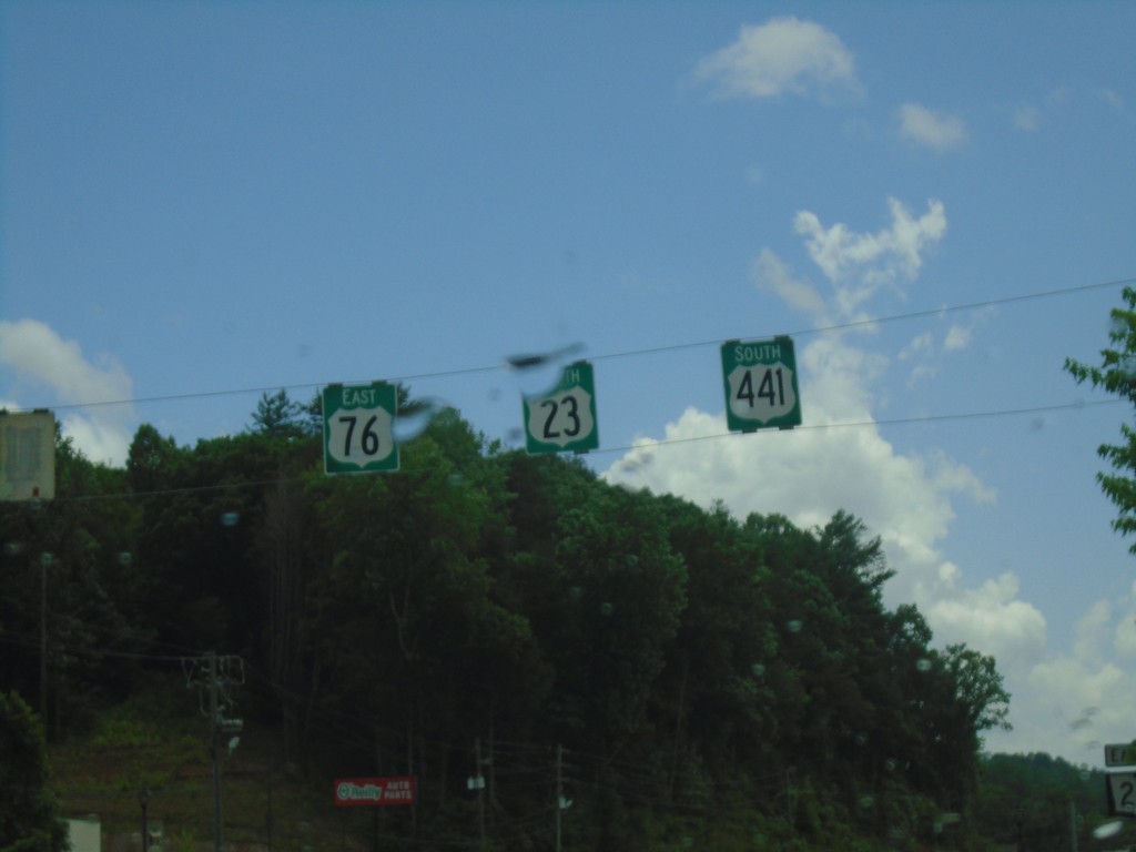
US-23/US-441 South/US-76 East - Clayton
US-23/US-441 South/US-76 East in Clayton
Taken 06-22-2019
Clayton
Rabun County
Georgia
United States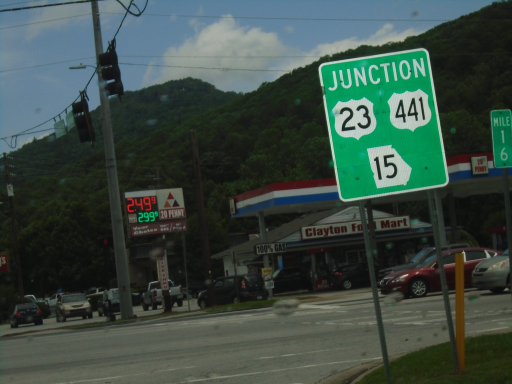
US-76/GA-2 East at US-23/US-441/GA-15 - Clayton
US-76/GA-2 East at US-23/US-441/GA-15 in Clayton. US-76/GA-2 East joins US-23/US-441/GA-15 South through Clayton.
Taken 06-22-2019
Clayton
Rabun County
Georgia
United States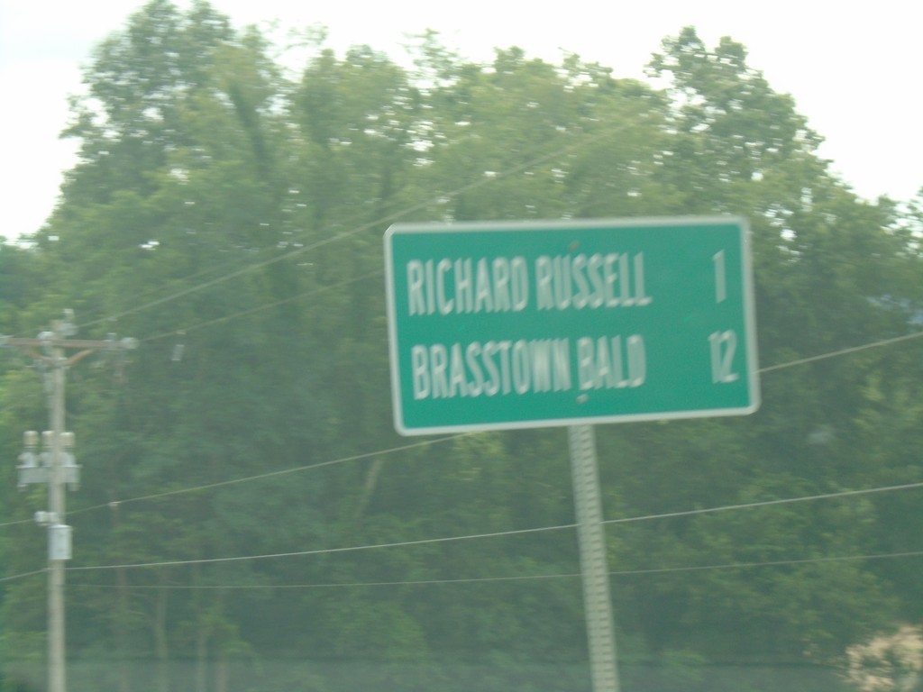
GA-180 East - Distance Marker
Distance marker on GA-180 east. Distance to Richard Russell and Brasstown Bald.
Taken 06-22-2019
 Blairsville
Union County
Georgia
United States
Blairsville
Union County
Georgia
United States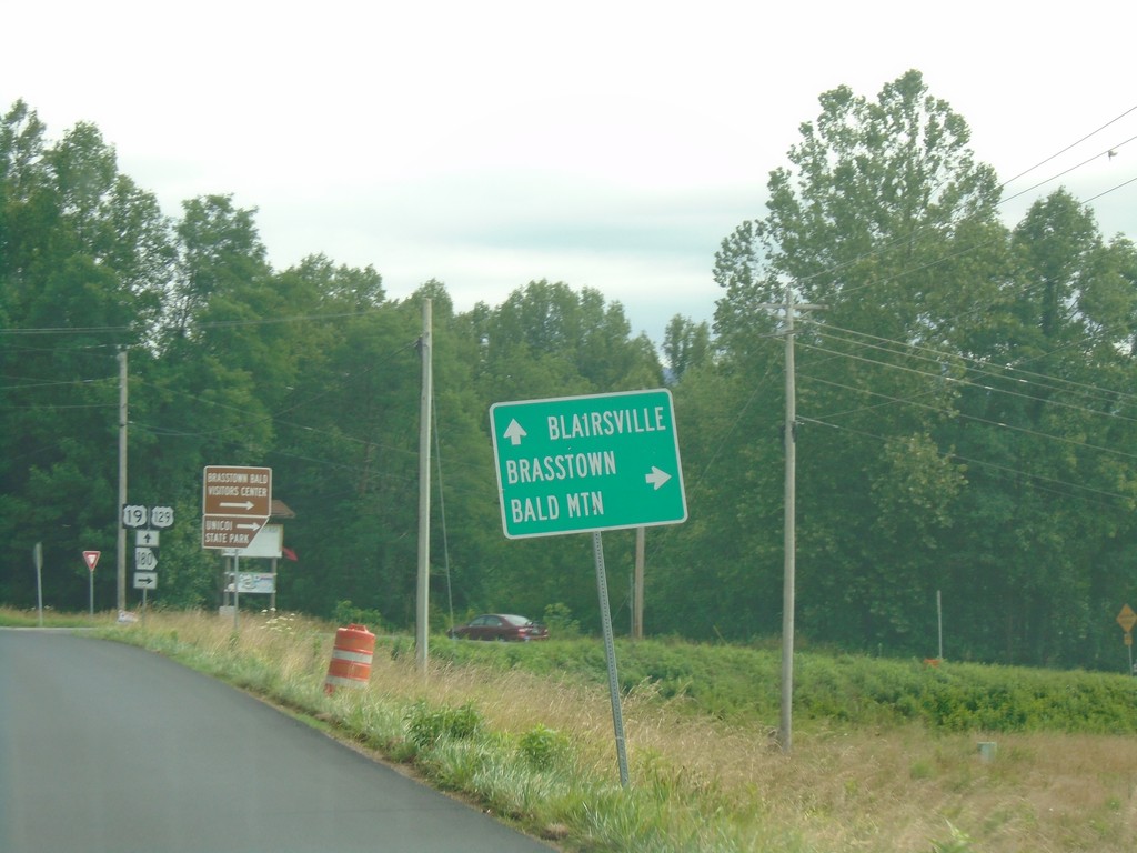
US-19/US-129/GA-11 North/GA-180 East Approaching GA-180
US-19/US-129/GA-11 North/GA-180 East approaching GA-180. Turn right to continue east on GA-180 towards Brasstown Bald. Continue straight for US-19/US-129/GA-11 North to Blairsville.
Taken 06-22-2019


 Blairsville
Union County
Georgia
United States
Blairsville
Union County
Georgia
United States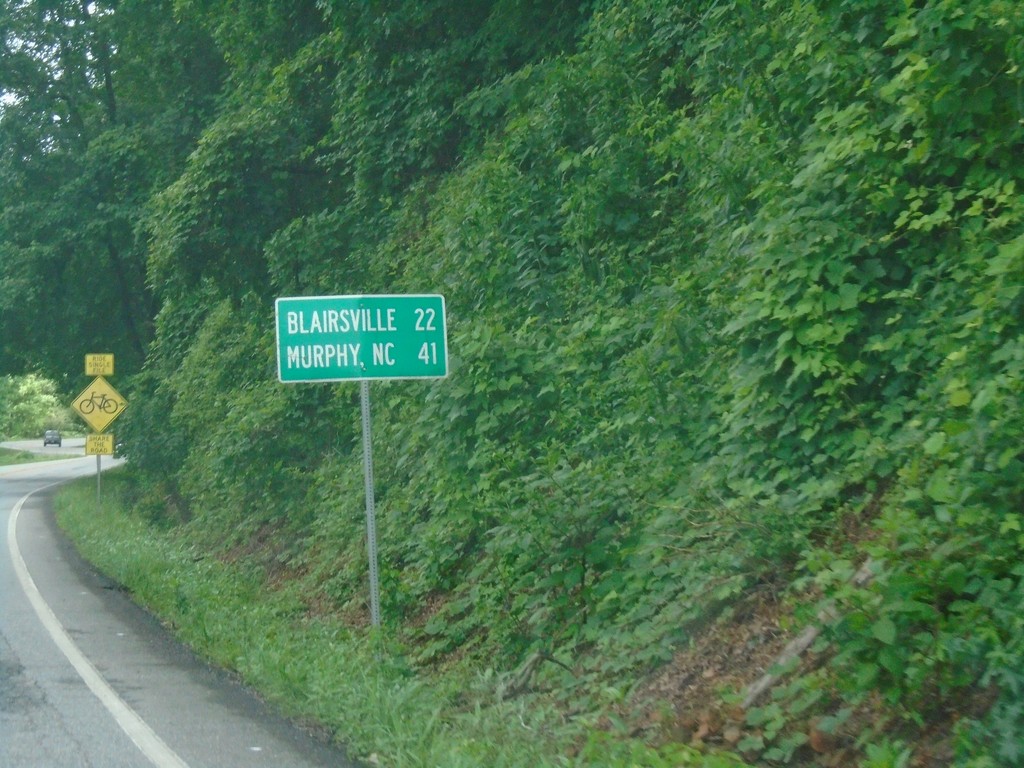
US-19/US-129/GA-11 North - Distance Marker
Distance maker on US-19/US-129/GA-11 north. Distance to Blairsville and Murphy (NC).
Taken 06-22-2019
Cleveland
Lumpkin County
Georgia
United States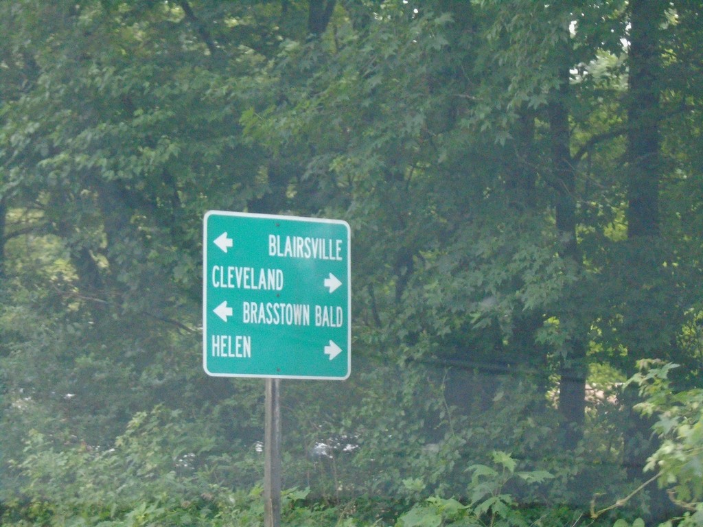
US-19/GA-9 North Approaching US-129/GA-11
US-19/GA-9 North approaching US-129/GA-11 in Lumpkin County. Turn left to continue north on US-19/US-129/GA-11 for Blairsville and Brasstown Bald; right for US-129/GA-11 south to Helen and Cleveland. GA-9 north ends here.
Taken 06-22-2019
 Cleveland
Lumpkin County
Georgia
United States
Cleveland
Lumpkin County
Georgia
United States