Signs Tagged With Big Green Sign
End UT-150 West at UT-32
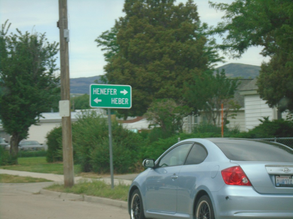
End UT-150 West at UT-32 in Kamas. Use UT-32 north for Henefer; UT-32 south for Heber.
Taken 08-03-2019

 Kamas
Summit County
Utah
United States
Kamas
Summit County
Utah
United States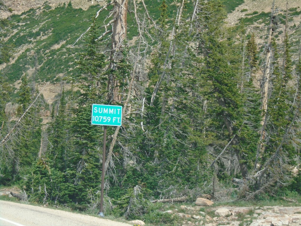
UT-150 South - Bald Mountain Pass
UT-150 South on (Bald Mountain Pass) Elevation 10,759 Feet.
Taken 08-03-2019
Kamas
Duchesne County
Utah
United States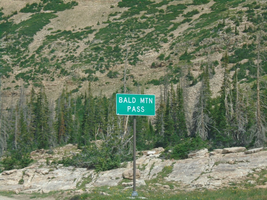
UT-150 South - Bald Mountain Pass
Bald Mountain Pass in the Uinta Mountains (10,715 Feet)
Taken 08-03-2019
Hanna
Duchesne County
Utah
United States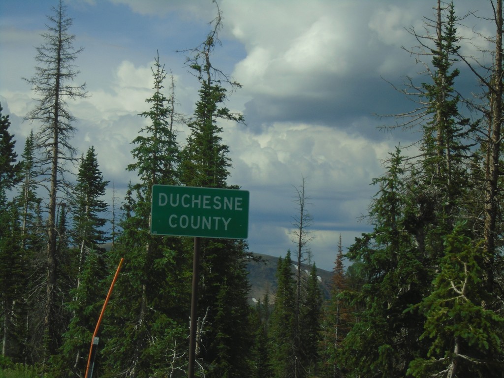
UT-150 South - Duchesne County
Duchesne County on UT-150 south. Taken at Hayden Pass.
Taken 08-03-2019
Hanna
Duchesne County
Utah
United States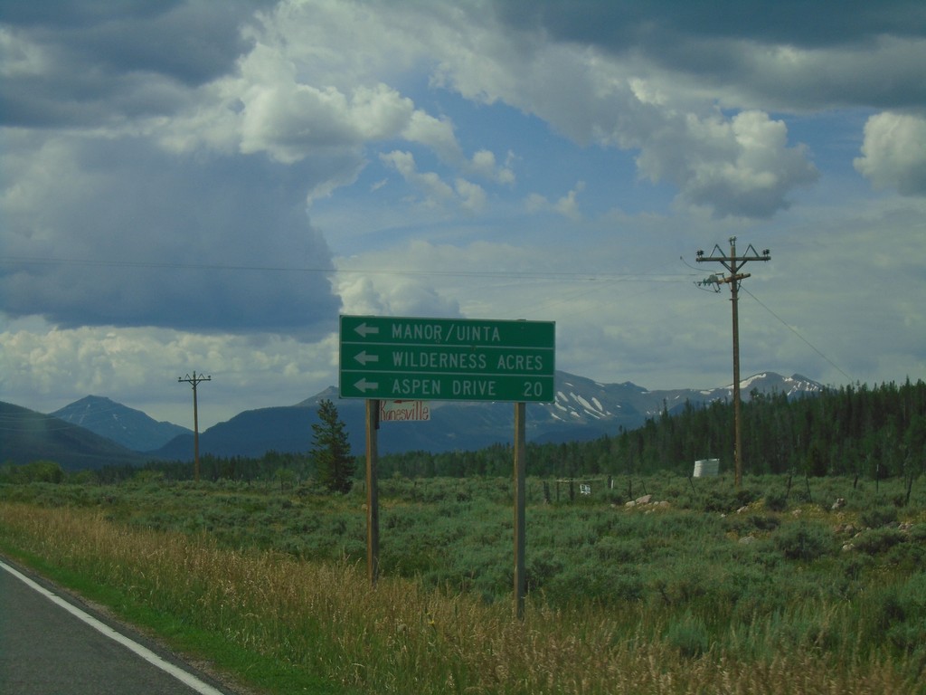
UT-150 South at Aspen Drive
UT-150 south at Aspen Drive/Manor/Uinta/Wilderness Acres.
Taken 08-03-2019
Kamas
Summit County
Utah
United States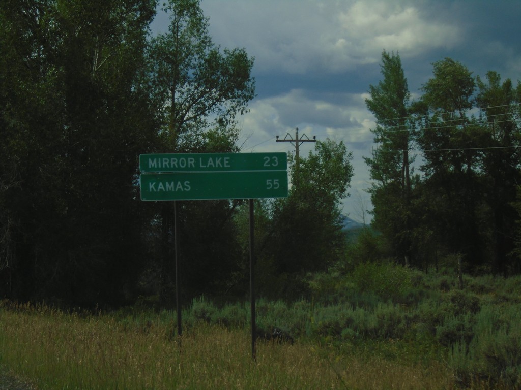
UT-150 South - Distance Marker
Distance marker on UT-150 south. Distance to Mirror Lake and Kamas.
Taken 08-03-2019
Coalville
Summit County
Utah
United States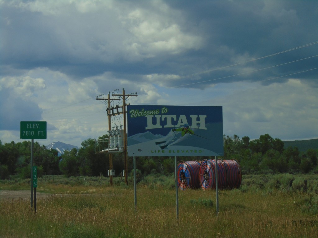
UT-150 South - Welcome To Utah
Welcome To Utah on UT-150 South. Elevation 7810 Feet. The mile marker of 23.56 is from Wyoming WY-150.
Taken 08-03-2019
Coalville
Summit County
Utah
United States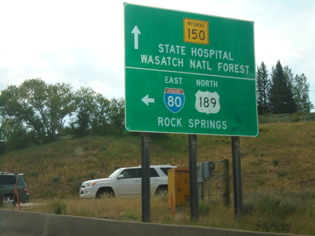
End WY-89 South at I-80 East and WY-150 South
End WY-89 South at I-80 East and WY-150 South in Evanston. Turn left for I-80 East/US-89 North/Rock Springs. Continue south on WY-150 for (Wyoming) State Hospital and Wasatch National Forest.
Taken 08-03-2019


 Evanston
Uinta County
Wyoming
United States
Evanston
Uinta County
Wyoming
United States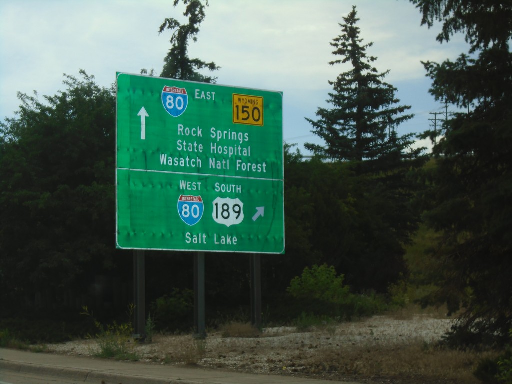
End WY-89 South at I-80/US-189/WY-150
End WY-89 South at I-80/US-189/WY-150 in Evanston. Turn right for I-80 West/US-189 South/Salt Lake (Utah). Continue under the freeway for I-80 East/US-189 North/Rock Springs and WY-150 South/Wasatch National Forest/(Wyoming)State Hospital.
Taken 08-03-2019
Evanston
Uinta County
Wyoming
United States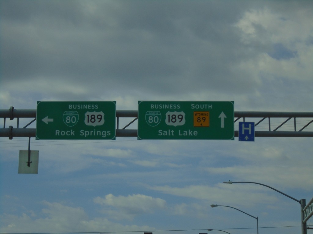
WY-89 South at BL-80/Bus. US-189
WY-89 South at BL-80/Bus. US-189. Turn left for BL-80/Bus. US-189 to Rock Springs. Continue straight for WY-89 South/BL-80/Bus. US-189 to Salt Lake.
Taken 08-03-2019

 Evanston
Uinta County
Wyoming
United States
Evanston
Uinta County
Wyoming
United States